For historical information only, do not use for navigation or aviation purposes!
| Coordinates | N492208 E0092622 (WGS84) Google Maps |
| Federal state | Baden-Württemberg |
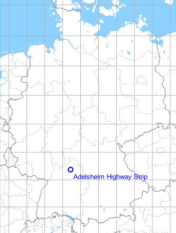
Germany during the Cold War Map
The history of the Cold War airfields: Adelsheim
General
On the Autobahn A 6 in the vicinity of Adelsheim-Leibenstadt, an emergency landing field was prepared during the Cold War. After the reunification, it was abandoned. In this section, the middle strip is concreted through and there is a parking area at both ends.
Location of airfield
Autobahn A81 between intersections Möckmühl and Osterburken.
During the Cold War
Use
Highway Strip
Overview
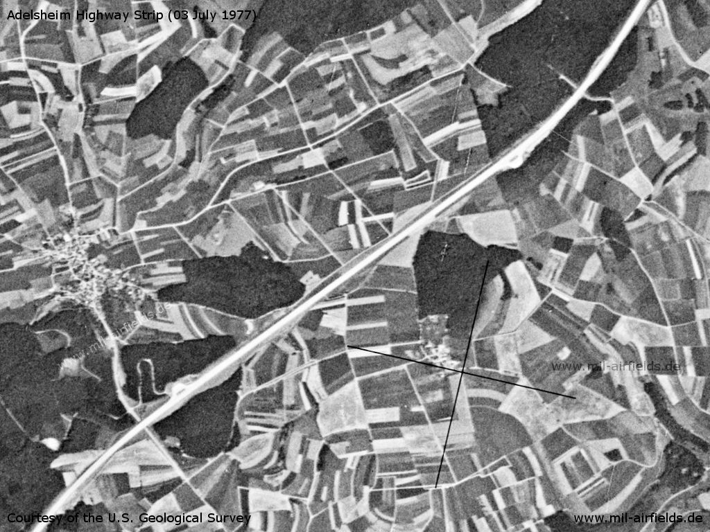
Adelsheim Highway Strip on a US satellite image from 03 July 1977
Source: U.S. Geological Survey
Runways
- 05/23: 2800m
Fuel equipment
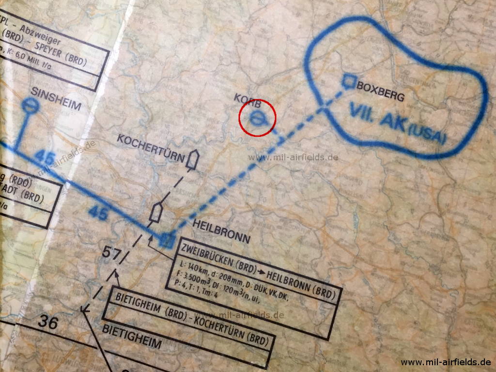
In the GDR they were informed: - Excerpt from a reconnaissance map of the National People's Army on the pipeline system in the Federal Republic of Germany. NATO pipelines in the CEPS (Central European Pipeline System) are shown in blue here. According to the map the NLP Adelsheim (here called KORB and circled in red for clarification) should be connected to the pipeline under construction from Heilbronn to Boxberg. The area circled in blue around the Boxberg tank farm means: "Probable accommodation area of corps supply points".
Source: NVA, Karte des Rohrleitungsnetzes, Geheime Verschlußsache GVS A 465 445
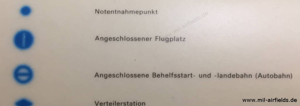
Excerpt from the legend
Source: NVA, Karte des Rohrleitungsnetzes, Geheime Verschlußsache GVS A 465 445
Today
Use
Closed.
Images
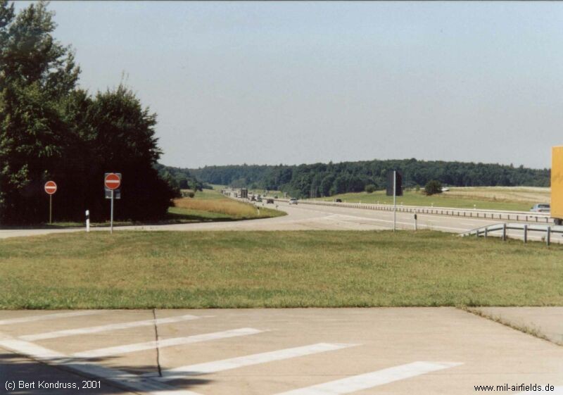
The highway strip in 2001, seen from the north-eastern rest area.
Airfields in the vicinity
Categories
Highway Strips WorldwideMilitary Airfields GermanyMilitary Airfields in former West GermanyHighway Strips in former West GermanyAirfields in Baden-WürttembergRecommended
Image credits are shown on the respective target page, click on the preview to open it.
 Follow mil-airfields on Facebook