Aschaffenburg: Army Airfield AAF
For historical information only, do not use for navigation or aviation purposes!
| Coordinates | N495731 E0090739 (WGS84) Google Maps |
| Federal state | Bayern (Bavaria) |
| Location indicator | EDEC (1990) |
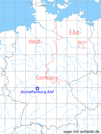
Germany during the Cold War Map
The history of the Cold War airfields: Aschaffenburg Army Airfield
Location of airfield
Southwest of the city center, at the Main river banks.
During the Cold War
Use
US Army airfield.
Situation
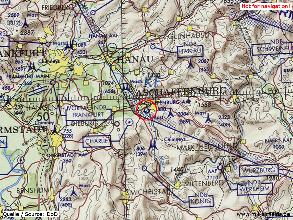
Aschaffenburg Army Airfield (AAF) on a map of the US Department of Defense from 1972
Source: ONC E-2 (1972), Perry-Castañeda Library Map Collection, University of Texas at Austin
Overview
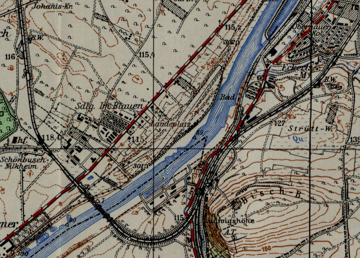
Aschaffenburg airfield on a US map from 1955
Source: AMS M841 GSGS 4414, Courtesy Harold B. Lee Library, Brigham Young University
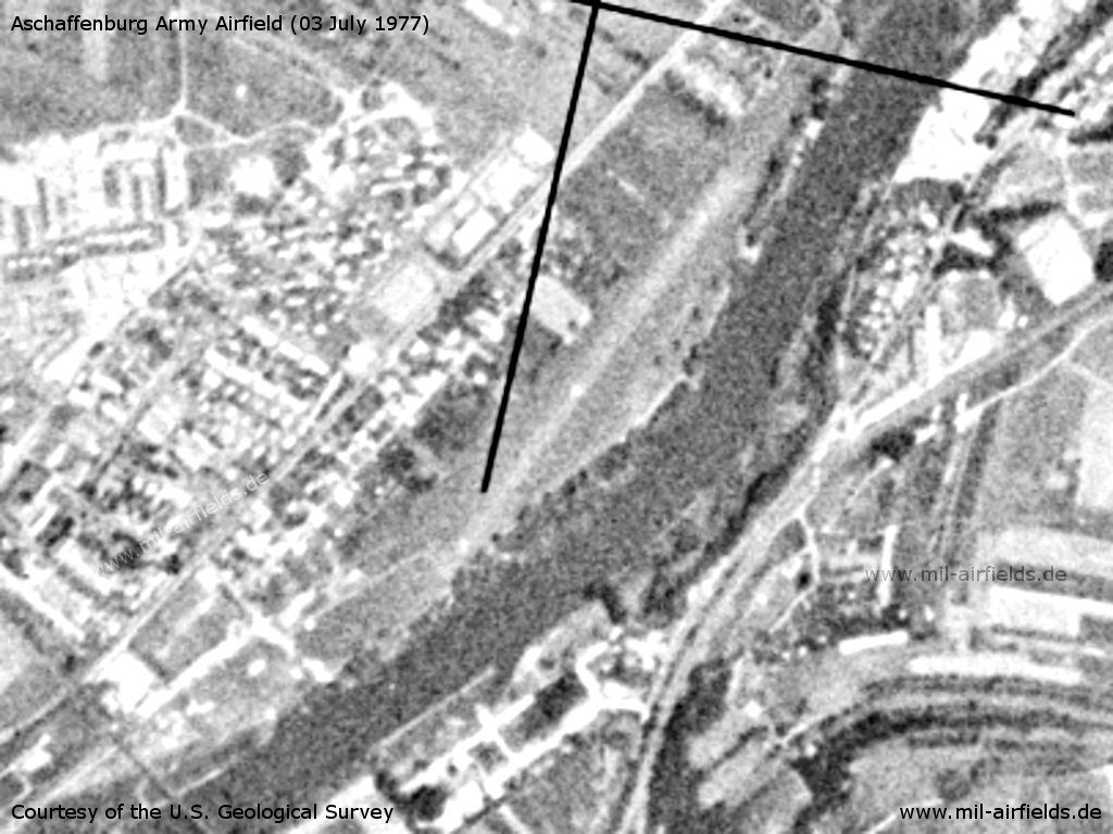
Aschaffenburg Army Airfield AAF on a US satellite image from 03 July 1977
Source: U.S. Geological Survey
Runways
Data for the year 1990:
- 04/22: 610 m x 20 m Asphalt
Radio communication
"SPESSART BASE" FM 39.95
Telephone
DSN 323-7xxx (1990)
Installations
The airfield had an area of 13 ha.
Additional information
In 1990, the following limitations applied: closed to fixed wing aircrafts; the airfield is not available for normal aviation use; overflight of the NATO site 2.4 nautical miles east-southeast prohibited.
Today
Use
Closed.
Overview
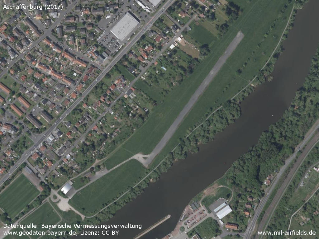
Aerial image (2017) - The location on the banks of the Main river is clearly visible.
Source: Datenquelle: Bayerische Vermessungsverwaltung www.geodaten.bayern.de, License: Creative Commons Namensnennung 3.0 Deutschland (CC BY 3.0 DE)
Links
- http://www.usarmygermany.com/Communities/Aschaffen... - Aerial Picture 2007
Airfields in the vicinity
Categories
Military Airfields GermanyMilitary Airfields in former West GermanyUS Army Airfields and Heliports in GermanyRecommended
Image credits are shown on the respective target page, click on the preview to open it.
 Follow mil-airfields on Facebook