For historical information only, do not use for navigation or aviation purposes!
| Coordinates | N511941 E0123917 (WGS84) Google Maps |
| Elevation | 538 ft |
| Former East Germany (GDR) | District of Leipzig |
| Federal state | Sachsen (Saxony) |
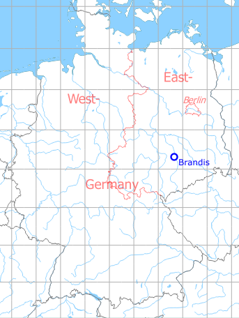
Germany during the Cold War Map
The history of the Cold War airfields: Brandis
During World War II
Use
Luftwaffe airbase (Fliegerhorst).
Situation
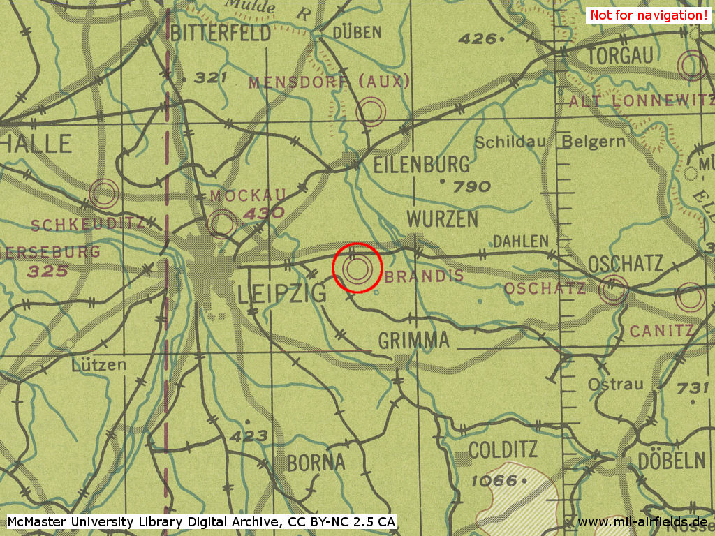
Brandis on a US map from 1944
Source: McMaster University Library Digital Archive, Lizenz: Creative Commons Attribution-NonCommercial 2.5 CC BY-NC 2.5 CA
Overview
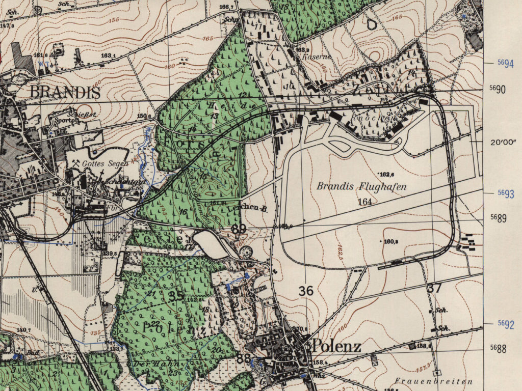
Brandis air base on a US map from 1955 or 1958 - The runway is clearly visible, as are facilities of the old air base and the connecting railway.
Source: AMS M841 GSGS 4414, Courtesy Harold B. Lee Library, Brigham Young University
During the Cold War
Use
Soviet airbase.
In the 1950s
History
- May 1954
Relocation of the Ground Attack Regiment Brandis (PFN 36 764) to Finsterwalde
In the 1960s
Overview
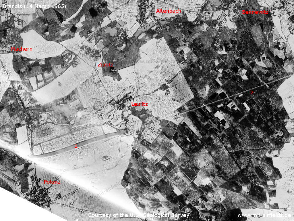
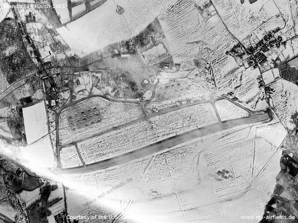
Brandis Air Base and surroundings on a US satellite image from 14 March 1965 - 1: airfield; 2: approach lane through the woods. Other places: Altenbach, Bennewitz, Leulitz, Machern, Polenz, Zeititz. The landscape is covered with snow.
Source: U.S. Geological Survey
Brandis airfield - The picture is a bit wavy
Source: U.S. Geological Survey
Buildings in the northwest
Source: U.S. Geological Survey
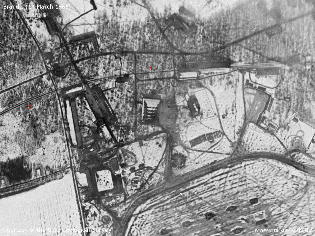
Buildings and hangars - 1: Railway siding
Source: U.S. Geological Survey
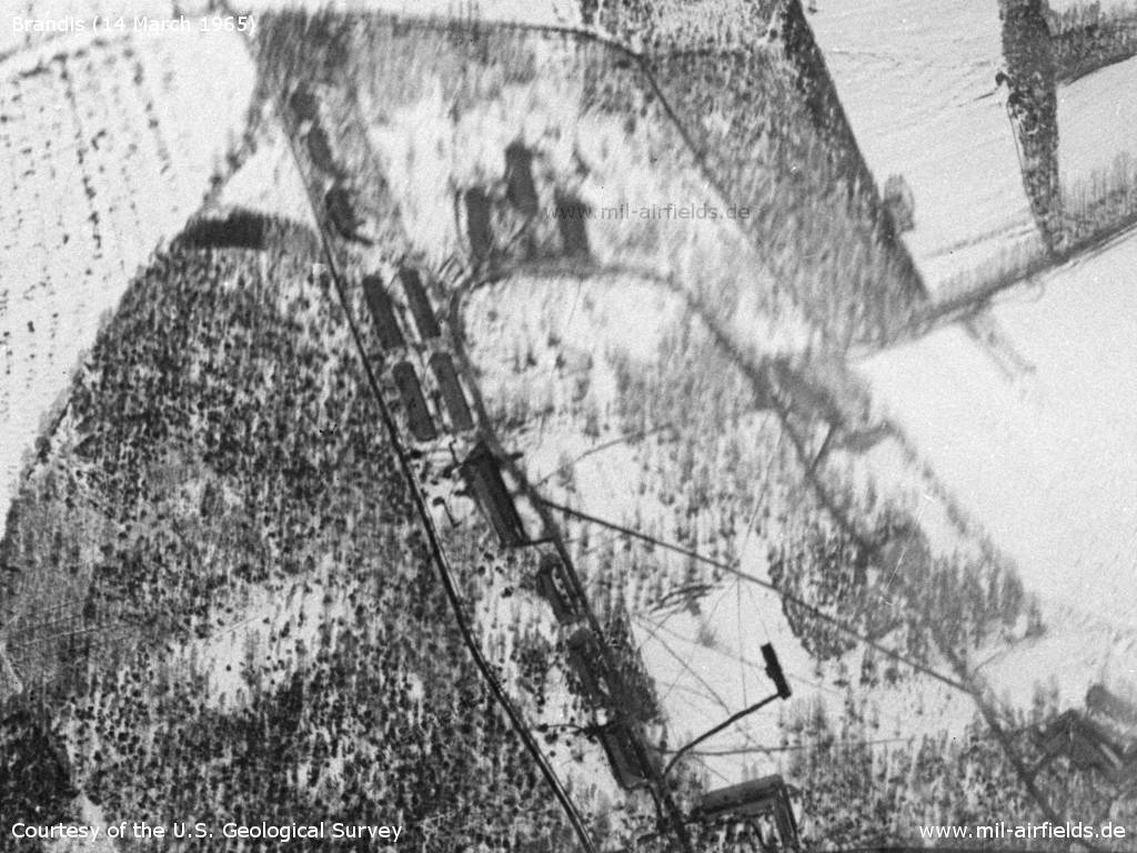
Hangars in the northeast
Source: U.S. Geological Survey
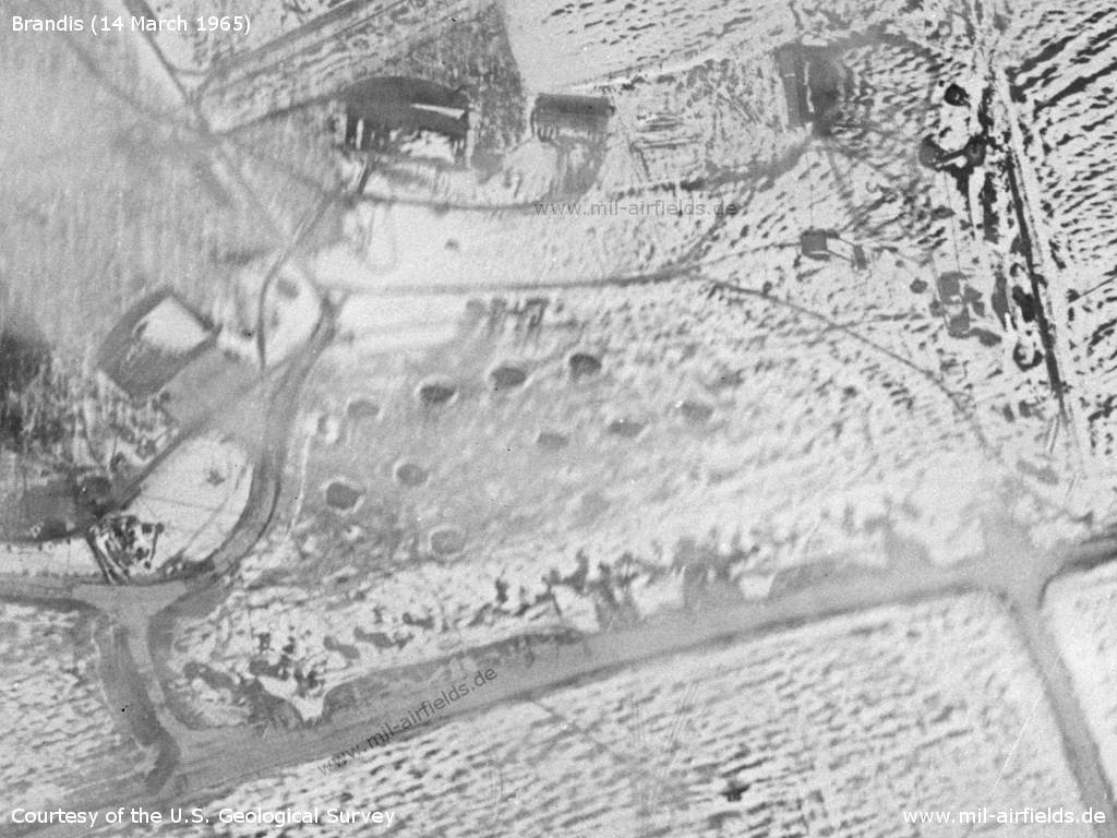
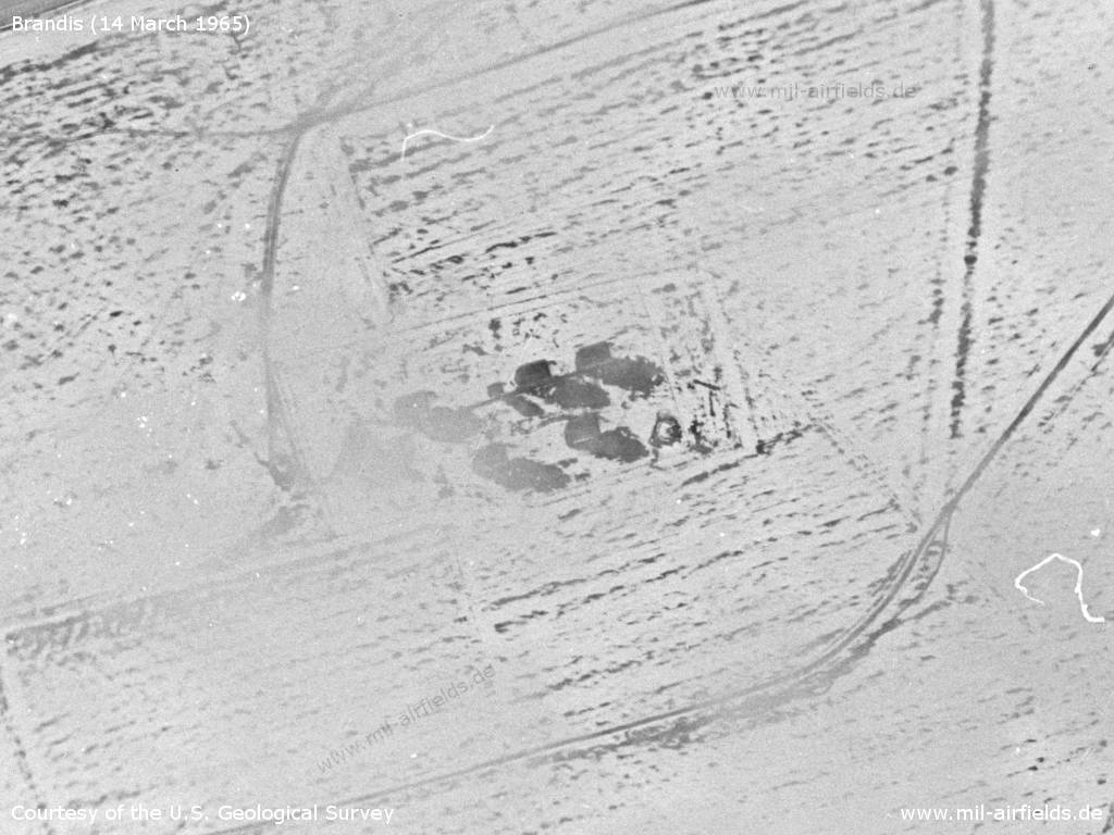
Parked helicopters
Source: U.S. Geological Survey
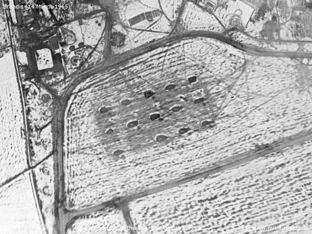
Facilities in the southeast
Source: U.S. Geological Survey
1970s
Situation
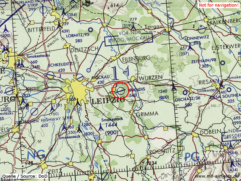
Brandis Air Base on a map of the US Department of Defense from 1972
Source: ONC E-2 (1972), Perry-Castañeda Library Map Collection, University of Texas at Austin
Overview
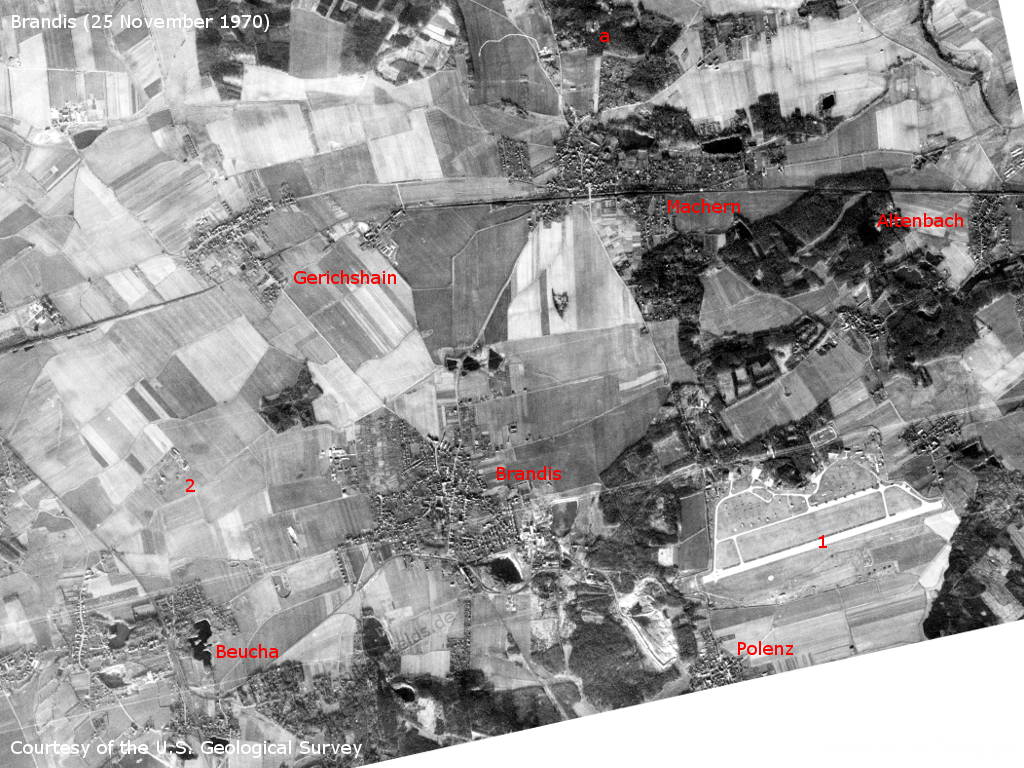
Brandis and surroundings on a US satellite image from Wednesday 25 November 1970 - 1: airfield; 2: surface-to-air missile (SAM) site Beucha. Other facilities: a: A-tower (communication tower) near Machern. Other places: Altenbach, Gerichshain, Machern, Polenz.
Source: U.S. Geological Survey
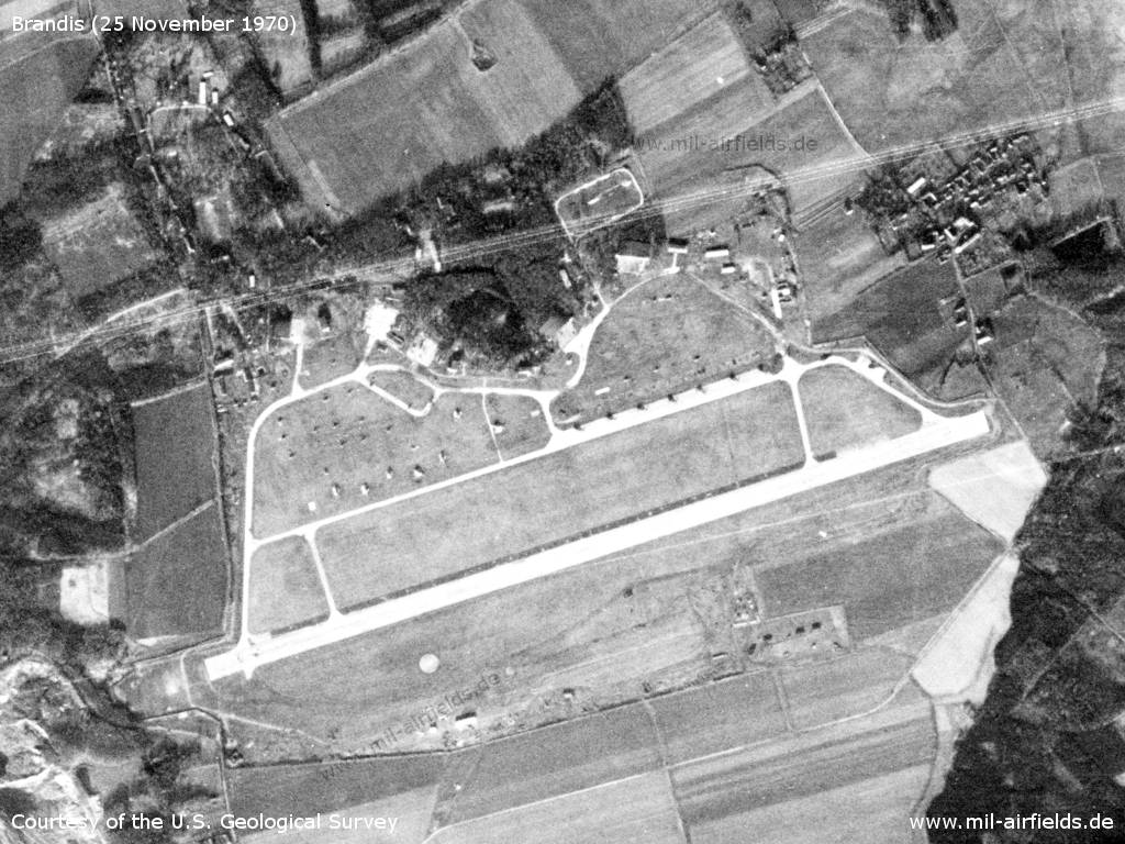
Brandis airfield
Source: U.S. Geological Survey
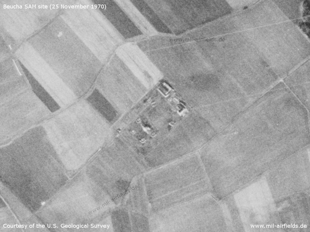
Surface-to-air missile (SAM) site near Beucha
Source: U.S. Geological Survey
Radio beacons
- LOM 26: 980 "CZ"
- LMM 26: 483 "C"
1980s
Runways
- 08/26: 2200m x 60m Concrete
Radio communication
The russian call sign for the airfield was ZAPAIKA (original notation in Cyrillic: ЗАПАЙКА).
Airspace
Coordination between the ATC units LEIPZIG ... AND BRANDIS (as of 04/1986)
For historical information only. Not for navigation!
Die APP LEIPZIG hat
- Flüge am Flugplatz EILENBURG und auf den im TMA gelegenen Flugplätzen des GST und des AF mit den FSS MERSEBURG und BRANDIS abzustimmen.
Die APP LEIPZIG ist verpflichtet, der FSS BRANDIS folgende Informationen zu übergeben:
- Arbeitsbeginn und -ende der APP;
- Beginn und Ende der Flüge auf den im TMA gelegenen Flugplätzen 30 Minuten vor dem ersten Start bzw. unmittelbar mit Ende der Flüge;
- die Start- und Landerichtung auf dem Flughafen LEIPZIG.
Die FSS BRANDIS ist verpflichtet, der APP LEIPZIG folgende Informationen zu übergeben:
- Beginn und Ende der Flüge am Flugplatz BRANDIS sowie Einschränkungen für zivil kontrollierte Flüge in der Luftstraße B 51 im LSA MACHERN-TREBSEN-OSTRAU eine Stunde vor Beginn und unmittelbar mit Ende der Flüge am Flugplatz BRANDIS;
- den Wechsel der Startrichtung auf 076° (Landung aus 256°) und sich daraus ergebendes Verbot aller Flüge im Raum Ortschaft MACHERN-MARKRANSTÄDT-MARKKLEEBERG-Ortschaft MACHERN im Höhenbereich von 300 m AGL bis 2750 m STD - 30 Minuten vor Wechsel der Startrichtung sowie unmittelbar nach Übergang auf die Hauptrichtung sowie das Ende der Flüge.
Real property
Anti-aircraft missile site near Beucha.
Today
Use
Closed, the area is a solar park.
Images
Pictures from 1994:
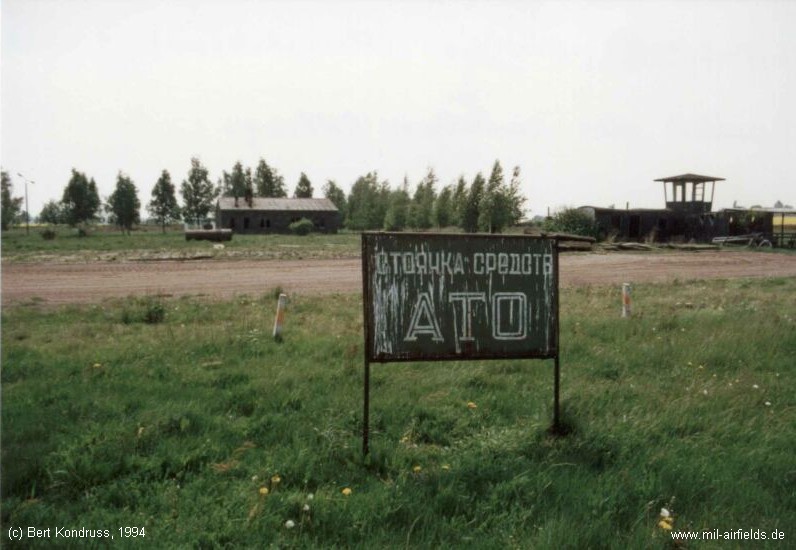
ATO
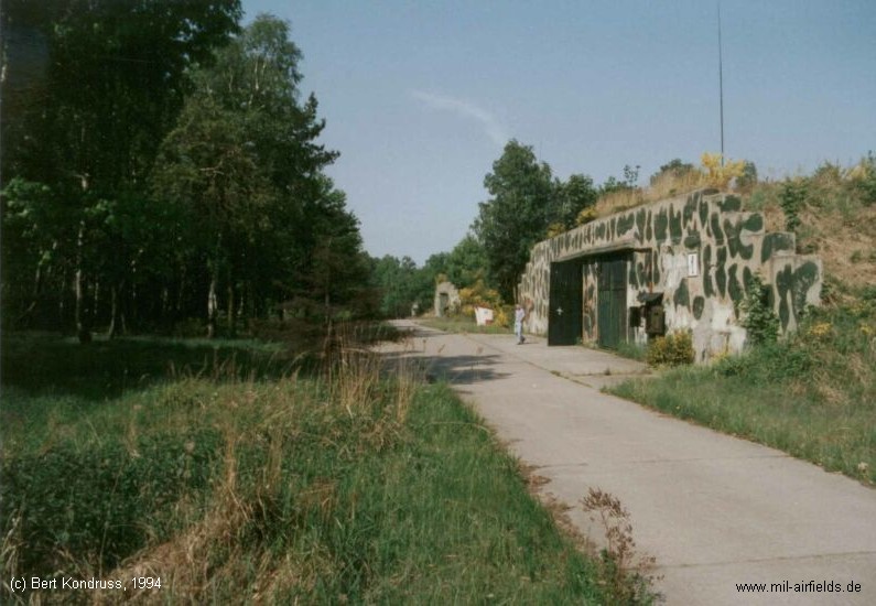
Bunker
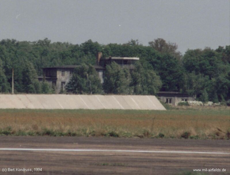
Tower and blast fence
Links
- https://lib.byu.edu/collections/german-maps/ - German Maps (Topographische Karte 1:25,000)
Related topics
Airfields in the vicinity
Categories
Military Airfields GermanyMilitary Airfields in former East GermanyAirfields of the Soviet Forces in GermanyRecommended
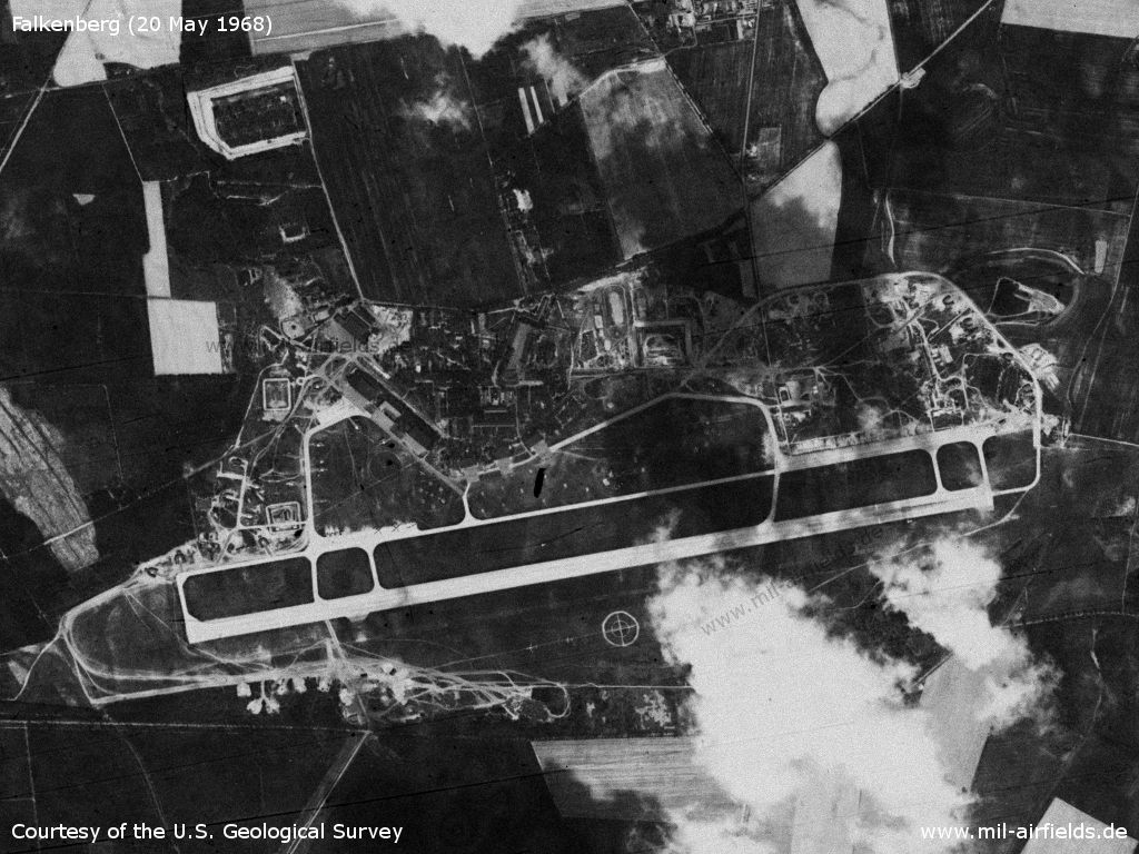
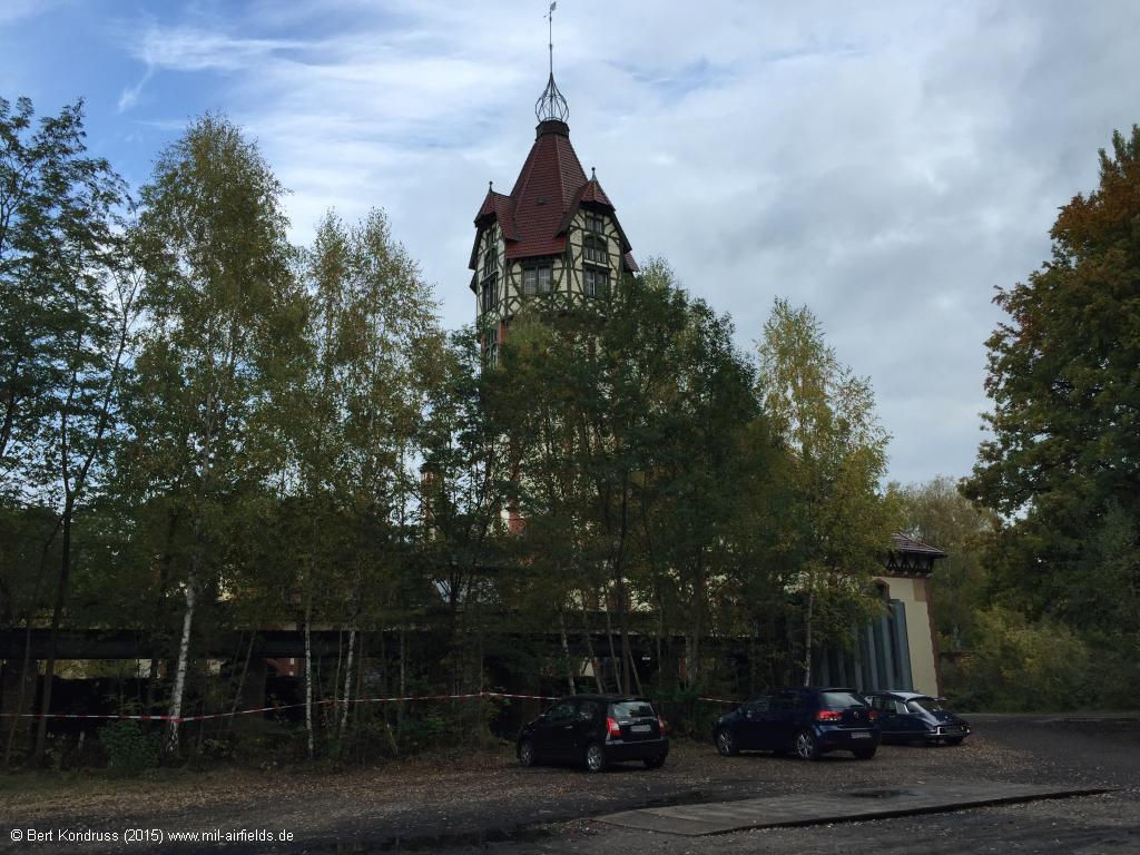
Image credits are shown on the respective target page, click on the preview to open it.