For historical information only, do not use for navigation or aviation purposes!
| Coordinates | N513627 E0134429 (WGS84) Google Maps |
| Elevation | 394 ft |
| Former East Germany (GDR) | District of Cottbus |
| Federal state | Brandenburg |
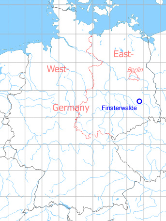
Germany during the Cold War Map
The history of the Cold War airfields: Finsterwalde
Location of airfield
Ca. 3 km south of Finsterwalde.
During World War II
Situation
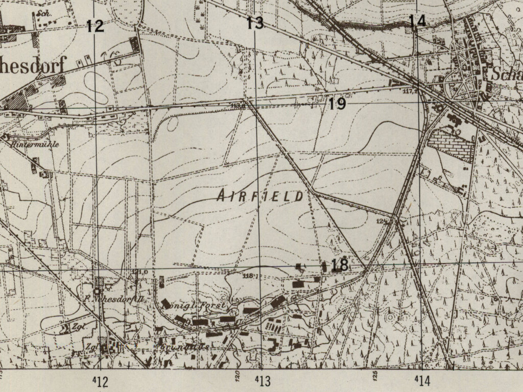
Fliegerhorst (Air Base) Finsterwalde in World War II on a US map from 1944
Source: McMaster University Library Digital Archive, License: Creative Commons Attribution-NonCommercial 2.5 CC BY-NC 2.5 CA
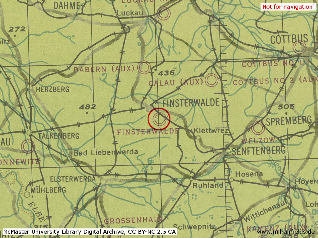
Overview
Former Fliegerhorst (Air Base) Finsterwalde in the approximate state during World War II on a US map from 1952 - Visible are the buildings of the old air base and the connecting railway.
Source: AMS M841 GSGS 4414, Courtesy Harold B. Lee Library, Brigham Young University
During the Cold War
Use
Base for soviet fighter-bomber until 1993.
In the 1950s
Units
Units in 1954
- Headquarters Soviet ground attack division
- Soviet ground attack regiment (P. O. Box of the technical unit: 36 764),
- Soviet ground attack regiment (P. O. Box of the technical unit: 45 043),
- A total of 14 MiG-15/MiG-15U were counted at the airfield.
Source: BND/Bundesarchiv B 206/3033
(For the P. O. Box numbers the digits 3 and 5 may be confused, because they are difficult to distinguish in the source document)
(For the P. O. Box numbers the digits 3 and 5 may be confused, because they are difficult to distinguish in the source document)
History
- May 1954
Relocation of the Ground Attack Regiment Brandis (PFN 36 764) to Finsterwalde.
In the 1960s
Overview
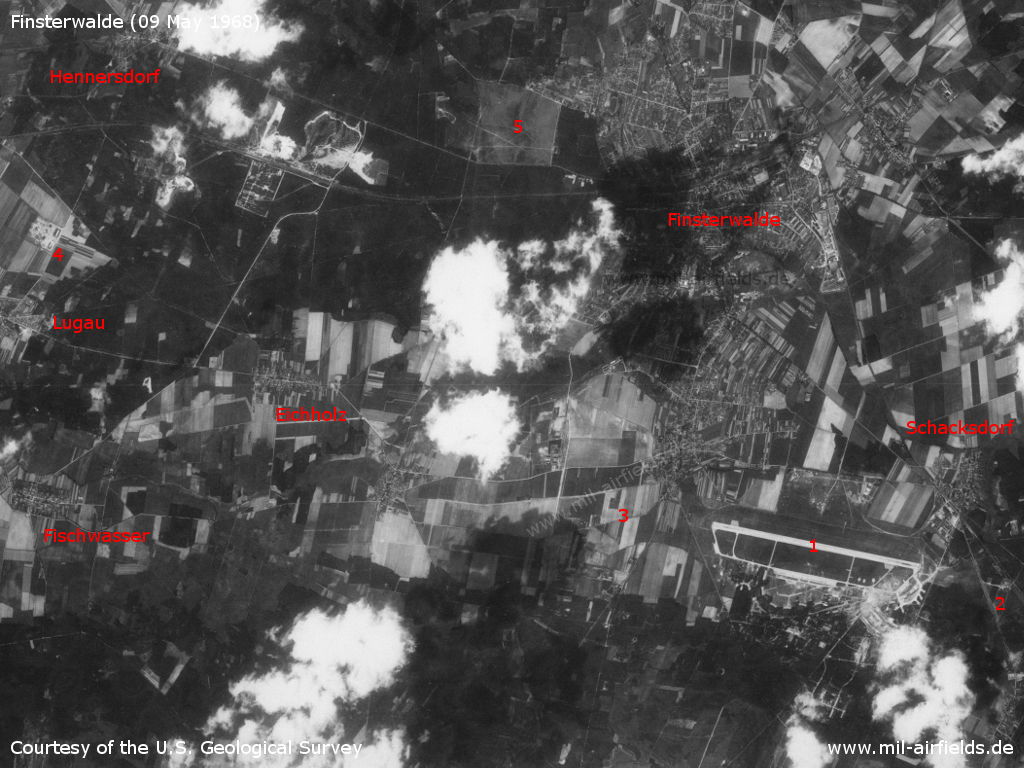
Satellite image from 09 May 1968, not fully oriented to the north. - 1: Airfield; 2: Inner radio beacon east; 3: Inner radio beacon west; 4: Lugau SAM site; 5: Finsterwalde-Heinrichsruh airfield; Places Eichholz, Fischwasser, Finsterwalde, Hennersdorf, Schacksdorf
Source: U.S. Geological Survey
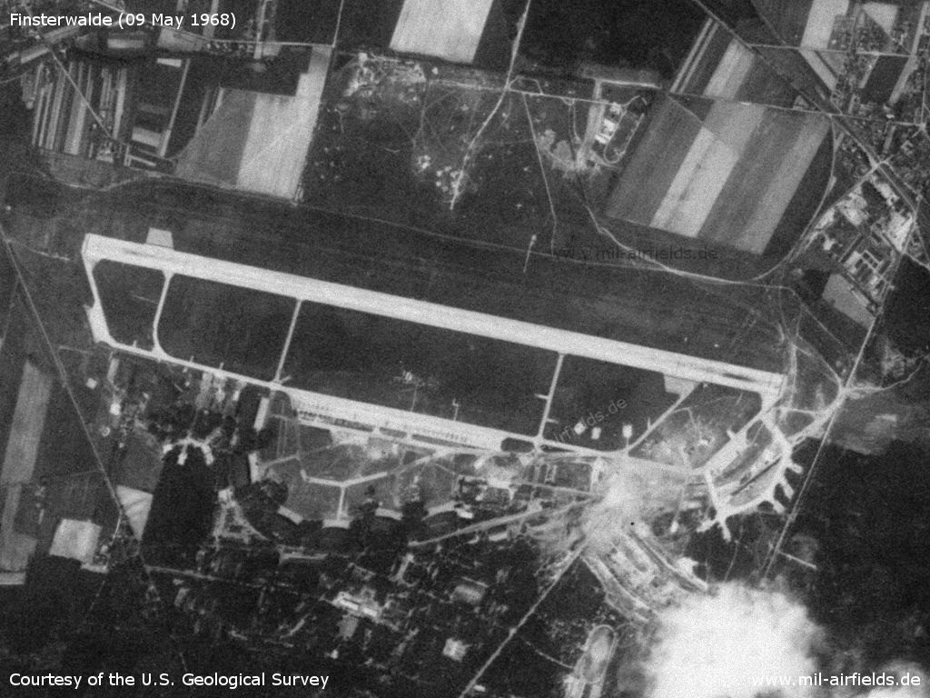
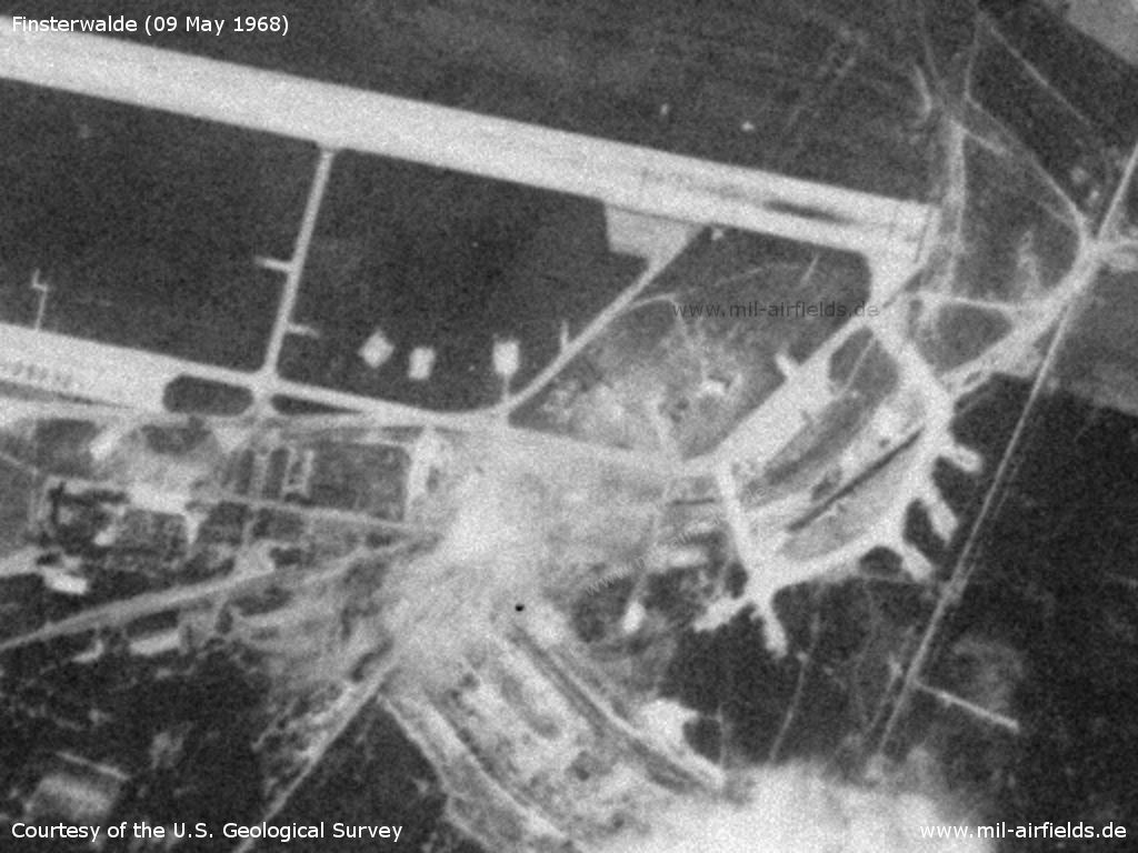
The airfield in the general view
Source: U.S. Geological Survey
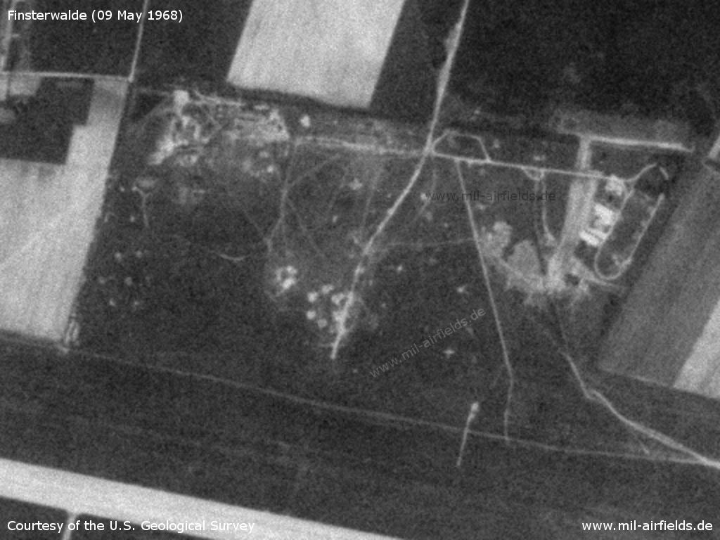
The two hexagonal structures are probably anti-aircraft positions.
Source: U.S. Geological Survey
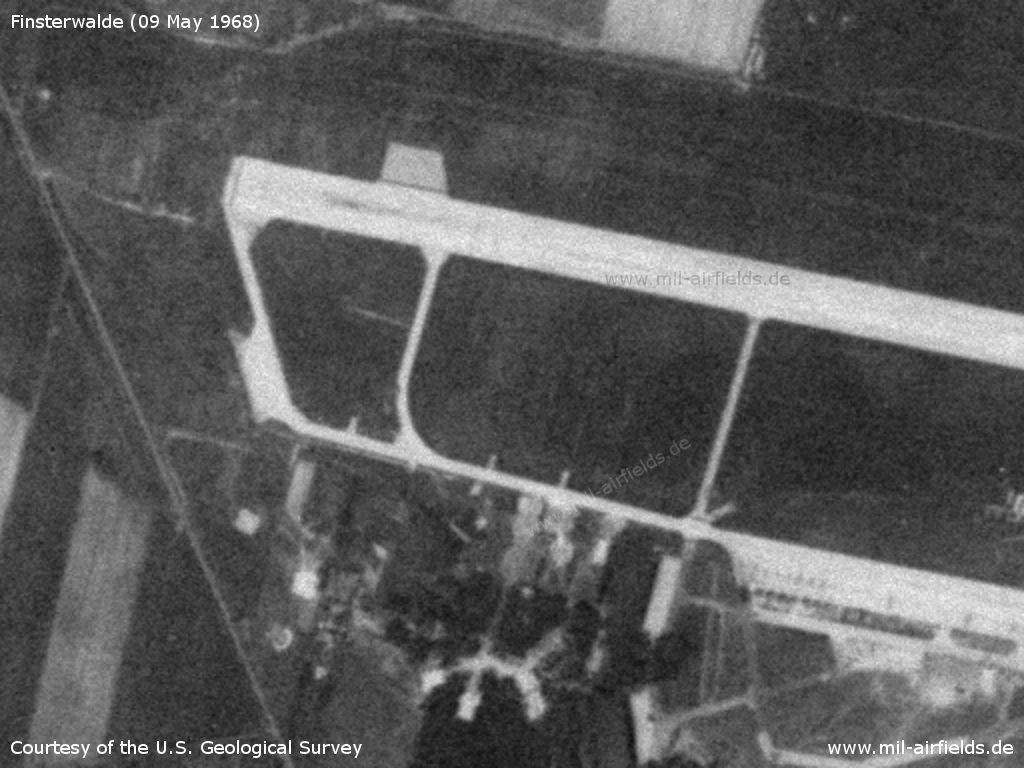
Western part
Source: U.S. Geological Survey
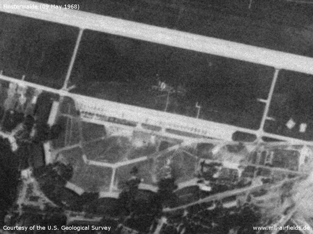
Central part with flight line and aircraft hangars
Source: U.S. Geological Survey
Eastern part
Source: U.S. Geological Survey
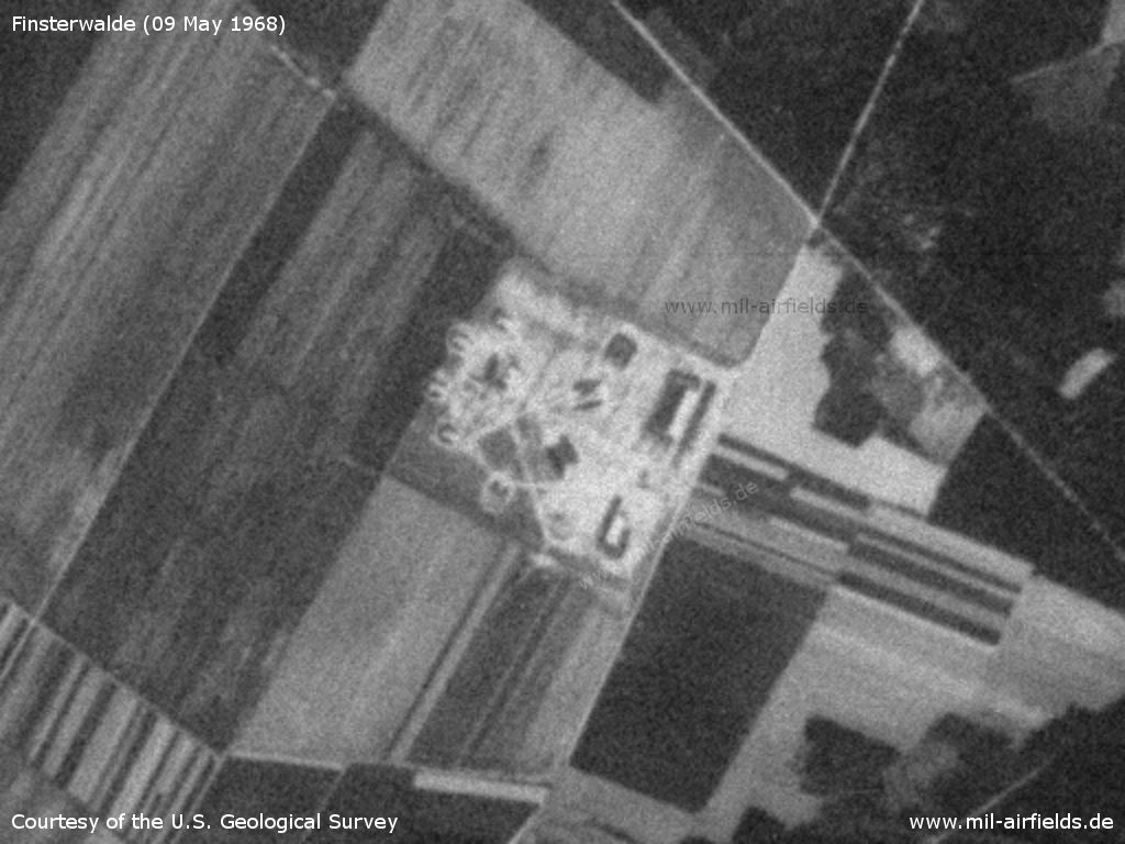
SAM site near Lugau - The soil looks freshly worked
Source: U.S. Geological Survey
Radio communication
Call sign: ANALITIK (known for 1967)
In the 1970s
Situation
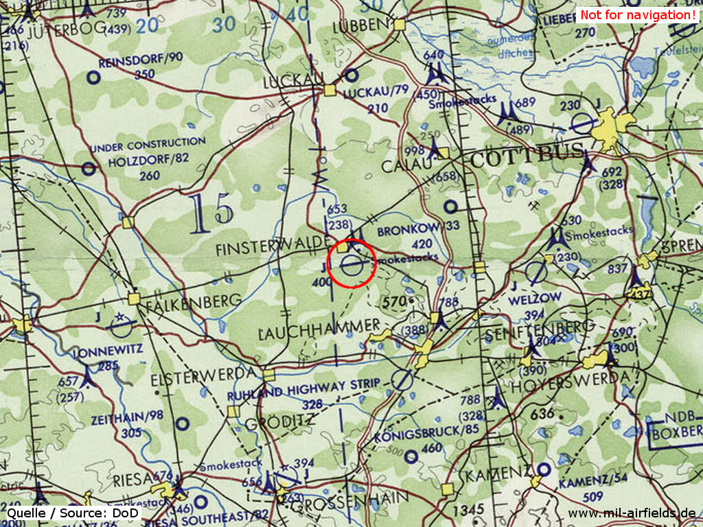
Finsterwalde Air Base on a map of the US Department of Defense from 1972
Source: ONC E-2 (1972), Perry-Castañeda Library Map Collection, University of Texas at Austin
Overview
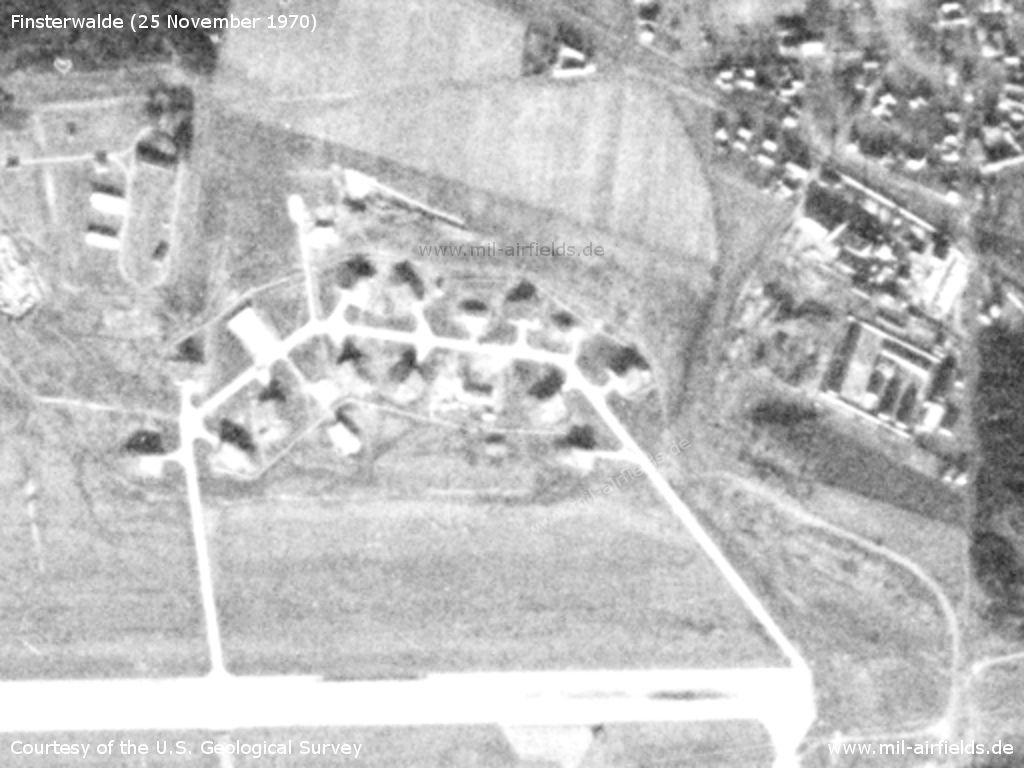
25 November 1970
In comparison with the pictures from 1968, numerous aircraft shelters can now be found on the airfield. In the northeast of the field, a shelter loop was built.
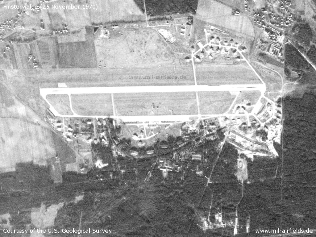
Satellite image from 25 November 1970
Source: U.S. Geological Survey

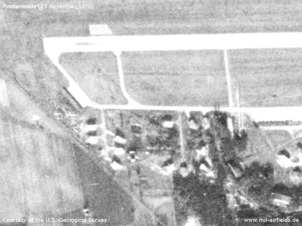
Northern part
Source: U.S. Geological Survey
New shelter loop in the northeast
Source: U.S. Geological Survey
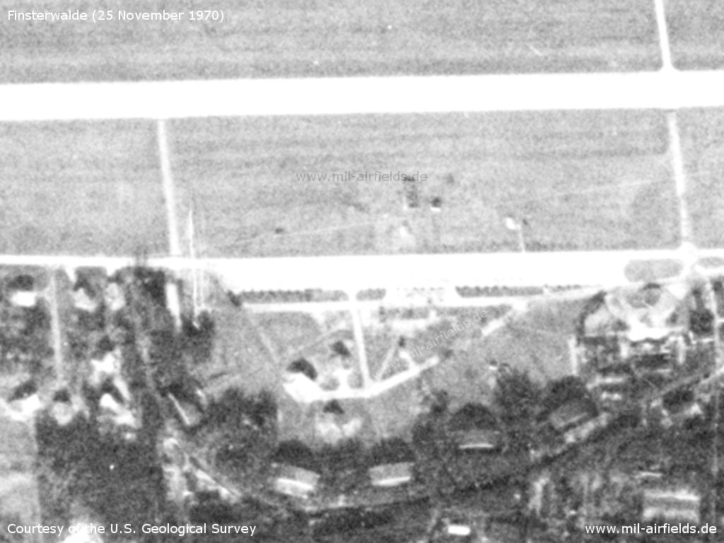
Southwestern part - Here also numerous shelters can be found
Source: U.S. Geological Survey
Hangars
Source: U.S. Geological Survey
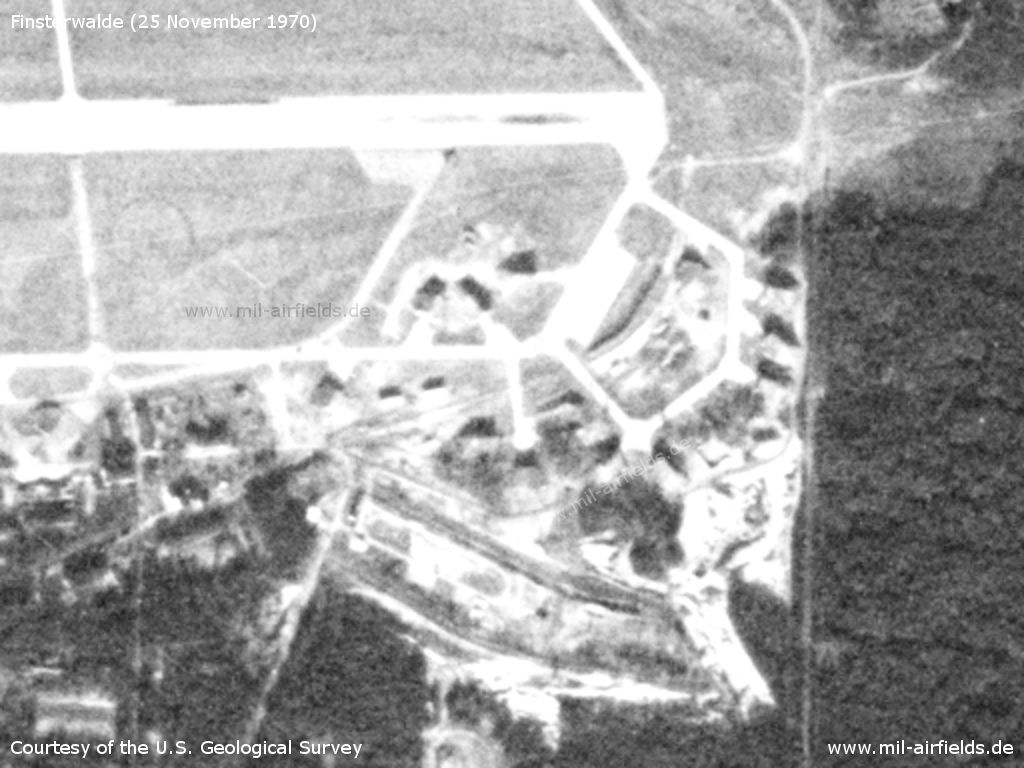
Shelters have also been built in the southeast
Source: U.S. Geological Survey
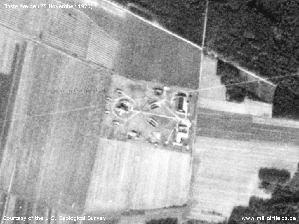
Lugau anti-aircraft missile site
Source: U.S. Geological Survey
16 May 1979
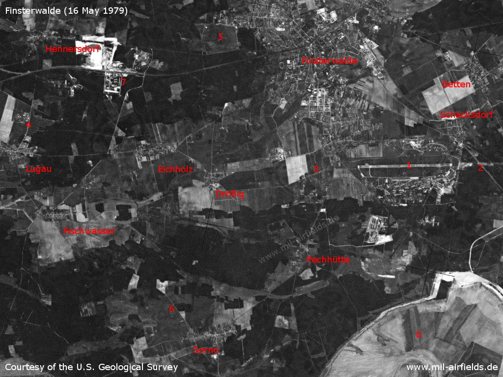
Finsterwalde Air Base and area to the west on a US satellite image from 16 May 1979 - 1: Airfield; 2: Inner radio beacon east; 3: Inner radio beacon west; 4: Lugau SAM site; 5: Finsterwalde-Heinrichsruh airfield; 6: Sorno agricultural airfield; 7: Depot; 8: Open-pit mine. Places Betten, Drößig, Eichholz, Fischwasser, Finsterwalde, Hennersdorf, Pechhütte, Schacksdorf
Source: U.S. Geological Survey
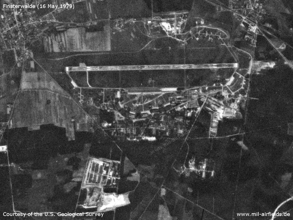
Finsterwalde Air Base
Source: U.S. Geological Survey
Dispersal area with aircraft shelters in the northeast
Source: U.S. Geological Survey
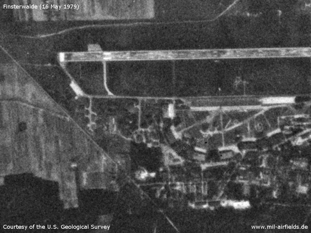
Southwestern part with hangars - The structure of the former Fliegerhorst can still be recognized at the hangars. raffic on the road west of the runway (top left) is stopped during flight operations.
Source: U.S. Geological Survey
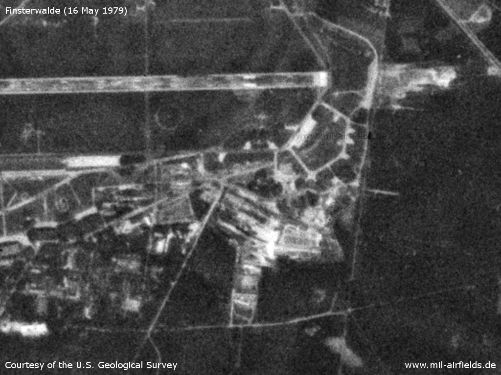
Southeastern part
Source: U.S. Geological Survey
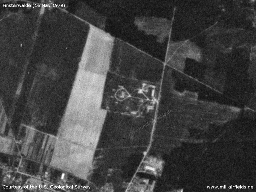
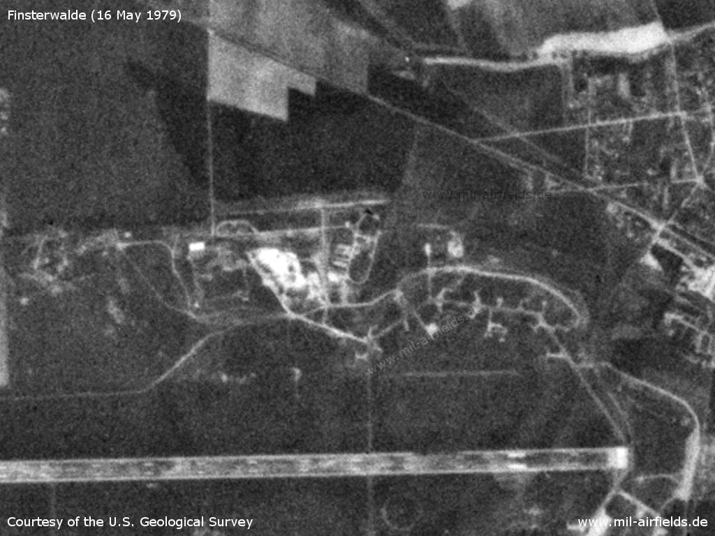
The surface-to-air missile (SAM) site of the airfield was located north of Lugau. - It was equipped with missile S-125 Newa (NATO designator SA-3 Goa).
Source: U.S. Geological Survey
Radio beacons
Data for the 1970s and 1980s:
- LOM 27: 868 "KL"
- LMM 27: 427 "K"
- LOM 09: 868 "JS"
- LMM 09: 427 "J"
In the 1980s and early 1990s
Runways
- 09/27: 2700 m Concrete
Radio communication
Aviation radio call sign: GORODOK.
Standard training routes
"Flüge der LSK/LV der NVA und der LSK der GSSD im Rahmen der Gefechtsausbildung sind entsprechend der Grafik der Flugtage / -nächte auf der Grundlage der "Hauptflugregeln zum Fliegen im Luftraum der Deutschen Demokratischen Republik" auf Standardflugstrecken in den dazu festgelegten Flughöhen durchzuführen. ..." (Quelle: "Verzeichnis der Standardflugstrecken der LSK/LV der NVA und der LSK der GSSD"
Stand 1989:
343 Finsterwalde, Terpt, 2 km südlich Baruth, Übigau, Finsterwalde
Höhe: 300 - 900 m
Höhe: 300 - 900 m
344 Finsterwalde, Rothenburg, Chojnow, Chocianow, Schießplatz Przemkow, Rothenburg, Finsterwalde
Höhe: 4900, 5500 m
Höheneinnahme: Traverse Bernsdorf
Höhenaufgabe: über dem Flugplatz
Höhe: 4900, 5500 m
Höheneinnahme: Traverse Bernsdorf
Höhenaufgabe: über dem Flugplatz
345 Finsterwalde, Terpt, 2 km südlich Baruth, Schießplatz Heidehof, Markendorf, Schönewalde, Finsterwalde
Höhe: zum Schießplatz 300, 1200 m, Rückflug 900 m
Höhe: zum Schießplatz 300, 1200 m, Rückflug 900 m
346 Finsterwalde, Holzdorf, Abtsdorf, Klein-Kreutz, Kyritz (LKV), Schießplatz Wittstock, Neuglienicke, Luckenwalde, Finsterwalde
Höhe: 4900, 5500 m (unter EWB zum Schießplatz 300 m)
Höheneinnahme: Traverse Herzberg, beim Rückflug bis Traverse Fehrbellin
Höhenaufgabe: Kyritz
Höhe: 4900, 5500 m (unter EWB zum Schießplatz 300 m)
Höheneinnahme: Traverse Herzberg, beim Rückflug bis Traverse Fehrbellin
Höhenaufgabe: Kyritz
347 Finsterwalde, Doberlug-Kirchhain, Holzdorf, Schweinitz, Schießplatz Belgern, Finsterwalde
Höhe: zum Schießplatz 300 - 600 m, Rückflug 900 m
Höhe: zum Schießplatz 300 - 600 m, Rückflug 900 m
Units
559 APIB: MiG-27, MiG-23UB (1990)
Installations
- Railway siding from Schacksdorf, passing the eastern threshold to the southern part of the airfield, with connection to the fuel depot in the south-eastern corner.
- SAM site at Lugau (Finsterwalder Berg, 25 ha)
Images
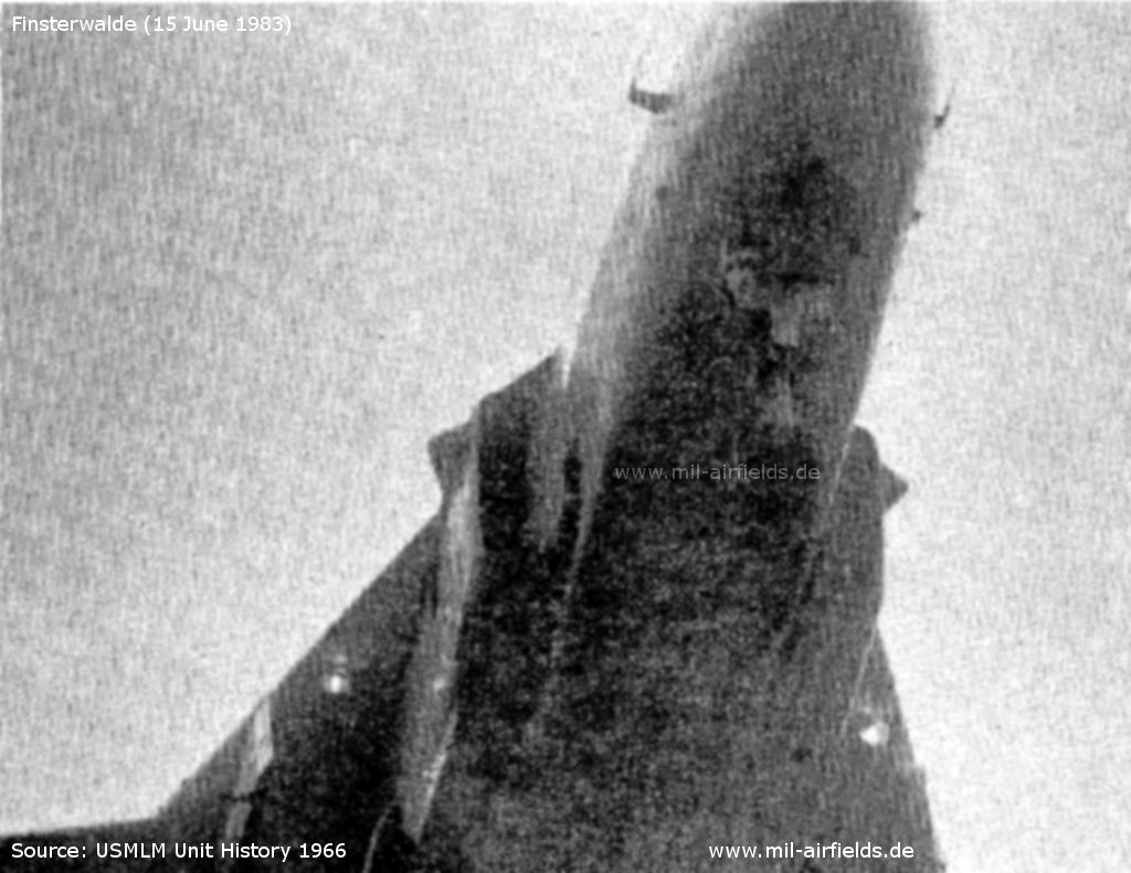
Su-24 Fencer C with pedestal under the radome - Photographed on 15 June 1983 by the US Military Liaison Mission
Source: USMLM Unit History 1983
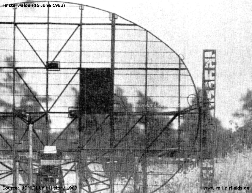
Variant of the Soviet END CURVE radar at the Soviet SA-3 Site - There are modifications to the END BOX and the metal plate on the sail (The MGRS/UTMREF coordinates are given as VT030097, but should probably read VT030197)
Source: USMLM Unit History 1983
Today
Use
General aviation.
Sources
- http://www.history.hqusareur.army.mil/uslmannual.htm (offline): USMLM Unit History 1969 - Beschreibung eines Übungsprogramms von Su-7 in Finsterwalde am 07.10.1969
- http://www.history.hqusareur.army.mil/uslmannual.htm (offline): USMLM Unit History 1971 - Bericht zu Problemen mit den Shelter-Toren in Finsterwalde und Allstedt
- http://www.history.hqusareur.army.mil/uslmannual.htm (offline): USMLM Unit History 1972 - Erste Sichtung von Su-7 mit 4 Tragflächenaufhängungen in Finsterwalde und später in Groß Dölln
- http://www.history.hqusareur.army.mil/uslmannual.htm (offline): USMLM Unit History 1974 - Im März 1974 erste Sichtung einer MiG-23 Flogger C in Finsterwalde
- http://www.history.hqusareur.army.mil/uslmannual.htm (offline): USMLM Unit History 1975 - Su-7 wurden durch MiG-23 ersetzt. Sichtung einer Flogger D, Sichtung einer tarnfarbenen MiG-23 Flogger C
- http://www.history.hqusareur.army.mil/uslmannual.htm (offline): USMLM Unit History 1978 - Sichtung eines neuen Kanonenbehälters an Flogger D aus Finsterwalde.
- http://www.history.hqusareur.army.mil/uslmannual.htm (offline): USMLM Unit History 1983 - Foto der Unterseite einer Su-24 Fencer C in Finsterwalde; Foto eines Radars der SA-3-FlaRak-Stellung; Notiz zu Flogger J mit AS-12
- http://www.history.hqusareur.army.mil/uslmannual.htm (offline): USMLM Unit History 1984 - Foto einer MiG-27 mit AS-12
- http://www.history.hqusareur.army.mil/uslmannual.htm (offline): USMLM Unit History 1985 - Notiz zur Umrüstung von Flogger D auf Flogger J (MOD)
Links
- http://www.sachsenschiene.net/bunker/flp/flp_36.ht... - Sachsenbunker
Bibliography
- Ries, Karl; Dierich, Wolfgang: "Fliegerhorste und Einsatzhäfen der Luftwaffe" Motorbuch Verlag Stuttgart, 1993 - Alliierte Planskizze
- Freundt, Lutz: "Sowjetische Fliegerkräfte in Deutschland 1945-1994, Band 1" Freundt Eigenverlag, Diepholz 1998 - Beschreibung des Platzes, Plan, Bilder und Luftbilder
- Freundt, Lutz: "Sowjetische Fliegerkräfte in Deutschland 1945-1994, Band 2" Freundt Eigenverlag, Diepholz 1999 - Angaben und Bilder zum 559 APIB
- Freundt, Lutz: "Sowjetische Fliegerkräfte in Deutschland 1945-1994, Band 4" Edition Freundt Eigenverlag, Diepholz 2000 - Ergänzungen
Related topics
Airfields in the vicinity
- 269°/12km Doberlug-Kirchhain: Helipad 3042 (HSLP / HLP 3042)
- 269°/14km Doberlug-Kirchhain: Helipad 1031 (HSLP / HLP 1031)
- 064°/17km Bronkow: Airfield
- 088°/17km Großräschen: Helipad 3134 (HSLP / HLP 3134)
- 163°/20km Ruhland: Highway Strip (Autobahnabschnitt ABA)
Categories
Military Airfields GermanyMilitary Airfields in former East GermanyAirfields of the Soviet Forces in GermanyRecommended
Image credits are shown on the respective target page, click on the preview to open it.
 Follow mil-airfields on Facebook