For historical information only, do not use for navigation or aviation purposes!
| Coordinates | N513813 E0142125 (WGS84) Google Maps (approximate location) |
| Former East Germany (GDR) | District of Cottbus |
| Federal state | Brandenburg |
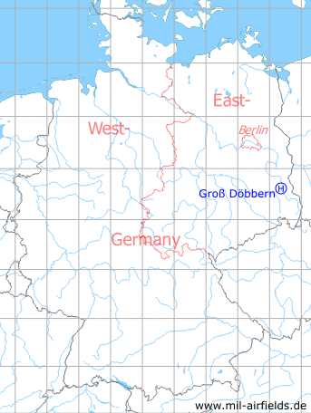
Germany during the Cold War Map
The history of the Cold War airfields: Groß Döbbern
Location of airfield
2.7 km southeast of Groß Döbbern.
Usage during the Cold War
Helipad 3132 for anti-aircraft missile unit 311 (FRA-311) of former East German Air Force (NVA LSK/LV).
Use today
Closed.
Runways, taxiways, aprons
Dimensions: 150 m x 150 m,
main takeoff and landing direction: 0° - 45°,
surface: solid grass,
usable without crop damage,
capacity: 2 helicopters
main takeoff and landing direction: 0° - 45°,
surface: solid grass,
usable without crop damage,
capacity: 2 helicopters
Telephone
Stabsnetz S1 9446-66-821
Airspace and procedures
Usable at day during good weather conditions.
Alert time: 60 minutes.
Alert time: 60 minutes.
Obstacles
Power transmission line: direction 180°, distance 1100 m, height 15 m.
Links
- Google Maps - Suspected location. The recalculated coordinates (from S42/83 to WGS84) puts it a little bit more to the southeast, but this location fits much better in size and landing direction.
- Sachsenbunker
Airfields in the vicinity
- 316°/11km Leuthen: Helipad 3021 (HSLP 3021)
- 343°/15km Cottbus: Air Base
- 246°/17km Welzow: Air Base (Neu-Welzow, Spremberg Welzow, Аэродром Ней-Вельцов)
- 099°/18km Döbern: Helipad 3160 (HSLP / HLP 3160)
- 081°/19km Preschen: Air Base (Jocksdorf)
 Follow mil-airfields on Facebook