For historical information only, do not use for navigation or aviation purposes!
| Coordinates | N512039 E0145008 (WGS84) Google Maps |
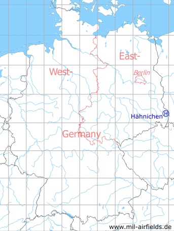
Germany during the Cold War Map
The history of the Cold War airfields: Hähnichen
General
Hähnichen is a village in today's federal state of Sachsen (Saxony), near the border to Poland. During the Cold War this area belonged to East Germany (GDR). For the 1980s, a helipad was listed here for POL Depot 14 (Treib- und Schmierstofflager 14, TSL-14) of the former East German Air Force (NVA LSK/LV). Probably there were no facilities at the landing site. With the German reunification and the end of the NVA, the helipad was closed.
Location of airfield
Sports field in the district Trebus.
During the Cold War
Use
Helipad 3038 for POL Depot 14 (Treib- und Schmierstofflager 14, TSL-14) of former East German Air Force (NVA LSK/LV).
Runways, taxiways, aprons
Dimensions: 50m x 100 m,
main takeoff and landing direction: 90°, reserve 360°,
surface: Solid grass (athletic field),
capacity: 1 helicopter.
main takeoff and landing direction: 90°, reserve 360°,
surface: Solid grass (athletic field),
capacity: 1 helicopter.
Telephone
Sondernetz/Stabsnetz S1 5347-a
Airspace and procedures
Usable at day during good weather conditions.
Alert time: 60 minutes.
Alert time: 60 minutes.
Obstacles
Forrest: direction 270°, distance 80-160 m, height 8-10 m.
Today
Use
Closed.
Airfields in the vicinity
- 074°/8km Rothenburg/Oberlausitz: Air Base (Görlitz)
- 048°/10km Steinbach: Helipad 3051 (HSLP / HLP 3051)
- 159°/22km Görlitz: Airfield (Zhorjelc)
- 247°/25km Zschillichau: Helipad 3052 (HSLP / HLP 3052)
- 233°/28km Bautzen: Air Base (Litten)
 Follow mil-airfields on Facebook