For historical information only, do not use for navigation or aviation purposes!
| Coordinates | N541844 E0093217 (WGS84) Google Maps |
| Federal state | Schleswig-Holstein |
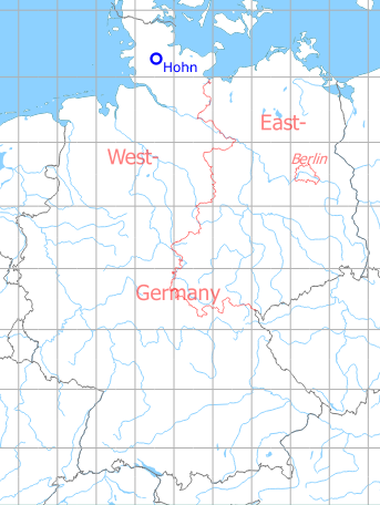
Germany during the Cold War Map
The history of the Cold War airfields: Hohn
During World War II
Situation
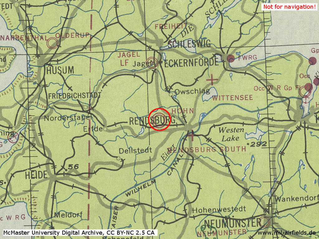
Hohn on a US map from 1944 - (McMaster University Library Digital Archive, License: Creative Commons Attribution-NonCommercial 2.5 CC BY-NC 2.5 CA /MULDA/)
During the Cold War
Situation
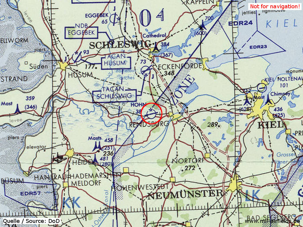
Hohn Air Base on a map of the US Department of Defense from 1972 - (ONC E-2 (1972), Perry-Castañeda Library Map Collection, University of Texas at Austin /PCL MC/)
Overview
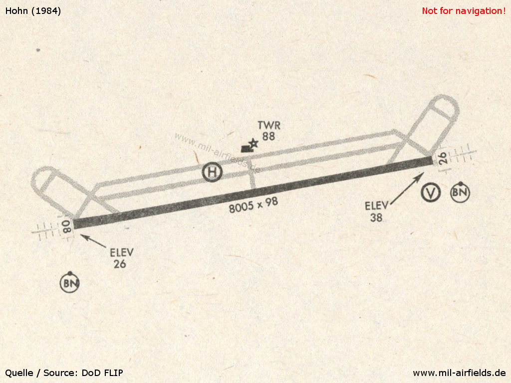
Hohn in 1984
Runways
- 08/26: 2440 m x 30 m Concrete
Radio beacons
- ILS 26: 108.9 "HN"
- LOM 26: 344 "HN"
Airfields in the vicinity
- 014°/14km Brekendorf: Highway Strip
- 355°/16km Schleswig: Air Base (Jagel, RAF Schleswigland)
- 312°/34km Husum: Schwesing Air Base
- 176°/35km Itzehoe: Hungriger Wolf Airfield (Hohenlockstedt)
- 350°/36km Bollingstedt: Highway Strip (Notlandeplatz NLP)
- 340°/37km Eggebek: Air Base (Langstedt)
- 079°/40km Kiel: Holtenau Airfield / Airport (Vossbrook)
Categories
Military Airfields GermanyMilitary Airfields in former West GermanyGerman Air Force Air BasesRecommended
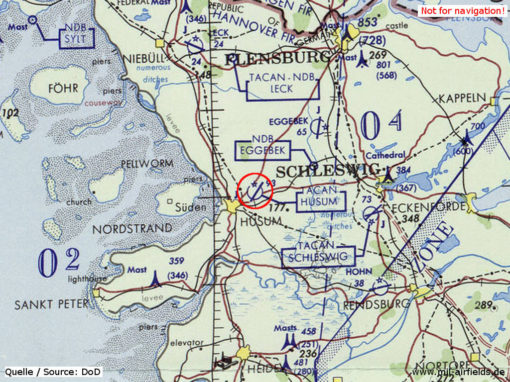
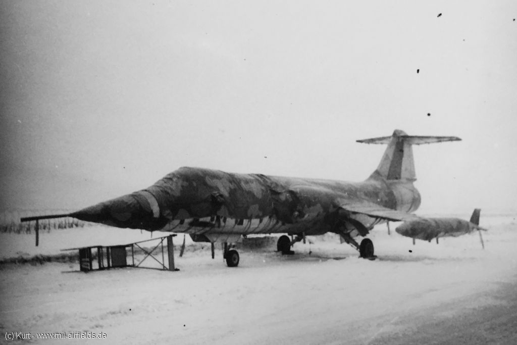
Image credits are shown on the respective target page, click on the preview to open it.
 Follow mil-airfields on Facebook