For historical information only, do not use for navigation or aviation purposes!
| Coordinates | N532217 E0142233 (WGS84) Google Maps (approximate location) |
| Former East Germany (GDR) | District of Neubrandenburg |
| Federal state | Mecklenburg-Vorpommern (Mecklenburg-Western Pomerania) |
Germany during the Cold War Map
The history of the Cold War airfields: Ladenthin
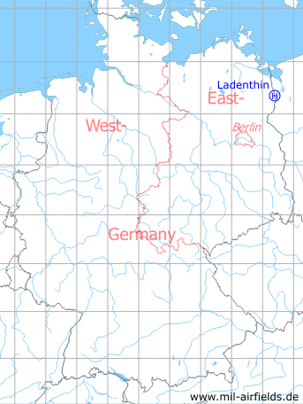
Location of airfield
According to the coordinates, the helipad was located 100 .. 200 m north of the main street and 150 m west of the road to Schwennenz.
Usage during the Cold War
Helipad 1020 for sub-depot 4 of Signals Depot 2 (TL-4/NGL-2) of former East German Ministry of National Defense (MfNV/NVA).
Use today
Closed.
Runways, taxiways, aprons
Dimensions: 75 m x 100 m,
Main takeoff and landing direction: 90°,
Surface: Grass,
Capacity: 1 helicopter.
Main takeoff and landing direction: 90°,
Surface: Grass,
Capacity: 1 helicopter.
Telephone
Fe-Feldverbindung 200 m auf Fe-Vermittlung OB 62-10 auf dieser HADP und Stabsnetz.
TL-4/NGL-2: Sondernetz/Stabsnetz S1: 48234-827p, Tarnname: Großlautsprecher 14
Airspace and procedures
Usable at day and night during good weather conditions.
Alert time: 60 minutes.
Alert time: 60 minutes.
Obstacles
None.
Units
Ladenthin was home for the sub-depot 4 of Signals Depot 2 (NGL-2) Rechlin. Signals Depot 2 was directly subordinated to the Ministry of Defense (MfNV).
Sub-depot 4:
- Postal address: PO Box 26228,
- National People's Army installation Id: 03/099.
Sub-depot 4:
- Postal address: PO Box 26228,
- National People's Army installation Id: 03/099.
Airfields in the vicinity
- 222°/9km Storkow (Penkun): Helipad 1021 (HSLP 1021)
- 313°/16km Löcknitz: Helipad 3380 (HSLP 3380)
- 299°/17km Bergholz: Agricultural Airfield
 Follow mil-airfields on Facebook