Peenemünde: Air Base
For historical information only, do not use for navigation or aviation purposes!
| Coordinates | N540929 E0134627 (WGS84) Google Maps |
| Former East Germany (GDR) | District of Rostock |
| Federal state | Mecklenburg-Vorpommern (Mecklenburg-Western Pomerania) |
| Region | Baltic sea, Isle of Usedom |
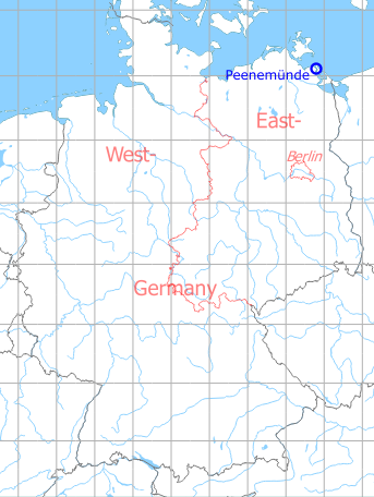
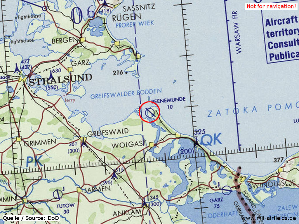
Germany during the Cold War Map
The history of the Cold War airfields: Peenemünde
During World War II
Situation
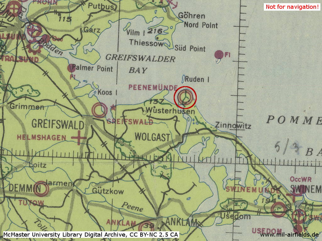
Peenemünde Air Base in World War II on a US map from 1943
Source: McMaster University Library Digital Archive, License: Creative Commons Attribution-NonCommercial 2.5 CC BY-NC 2.5 CA
Overview
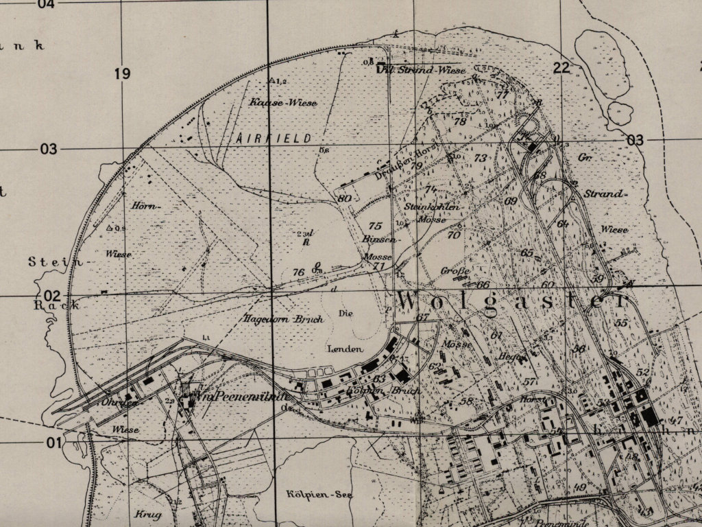
Peenemunde airfield on a US map from 1952
Source: AMS M841 GSGS 4414, Courtesy Harold B. Lee Library, Brigham Young University
During the Cold War
In the 1960s
Overview
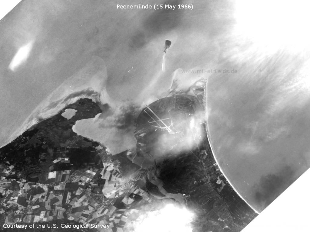
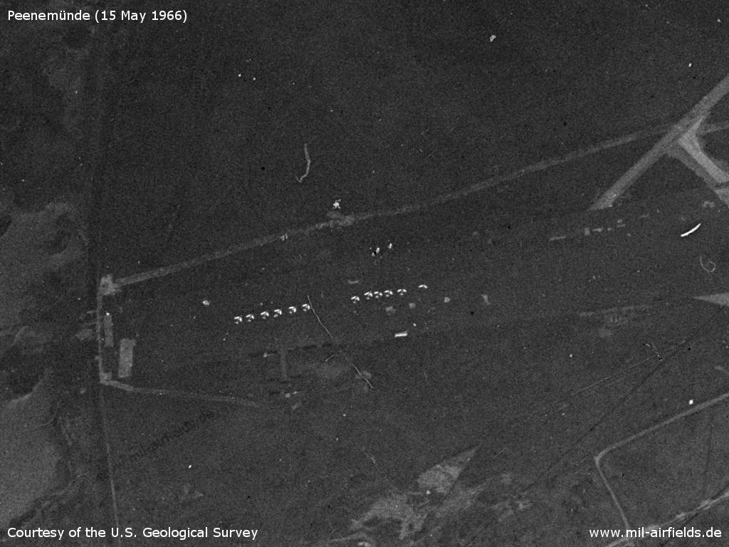
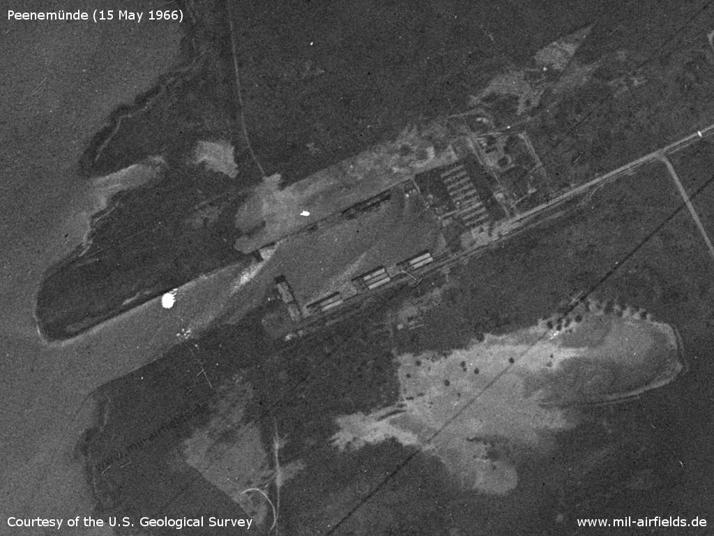
The north of Usedom Island with the airfield on on a US satellite image from 15 May 1966 - To the north is the small island of Ruden. On the mainland west of the northern tip, the Greifswald/Lubmin nuclear power plant was already planned at that time, but no traces are visible here yet.
Source: U.S. Geological Survey
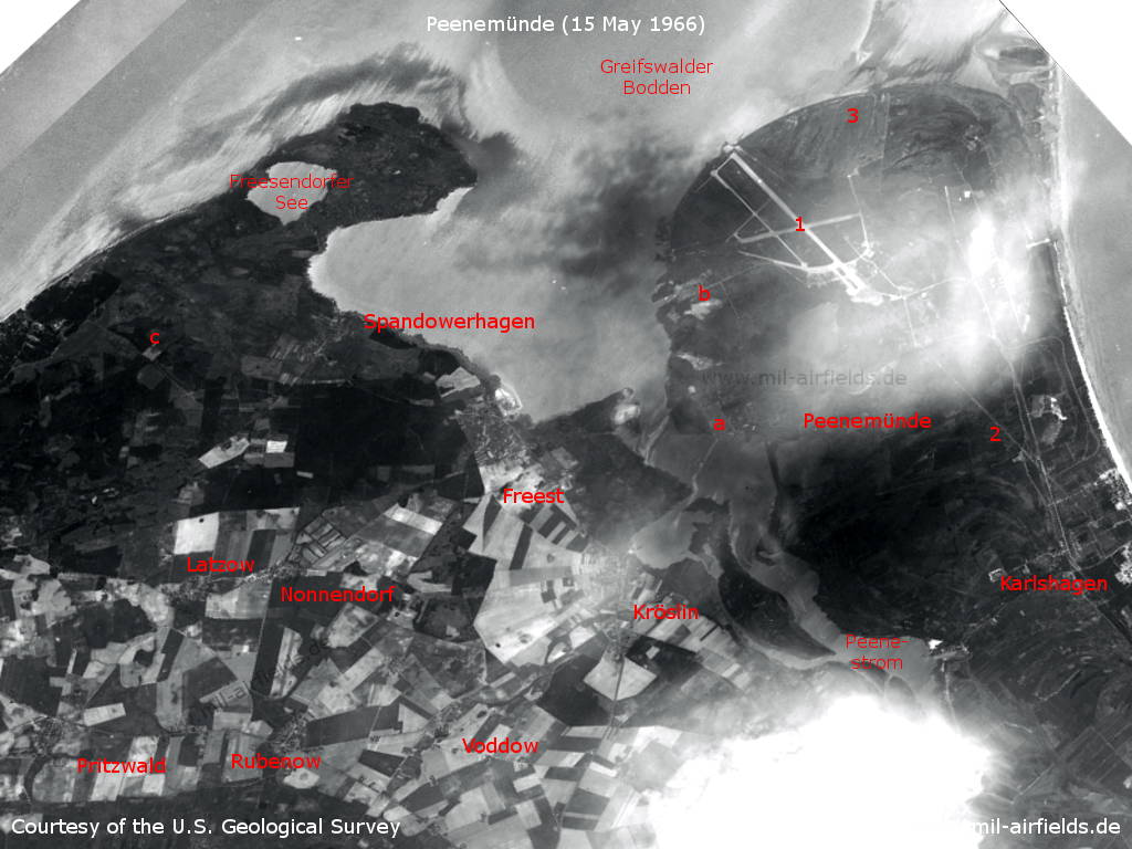
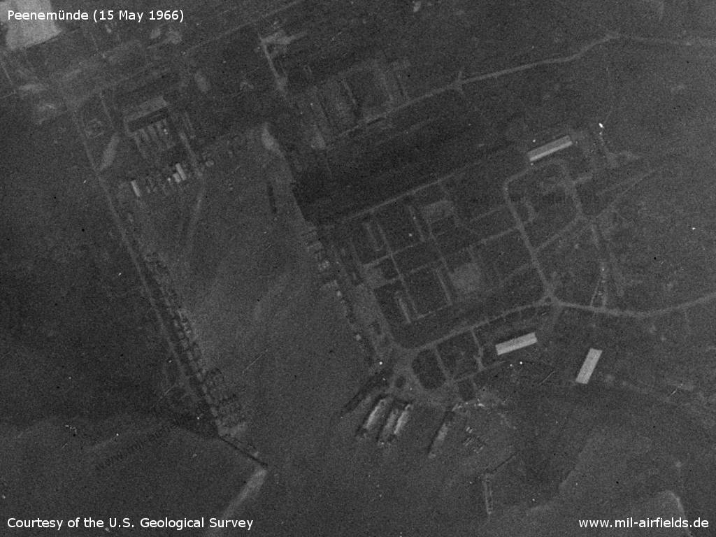
Usedom with Peenemünde, 1966 - 1: airfield: 2: approach lane; 3: Firing range; a: Peenemünde port; b: Peenemünde northern port; c: Area of the later Lubmin nuclear power plant; Places: Freest, Karlshagen, Kröslin, Latzow, Nonnendorf, Pritzwald, Rubenow, Spandowerhagen, Voddow. Waters: Greifswalder Bodden, Freesendorfer See, Peenestrom.
Source: U.S. Geological Survey
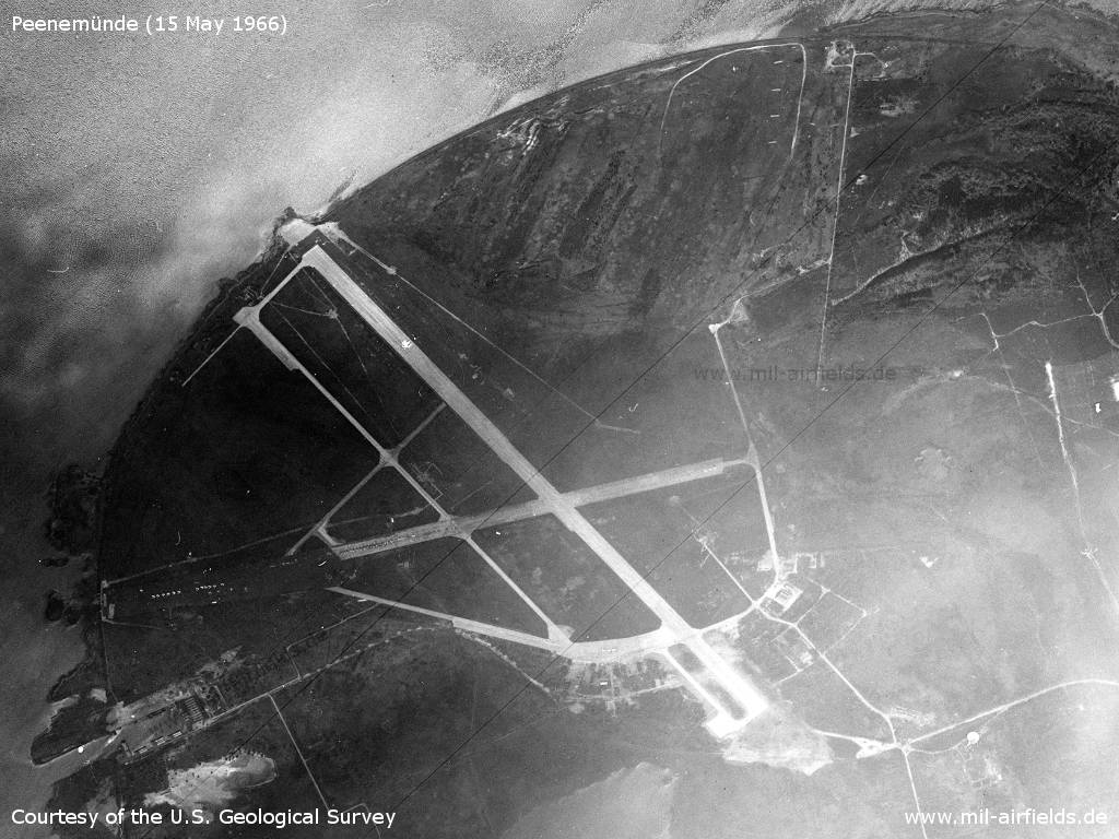
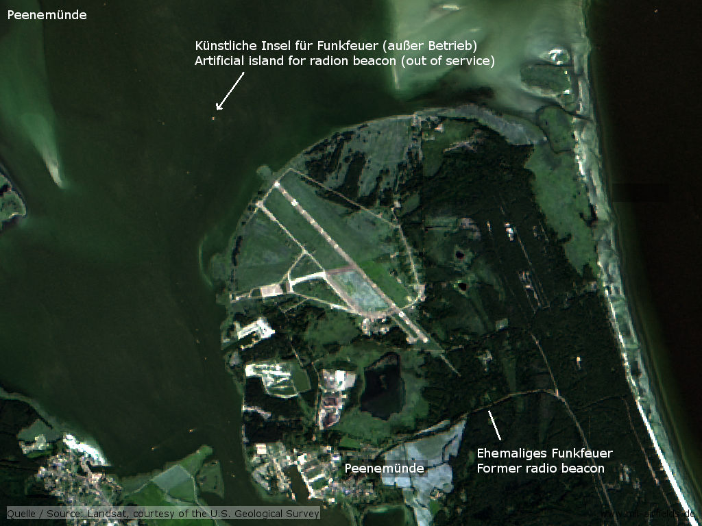
Peenemünde Air Base
Source: U.S. Geological Survey
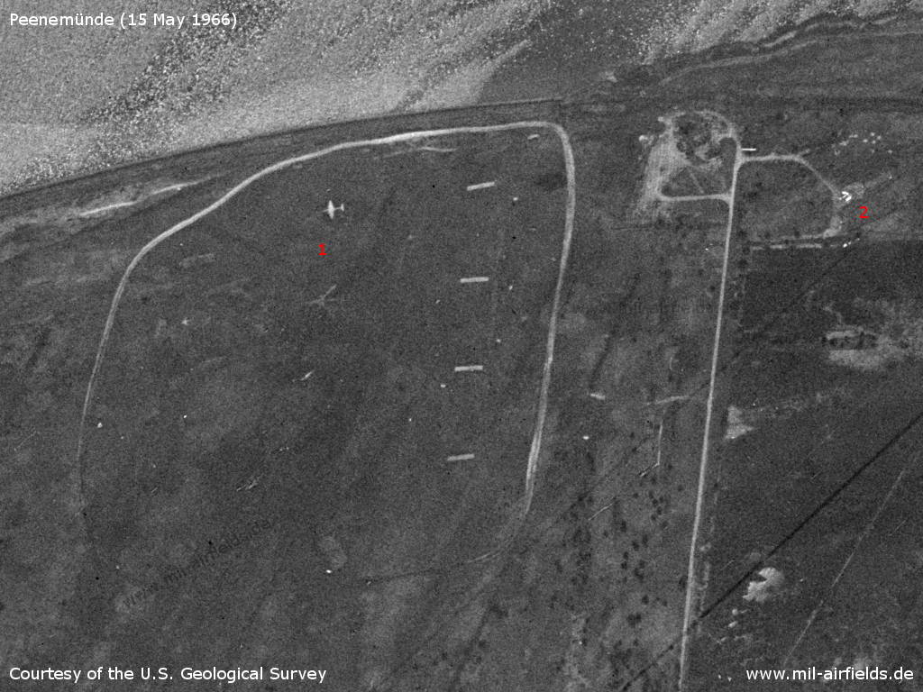
Air-to-ground firing range with aircraft silhouettes (1) and parked aircraft (2)
Source: U.S. Geological Survey
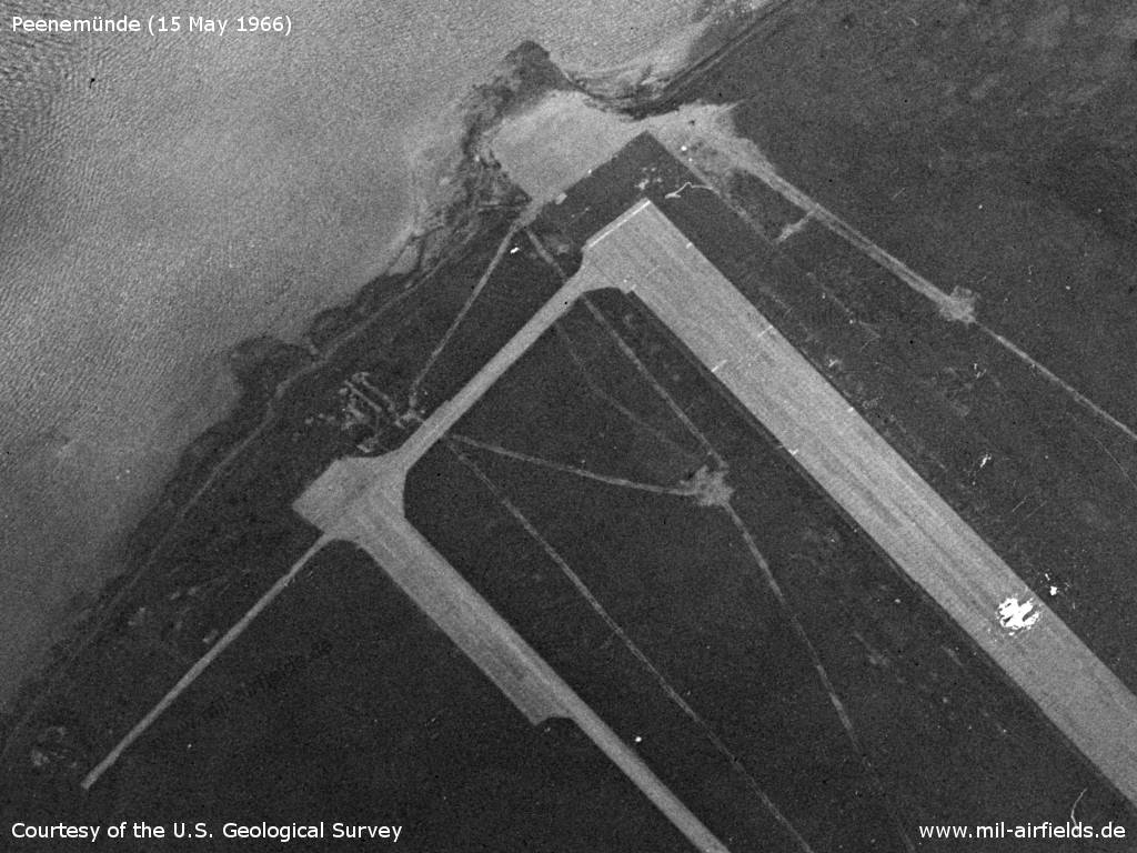
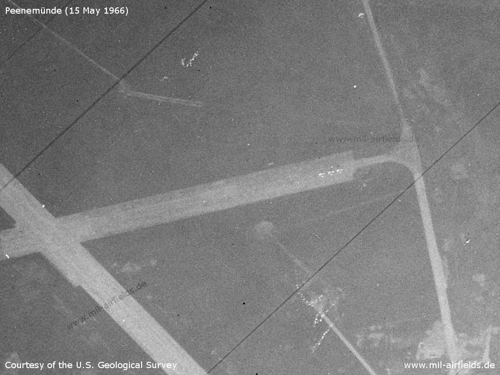
Northern end of the runway
Source: U.S. Geological Survey
Western part with 12 parked fighter aircraft, probably MiG-15/MiG-17
Source: U.S. Geological Survey
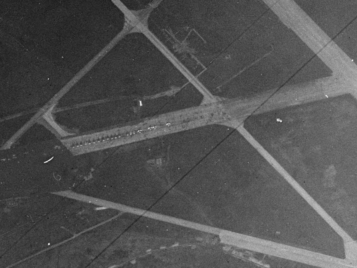
Middle part with 19 aircraft, of which possibly 15 MiG-21 and 4 MiG-15/MiG-17
Source: U.S. Geological Survey
Eastern part with four aircraft, three of them on the flightline and one at the top, left of the taxiway
Source: U.S. Geological Survey
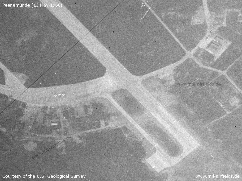
Southern part with four more airplanes
Source: U.S. Geological Survey
Harbor
The two ports of Peenemünde operated by the GDR-Volksmarine are located in the immediate vicinity of the air base.
Peenemünde Northern Harbor
Source: U.S. Geological Survey
Peenemünde Harbor
Source: U.S. Geological Survey
1970s
Situation
Peenemünde Air Base on a map of the US Department of Defense from 1972
Source: ONC E-2 (1972), Perry-Castañeda Library Map Collection, University of Texas at Austin
Radio beacons
- LOM 32: 418 "NE"
- LMM 32: 850 "N"
1980s
Overview
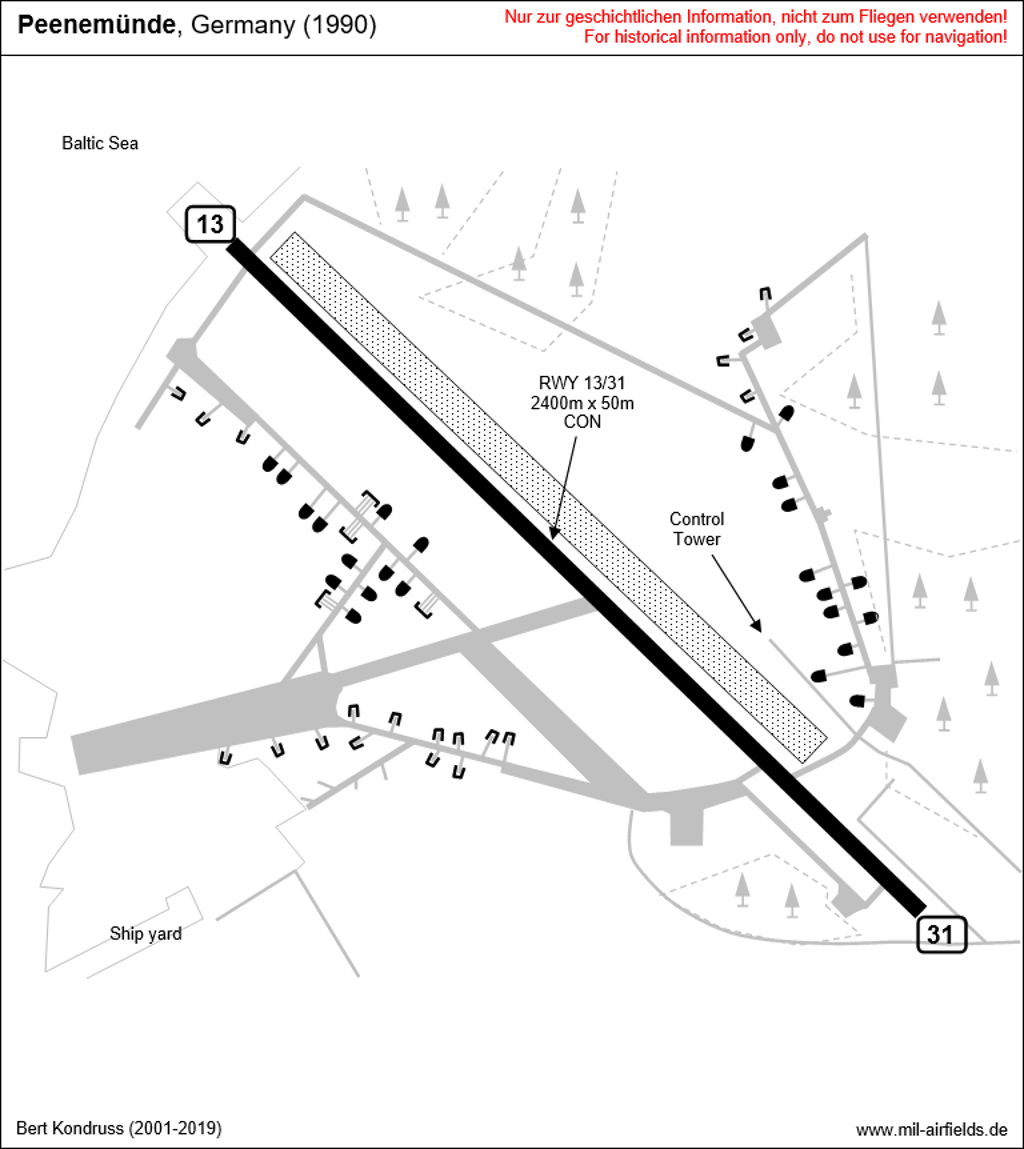
Runways
- 14/32: 2400 m x 50 m Concrete
Radio beacons
- LOM 32: 423.5 "NE", 4370 m to threshold 32
- LMM 32: 867.5 "N", 1050 m to threshold 32
- LOM 14: 423.5 "EN"
- LMM 14: 867.5 "E"
Radio communication
The call sign was NARKOSE.
Telephone
Stabsnetz S1 63727, code names "Tiefenwirkung" and "Brustfell".
Today
Use
General aviation.
Overview
Links
- /BYU/:
http://lib.byu.edu/collections/german-maps/ - German Maps (Topographische Karte 1:25,000)
Airfields in the vicinity
- 143°/5km Karlshagen: Helipad 3361 (HSLP / HLP 3361)
- 180°/18km Seckeritz: Agricultural Airfield
Categories
Military Airfields GermanyMilitary Airfields in former East GermanyAir bases of former National People's ArmyRecommended
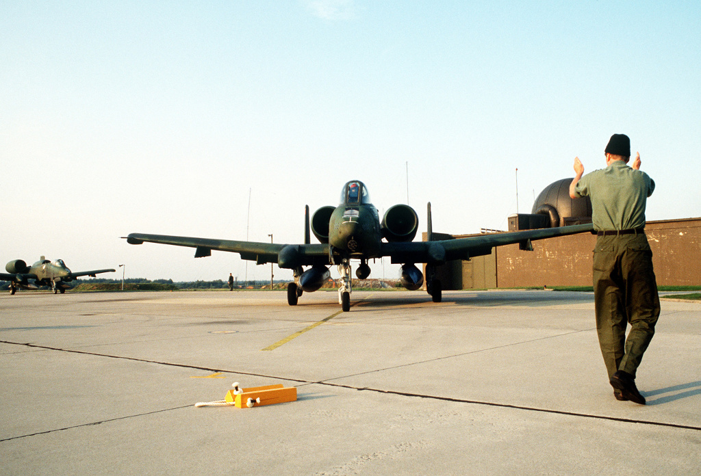
Image credits are shown on the respective target page, click on the preview to open it.
 Follow mil-airfields on Facebook