Ranzig: Helipad 3003
For historical information only, do not use for navigation or aviation purposes!
| Coordinates | N520822 E0141229 (WGS84) Google Maps |
| Former East Germany (GDR) | District of Frankfurt/O |
| Federal state | Brandenburg |
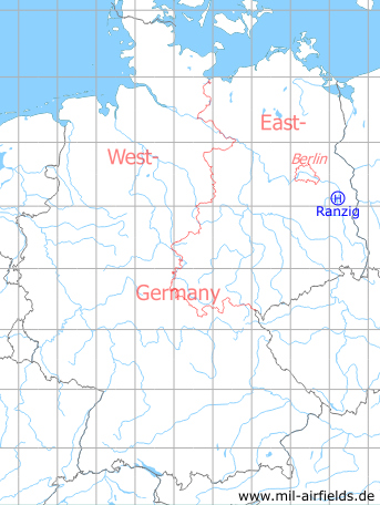
Germany during the Cold War Map
The history of the Cold War airfields: Ranzig
Location of airfield
4.4 km southwest of Beekow, 2.7 km northeast of Ranzig.
Usage during the Cold War
Helipad 3003 for HQ of former East German Air Force (Kdo LSK/LV), presumably for the Rear Command Post.
Use today
Closed.
Runways, taxiways, aprons
Dimensions: 500 m x 260 m,
main takeoff and landing direction: 120°,
surface: grass, meadow,
capacity: 2 helicopters.
main takeoff and landing direction: 120°,
surface: grass, meadow,
capacity: 2 helicopters.
Telephone
Stabsnetz S1 2734-761-88
Airspace and procedures
Usable at day and night during good weather conditions.
Alert time: 60 minutes.
Alert time: 60 minutes.
Obstacles
Power transmission line: direction 90°, distance 300 m.
Links
- http://www.untergrund-brandenburg.de/Sub_Sites/NVA... - Die Rückwärtige Führungsstelle der LSK/LV bei Ranzig (WE-14) Description of the command post
Airfields in the vicinity
- 020°/7km Beeskow: Agricultural Airfield
- 077°/10km Schneeberg: Helipad 3043 (HSLP / HSLP 3043)
- 280°/13km Limsdorf: Helipad 3011 (HSLP 3011)
- 337°/14km Wilmersdorf: Helipad 3023 (HSLP / HLP 3023)
- 124°/16km Weichensdorf: Helipad 1033 (HSLP / HLP 1033)
- 225°/19km Krugau: Helipad 3036 (HSLP / HLP 3036)
- 280°/19km Kehrigk: Helipad 3071 (HSLP / HLP 3071)
- 315°/19km Reichenwalde: Helipad 3120 (HSLP 3120)
- 301°/21km Storkow: Helipad 1027 (HSLP 1027)
 Follow mil-airfields on Facebook