For historical information only, do not use for navigation or aviation purposes!
| Coordinates | N504652 E0111159 (WGS84) Google Maps |
| Airfield Id | 3150 |
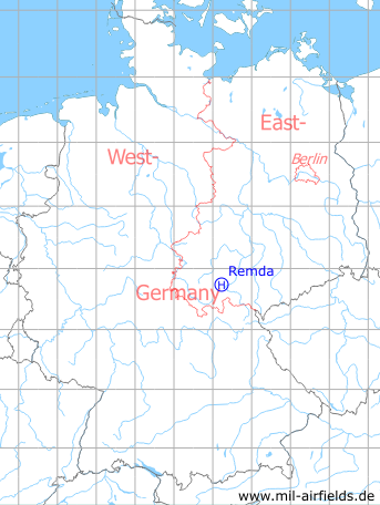
Germany during the Cold War Map
The history of the Cold War airfields: Remda
Location of airfield
3 km NW Remda, at Breitenheerda
Usage during the Cold War
Helipad 3150 for Anti-aircraft unit 514 (FRA-514) of former East German Airforce (NVA LSK/LV).
Use today
Closed.
Runways, taxiways, aprons
Dimensions: 100 m x 100 m
Main takeoff and landing direction: 30°
Surface: Grass (Athletic field)
Capacity: 1 helicopter
Main takeoff and landing direction: 30°
Surface: Grass (Athletic field)
Capacity: 1 helicopter
Telephone
Stabsnetz S1 73391-64
Airspace and procedures
Usable day during good weather conditions
Alert time: 60 minutes
Alert time: 60 minutes
Obstacles
None
Airfields in the vicinity
- 063°/14km Blankenhain: Airfield (Kottenhain)
- 009°/22km Nohra: Airfield (Weimar-Nohra)
- 286°/26km Röhrensee: Airfield (Ohrdruf)
- 078°/28km Schöps: Agricultural Helipad
- 322°/28km Erfurt: Bindersleben Airport (Fliegerhorst Erfurt-Bindersleben, Аэродром Эрфурт, Flughafen Erfurt-Weimar)
- 074°/29km Rothenstein: Helipad
- 335°/29km Erfurt: Erfurt North Airport (Roter Berg Airfield)
- 018°/30km Großobringen: Helipad 3012 (HSLP / HLP 3012)
 Follow mil-airfields on Facebook