Salzwedel: Fliegerhorst, Heliport
For historical information only, do not use for navigation or aviation purposes!
| Coordinates | N525001 E0111214 (WGS84) Google Maps |
| Former East Germany (GDR) | District of Magdeburg |
| Federal state | Sachsen-Anhalt (Saxony-Anhalt) |
| Location indicator | ETSA (ca. 1985-1990) |
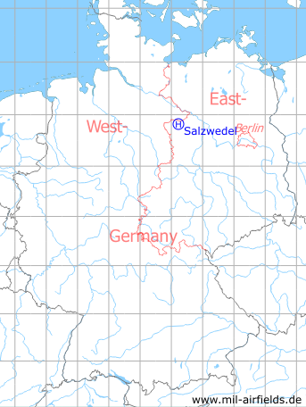
Germany during the Cold War Map
The history of the Cold War airfields: Salzwedel
During World War II
Use
Luftwaffe airbase.
Overview
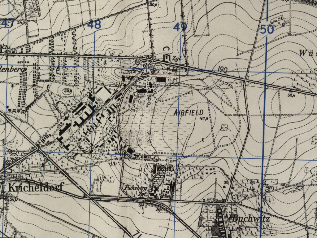
The former Salzwedel air base on a US map from 1951
Source: AMS M841 GSGS 4414, Courtesy Harold B. Lee Library, Brigham Young University
Radio beacons
After the end of the Second World War in the second half of 1945, there was a Range radio beacon "Salzwedel" operated by US troops. According to the coordinates given, however, it was not located near Salzwedel, i.e. not in the Soviet zone, but in the British zone south of Wustrow (Wendland), near the zone border. Already at the beginning of 1946 it was no longer in operation.
During the Cold War
Use
Helicopter landing ground for helicopter squadron 16 (HS-16) of East German Border Troops (Grenztruppen, GT)

Helicopter of the East German Border Troops at Salzwedel (not to scale)
Mil Mi-1 / PZL SM-1 HARE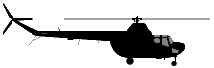
Mil Mi-4 HOUND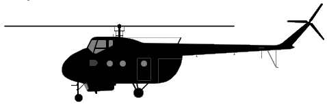
Mil Mi-8 HIP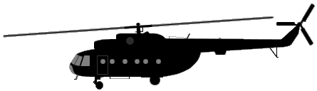
Mil Mi-2 HOPLITE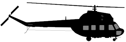
(Sources: Aicraft silhouettes: AirVectors / GVG, Public Domain)
In the 1960s
Overview
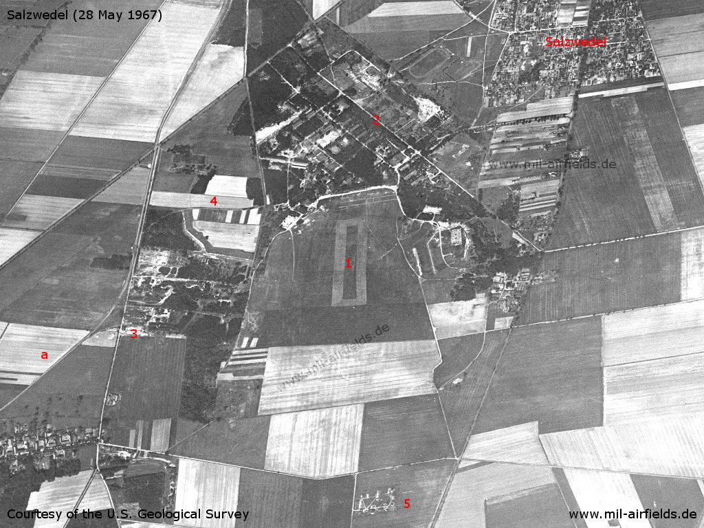
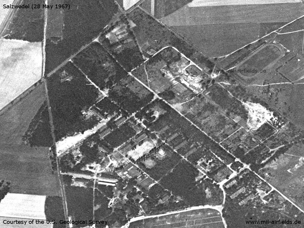
Salzwedel former Fliegerhorst and now Heliport on a US satellite image from 28 May 1967 - Viewing direction approx. west. 1: airfield, 2: barracks, 3, 4: railway sidings to the airfield, 5: ammunition dump?; a: railway line Salzwedel - Badel
Source: U.S. Geological Survey
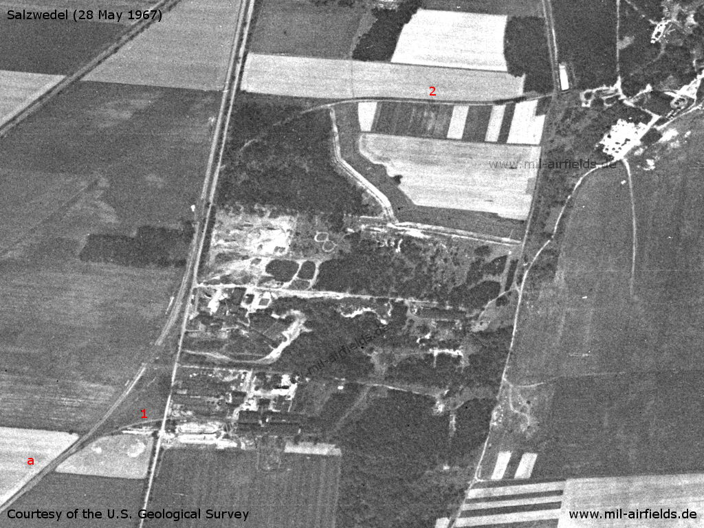
Enlargement: Southern part - 1, 2: spur track; a: railway Salzwedel - Badel
Source: U.S. Geological Survey
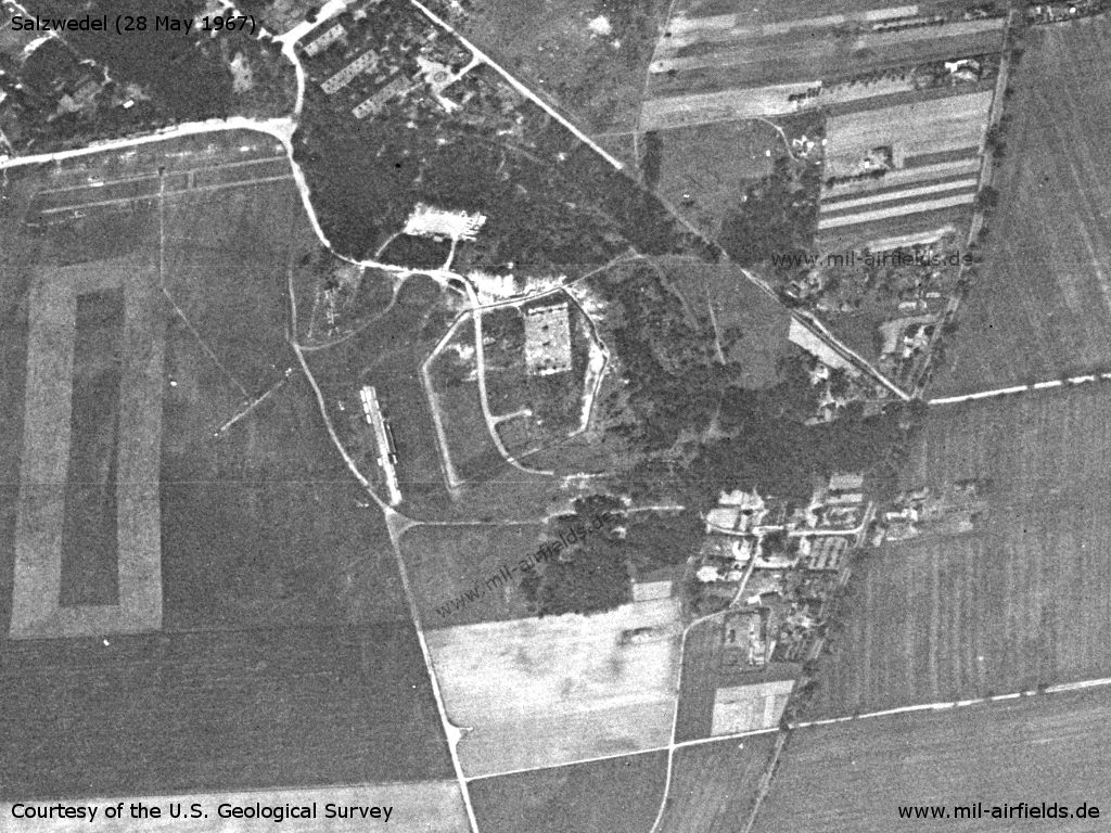
Enlargement: Barracks - Most of the buildings seem to have been demolished.
Source: U.S. Geological Survey
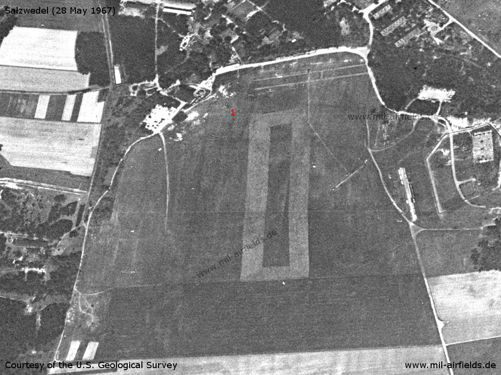
Enlargement: Airfield - 1: this could be a helicopter
Source: U.S. Geological Survey
Enlargement: Northern part
Source: U.S. Geological Survey
In the 1980s and early 1990s
Radio beacons
- Airfield radio beacon: 334,0 "KS"
Radio communication
Call sign: KOSMOS
Telephone
Sondernetz/Stabsnetz S1 über 042-88 (GR-24 / GKK-201), "Preßluftbohrer 21"
Teletype
Sondernetz/Stabsnetz S1 über 035-211 (GR-24 / GKK-201)
Today
Use
Closed.
Overview
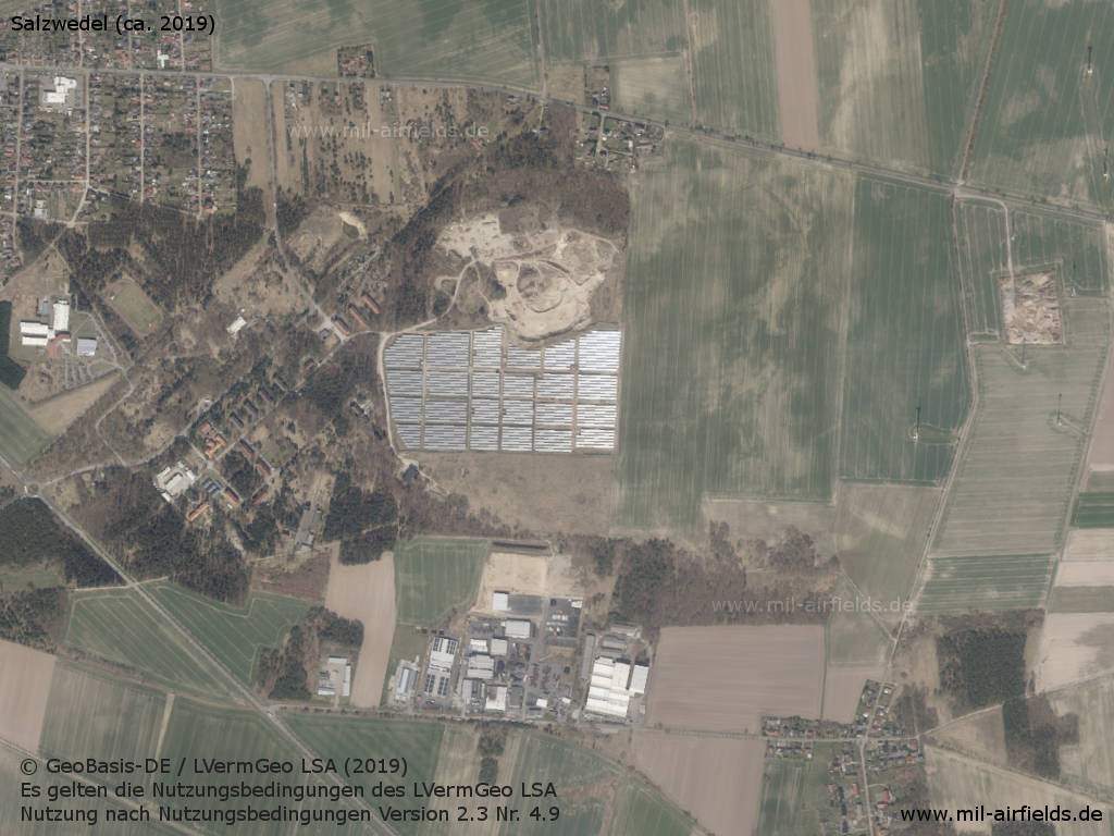
Aerial image (approx. 2019) - The area is partially used as solar park.
Source: © GeoBasis-DE / LVermGeo LSA (2019).
Es gelten die Nutzungsbedingungen des LVermGeo LSA. Nutzung nach Nutzungsbedingungen Version 2.3 Nr. 4.9
Sources
- https://lib.byu.edu/collections/german-maps/http:/... - German Maps (Topographische Karte 1:25,000)German Maps (Topographische Karte 1:25,000)
- http://www.airvectors.net/ - AirVectors by Greg Goebel
- https://www.lvermgeo.sachsen-anhalt.de - Landesamt für Vermessung und Geoinformation Sachsen-Anhalt
Links
- http://www.nva-flieger.de/index.php/nva-hs-plaetze... - nva-flieger.de - Hubschrauberplatz Salzwedel Pictures and document "Ordnung zum Fliegen auf dem Landeplatz Salzwedel" (Instruction for flying at the landing ground Salzwedel) from 1986.
Im Dokument ist auf Seite 12 (Anlage 1) eine Landerichtung 270°/90° angegeben. Aber auf der nächsten Seite 13 (Anlage 2) ist eine Art Platzrunde eingezeichnet, die gegenüber der Ost-West-Richtung gedreht ist. Der Webmaster von nva-flieger.de, Thomas Hietschold, hat recherchiert und schreibt dazu: "Die Ursache für die Diskrepanz ist recht einfach: Schlamperei beim Zeichnen. Man ja seinerzeit alles mit dem Stift gemacht (im besten Falle als schöne Tuschezeichnung, so wie im Dokument Nordhausen - auch wenn das auf dem Scan nicht mehr so gut zu erkennen ist) und hatte wahrscheinlich nicht die rechten Ambitionen, das ganze noch einmal zu zeichnen. Das kann ich zwar nicht nachvollziehen, da es der geforderten "Stabskultur" in der NVA widersprach und außerdem eben auch ungenaue fliegerische Unterlagen ergab. Aber man muss nicht alles verstehen. Die Richtung muss also wirklich 270° betragen."
Bibliography
- Ries, Karl; Dierich, Wolfgang: "Fliegerhorste und Einsatzhäfen der Luftwaffe" Motorbuch Verlag Stuttgart, 1993 - Allied map of the former Luftwaffe airbase Salzwedel.
Related topics
Airfields in the vicinity
- 208°/7km Altensalzwedel: Radio-technical company 614 (Helipad 3184)
- 012°/45km Karenz: Helipad 3372 (HSLP / HLP 3372)
- 118°/47km Stendal: Air Base (Borstel)
Recommended
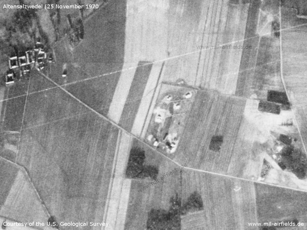
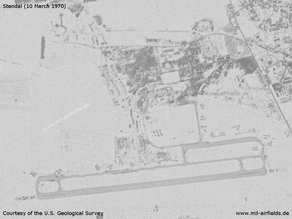
Image credits are shown on the respective target page, click on the preview to open it.
 Follow mil-airfields on Facebook