For historical information only, do not use for navigation or aviation purposes!
| Coordinates | N531828 E0141653 (WGS84) Google Maps (approximate location) |
| Former East Germany (GDR) | District of Neubrandenburg |
| Federal state | Mecklenburg-Vorpommern (Mecklenburg-Western Pomerania) |
Germany during the Cold War Map
The history of the Cold War airfields: Storkow (Penkun)
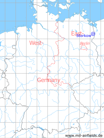
Location of airfield
According to the coordinates, the helipad was located at the eastern edge of Storkow, to the south of the lake.
Usage during the Cold War
Helipad 1021 for Sub Depot 5 of Signals Depot 2 (TL-5/NGL-2) of former East German Ministry of National Defense (MfNV/NVA).
Use today
Closed.
Runways, taxiways, aprons
Dimensions: 100 m x 50 m,
Main takeoff and landing direction: 180°,
Surface: Agricultural ground,
Capacity: 1 helicopter.
Main takeoff and landing direction: 180°,
Surface: Agricultural ground,
Capacity: 1 helicopter.
Telephone
Fe-Feldverbindung 500 m auf Fe-Vermittlung OB 62-10 auf dieser HADP und S-1 (Fs vorhanden)
TL-5/NGL-2: Sondernetz/Stabsnetz S1: 48234-820p, Tarnname: Großlautsprecher 15
Airspace and procedures
Usable at day and night during good weather conditions.
Alert time: 60 minutes.
Alert time: 60 minutes.
Obstacles
None.
Units
Storkow was home for sub-depot 5 of Signals Depot 2 (NGL-2) Rechlin. NGL-2 was directly subordinated to the Ministry of National Defense.
Sub-depot 5:
- Postal address: PO Box 26229,
- National People's Army installation ID: 03/100.
Sub-depot 5:
- Postal address: PO Box 26229,
- National People's Army installation ID: 03/100.
Airfields in the vicinity
- 042°/9km Ladenthin: Helipad 1020 (HSLP 1020)
- 331°/17km Bergholz: Agricultural Airfield
- 343°/19km Löcknitz: Helipad 3380 (HSLP 3380)
 Follow mil-airfields on Facebook