For historical information only, do not use for navigation or aviation purposes!
| Coordinates | N521642 E0090456 (WGS84) Google Maps |
| Elevation | 230 ft |
| Location indicator | DEBU (195x), EDCB (196x-1995), ETHB (1995-) |
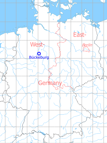
Germany during the Cold War Map
The history of the Cold War airfields: Bückeburg
During the Cold War
Use
Royal Air Force airfield until 1954, thereafter German Army aviation.
In the 1940s
Use
Royal Air Force air base.
Runways
- 085/265: 1372 m
Radio communication
- Bückeburg Tower 6440, 117.9
- Bückeburg Homer 3255, 116.1
In the 1950s
Situation
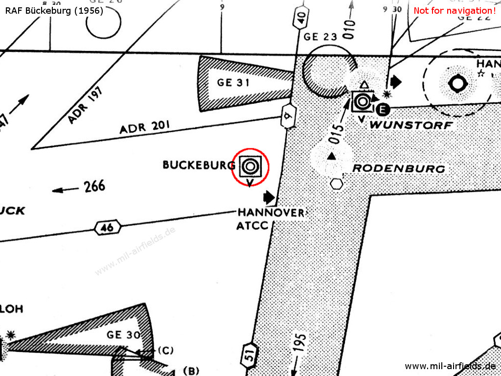
RAF Bückeburg on a map from 1956
Early 1960s
Runways
- 08/26: 1832 m (6010 ft) x 45 m (148 ft)
Radio communication
- Hannover Approach Control 380.7, 118.05
- Bückeburg Tower 303.4, 257.8, 117.9
Late 1960s
Situation
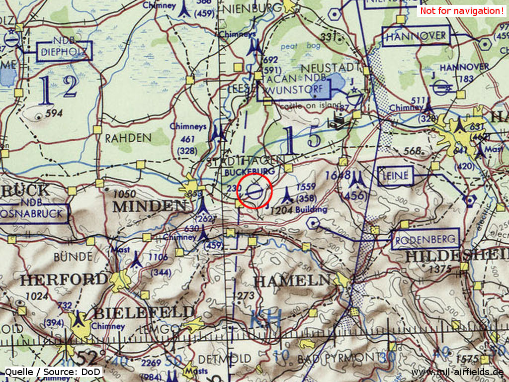
Bückeburg airfield on a map of the US Department of Defense from 1972 - (ONC E-2 (1972), Perry-Castañeda Library Map Collection, University of Texas at Austin /PCL MC/)
Radio beacons
- NDB: 368 "BY", am Platz
Radio communication
- Hannover Approach Control 380.7, 118.05
- Bückeburg GCA 267.4, 270.4, 142.8, 143.7, 344.0, 385.4, 123.3
- Bückeburg Tower 303.4, 257.8, 304.5, 268.6, 122.1, 147.6, 34.6
In the 1980s
Overview
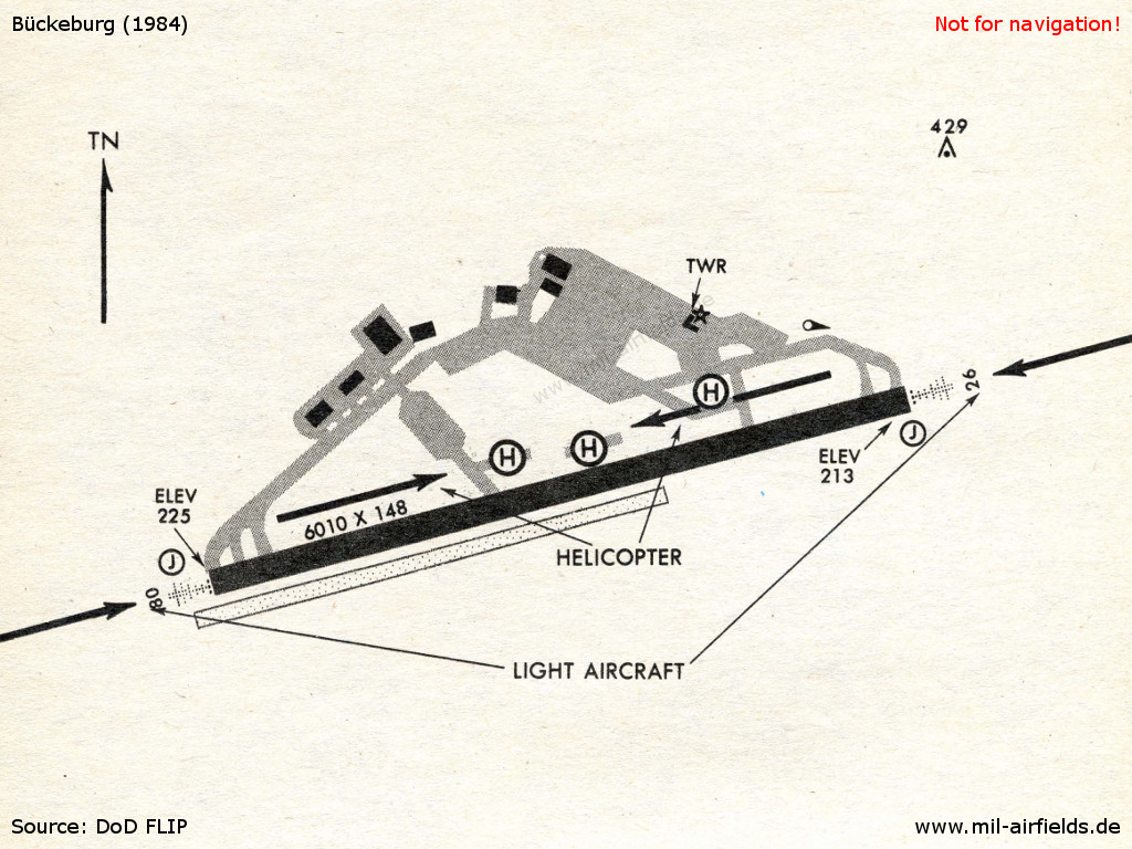
Bückeburg Army in 1984
Runways
- 08/26: 1832 m x 45 m Asphalt
Radio beacons
- NDB: 368 "BYC", am Platz
Radar
ASR, PAR
 Follow mil-airfields on Facebook