Ludwigslust: Airfield
For historical information only, do not use for navigation or aviation purposes!
| Coordinates | N531858 E0113260 (WGS84) Google Maps |
| Former East Germany (GDR) | District of Schwerin |
| Federal state | Mecklenburg-Vorpommern (Mecklenburg-Western Pomerania) |
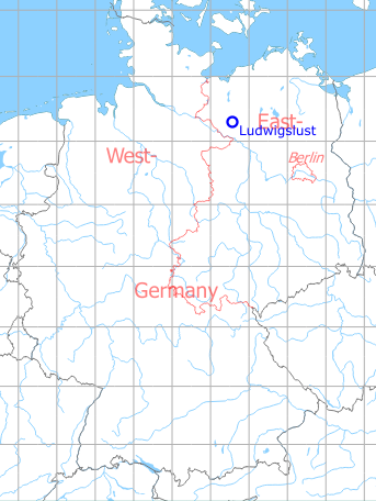
Germany during the Cold War Map
The history of the Cold War airfields: Ludwigslust
General
Approximately three kilometres southeast of Ludwigslust there was an auxiliary airfield of the Soviet armed forces in East Germany ("GDR"). It was located on a military training ground and had a runway with a grass surface. The site is not identical to the former Fliegerhorst Ludwigslust (Luftwaffe Air Base), which was located approx. 3 km south-southeast of the city. Today both the auxiliary airfield and the airbase are closed.
During the Cold War
Use
Soviet reserve airfield.
In the 1960s
Overview
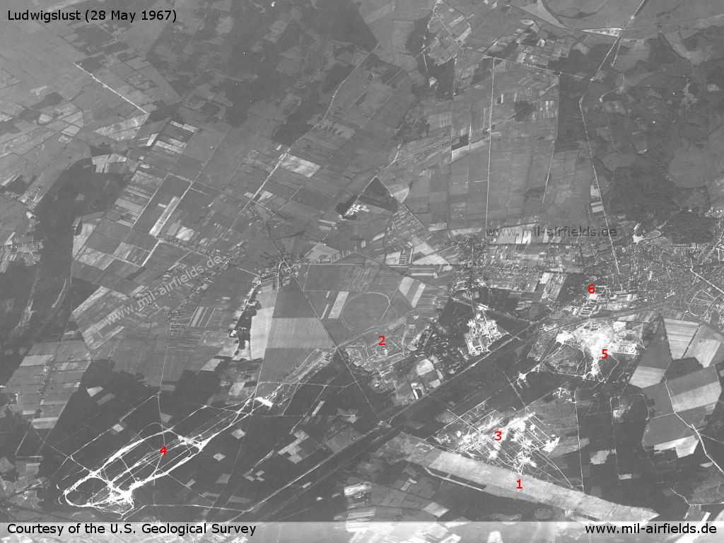
View over the military installations in Ludwigslust on a US satellite image from 28 May 1967. Direction of view is about west - 1: auxiliary airfield, 2: former Luftwaffe air base, now Soviet barracks with air defence site, 3,4,5: military training areas, 6: City of Ludwigslust
Source: U.S. Geological Survey
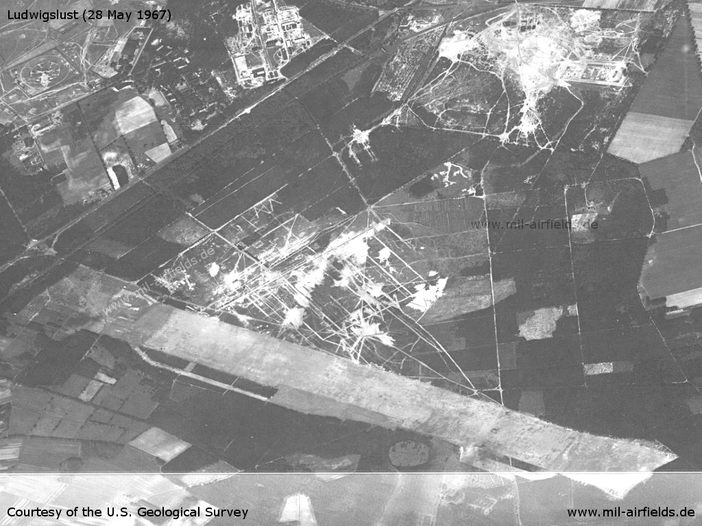
Enlargement. Airfield
Source: U.S. Geological Survey
In the 1970s
Overview
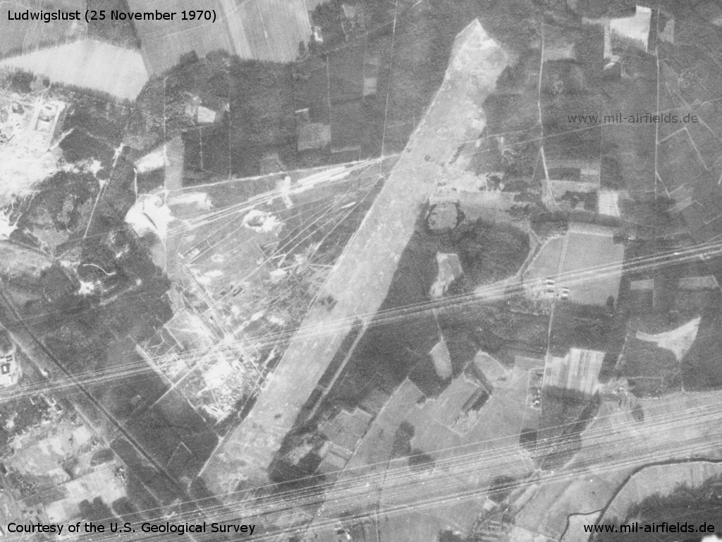
Ludwigslust Airfield on a US satellite image from 25 November 1970
Source: U.S. Geological Survey
In the 1980s and early 1990s
Runways
Data for the year 1990:
- 03/21: 2500 m Grass
Today
Use
Closed.
Airfields in the vicinity
- 233°/17km Karenz: Helipad 3372 (HSLP / HLP 3372)
- 096°/18km Ziegendorf: Helipad 3346 (HSLP / HLP 3346)
- 051°/20km Parchim: Airfield (Schwerin-Parchim)
- 019°/25km Tramm: Helipad 3344 (HSLP / HLP 3344)
- 321°/25km Alt Zachun: Agricultural Airfield
 Follow mil-airfields on Facebook