Neuhausen ob Eck: Airfield
For historical information only, do not use for navigation or aviation purposes!
| Coordinates | N475836 E0085417 (WGS84) Google Maps |
| Elevation | 2630 ft |
| Location indicator | EDPH (1990), EDSN |
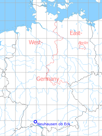
Germany during the Cold War Map
The history of the Cold War airfields: Neuhausen ob Eck
During World War II
Use
Luftwaffe airfield.
During the Cold War
Use
German Army aviation airfield.
In the 1970s
Overview
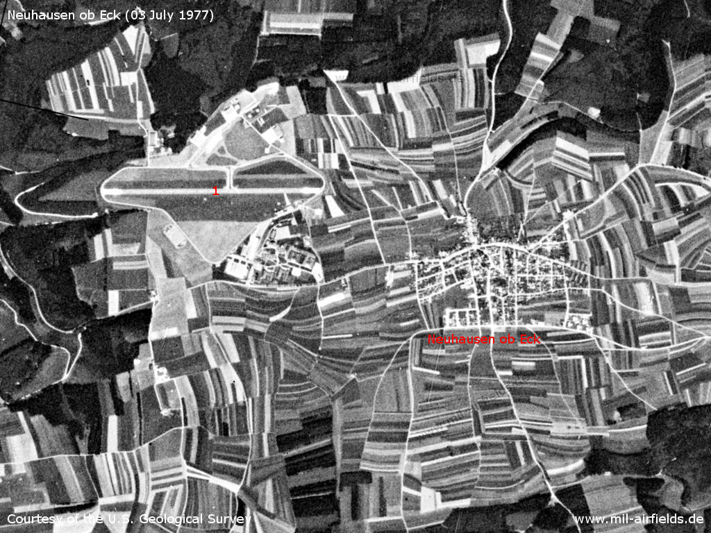
Neuhausen ob Eck on a US satellite image from 03 July 1977 - 1: airfield.
Source: U.S. Geological Survey
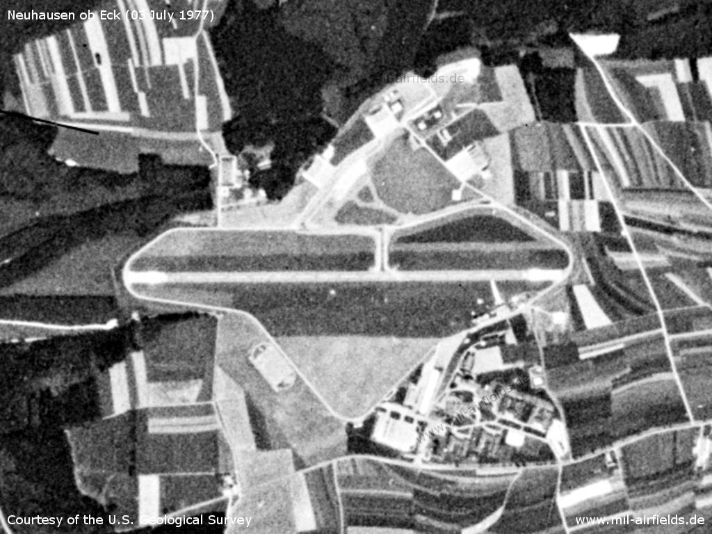
Airfield
Source: U.S. Geological Survey
In the 1980s and early 1990s
Situation
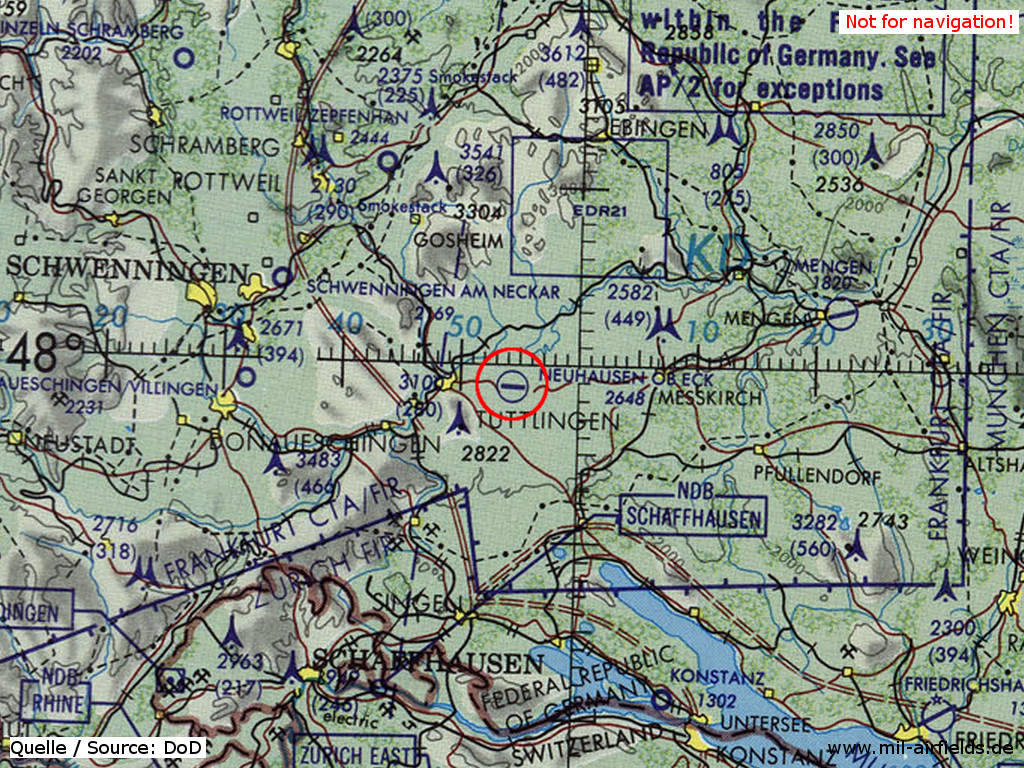
Neuhausen ob Eck Airfield on a map of the US Department of Defense from 1981
Source: ONC F-2 (1981), Perry-Castañeda Library Map Collection, University of Texas at Austin
Overview
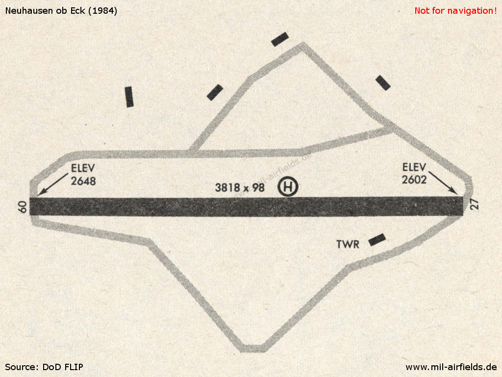
Neuhausen ob Eck in 1984
Radio beacons
- NDB: 442.5 "NUN", at field
Radar
ASR/PAR (1990)
Radio communication
Call sign: HAUSEN.
Units
1990: Heeresfliegerregiment 20 (HFlgRgt 20) mit UH-1D, Heeresfliegerstaffel 10 (HFlgS 10) mit Bo-105M.
Today
Use
Special airfield / general aviation, business park and festival area.
Pictures from January 2006
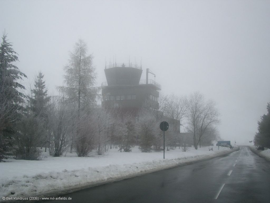
Control tower in snow and fog
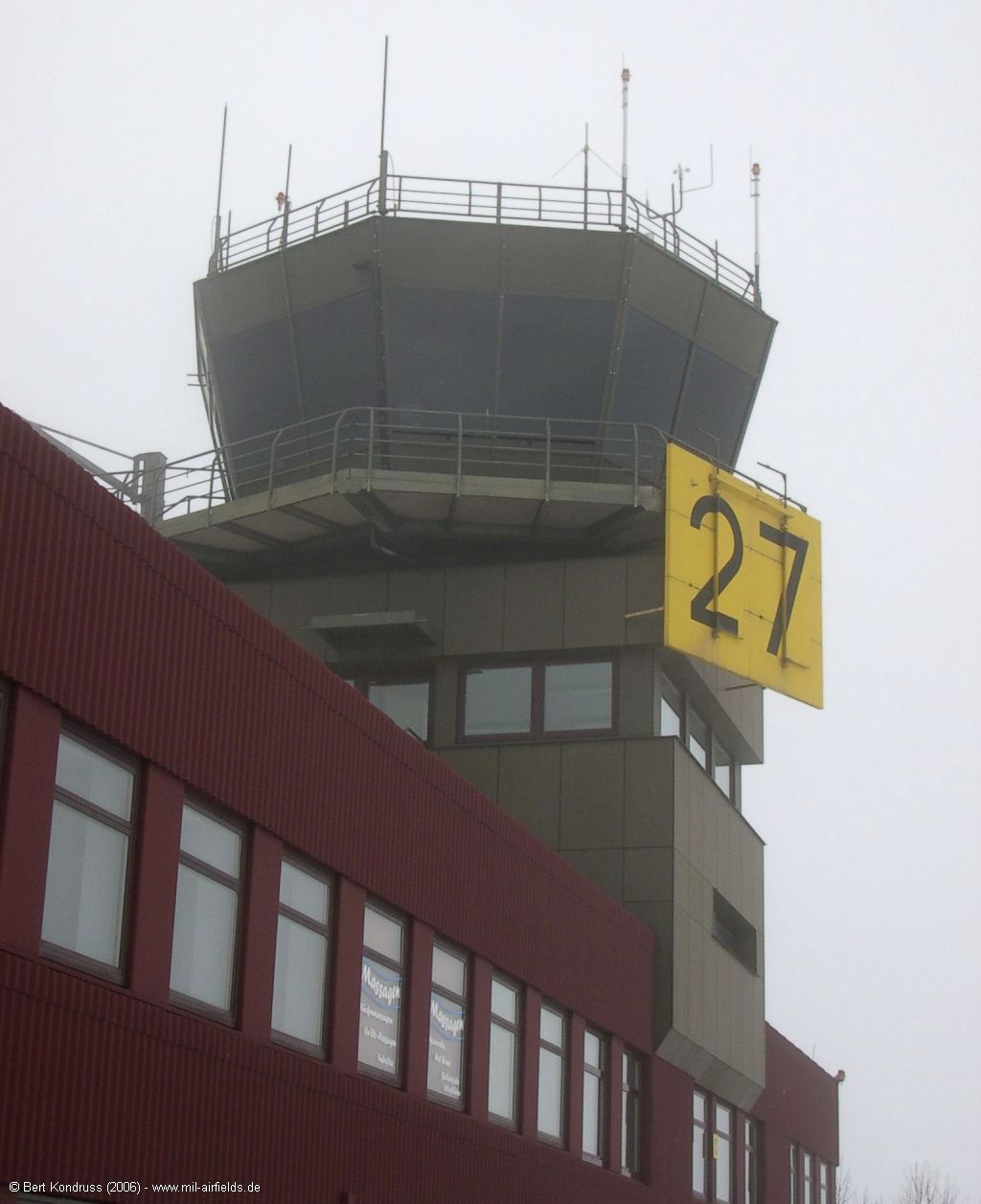
Active runway: 27
Links
- http://www.take-off-park.de/ - take-off GewerbePark
Airfields in the vicinity
Recommended
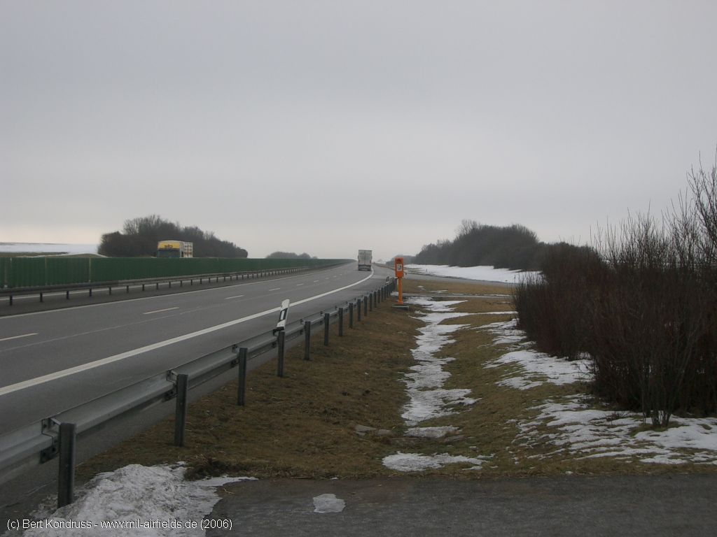
Image credits are shown on the respective target page, click on the preview to open it.
 Follow mil-airfields on Facebook