For historical information only, do not use for navigation or aviation purposes!
| Coordinates | N513435 E0140811 (WGS84) Google Maps |
| Elevation | 375 ft |
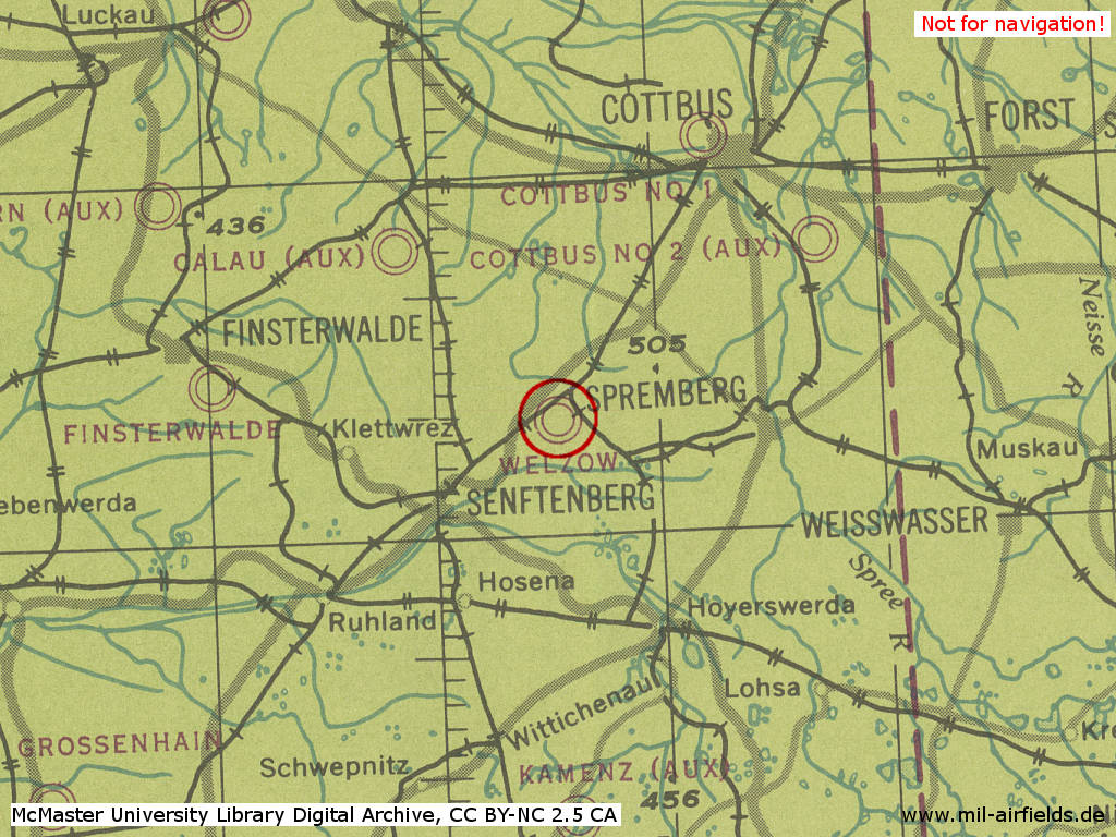
| Former East Germany (GDR) | District of Cottbus |
| Federal state | Brandenburg |
| Location indicator | EDCY |
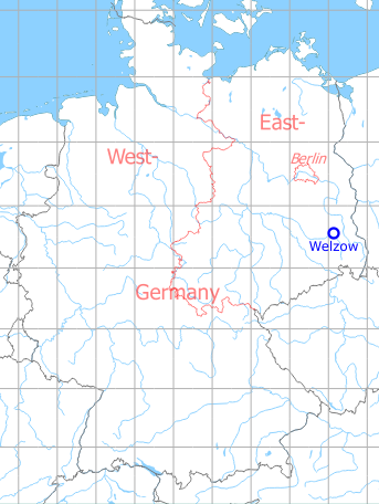
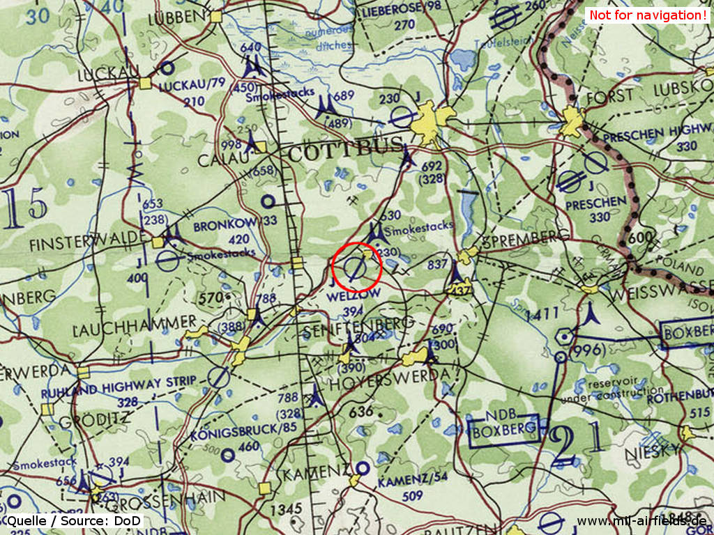
Germany during the Cold War Map
The history of the Cold War airfields: Welzow
Location of airfield
2 km west of Welzow.
Overview
Welzow was built in the mid-1930s as an airfield for the German Luftwaffe. At the end of the Second World War it was taken over by the Soviet occupation forces and massively expanded in the 1950s. From this time on, the 11th Independent Reconnaissance Air Regiment (11 ОРАП - 11 отдельный разведывательный авиационный полк) was stationed here, which was equipped with different aircraft types over the following years: Il-28R, Yak-27R, Yak-28R/PP, Su-24MR and Su-24MP. After the withdrawal of the Soviet/Russian units at the beginning of the 1990s, the airfield is used for general aviation.
Highlights
- Remote dispersal area 4 km northwest
- Since mid-1970 two parallel runways
During World War II
Use
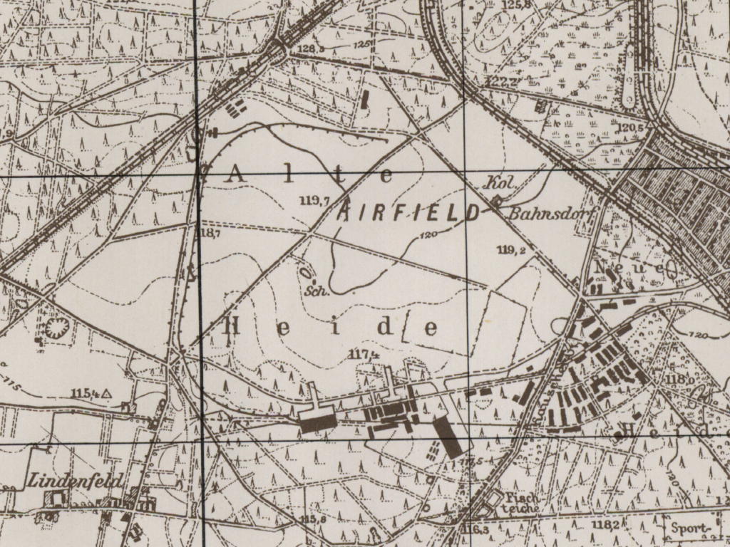
Luftwaffe air base.
Situation
Fliegerhorst Welzow in World War II on a US map from 1944
Source: McMaster University Library Digital Archive, License: Creative Commons Attribution-NonCommercial 2.5 CC BY-NC 2.5 CA
Overview
Welzow air base on a US map from 1952
Source: AMS M841 GSGS 4414, Courtesy Harold B. Lee Library, Brigham Young University
During the Cold War
Usage during the Cold War
Soviet airbase.
In the 1950s
Overview
The following map is from a report for the CIA from 1955.
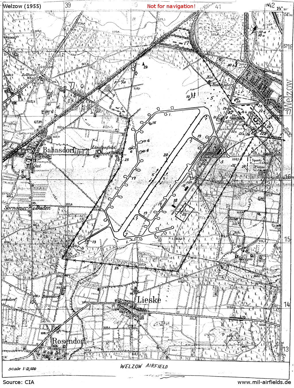
The Air Base in 1955
Source: CIA
| 1 | Dispersal areas: Round concreted hardstands on both sides of the taxiways. Eastern taxiway expanded in front of flight control station. |
| 2 | Bunkers: Earth bunkers east of Bahnsdorf cemetery in former AA gun emplacement. |
| 3 | Railroad connection: Supply railroad station is Welzow, the spur track is leading from Welzow railroad station in a curve to the airfield, the track terminates at fuel dump, ramps presumably near dump. |
| 4 | Barracks: 8 brick barracks between eastern taxiway and new road. |
| 5 | Lighting facilities: |
| Searchlights: 2 at southern runway end, 1 at northern runway end, 1 near triangulation point 120.5 in northern extension of runway | |
| Runway lights: White lamps on both sides of runway | |
| Flare path: in northern direction | |
| Revetments: 35 (?) adjacent to round dispersal areas, 3 revetments are entered on sketch | |
| 7 | Electric installation: Connecting pieces for lighting facilities |
| 8 | Flight control station: New building with tower |
| 9 | AA gun emplacement North of Bahnsdorf cemetery in northwestern corner of landing field occupied by up to 8 x 84-mm guns |
| 9a | New brick quartering building 35 x 15 meters: Just north of AA guns. |
| Additional 85-mm and 37-mm AA guns parked in northeastern corner of field, temporarily on apron in front of garage. | |
| 10 | Radio installations |
| 10a | PKV-45 direction finding (DF) station: East-southeast of Geisendorf, on triangulation point 157.6 (see plane table sheet No 4351). |
| 10b | Inner low frequency approach beacon: In northeastern extension of runway, near triangulation point 120.5. |
| 10c | Outer low frequency approach beacon: South of Geisendorf, on triangulation point 135.5 (see plane table sheet No 4351) |
| 10d | Kniferest and Fishnet radar: On landing field northwest of northern end of runway. |
| - | 2-mast radio installation: About 200 meters southwest of Rosendorf, west of triangulation point 107.6, southwest of airfield. |
| 11 | Garage: New building with apron surrounded by board fence. |
| 12 | Hangars: 2 northeast of flight control station, each about 60 x 35 meters, pin-point location not determined. |
| 13 | Firing and zeroing-in stand Branch off southwest of taxiway and leading into "Weisser Berg" most part of which was leveled. |
| 14 | Buildings |
| 14a | Brick building housing kitchen. |
| 14b | New building with officers' club. |
| 14c | U-shaped new building, probably planned to house officers' club. |
| 15 | Compensating base: Planned instead of round parking area. |
| 16 | Storehouse New building storing rations, clothing and material. |
| 17 | Ammunition dump: In northern corner of airfield; surrounded by double fence; searchlights on wooden poles 30 meters apart; 3 to 5 bunker-like buildings. |
| 18 | New building: Type and utilization unknown. |
| 19 | Taxiways: 18.25 (?) m wide, 20 cm thick. |
| 20 | Runway: Extending from south-southwest to north-northeast, 2.500 meters long, 80 meters wide, 20 to 25 cm thick. |
| 21 | Underground fuel dump: South of flight control station; 48 containers, each holding 25,000 liters arranged in pairs |
| Old fuel dump in northern section of field, pin-point location unknown, probably not in operation | |
| 22 | Quartering buildings |
| 22a, 22b | 7 new barracks |
| 22c | 6 old barracks: repaired. |
| 22d | 12 to 15 brick buildings: New 3-story barracks with gable roof, each 40 x 12-14 meters, some of them still under construction. |
| 23 | Guardhouse: At northeastern entrance. |
| 24 | Watchtowers: In northwestern corner and near barracks buildings. |
Units
Units in 1954
One Soviet bomber regiment
Source: BND/Bundesarchiv B 206/3033
Source: BND/Bundesarchiv B 206/3033
History
- July 1954
Relocation of the Reconnaissance Regiment (MiG-15) Welzow (Post box number of the technical unit: FN 78 633) to Köthen Air Base.
In the 1960s
Overview
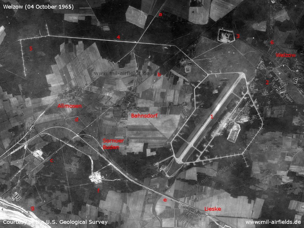
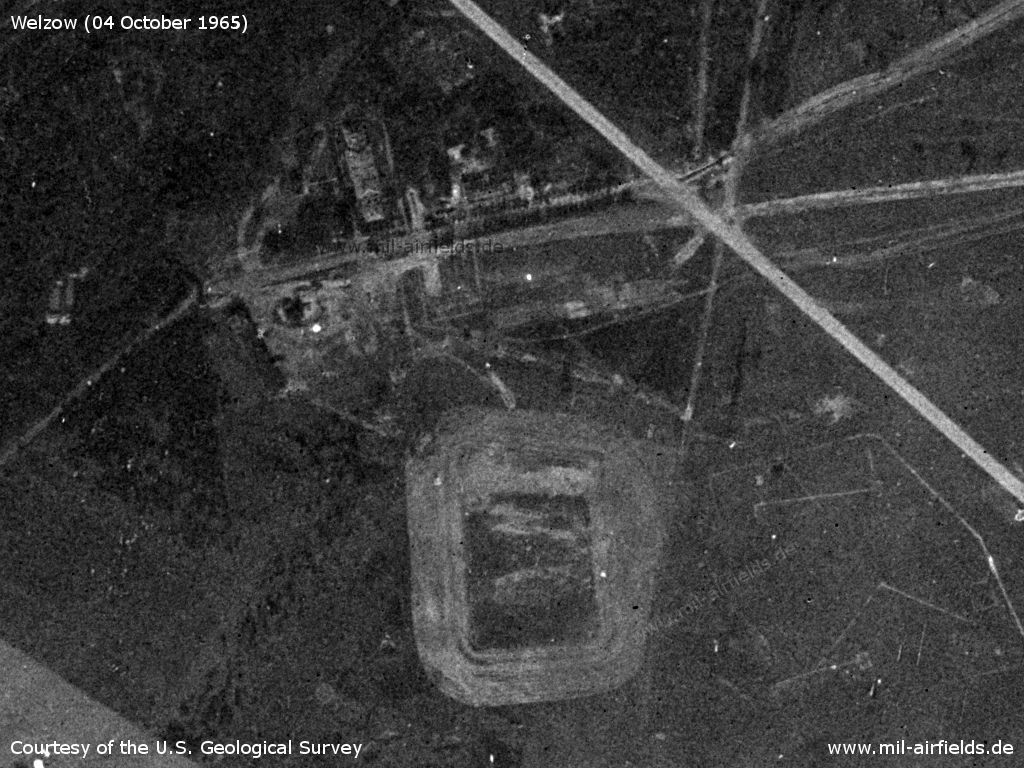
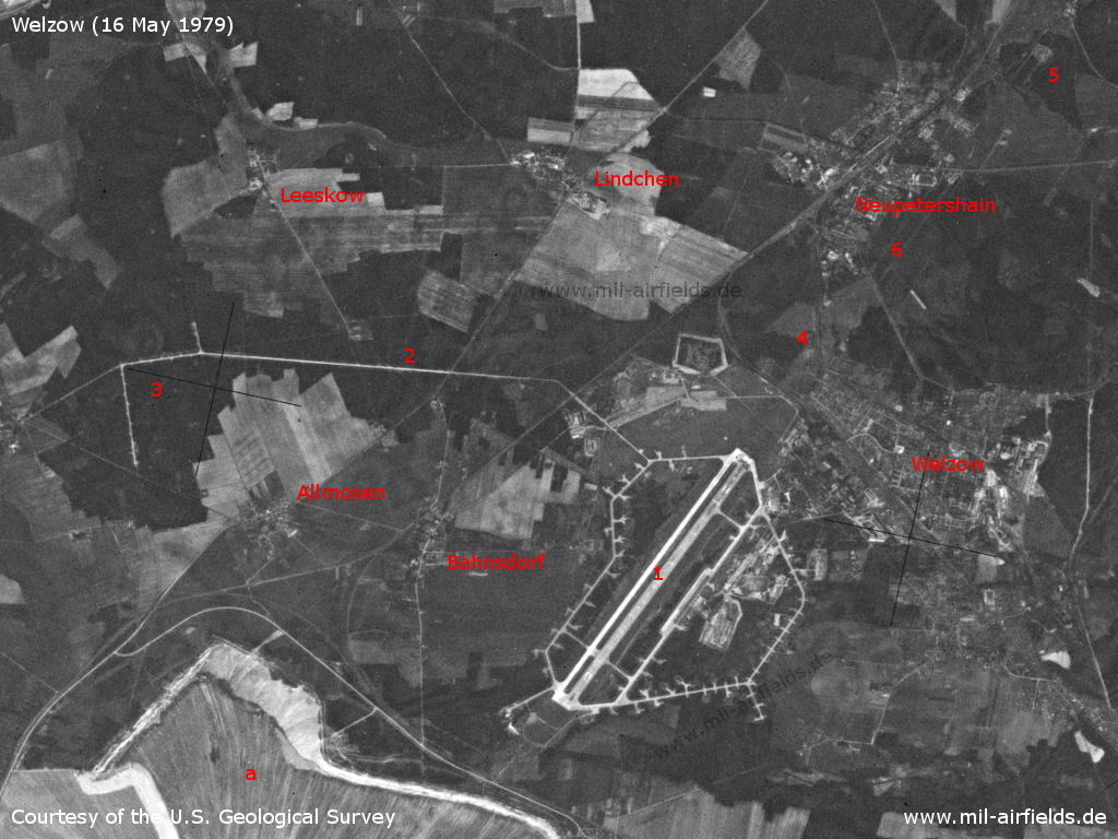
Welzow Air Base on a US satellite image from 04 October 1965 - 1: Airfield; 2: Barracks; 3: Ammunition depot; 4: Taxiway to the remote dispersal area; 5: Remote dispersal northeast of Dörrwalde; 6: Inner radio beacon; a: Main road 169; b: Cottbus - Großenhain railway line; c: disused railway section between Bahnsdorf and Sedlitz; d: new railway line to bypass the opencast mine; e: main road 156 and railway line to Knappenrode; f: object new or under construction, presumably in connection with the opencast lignite mine; no longer in existence today, northern shore of lake Sedlitzer See; g: Opencast mine, today lake Sedlitzer See. Places: Allmosen, Bahnsdorf, Lieske, Sornoer Buden, Welzow.
Source: U.S. Geological Survey
Air base
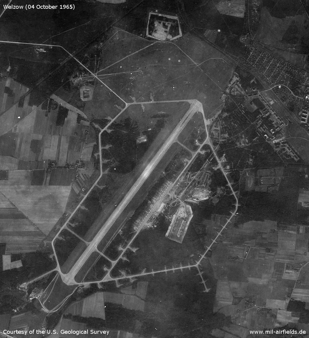
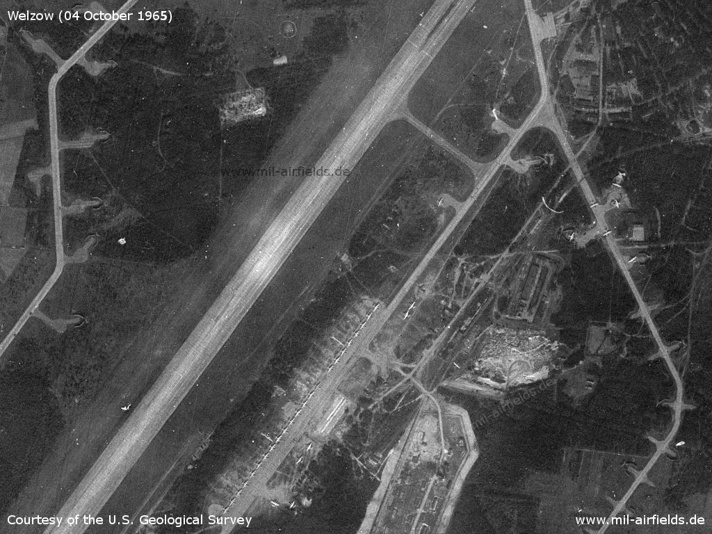
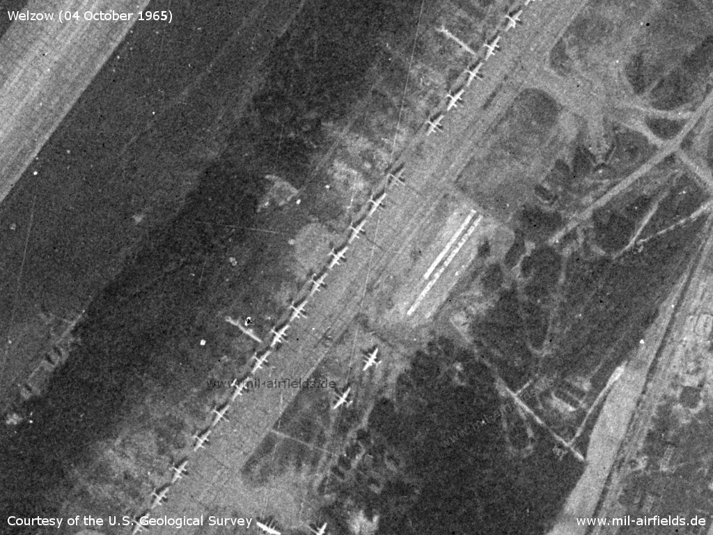
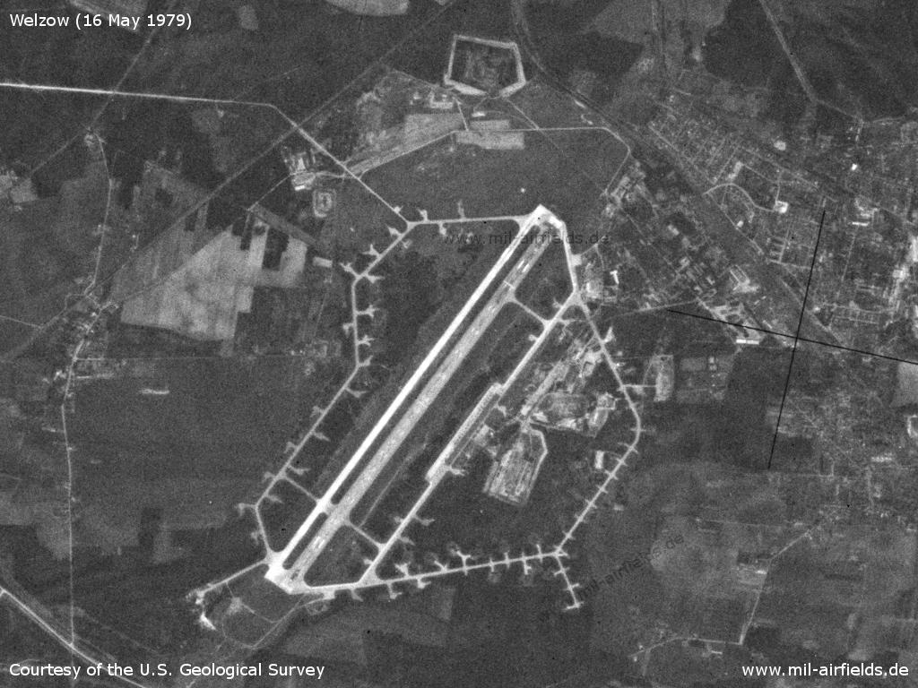
The airfield - The movement area of the former Fliegerhorst is still recognizable as open space in the north. In the middle of the left are the houses of the Lindenhof settlement. There are 40 Il-28 aircraft on the field, probably the Il-28R reconnaissance variant. Two of them are probably out of service. In addition, 2 transport aircraft Li-2 are recognizable.
Source: U.S. Geological Survey
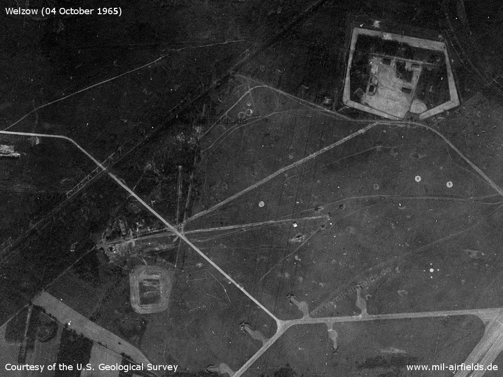
Old movement area and ammunition dump
Source: U.S. Geological Survey
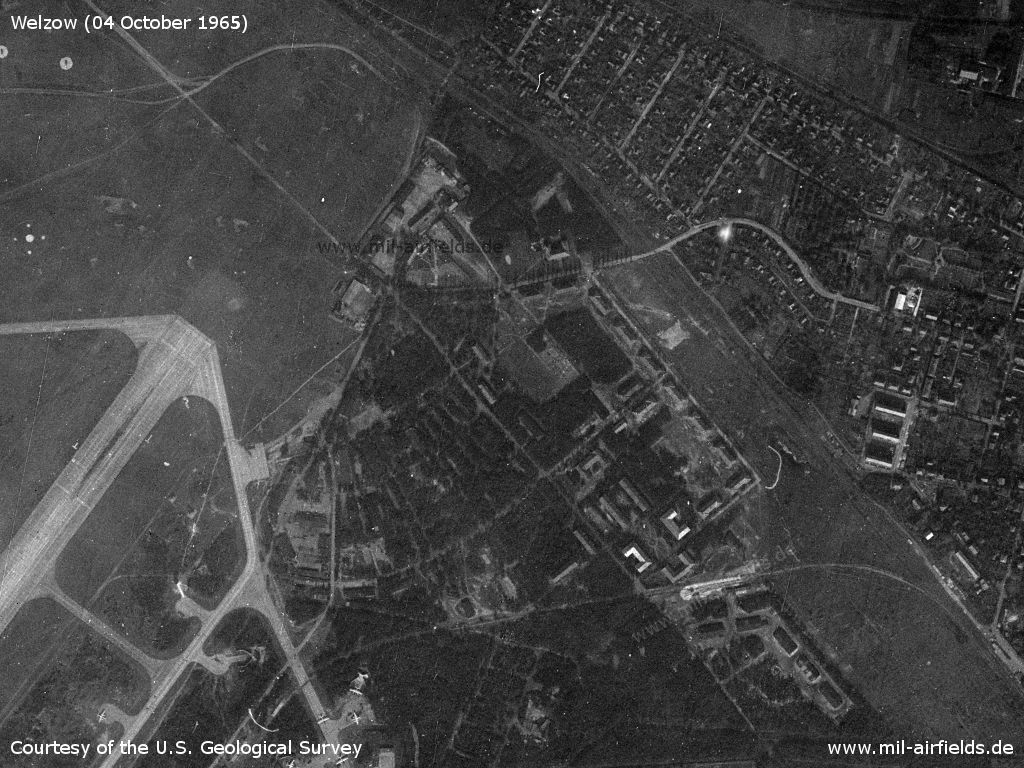
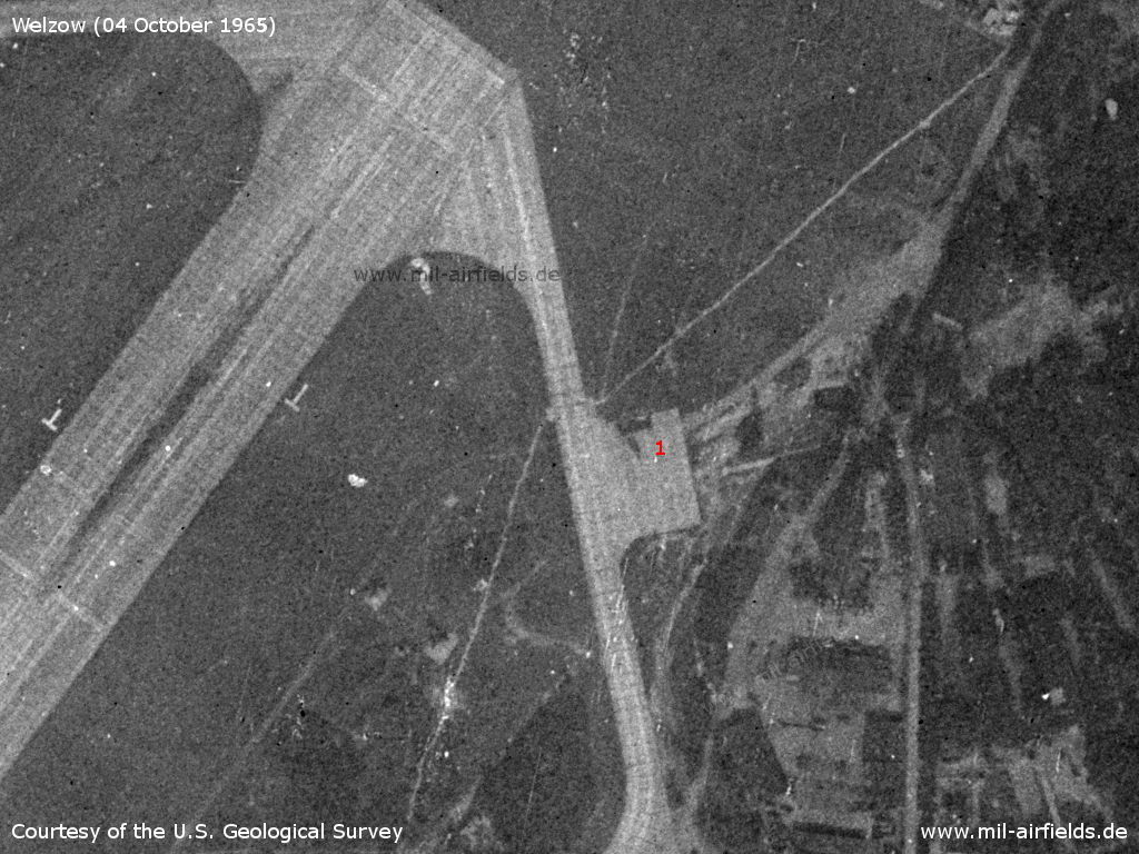
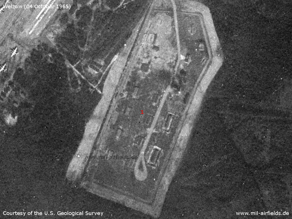
Barracks - From the bottom right, the railway spur leads to the site.
Source: U.S. Geological Survey
Northern part of the flight line
Source: U.S. Geological Survey
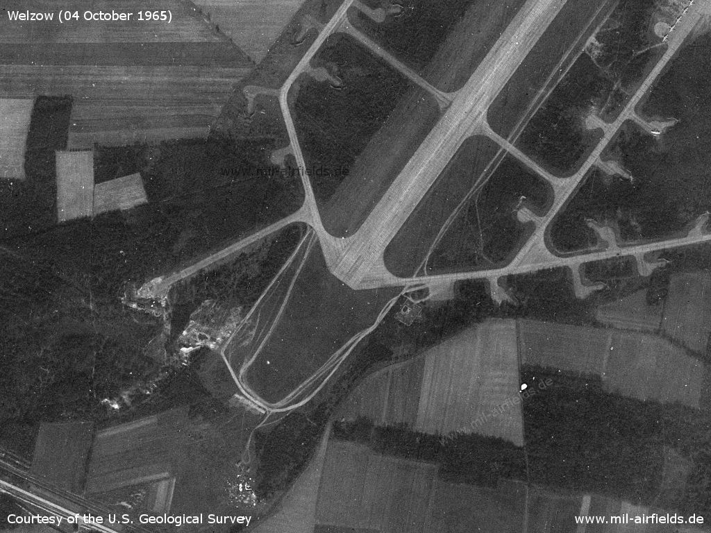
Southwestern part - At the bottom left is the Weißer Berg hill.
Source: U.S. Geological Survey
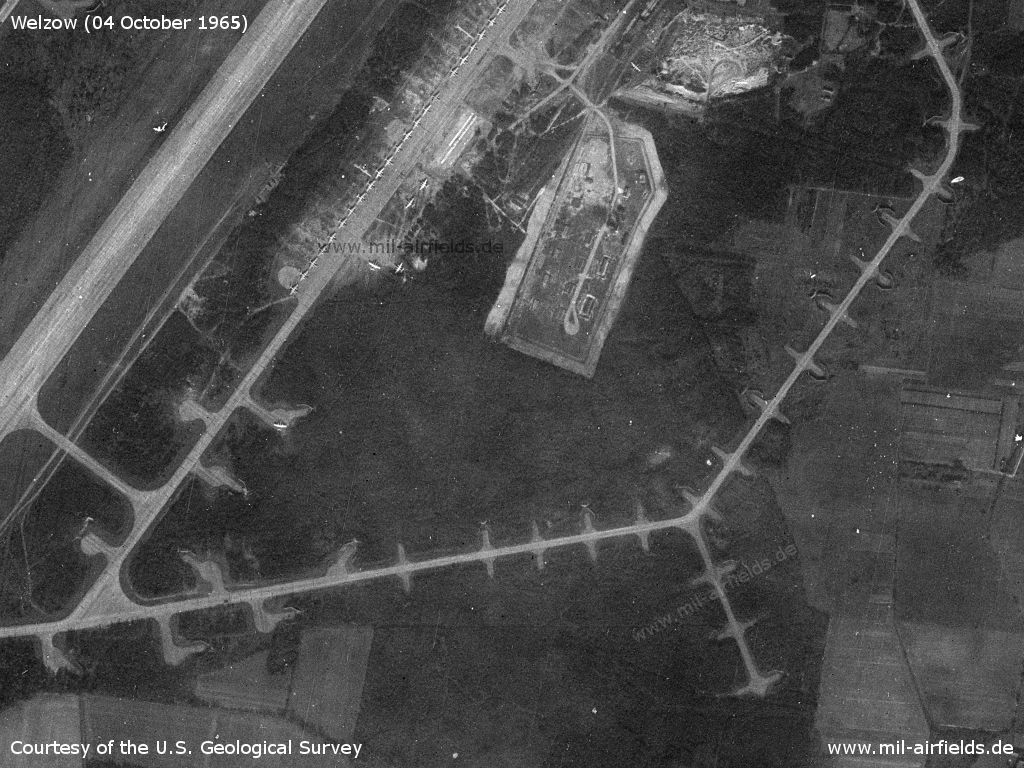
Southern part with flight line, depot and aircraft revetments
Source: U.S. Geological Survey
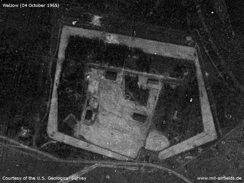
Ammunition dump in the north
Source: U.S. Geological Survey
Object in the northwest
Source: U.S. Geological Survey
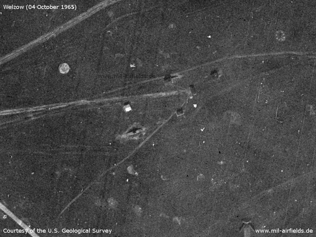
Suspected radar site
Source: U.S. Geological Survey
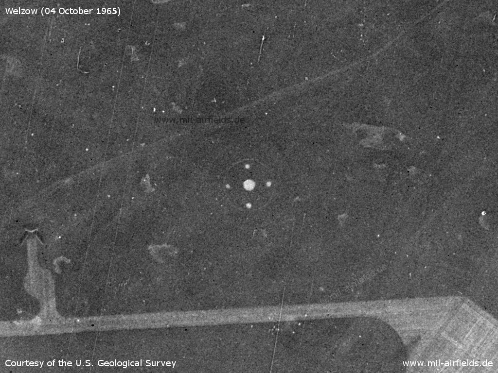
Circle - Purpose?
Source: U.S. Geological Survey
Aircraft revetments
Source: U.S. Geological Survey
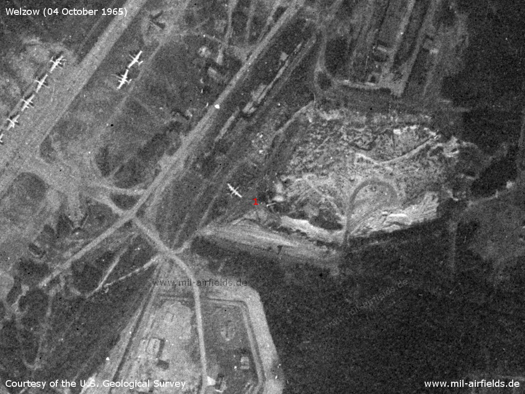
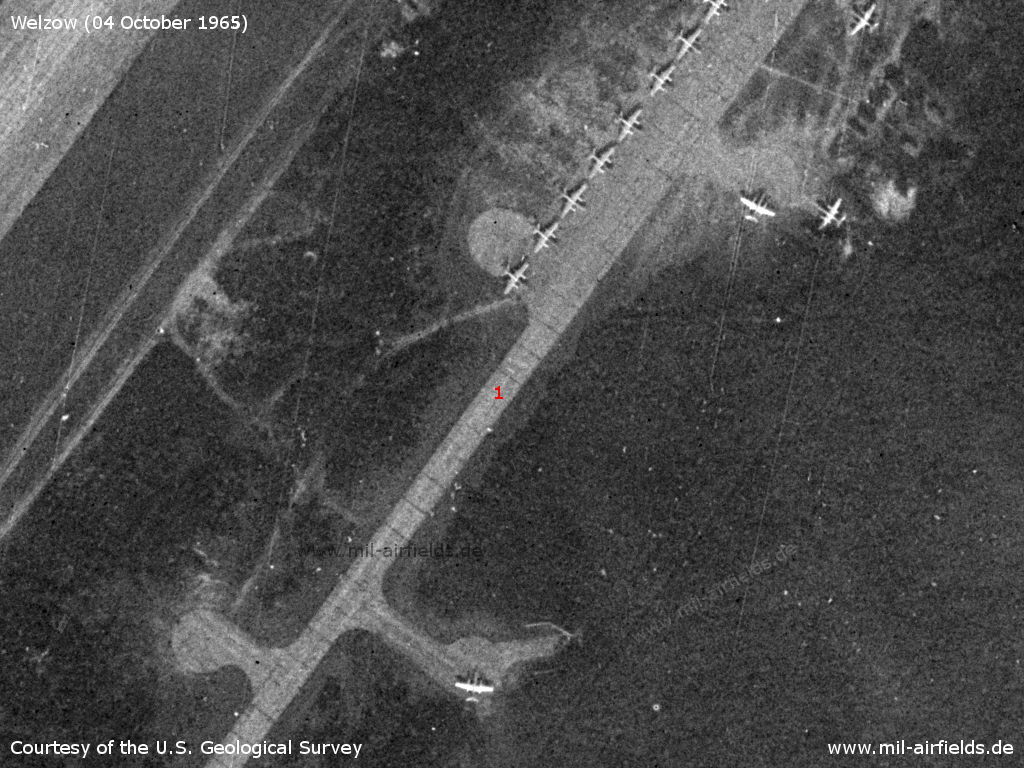
At (1) there's a bigger plane, probably a Li-2.
Source: U.S. Geological Survey
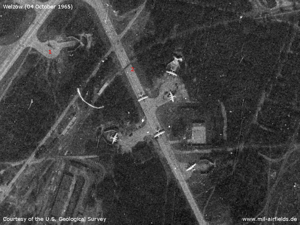
6 planes Il-28. (1) could be a helicopter. At (2) the siding crosses the taxiway.
Source: U.S. Geological Survey
Next to multiple Il-28, there is another Li-2 at the northern end of the flightline (1)
Source: U.S. Geological Survey
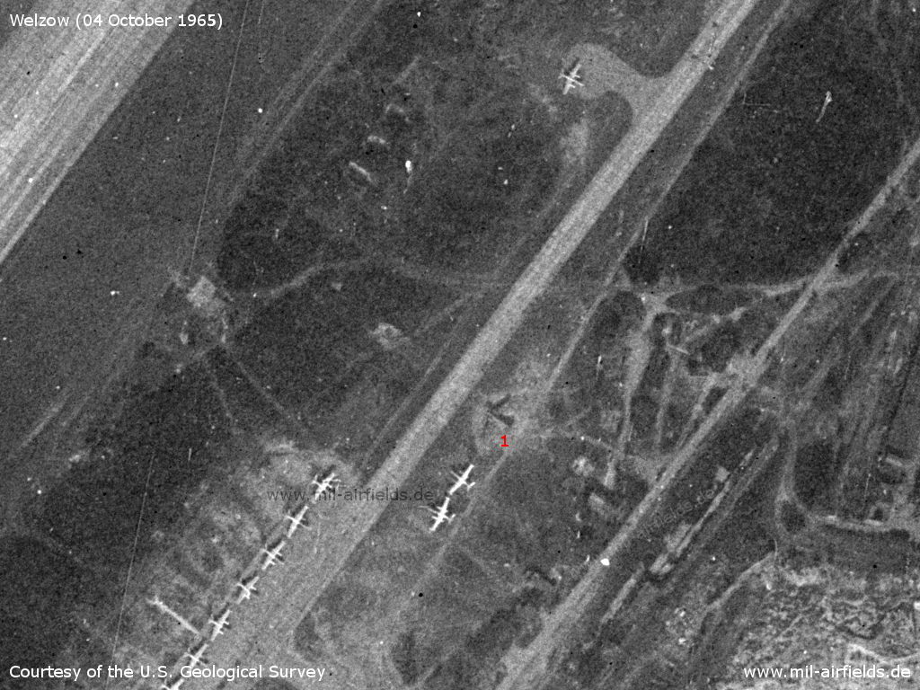
At (1) there are two more Il-28, presumably discarded.
Source: U.S. Geological Survey
Flightline with Il-28
Source: U.S. Geological Survey
Southern part
Source: U.S. Geological Survey
Storage area
Source: U.S. Geological Survey
Remote dispersal
Northwestern corner of the air base - The taxiway leads out of the airfield area (below right), crosses the railway line Cottbus - Großenhain at ground level (middle of picture) and then bends approximately to the west (top left). From here it is about 2.8 km to the decentralization area.
Source: U.S. Geological Survey
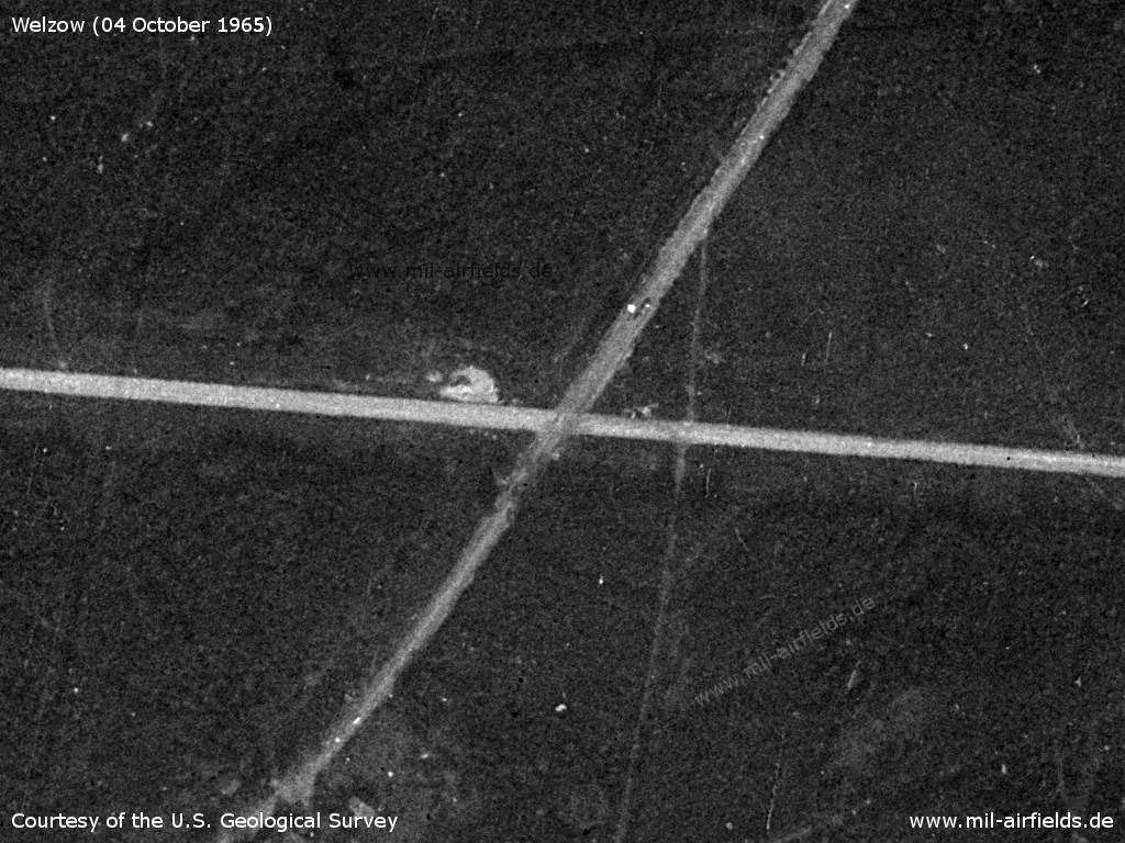
Crossing with main road F169 in the area between Lindchen and Allmosen
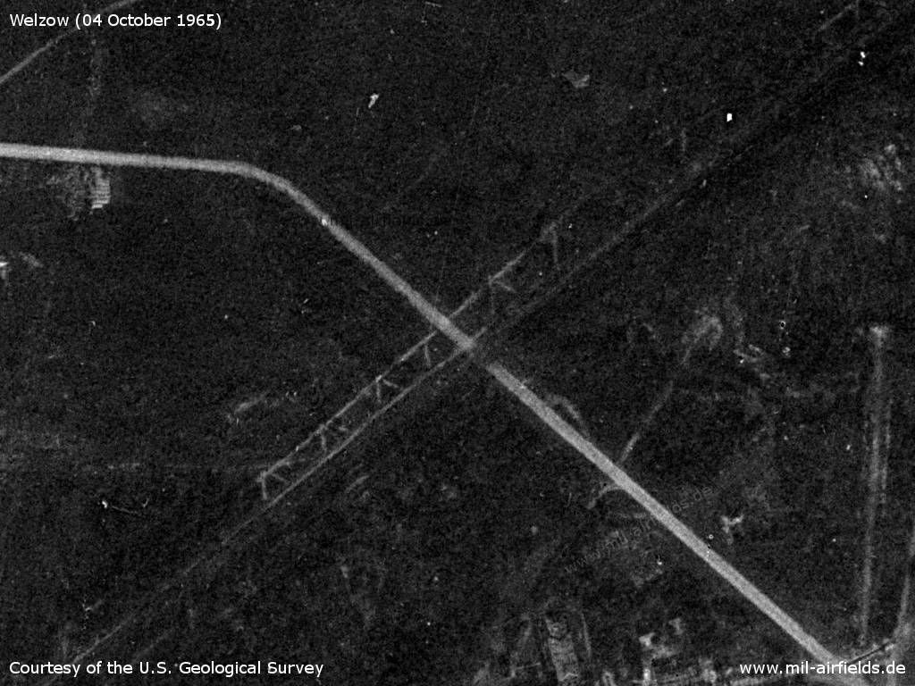
Source: U.S. Geological Survey
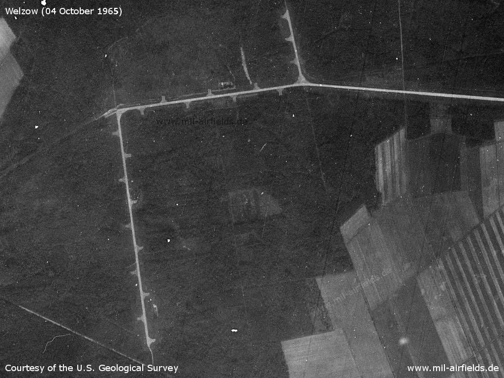
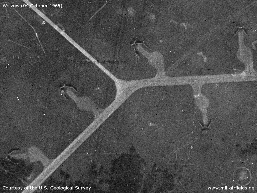
Overview - The dispersal has 20 prepared aircraft parkings. The two paths on the left side of the picture lead to Dörrwalde
Source: U.S. Geological Survey
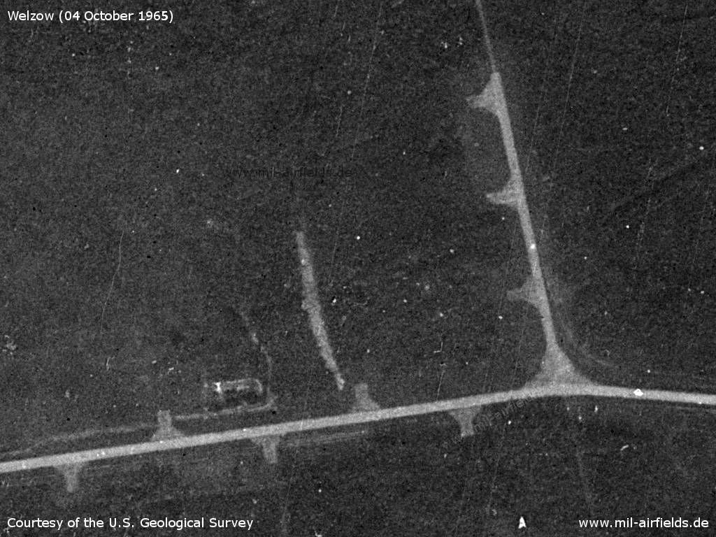
Northeastern part - The branch to the north is about 250 m long.
Source: U.S. Geological Survey
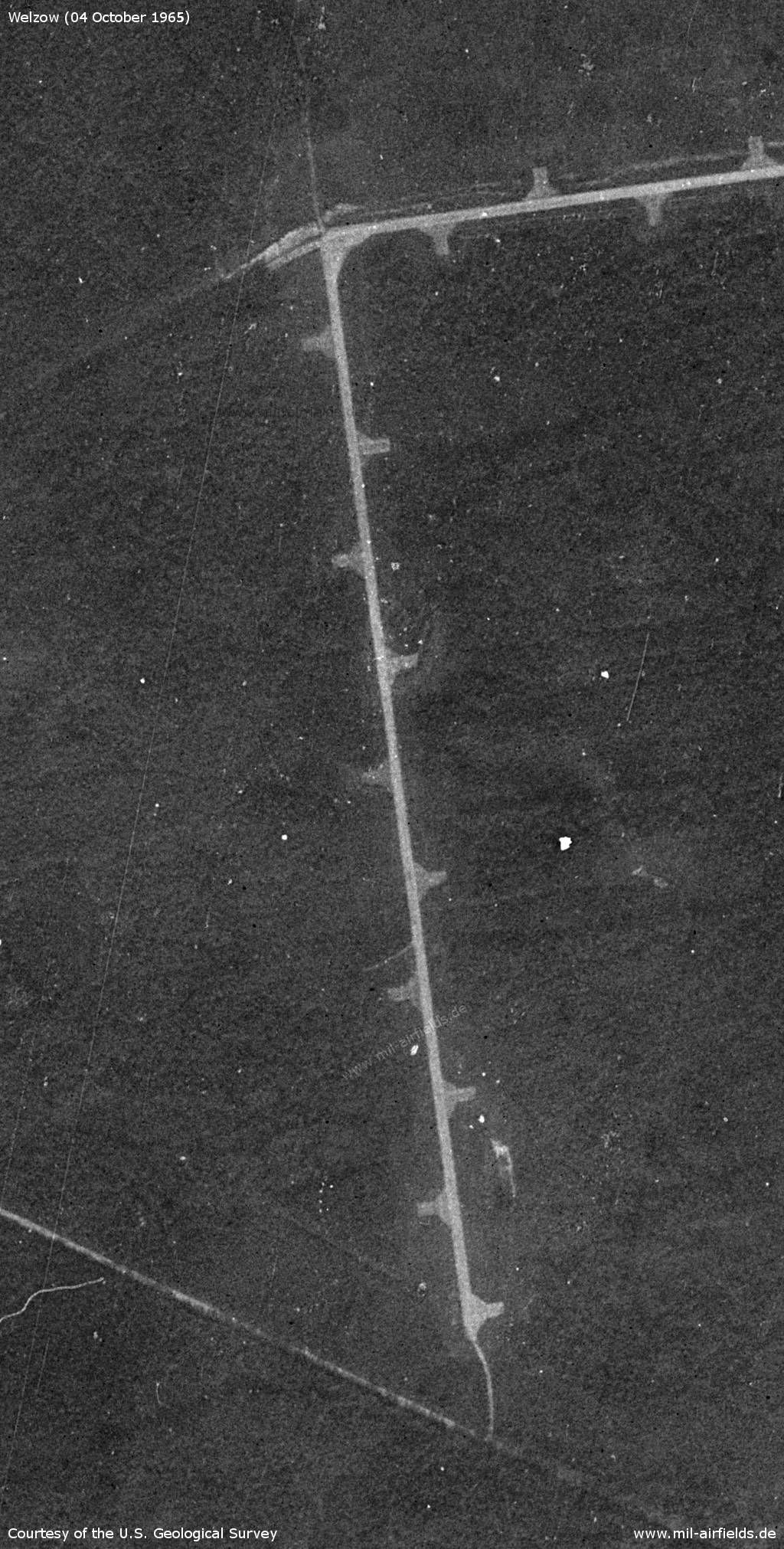
Western part - The western branch is about 800 m long.
Source: U.S. Geological Survey
Inner radio beacon
Inner radio beacon (Middle Marker), about 830 m to the northeast of the runway threshold. - 1: radio beacon; a: northwestern foothills of Welzow; b: railway line comming from Neupetershain and running north through Welzow; c: Railway line coming from Neupetershain and passing Welzow to the south and from which the connecting track to the airfield leaves.
Source: U.S. Geological Survey
Sedlitz open-pit mining
Südlich vom Flugplatz Welzow wurde im Tagebau Sedlitz bis Ende der 1970er Jahre Braunkohle gefördert. Auch wenn der Tagebau nicht unmittelbar mit dem Flugplatz in Verbindung steht, so werden nachfolgend Satellitenbilder der Landschaft gezeigt, die später grundlegend verändert wurde und heute den Sedlitzer See bildet.
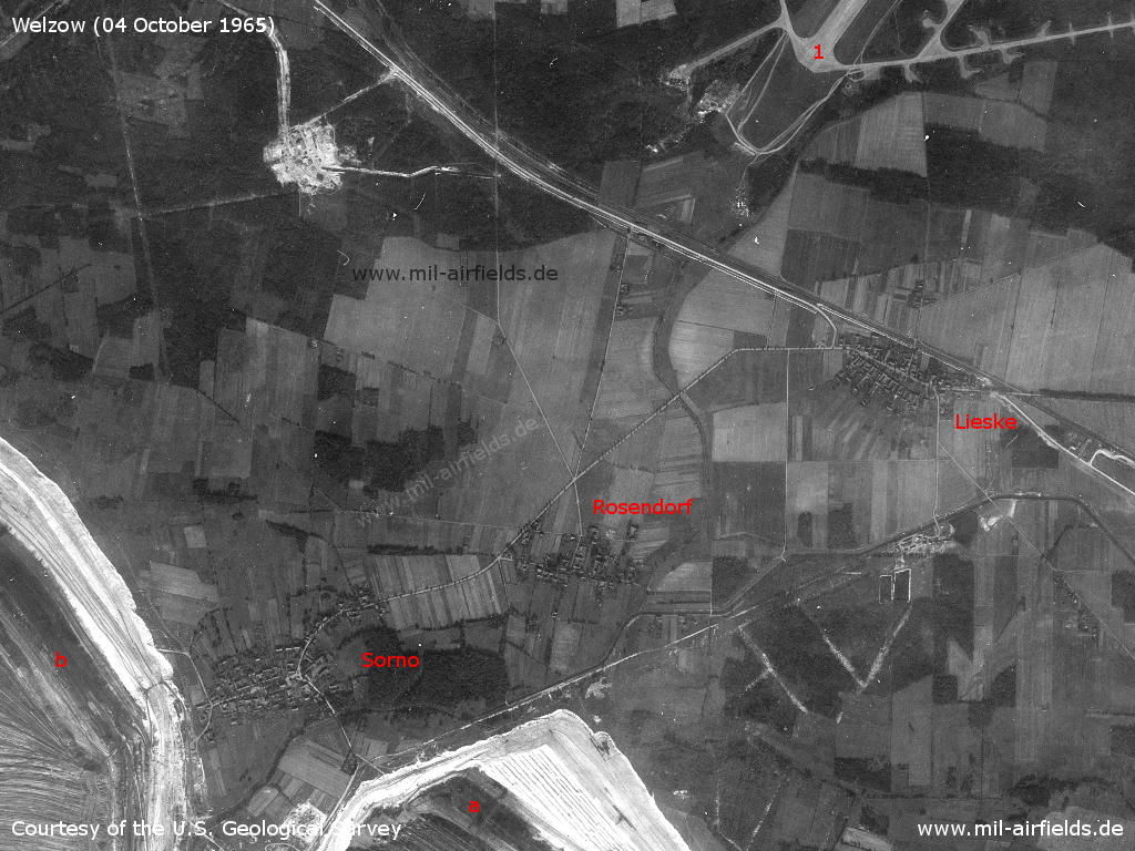
Area of today's lake Sedlitz - 1: Aerodrome; a, b: open-pit mine. Places Lieske, Rosendorf, Sorno.
Source: U.S. Geological Survey
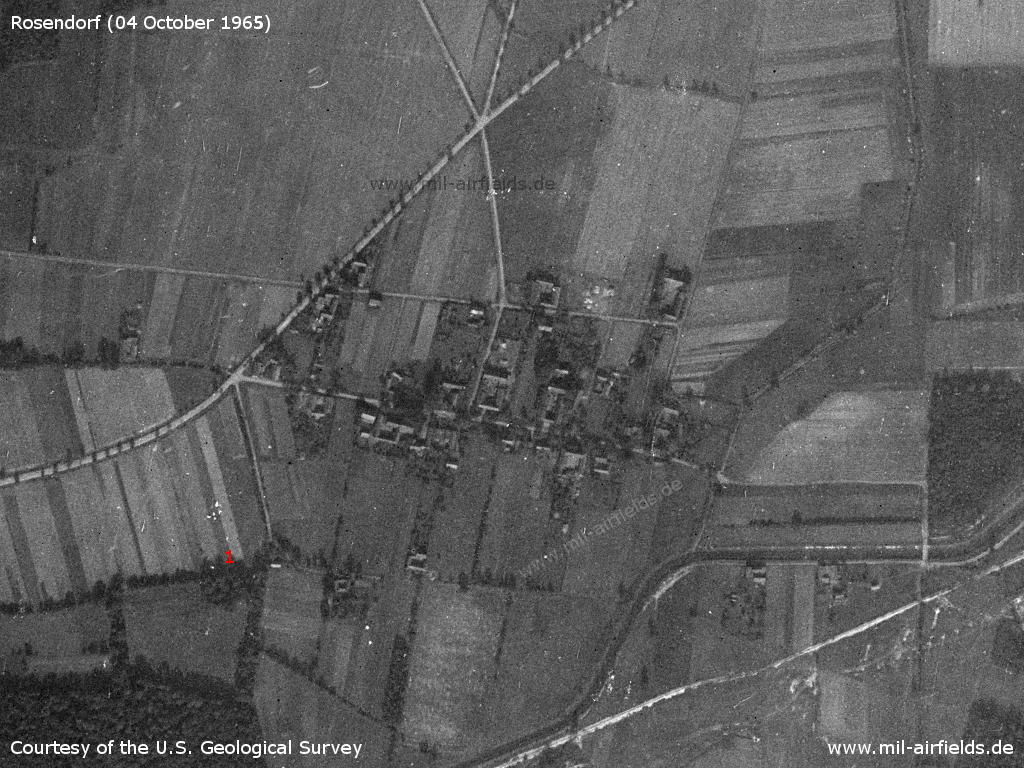
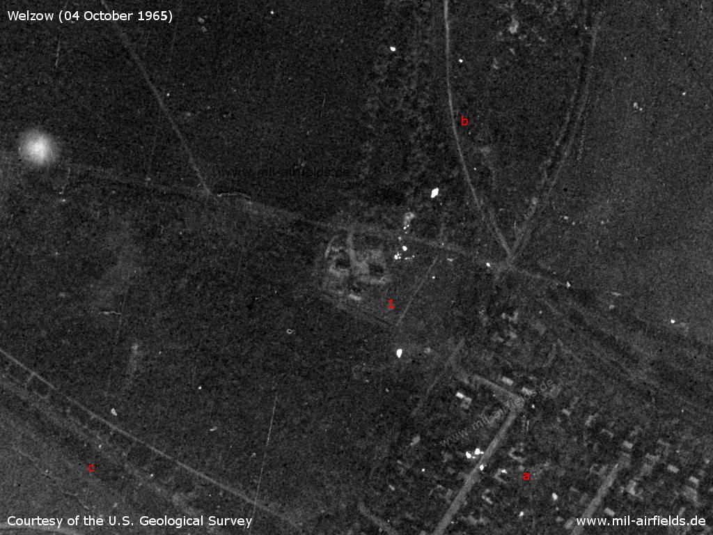
Rosendorf (sorbian Zasrjew) in Niederlausitz (Lower Lusatia) on 04 October 1965 - Later the place had to give way to open-pit mining and was demolished (devastated). On the lower right the Oberer Landgraben creek can be seen. The radio station from 1955 mentioned above must have been in the area of (1). Today lake Sedlitzer See.
Source: U.S. Geological Survey
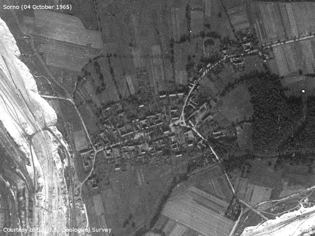
Sorno (previously Wendisch Sorno, sorbian Žarnow) on 04 October 1965 - This village, too, was later demolished for the open-pit lignite mining, which can already be seen on the left and bottom right of this picture. Today Lake Sedlitz.
Source: U.S. Geological Survey
In the 1970s
Situation
Welzow Air Base on a map of the US Department of Defense from 1972
Source: ONC E-2 (1972), Perry-Castañeda Library Map Collection, University of Texas at Austin
Overview
16 May 1979 - 1: Airfield, now with two parallel runways; 2: taxiway; 3: remote dispersal area; 4: inner radio beacon (new); 5: outer radio beacon south of Geisendorf; 6: There are two parallel lanes from the airfield to the outer radio beacon; a: Meanwhile, the Sedlitz open-pit mine has reached its maximum extent and is about to be closed.
Source: U.S. Geological Survey
In the mid-1970s, a second runway has been, which runs parallel on the west side to the existing runway.
Source: U.S. Geological Survey
Radio communication
Call sign: ANGARKA (1970?)
Images
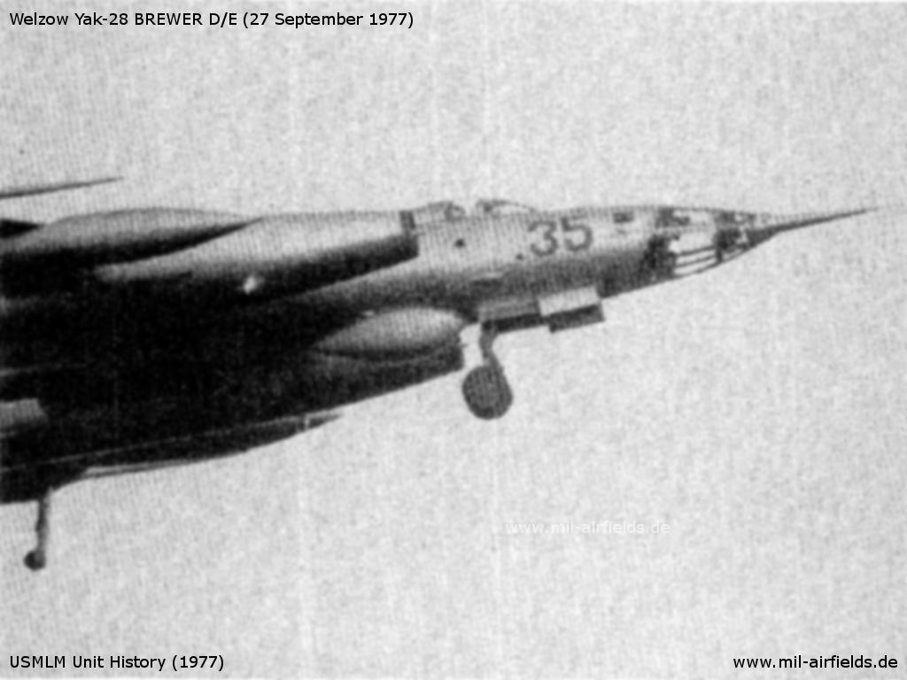
Yak-28 Brewer D/E from Welzow
Source: USMLM Unit History (1977)
In the 1980s and early 1990s
Runways
- 04/22: 2500 m x 42 m
- 04/22: 2500 m x 60 m old runway
Radio beacons
- LOM 22: 285 "OP"
- LMM 22: 588 "O"
- LOM 04: 285 "NÜ"
- LMM 04: 588 "N"
Radio communication
Call sign: DUBRAVKA (ДУБРОВКА) (198x)
Units
1990: 11 ORAP (Su-24MR, Su-24MP)
Installations
The airfield covered an area of 525 ha
Today
Use
General aviation (EDCY).
Sources
- http://lib.byu.edu/collections/german-maps/ - German Maps (Topographic Map 1:25,000)
- https://www.usgs.gov/ - USGS U.S. Geological Survey
Links
- http://www.16va.be/3.4_la_reco_part2_eng.html - 11 ORAP: Il-28R Beagle, Yak-27R Mangrove, Yak-28R, Yak-28PP Brewer
- http://www.16va.be/3.4_la_reco_part3_eng.html - 11 ORAP: Su-24MR, Su-24MP - Welzow's Fencers
- Honepage
- Sachsenbunker
Bibliography
- Ries, Karl; Dierich, Wolfgang: "Fliegerhorste und Einsatzhäfen der Luftwaffe" Motorbuch Verlag Stuttgart, 1993 - Alliierte Planskizze
- Freundt, Lutz (Hrsg.), Büttner, Stefan: "Rote Plätze - Russische Militärflugplätze in Deutschland 1945 - 1994" AeroLit Verlag, 2007 - Beschreibung, Bilder, Luftbilder 1953 und 1991
Related topics
Airfields in the vicinity
- 290°/11km Großräschen: Helipad 3134 (HSLP / HLP 3134)
- 028°/16km Leuthen: Helipad 3021 (HSLP 3021)
- 312°/16km Bronkow: Airfield
- 066°/17km Groß Döbbern: Helipad 3132 (HSLP / HLP 3132)
- 027°/24km Cottbus: Air Base
Categories
Military Airfields GermanyMilitary Airfields in former East GermanyAirfields of the Soviet Forces in GermanyRecommended
Image credits are shown on the respective target page, click on the preview to open it.
 Follow mil-airfields on Facebook