For historical information only, do not use for navigation or aviation purposes!
| Coordinates | N493552 E0153252 (WGS84) Google Maps |
| Airfield Id | Punkt 240 |
The history of the Cold War airfields: Havlíčkův Brod
Location of airfield
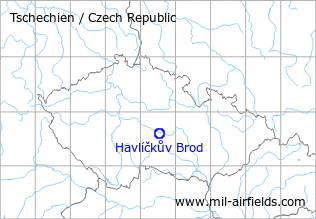
About 2 km west-southwest of Havlíčkův Brod city center.
Usage during the Cold War
Military helicopter base.
Radio communication
Call sign "CITRUS" (198x).
According to western signals intelligence (SIGINT), the airfield was also called "Navigacni Punkt 240" by the Czechoslovak Air Force.
Units
52 LTVP "Rebelove": Mi-2, Mi-8 (1990)
Airfields in the vicinity
- 130°/37km Měřín: Highway Strip (Merin)
- 343°/40km Čáslav: Air Base (Chotusice, Letiště Čáslav)
 Follow mil-airfields on Facebook