For historical information only, do not use for navigation or aviation purposes!
| Coordinates | N515405 E0131147 (WGS84) Google Maps |
| Former East Germany (GDR) | District of Potsdam |
| Federal state | Brandenburg |
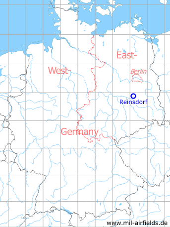
Germany during the Cold War Map
The history of the Cold War airfields: Reinsdorf
During World War II
Use
Luftwaffe airfield.
During the Cold War
Use
Soviet airfield and later auxilliary airfield.
In the 1950s
Overview
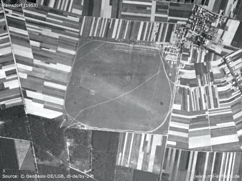
Aerial image 1953
Source: Landesvermessung und Geobasisinformation Brandenburg (LGB), Datenlizenz Deutschland - Namensnennung - Version 2.0, © GeoBasis-DE/LGB, dl-de/by-2-0, (Kontrast erhöht)
Airstrip with landing T - According to the location and orientation of the landing T, the brighter area could be used more frequently for takeoffs and landings.
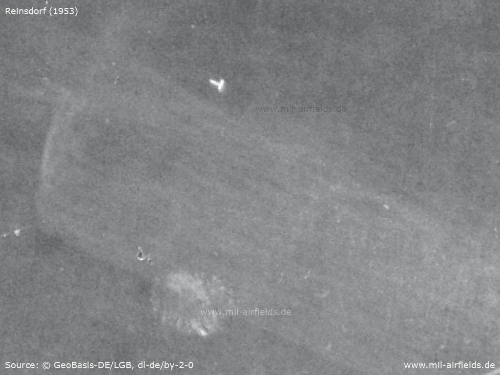
Source: Landesvermessung und Geobasisinformation Brandenburg (LGB), Datenlizenz Deutschland - Namensnennung - Version 2.0, © GeoBasis-DE/LGB, dl-de/by-2-0, (Kontrast erhöht)
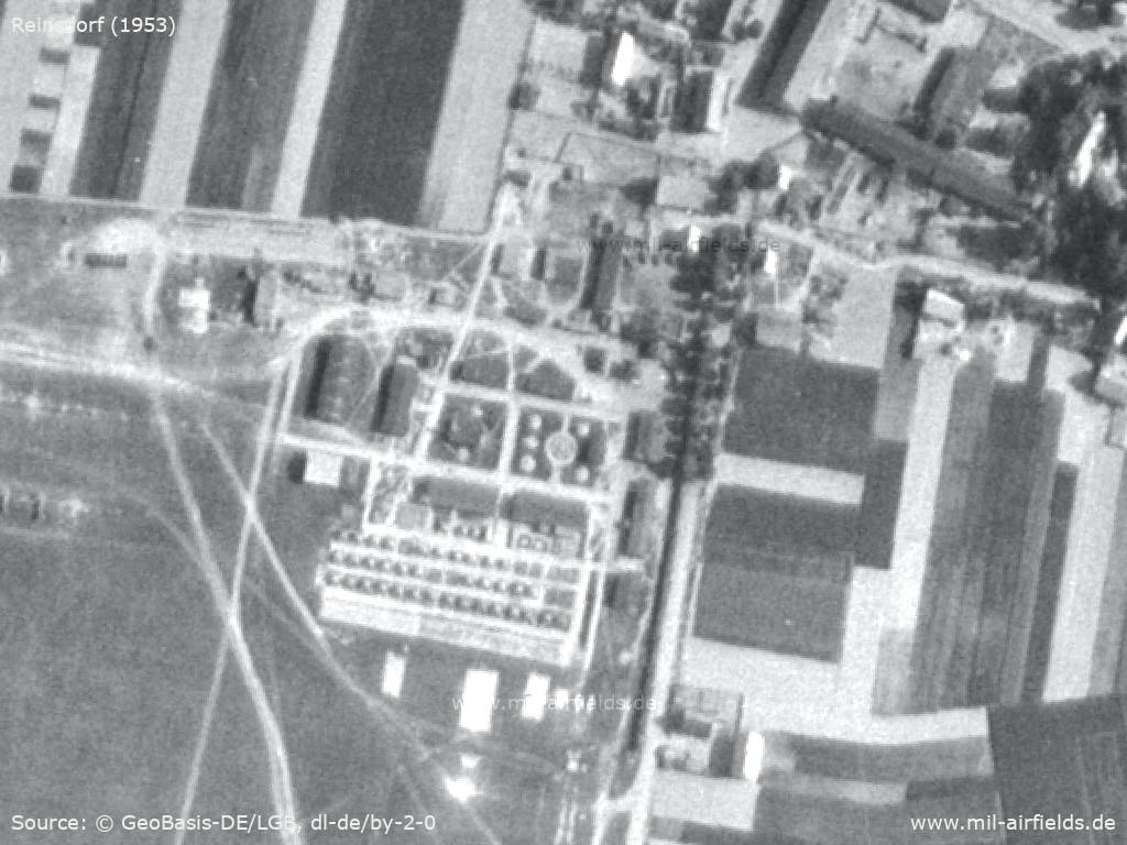
31 airplanes in the north of the field
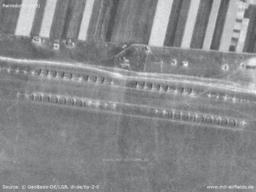
Source: Landesvermessung und Geobasisinformation Brandenburg (LGB), Datenlizenz Deutschland - Namensnennung - Version 2.0, © GeoBasis-DE/LGB, dl-de/by-2-0, (Kontrast erhöht)
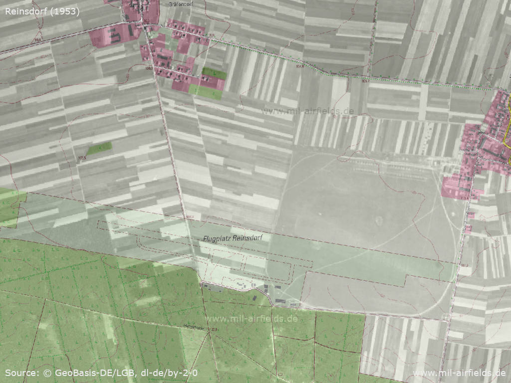
The airfield facilities extend to the village of Reinsdorf
Source: Landesvermessung und Geobasisinformation Brandenburg (LGB), Datenlizenz Deutschland - Namensnennung - Version 2.0, © GeoBasis-DE/LGB, dl-de/by-2-0, (Kontrast erhöht)
Location of the old airstrip compared to the alignment of the later runway
Source: Landesvermessung und Geobasisinformation Brandenburg (LGB), Datenlizenz Deutschland - Namensnennung - Version 2.0, © GeoBasis-DE/LGB, dl-de/by-2-0
In the 1960s
Overview
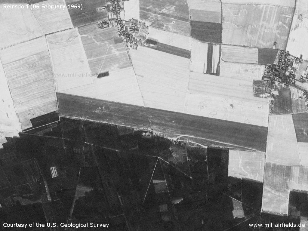
The airfield on 06 February 1969 - Partly there is snow. At the top right you can still see the route of the narrow-gauge railway Jüterbog-Dahme, coming from the north and bending in an easterly direction to Reinsdorf. At this time the railway should have already been out of service.
Source: U.S. Geological Survey
History
- May 1966
Observation by the US Military Liaison Mission: "In May the FISHBED air defense regiment at Jueterbog twice deployed to the Reinsdorf grass strip; this was the first sighting of FISHBED F aircraft operating on a natural surface and added measurably to our knowledge of the aircraft's capabilities." (Source: USMLM 1966) - November 1966
Sighting of an expanded POL storage complex at Reinsdorf by the USMLM. The complex of 25 fuel storage tanks was consistent with that seen earlier at Hassleben and indicates the standardization of POL requirements at Soviet dispersal airfields. (Source: USMLM 1966)
Images
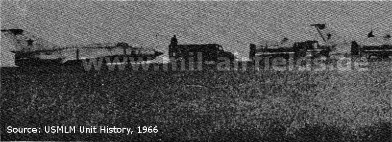
MiG-21 FISHBED F from Altes Lager deployed to Reinsdorf grass strip in 1966
Source: USMLM 1966
In the 1970s
Situation
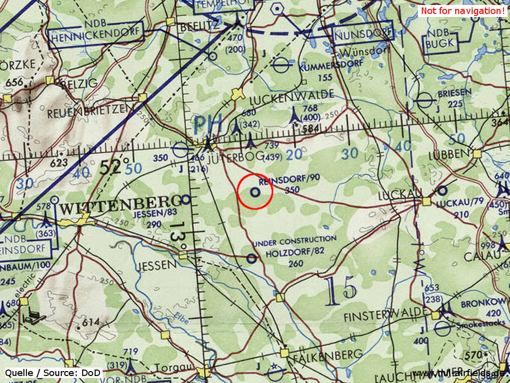
Reinsdorf Airfield on a map of the US Department of Defense from 1972
Source: ONC E-2 (1972), Perry-Castañeda Library Map Collection, University of Texas at Austin
Radio beacons
- LOM 28: 1215 "ÄF"
- LMM 28: 597 "Ä"
In the 1980s and early 1990s
Overview
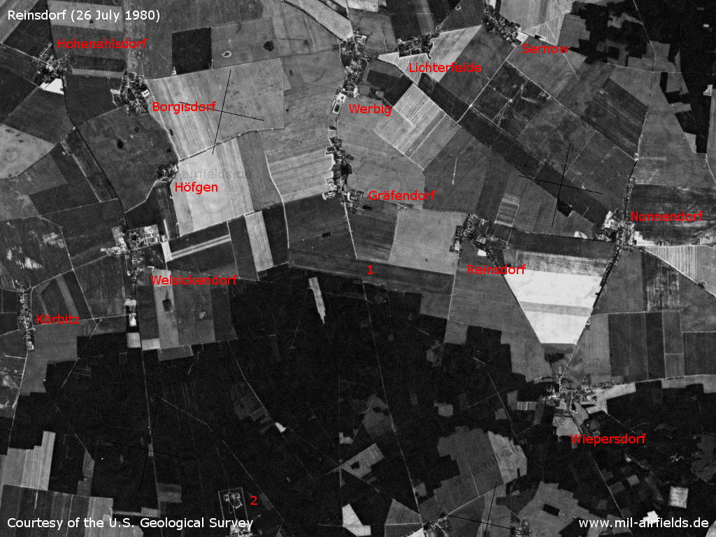
Reinsdorf Airfield on a US satellite image from 26 July 1980 - 1: airfield; 2: Soviet special weapons depot Stolzenhain. Places: Borgisdorf, Gräfendorf, Hohenahlsdorf, Höfgen, Körbitz, Nonnendorf, Reinsdorf, Sernow, Welsickendorf, Werbig, Wiepersdorf.
Source: U.S. Geological Survey
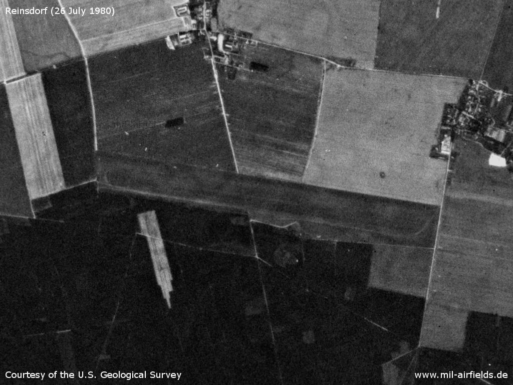
Airfield - The field has two parallel grass runways and only little infrastructure. The narrow-gauge railway line, which was still recognizable in 1969, is no longer visible here.
Source: U.S. Geological Survey
Runways
- 10L/28R: 2400 m x 40 m Grass
- 10R/28L: 1200 m x 40 m Grass
Radio communication
The russian radio call sign of the airfield was BUTON (БУТОН).
Images
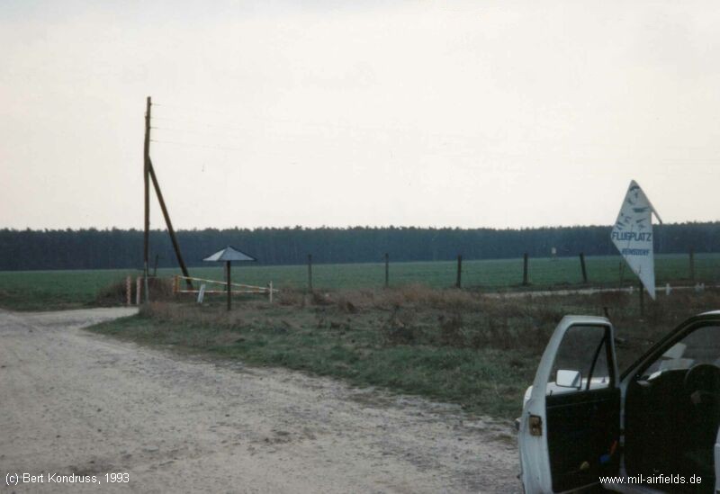
The airfield gate in 1993.
Today
Use
General aviation.
Bibliography
- /USMLM 1966/:
United States Military Liaison Mission: "Unit History 1966"
Airfields in the vicinity
Categories
Military Airfields GermanyMilitary Airfields in former East GermanyAirfields of the Soviet Forces in GermanyRecommended
Image credits are shown on the respective target page, click on the preview to open it.
 Follow mil-airfields on Facebook