For historical information only, do not use for navigation or aviation purposes!
| Coordinates | N531327 E0121913 (WGS84) Google Maps |
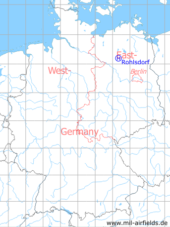
Germany during the Cold War Map
The history of the Cold War airfields: Rohlsdorf
Location of airfield
2,4 km east of Rohlsdorf
Usage during the Cold War
Helipad 3355 for Radar company 232 (FuTK-232) of East German Airforce (NVA LSK/LV)
Use today
Closed.
Runways, taxiways, aprons
Dimensions: 70 m x 40 m,
main takeoff and landing direction: 90°,
surface: Solid grass,
capacity: 1 Helicopter.
main takeoff and landing direction: 90°,
surface: Solid grass,
capacity: 1 Helicopter.
Telephone
Stabsnetz S1 ü 43301
Airspace and procedures
Usable at day during good weather conditions,
alert time: 60 minutes.
alert time: 60 minutes.
Obstacles
Antenna: direction 270°,
Buildings: direction 180°,
Trees: direction 360°, height 15 m.
Buildings: direction 180°,
Trees: direction 360°, height 15 m.
Airfields in the vicinity
- 027°/7km Freyenstein: Agricultural Airfield
- 100°/14km Wittstock: Air Base (Wittstock/Dosse, Alt Daber, Аэродром Витшток)
- 257°/14km Steffenshagen: Helipad 3348 (HSLP / HLP 3348)
- 332°/17km Retzow: Airfield
 Follow mil-airfields on Facebook