Oberpfaffenhofen: Airfield
For historical information only, do not use for navigation or aviation purposes!
| Coordinates | N480455 E0111702 (WGS84) Google Maps |
| Elevation | 1947 ft |
| Federal state | Bayern (Bavaria) |
| Location indicator | DDOP (195x), EDMO |
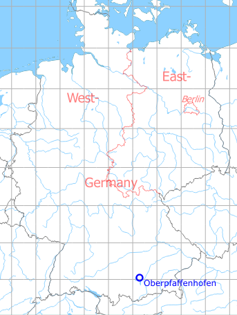
Germany during the Cold War Map
The history of the Cold War airfields: Oberpfaffenhofen
General
Oberpfaffenhofen airfield was built in the 1930s as a factory airfield. From 1945 until the 1950s the field was used by the US Air Force, after which it served again as a factory airfield. Today it is a "special airport".
During World War II
Use
Aircraft factory airfield.
Situation
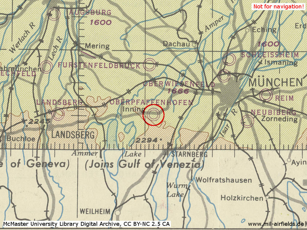
Oberpfaffenhofen Airfield in World War II on a US map from 1944
Source: McMaster University Library Digital Archive, License: Creative Commons Attribution-NonCommercial 2.5 CC BY-NC 2.5 CA
During the Cold War
Use
Aircraft factory airfield.
In the 1940s
Overview
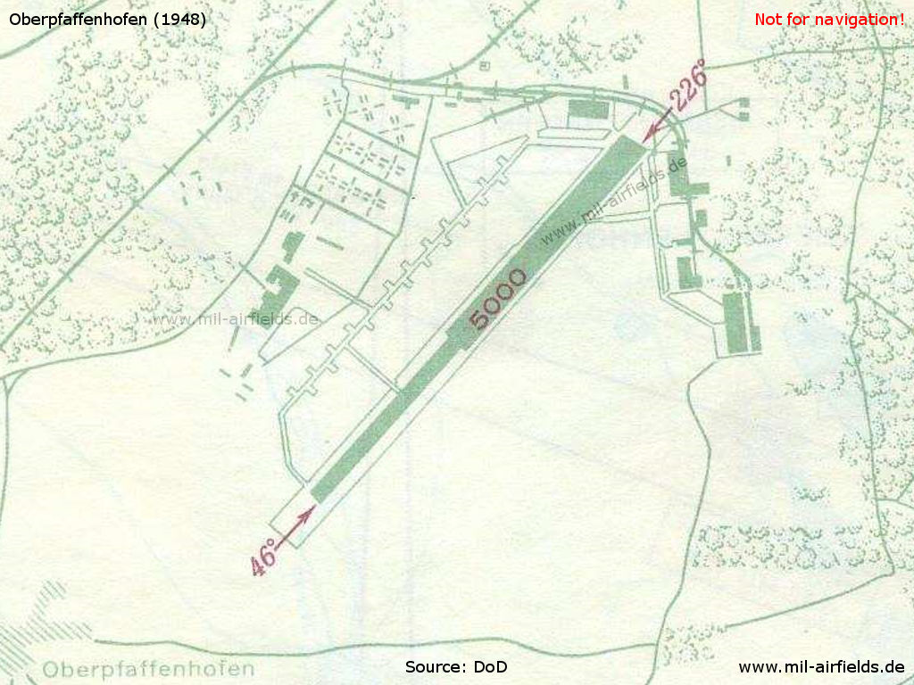
Chart of Oberpfaffenhofen airfield in 1948
Runways
- 05/23: 1524 m
Radio beacons
- NDB: 313 "OB"
- NDB: 325 "ON"
Radio communication
- Tower 3255 kHz, 118.1, 126.18
In the 1960s
Overview
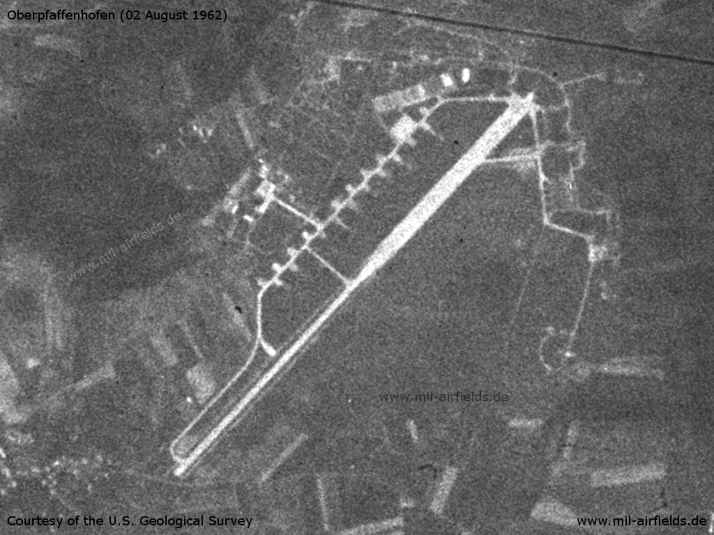
Oberpfaffenhofen airfield on a US satellite image from 02 August 1962
Source: U.S. Geological Survey
In the 1970s
Overview
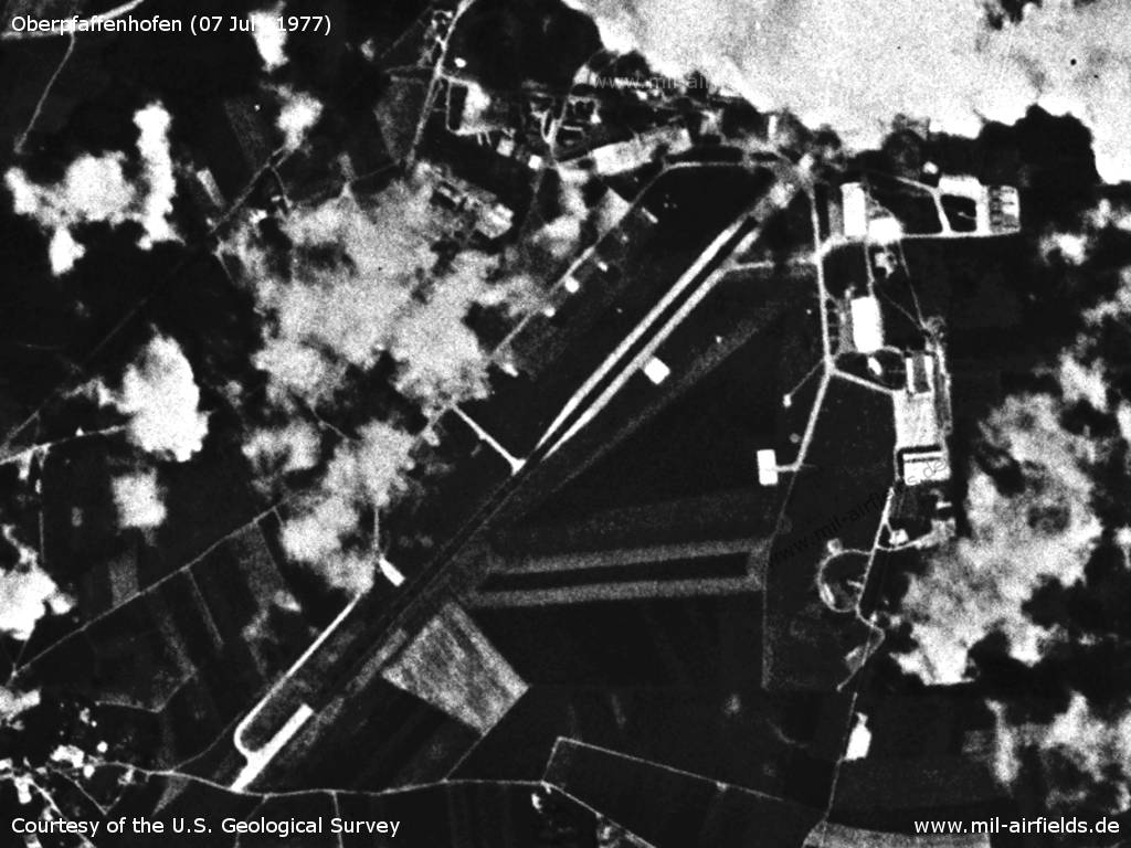
Oberpfaffenhofen Airfield on a US satellite image from 07 July 1977
Source: U.S. Geological Survey
In the 1980s and early 1990s
Situation
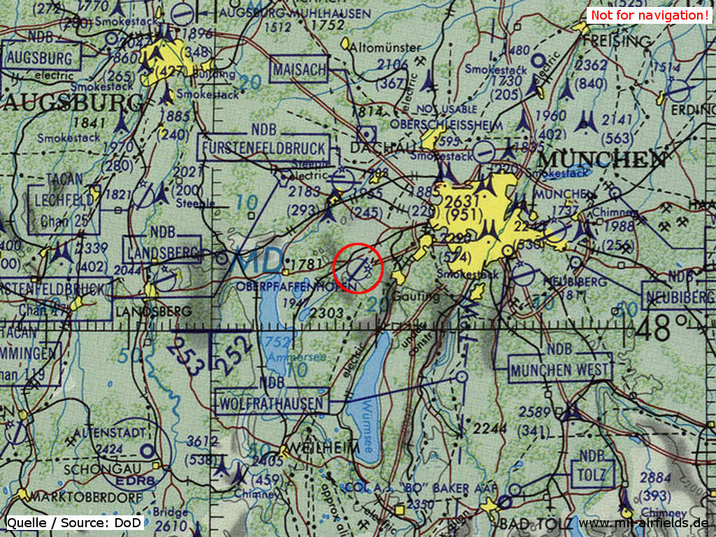
Oberpfaffenhofen Airfield on a map of the US Department of Defense from 1981
Source: ONC F-2 (1981), Perry-Castañeda Library Map Collection, University of Texas at Austin
Overview
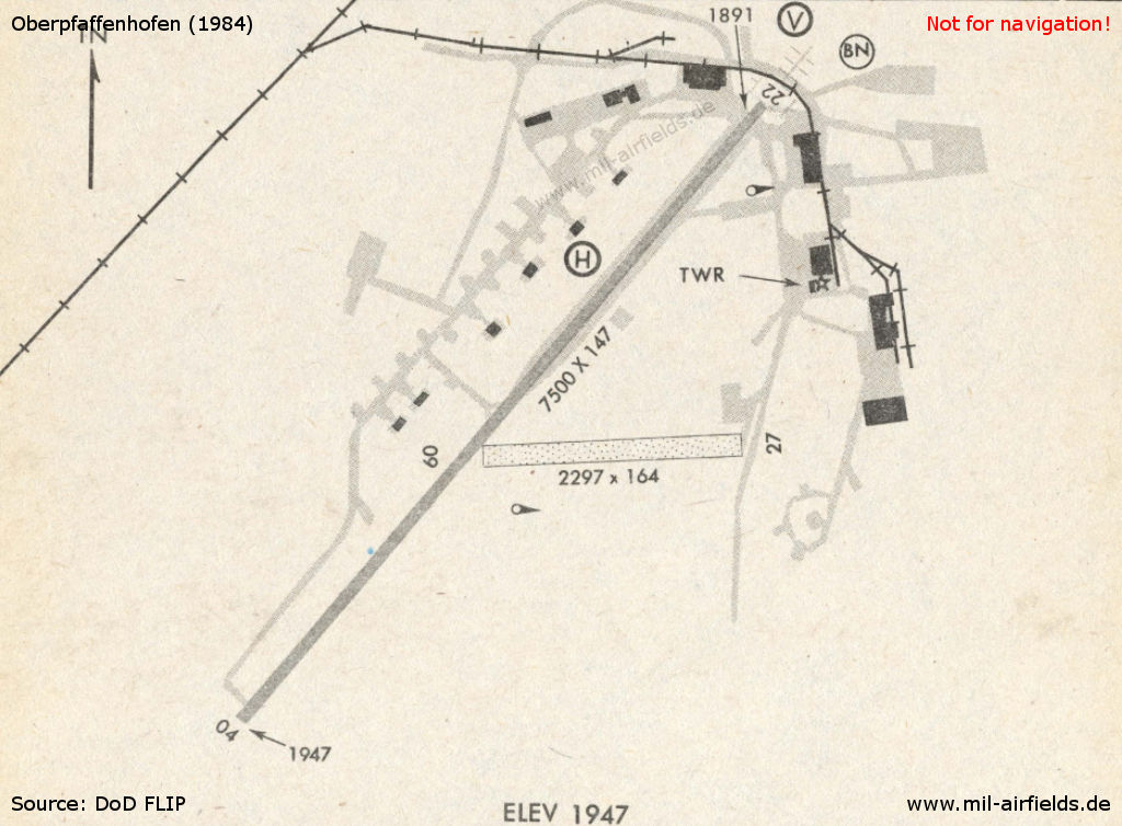
Chart of Oberpfaffenhofen airfield in 1984
Runways
Data for the year 1990:
- 04/22: 2286 m x 45 m Asphalt
Radio beacons
Data for the year 1990:
- ILSDME22: 110.5 "OBI"
- NDB: 429 "OBI"
Today
Use
Special airport.
Situation
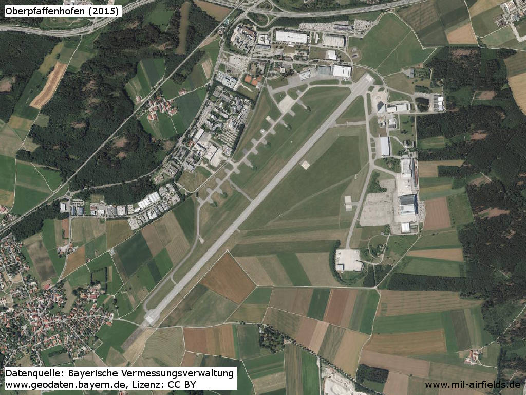
Orthophoto 2015
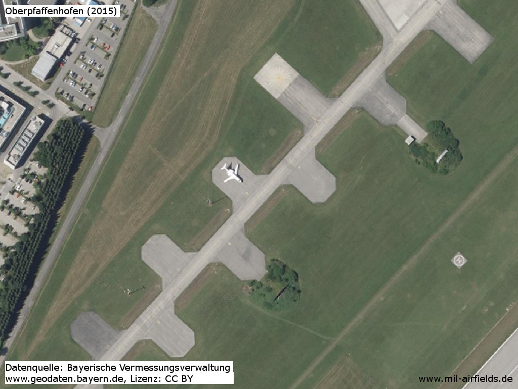
Enlargement: The hardstands created by the US troops after World War II have been preserved to this day.
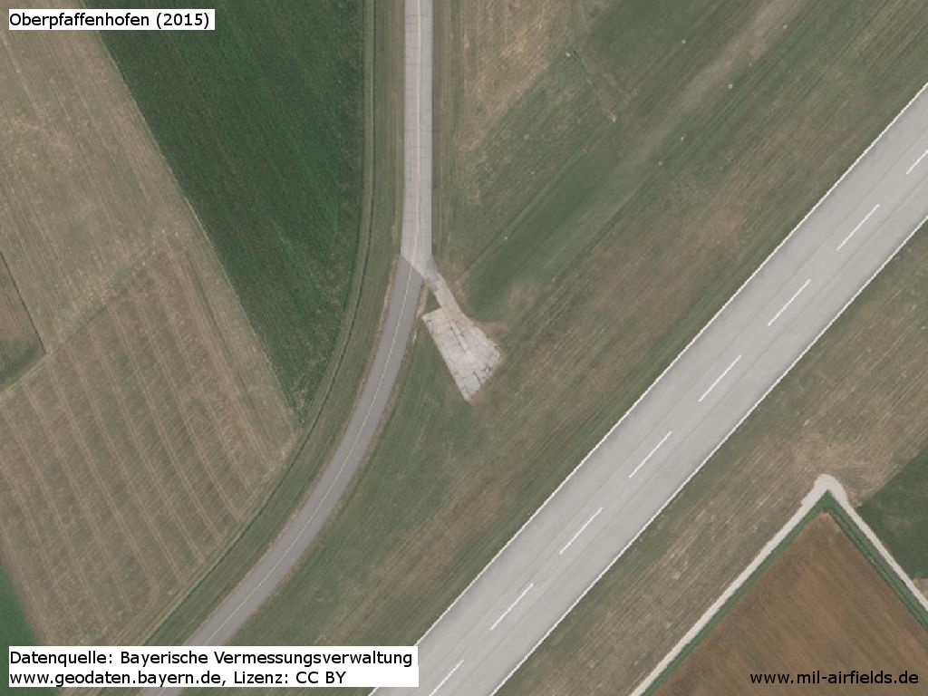
Enlargement: Remains of the taxiway to the former runway end
Airfields in the vicinity
- 355°/14km Fürstenfeldbruck: Air Base (Fürstenfeldbruck Airfield)
- 061°/22km Munich: Oberwiesenfeld Airfield (München)
- 092°/26km Neubiberg: Airfield (Neubiberg Air Base)
- 049°/27km Oberschleißheim: Airfield (Schleissheim)
- 056°/27km Munich: Warner Strip Airfield (Panzerwiese) (München, Warner Kaserne)
- 268°/28km Landsberg/Lech: Air Base (Penzing)
Recommended
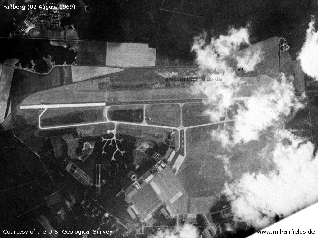
Image credits are shown on the respective target page, click on the preview to open it.
 Follow mil-airfields on Facebook