Wildenrath: Royal Air Force Base
For historical information only, do not use for navigation or aviation purposes!
| Coordinates | N510652 E0061307 (WGS84) Google Maps |
| Elevation | 291 ft |
| Federal state | Nordrhein-Westfalen (North Rhine-Westphalia) |
| Location indicator | EDUW |

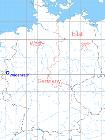
Germany during the Cold War Map
The history of the Cold War airfields: Wildenrath
During the Cold War
Use
Royal Air Force (RAF) base until 1992.
Units
1971: 4 Sq (Harrier GR1/GR1A); 20 Sq (Harrier GR1/GR1A); 60 Sq (Andover CC2, Heron C4, Pembroke C1)
1975: 3 Sq (Harrier GR3); 4 Sq (Harrier GR3); 20 Sq (Harrier GR3); 60 Sq (Pembroke C1)
1980: 19 Sq (Phantom FGR2); 60 Sq (Pembroke C1); 92 Sq (Phantom FGR2)
1985: 19 Sq (Phantom FGR2); 60 Sq (Pembroke C1); 92 Sq (Phantom FGR2)
1990: 19 Sq (Phantom FGR2); 60 Sq (Andover C1, CC2, C1(PR), Pembroke C1); 92 Sq (Phantom FGR2)
In the 1950s
Situation
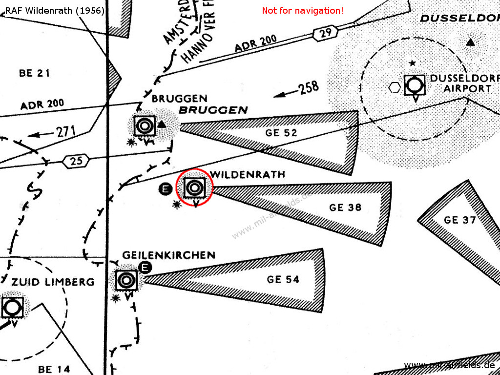
RAF Wildenrath on a map from 1956 - The approach areas of the three British airfields Brüggen, Wildenrath and Geilenkirchen are protected by restricted areas. The white "E" in the circle symbolizes the Eureka radio beacon, used by the British at this time. The square around the airport symbol with the "V" underneath shows an VHF direction finder. The black star stands for the coded beacons which is characteristical for British airfields
In the 1970s
Situation
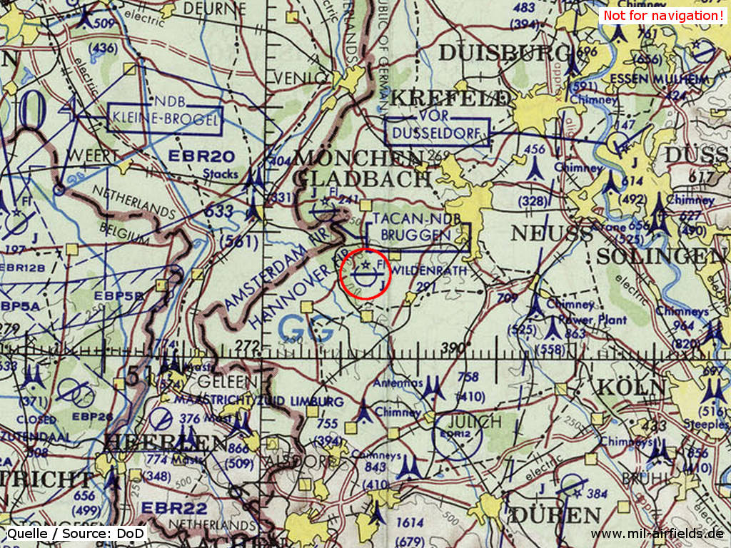
RAF Wildenrath on a map of the US Department of Defense from 1972
Source: ONC E-2 (1972), Perry-Castañeda Library Map Collection, University of Texas at Austin
Overview
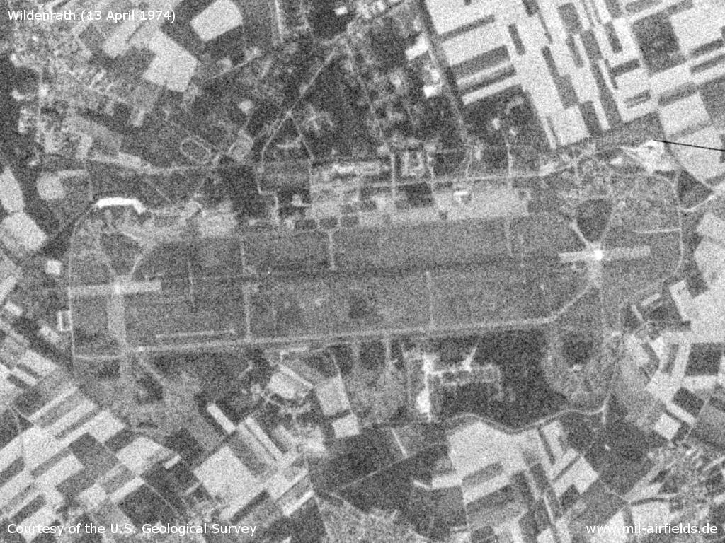
Wildenrath Air Base on a US satellite image from 13 April 1974
Source: U.S. Geological Survey
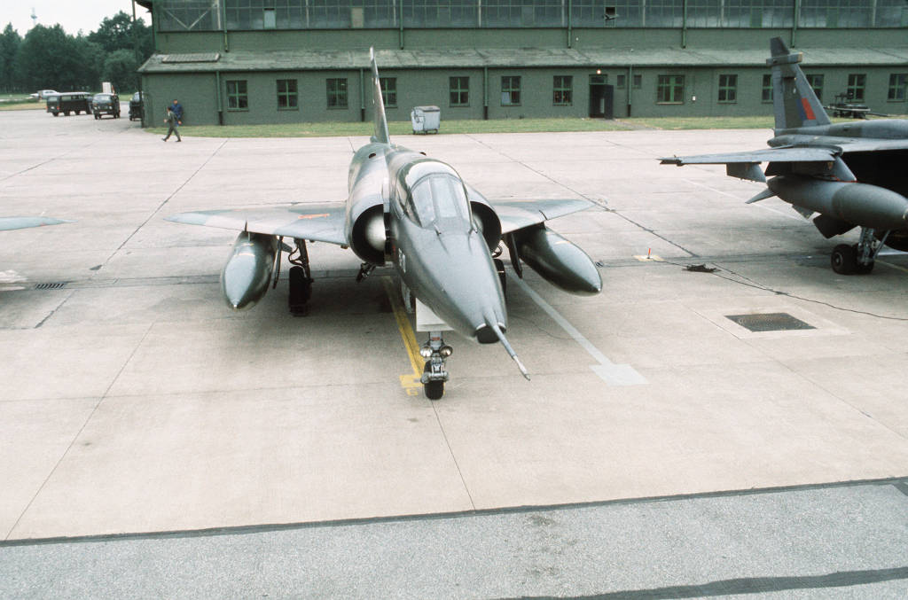
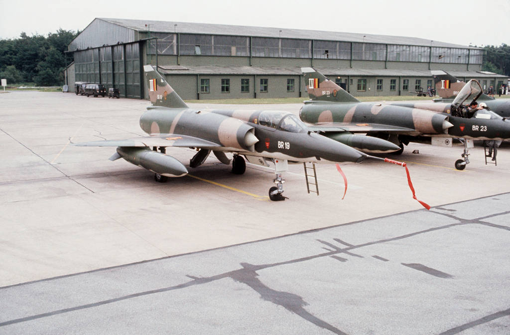
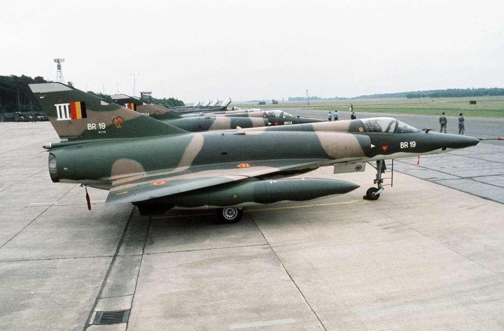
Pictures from the Tactical Air Meet '78
Taken on 15 May 1978
Source: US DoD, Scene Camera Operator: SSGT David E. Schaffer
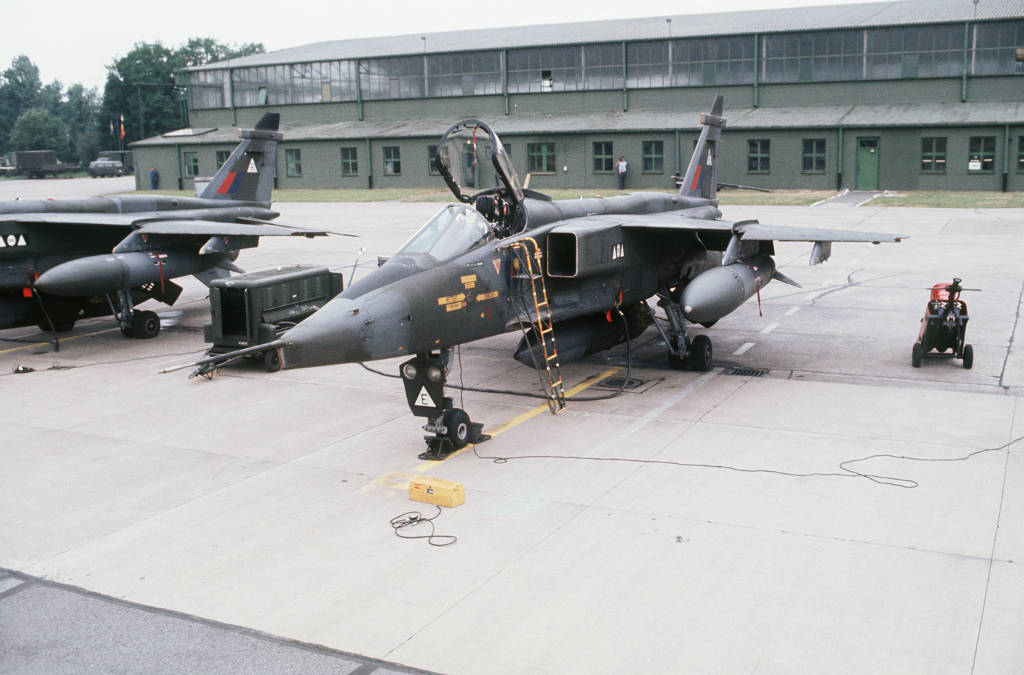
Royal Air Force Jaguar
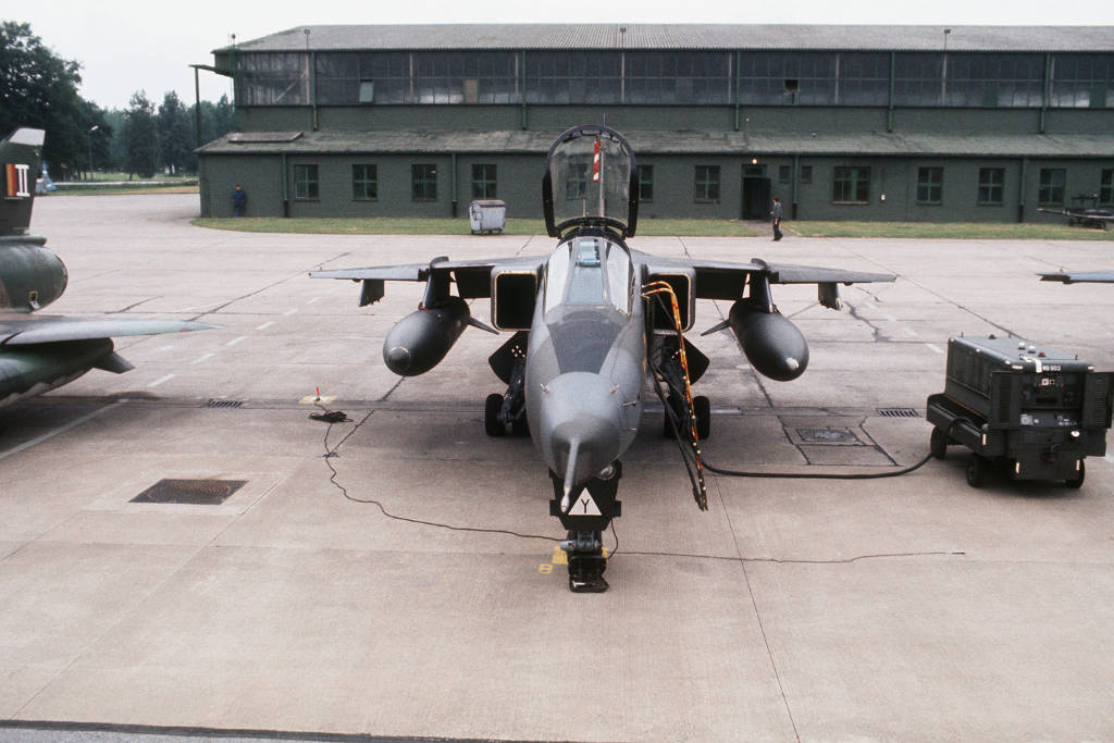
Royal Air Force Jaguar
Mirage 5BR of the Belgian Air Force (BAF)
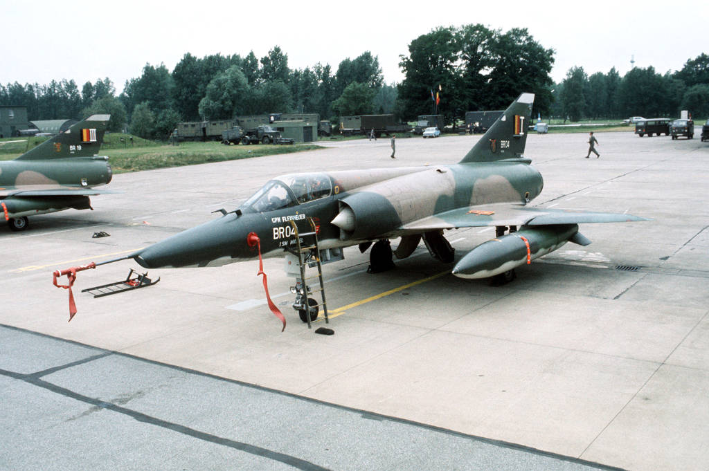
Mirage 5BR "BR 04" of the BAF
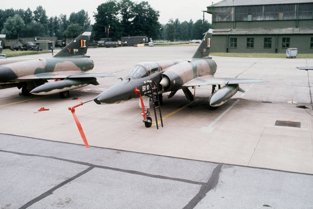
Mirage 5BR "BR10" of the BAF
Mirage 5BR
Mirage 5BR
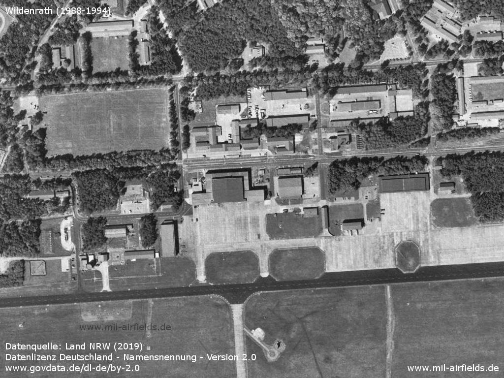
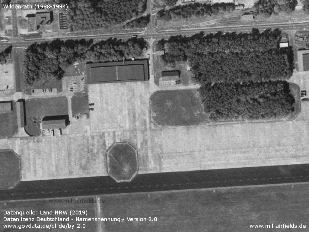
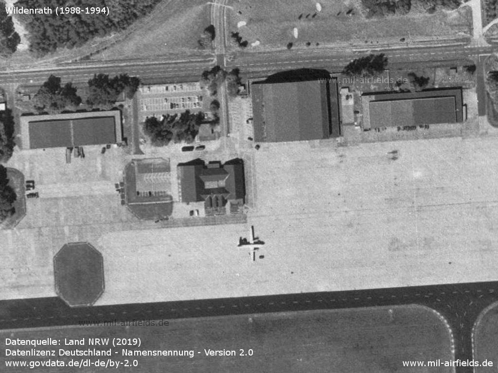
In the 1980s and early 1990s
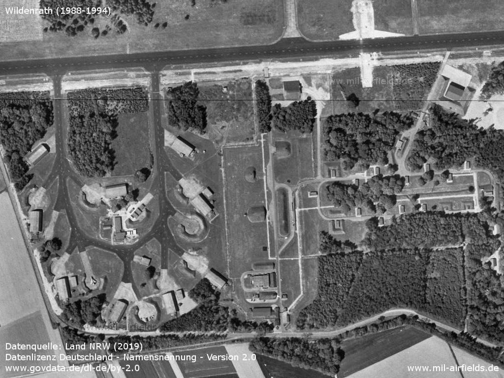
Overview
Datenquelle: Land NRW (2019) Datenlizenz Deutschland - Namensnennung - Version 2.0 www.govdata.de/dl-de/by-2.0
Airfield, barracks and housing area
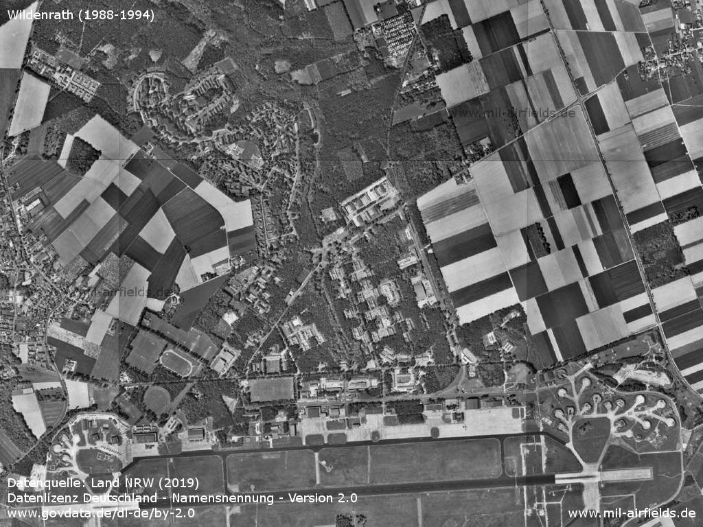
Northern part
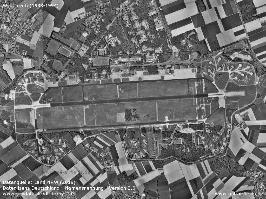
Air base
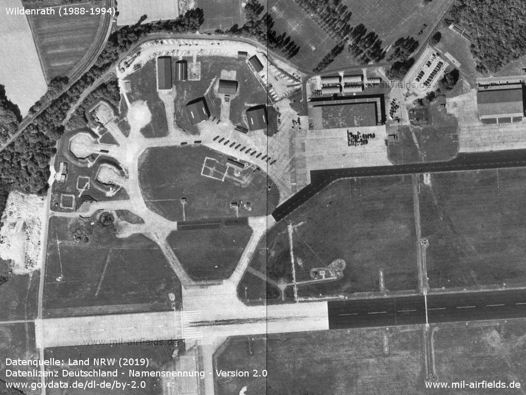
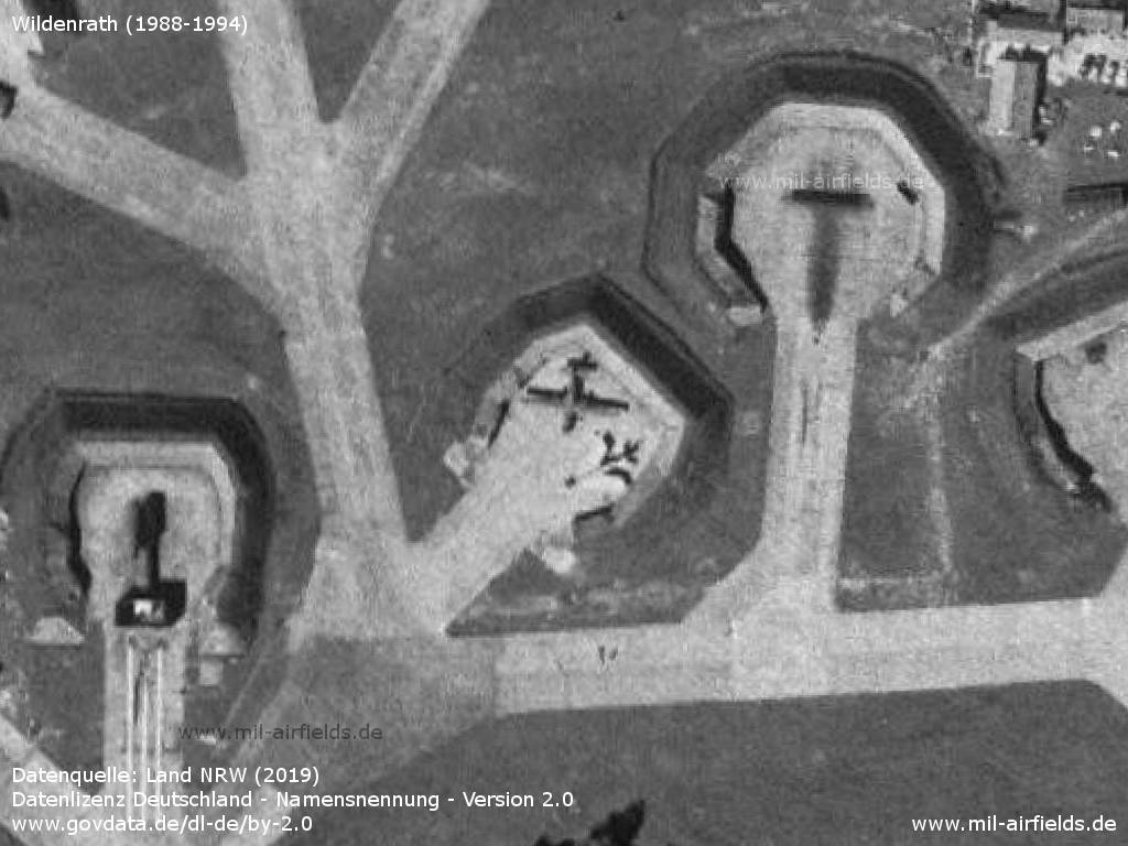
Northwestern shelter area
Ramp, control tower, hangars
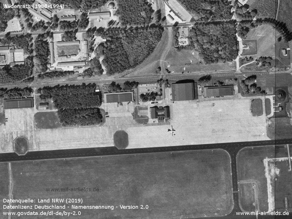
Airplane
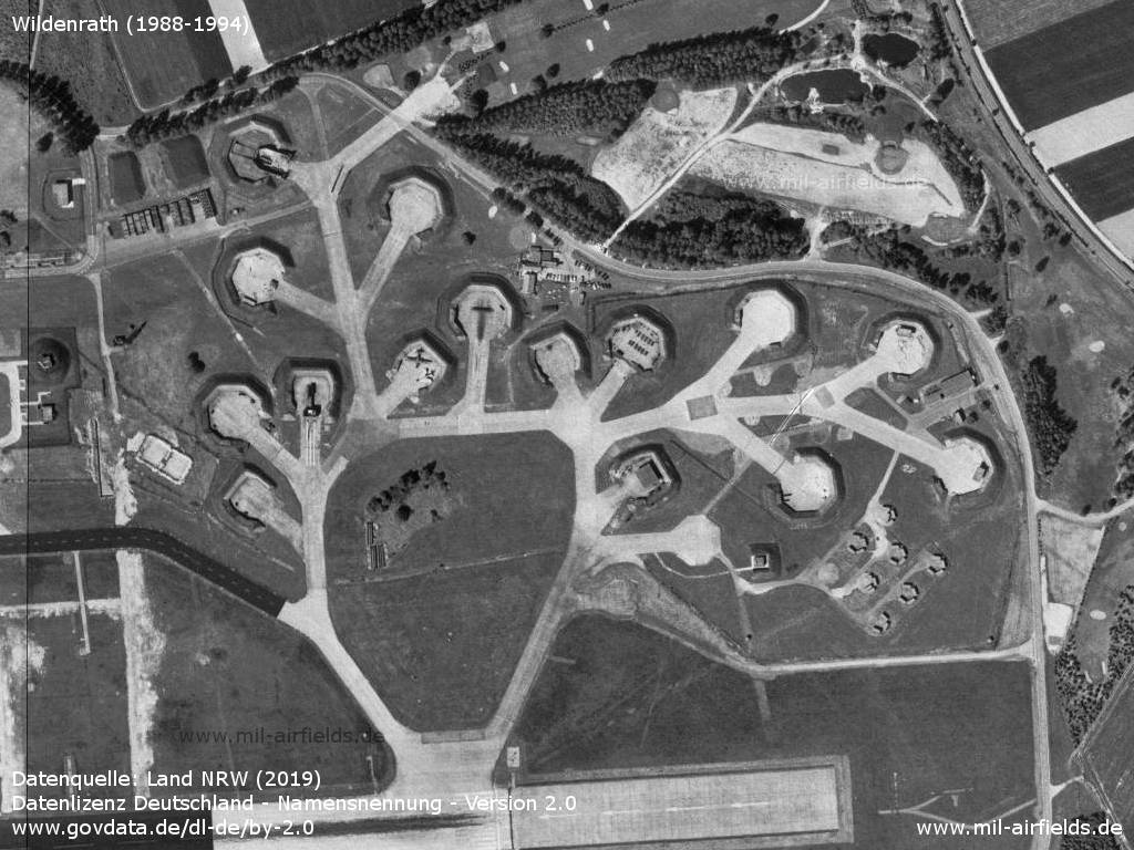
Northeastern shelter area
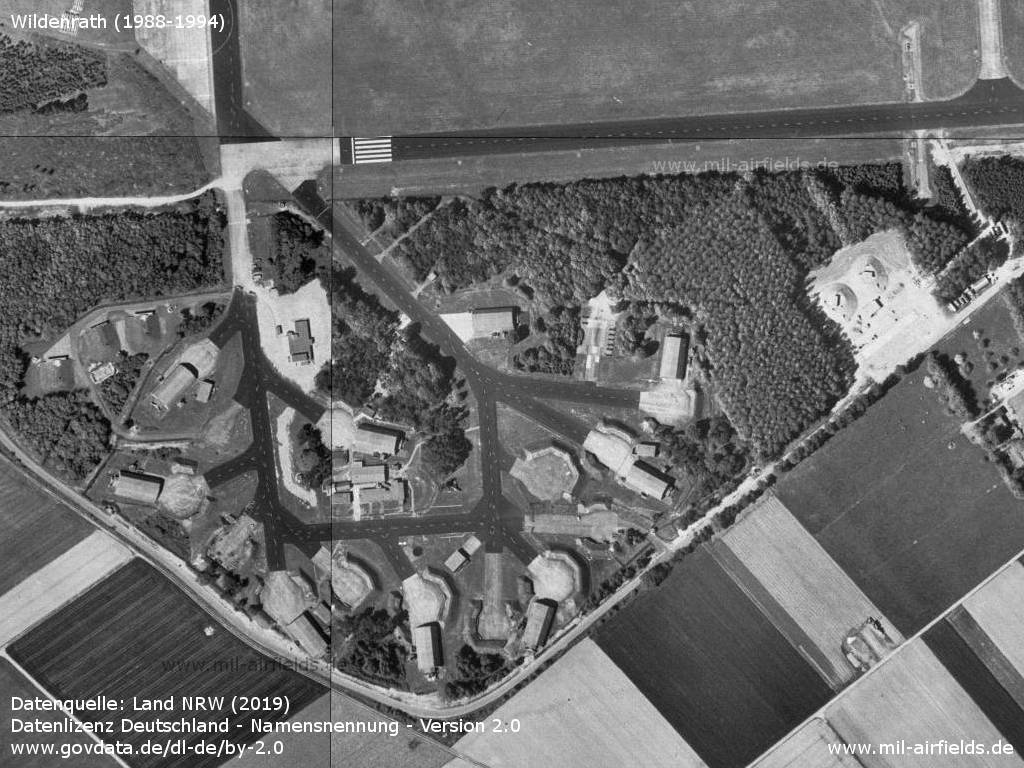
Southwestern shelter area - The southern taxiway is also marked as runway.
Southern area with ammunition dump
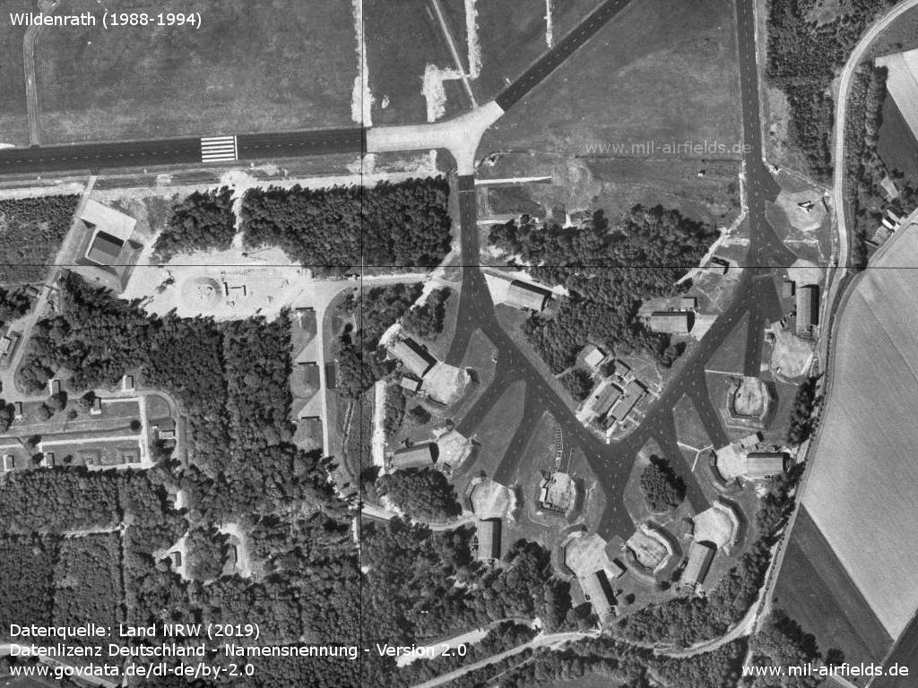
Southeastern shelter area
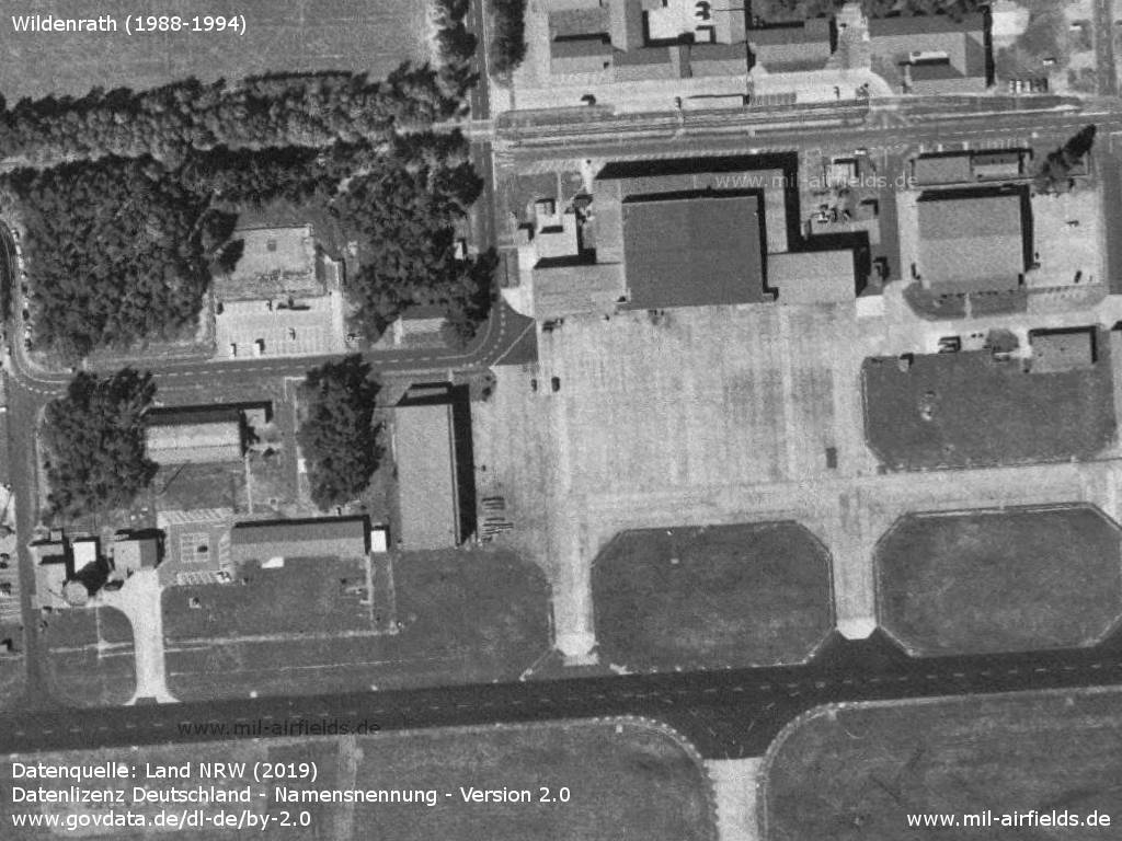
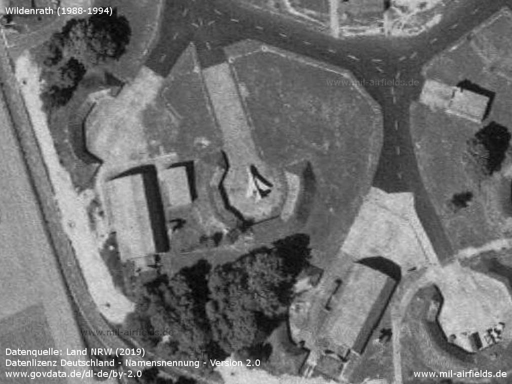
Tower, hangar
Decoys, including a BAC Lightning
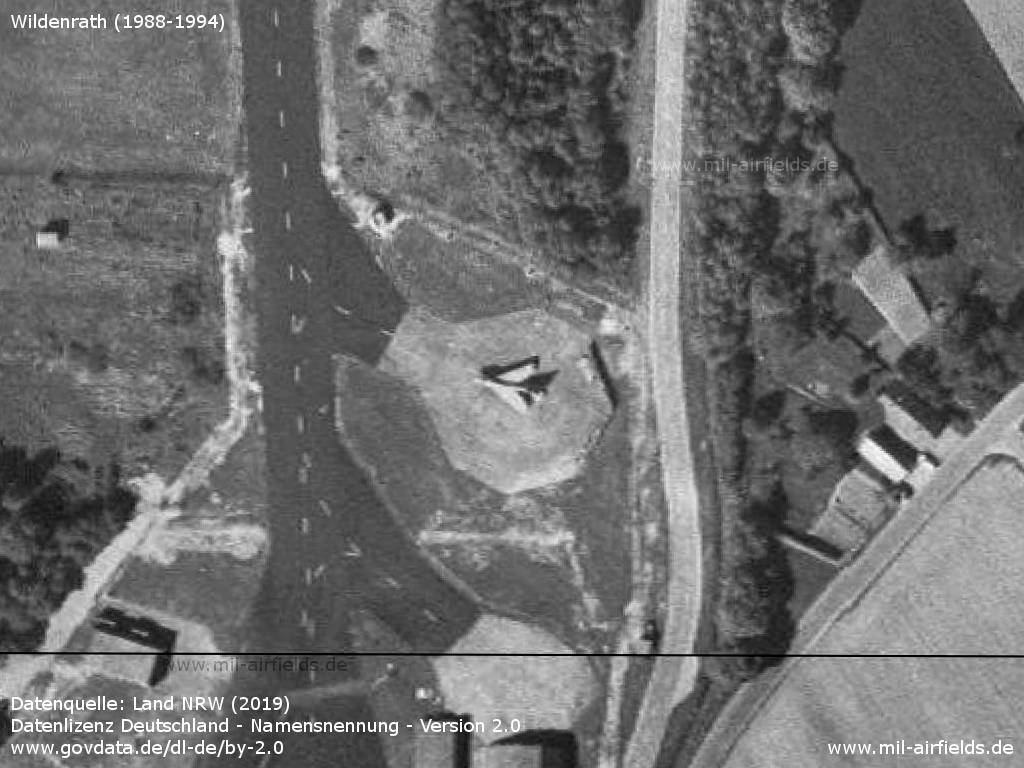
BAC Lightning as decoy
BAC Lightning as decoy
Runways
- 09/27: 2497 m x 45 m Asphalt
Radio beacons
- ILS27: 108.7 "WI"
Radar
ASR, PAR (1990)
Images from the exercise Reforger '81 (or '82)
Taken on 01 October 1981 or 1982
Source: US DoD, Scene Camera Operator: SSGT Thompson
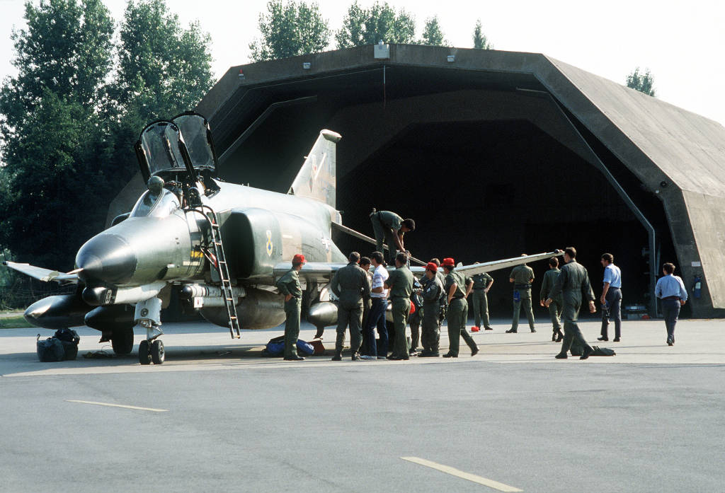
A F-4 Phantom II of the 563rd Tactical Fighter Squadron from George Air Force Base, California
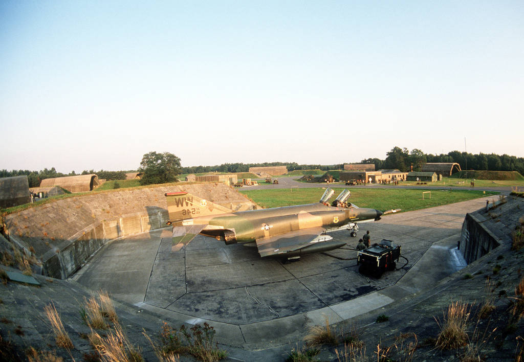
F-4 Phantom II of the 563rd TFS, USAF
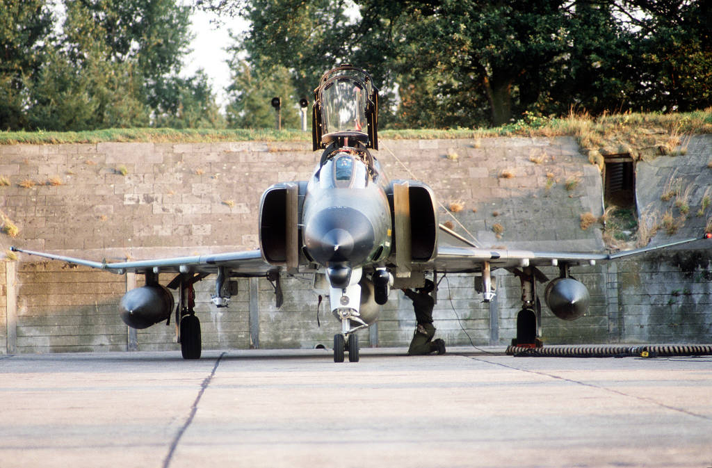
F-4 Phantom II of the 563rd TFS, US Air Force
Today
Use
Closed.
The former airfield site is used for the railway test center Wegberg-Wildenrath.
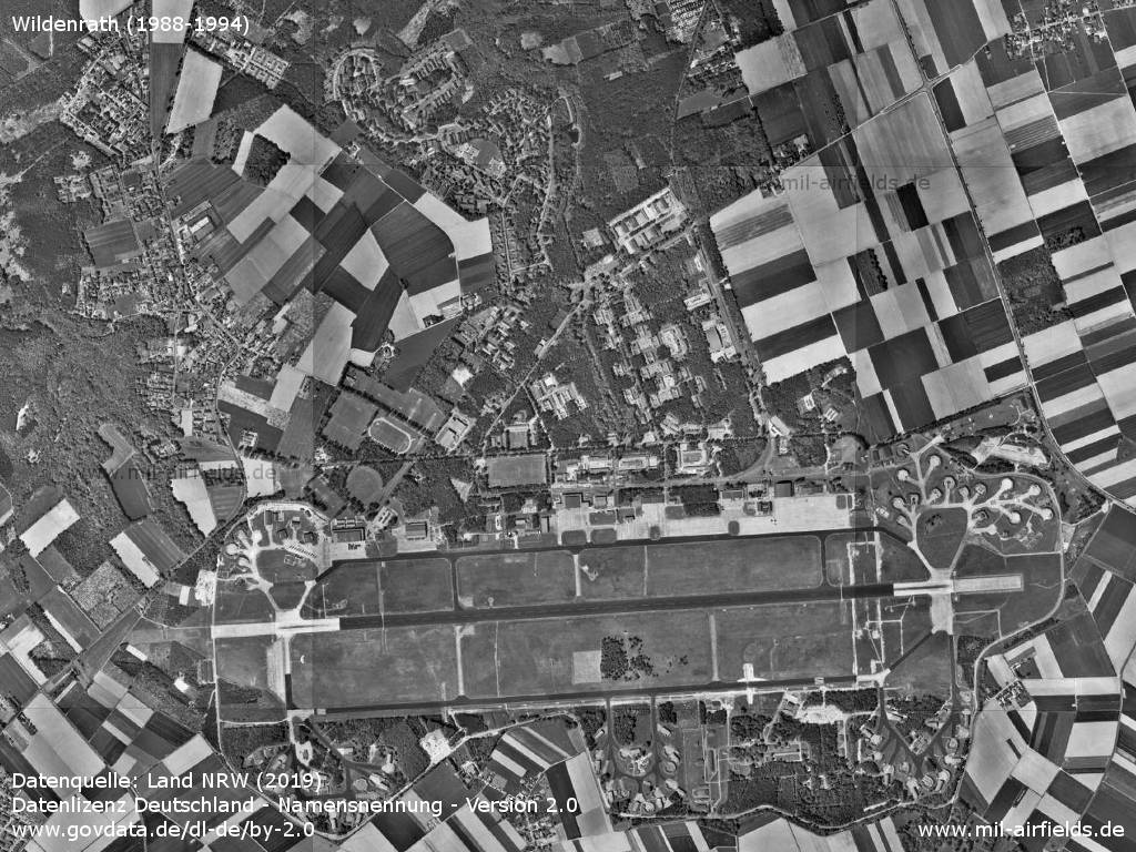
Overview
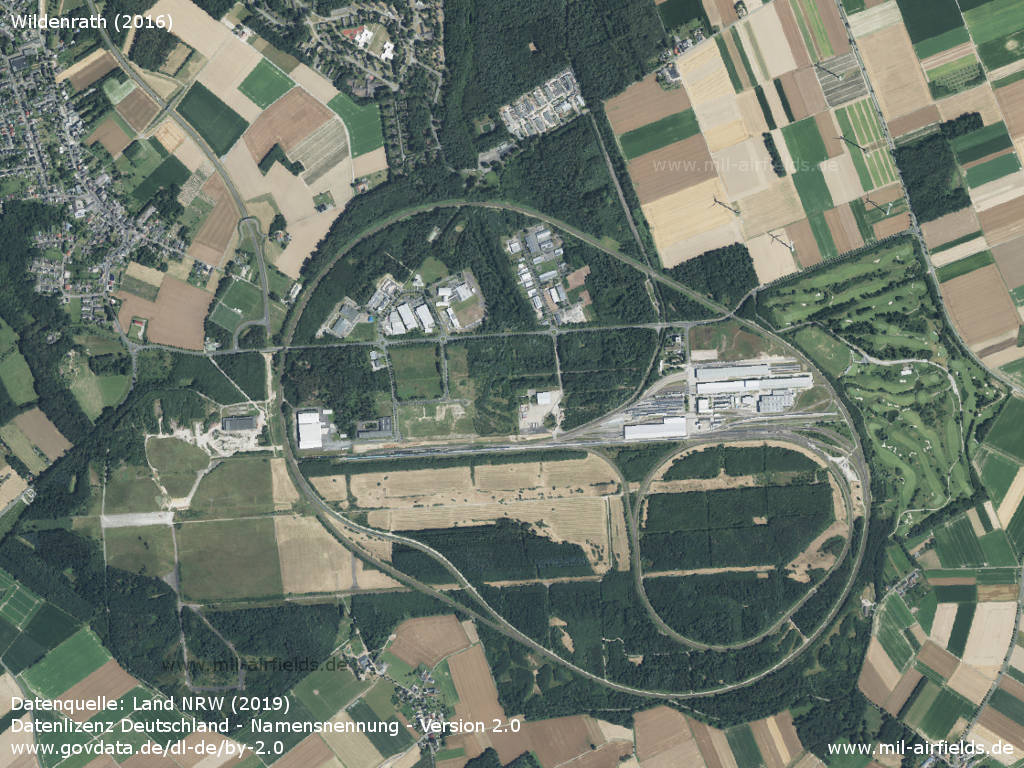
Aerial image of the Test and validation center, Wegberg-Wildenrath (2016)
Approach and aerodrome maps
The development of RAF Wildenrath over the years can also be seen from historical maps.
Approach charts RAF Wildenrath
Approach charts RAF Wildenrath
Sources
- https://www.geoportal.nrw/ - Geoportal NRW
- https://www.archives.gov/ - National Archives
Links
- https://new.siemens.com/global/de/produkte/mobilit... - Prüf- und Validationcenter in Wegberg-Wildenrath
Airfields in the vicinity
Categories
Military Airfields GermanyMilitary Airfields in former West GermanyRoyal Air Force (RAF) Bases in GermanyRecommended


Image credits are shown on the respective target page, click on the preview to open it.
 Follow mil-airfields on Facebook