Brochocin: Airfield
Schönfeld/Seifersdorf, Lotnisko Łukaszów, Аэродром Брохоцин
For historical information only, do not use for navigation or aviation purposes!
| Coordinates | N511127 E0155652 (WGS84) Google Maps |
| Elevation | 663 ft |
| Region | Województwo dolnośląskie |
The history of the Cold War airfields: Brochocin
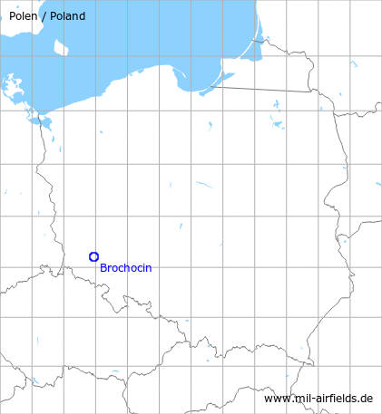
Location of airfield
16 km west of Legnica, southeast of Brochocin (formerly Brockendorf).
During World War II
Use
Luftwaffe airfield?
During the Cold War
Use
Soviet auxiliary airfield.
Situation
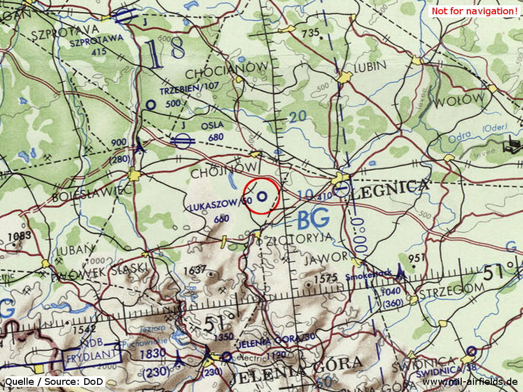
Brochocin Airfield on a map of the US Department of Defense from 1972
Source: ONC E-2 (1972), Perry-Castañeda Library Map Collection, University of Texas at Austin
Overview
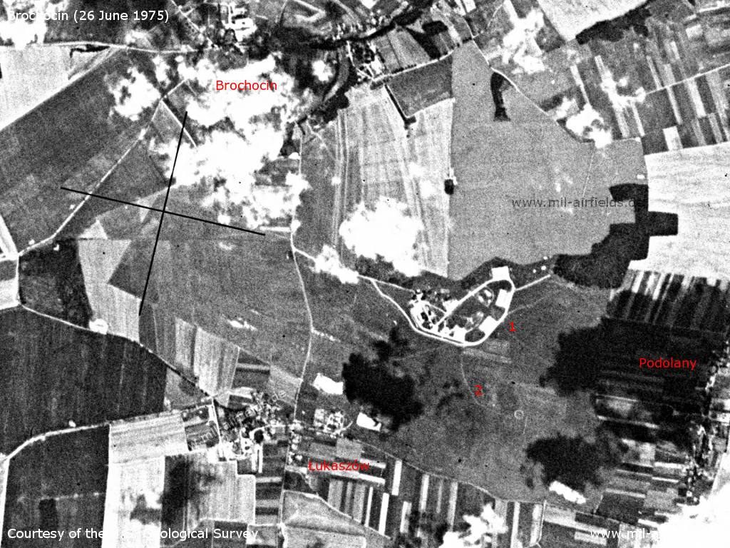
Brochocin Airfield on a US satellite image from 26 June 1975 - With this picture it remains unclear which areas can be attributed exactly to the airfield, especially as the view is obstructed by clouds. The facilities with the large concrete areas are clearly visible at 1. The airfield could be at 2 and reach as far as to the Brochocin Łukaszów road. This would give the runway length of about 1.500 m (5.000 feet) indicated on the US map and the landing direction 28 indicated by the Soviets. Interesting, however, is the square structure west of the road (at the black cross), which could also represent the western end of the airfield. But then the length would be approx. 3,400 m and the orientation rather 11/29. The area of 1463 hectares handed over according to bicc in 1992 also remains unclear. The area with the facilities and the runway up to the road has approx. 220 hectares. Even if the area west of the road is included, it is only about 300 hectares. And even with the large area north of the facilities, the value only increases to about 550 hectares.
Source: U.S. Geological Survey
Runways
- 10/28: 1500 m x 300 m Grass
Radio beacons
In landing direction 28, the field had an outer an an inner radio beacon:
- LOM 28: 868 kHz
- LMM 28: 425 kHz
Radio communication
Call sign: "PROBOSCHNIK" (ПРОБОЧНИК) (ca. 1980)
Installations
"Surface of 1463,0 hectares. Several dozen of habitation, barrack and warehouse buildings. Fuel station" (Source: bicc)
Today
Use
Closed. The field was handed over by the Russian military to the Polish authorities on 06 June 1992 (source: bicc).
Sources
- https://www.bicc.de/ - bicc
Airfields in the vicinity
Recommended

Image credits are shown on the respective target page, click on the preview to open it.
 Follow mil-airfields on Facebook