For historical information only, do not use for navigation or aviation purposes!
| Coordinates | N481304 E0113456 (WGS84) Google Maps |
| Elevation | 1610 ft |
| Federal state | Bayern (Bavaria) |
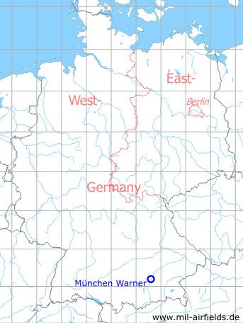
Germany during the Cold War Map
The history of the Cold War airfields: Munich Warner Strip
Location of airfield
Milbertshofen-Am Hart, north of Warner Barracks, on Panzerwiese.
During the Cold War
Use
US Army landing ground, probably until the end of the 1960s. The field was probably used only occasionally.
Overview
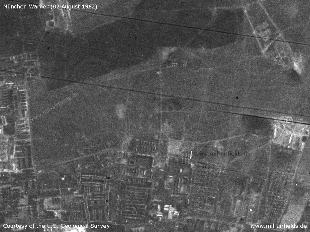
Area around Munich Warner Strip Landing Ground on a US satellite image from 02 August 1962 - The location of the runway is not clearly identifiable.
Source: U.S. Geological Survey
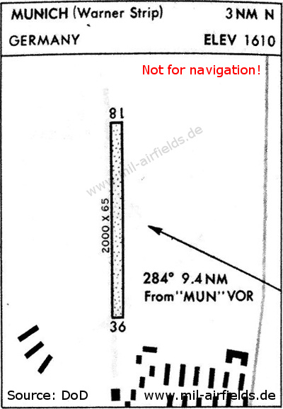
Warner Strip landing ground on a US map from 1967 - The runway is runs in north-south direction, is unpaved and has a length of 610 m (2,000 feet) and a width of 20 m (65 feet). In the south, the buildings of the barracks are indicated.
Source: DoD
Runways
- 18/36: 610 m x 20 m Grass
Airspace and procedures
Prior permission required (PPR). Airfield is unattended. Contact Schleissheim Tower prior to landing and takeoff.
Obstacles
Buildings south and trees parallel to strip on the east side.
Today
Use
Closed.
Overview
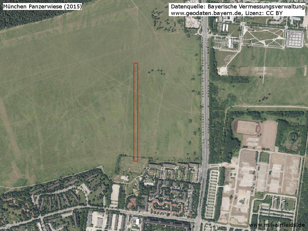
The area in 2015 - The red rectangle indicates the approximate location of the previous runway, according to the map from 1967. The former Warner Barracks, now Ernst-von-Bergmann-Kaserne, begins at the bottom of the picture. On the right in the lower half is the torn down area of the Prinz-Wrede-Kaserne
Source: Bayerische Vermessungsverwaltung, www.geodaten.bayern.de, Lizenz CC BY
Sources
- http://geoportal.bayern.de/ - Geoportal Bayern
- https://www.usgs.gov/ - USGS U.S. Geological Survey
Airfields in the vicinity
Categories
Military Airfields GermanyMilitary Airfields in former West GermanyUS Army Airfields and Heliports in GermanyRecommended
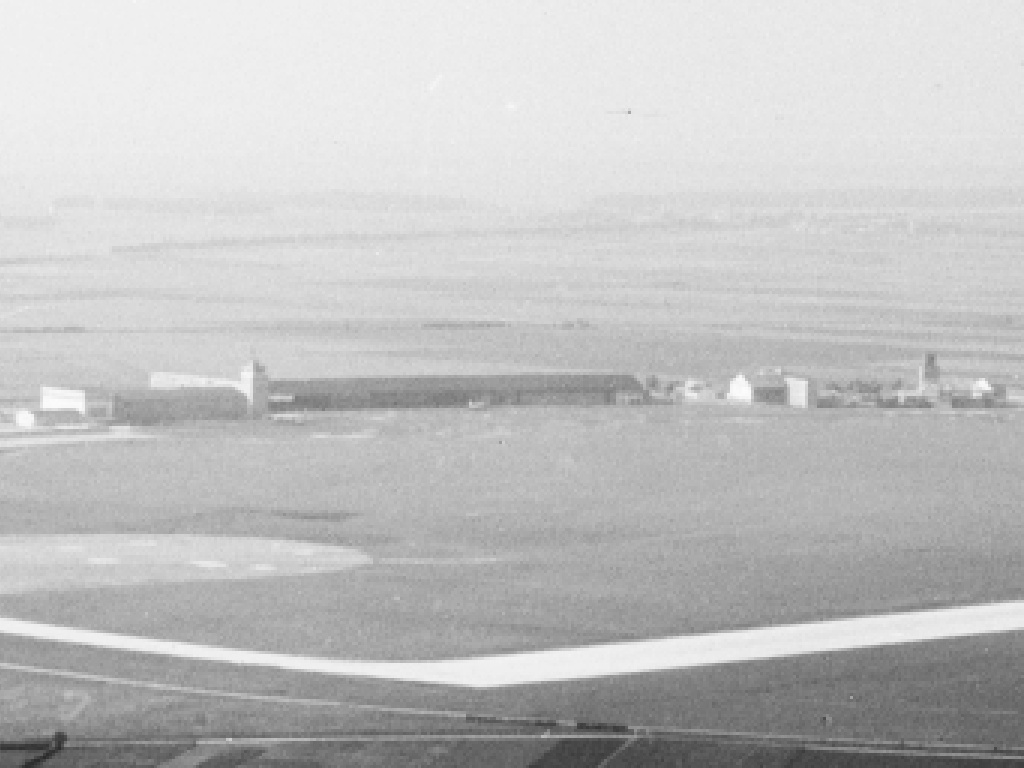
Image credits are shown on the respective target page, click on the preview to open it.
 Follow mil-airfields on Facebook