For historical information only, do not use for navigation or aviation purposes!
| Coordinates | N501211 E0125456 (WGS84) Google Maps |
| Location indicator | LKKV |
The history of the Cold War airfields: Karlovy Vary
During the Cold War
Use
Regional airport; reserve airfield?
Situation
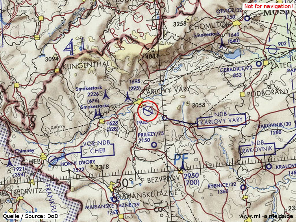
Karlovy Vary Airport on a map of the US Department of Defense from 1972
Source: ONC E-2 (1972), Perry-Castañeda Library Map Collection, University of Texas at Austin
Overview
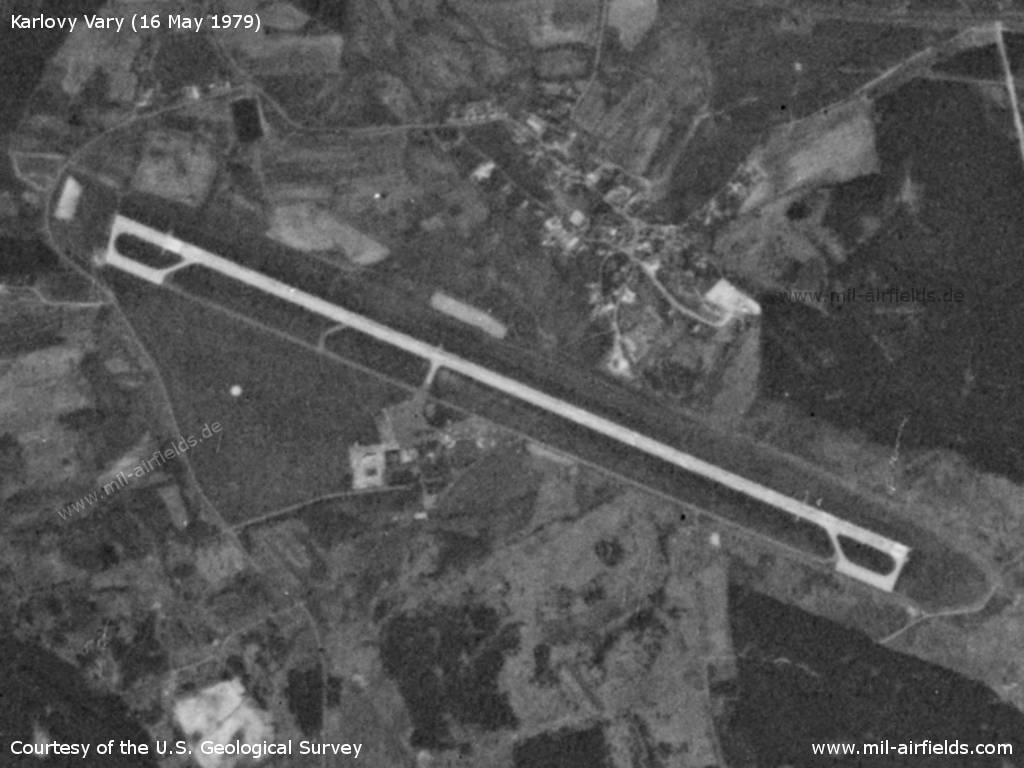
Karlovy Vary Airport on a US satellite image from 16 May 1979 - The airport has parking areas at both ends of the taxiway, which are characteristical for Czechoslovak reserve airports.
Source: U.S. Geological Survey
Today
Use
Regional airport.
 Follow mil-airfields on Facebook