For historical information only, do not use for navigation or aviation purposes!
| Coordinates | N542604 E0130122 ? (WGS84) Google Maps (approximate location) |
| Former East Germany (GDR) | District of Rostock |
| Federal state | Mecklenburg-Vorpommern (Mecklenburg-Western Pomerania) |
| Region | Baltic Sea |
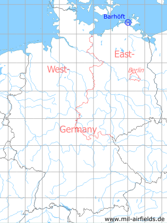
Germany during the Cold War Map
The history of the Cold War airfields: Barhöft
General
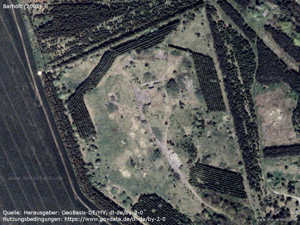
Barhöft is a small village on the Baltic Sea coast that had several military facilities during the GDR era. At the end of the 1980s, the port was home to the East German 3rd Border Boat Group and the 2nd Technical Observation Platoon of Border Battalion 2 of the 6th Border Brigade "Coast". The East German Navy Volksmarine operated a radio relay station in Barhöft. West of the village was an surface-to-air (SAM) missile site of the Anti-aircraft Missile Unit 4331 (FRA-4331) of the Air Force/Air Defense (LSK/LV). It was equipped with missiles S-125 Newa (NATO designator SA-3 GOA). In addition, the Ministry of State Security (MfS, Stasi) had an object in Barhöft of unknown purpose.
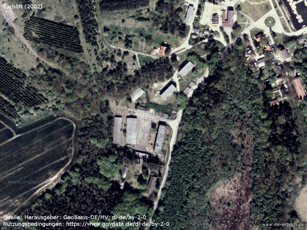
There were at least two barracks or two parts. One was built in 1965, had a floor area of approx. 4,300 sqm and was covered with 2-storey accommodation and storage buildings. The other was from 1974, had a property size of 19,000 square meters and was built with guard house, accommodation buildings, barracks, warehouse buildings, motor vehicle hall and boiler house.
Another East German source lists for the barracks of FRA-4331:
- Installation ID 01/937
- surface area: 22,3
- housing capacity: 83
- Installation ID 01/937
- surface area: 22,3
- housing capacity: 83
For the 1980s, a helipad was designated for the Anti-Aircraft Missile Unit 4331, which is described below.
During the Cold War
In the 1960s
Overview
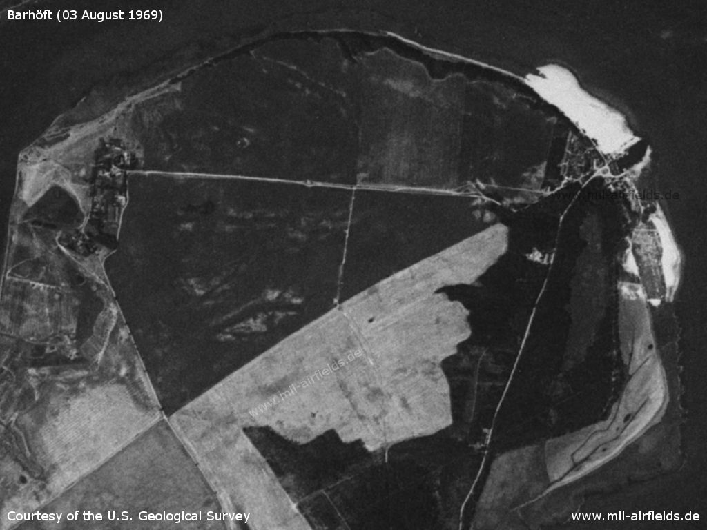
Satellite image of Barhöft, 03 August 1969 - At this time there was no anti-aircraft missile site yet.
Source: U.S. Geological Survey
In the 1980s and early 1990s
Location of airfield
Northwest of Barhöft, exact location unknown. The official coordinates N542538 E0130138 do not match in any geodetic system the distance of 200 m to the observation tower of the Volksmarine, which is mentioned as obstacle.
Use
Helipad 3318 for Anti-aircraft missile unit 4331 (FRA-4331) of former East German Air Force (NVA LSK/LV).
Overview
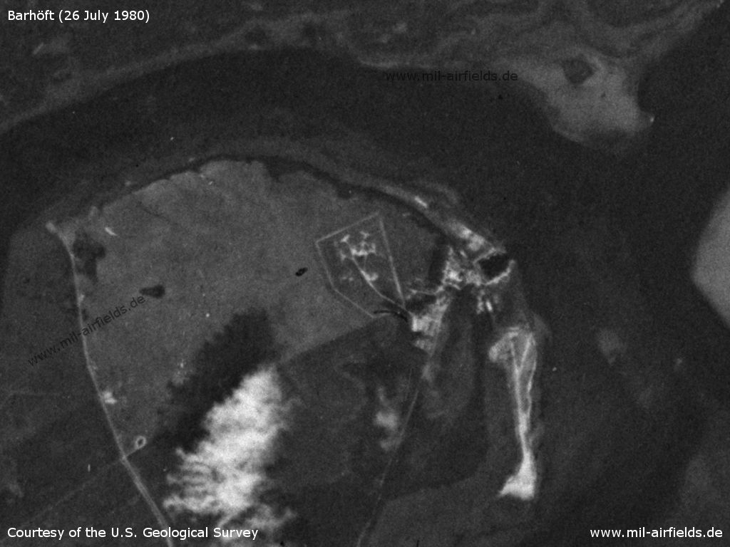
Barhöft SAM site on a US satellite image from 26 July 1980
Source: U.S. Geological Survey
Runways, taxiways, aprons
Dimensions: 600 m x 300 m,
Main takeoff and landing direction: 0° - 270°,
Surface: Gras with loamy ground,
Capacity: 1-2 helicopters.
Main takeoff and landing direction: 0° - 270°,
Surface: Gras with loamy ground,
Capacity: 1-2 helicopters.
Telephone
Stabsnetz S1 6338-11
Airspace and procedures
Usable at day during good weather conditions,
Alert time: 60 minutes.
Alert time: 60 minutes.
Obstacles
Navy observation tower: distance 200 m, height 30 m
Units
Anti-aircraft Missile Unit 4331 (FRA-4331)
Address:
Post box 84213
Post box 84213
Hierarchy 1989:
- Ministry of National Defense (MfNV)
-- National People's Army (NVA)
--- Air Force/Air Defense (LSK/LV)
---- 3rd Air Defense Division (3. LVD)
----- 43rd Surface-to-Air Missile Brigade (43. FRBr)
------ Anti-aircraft Missile Unit 4331 (FRA-4331)
- Ministry of National Defense (MfNV)
-- National People's Army (NVA)
--- Air Force/Air Defense (LSK/LV)
---- 3rd Air Defense Division (3. LVD)
----- 43rd Surface-to-Air Missile Brigade (43. FRBr)
------ Anti-aircraft Missile Unit 4331 (FRA-4331)
Today
Use
Closed.
Overview
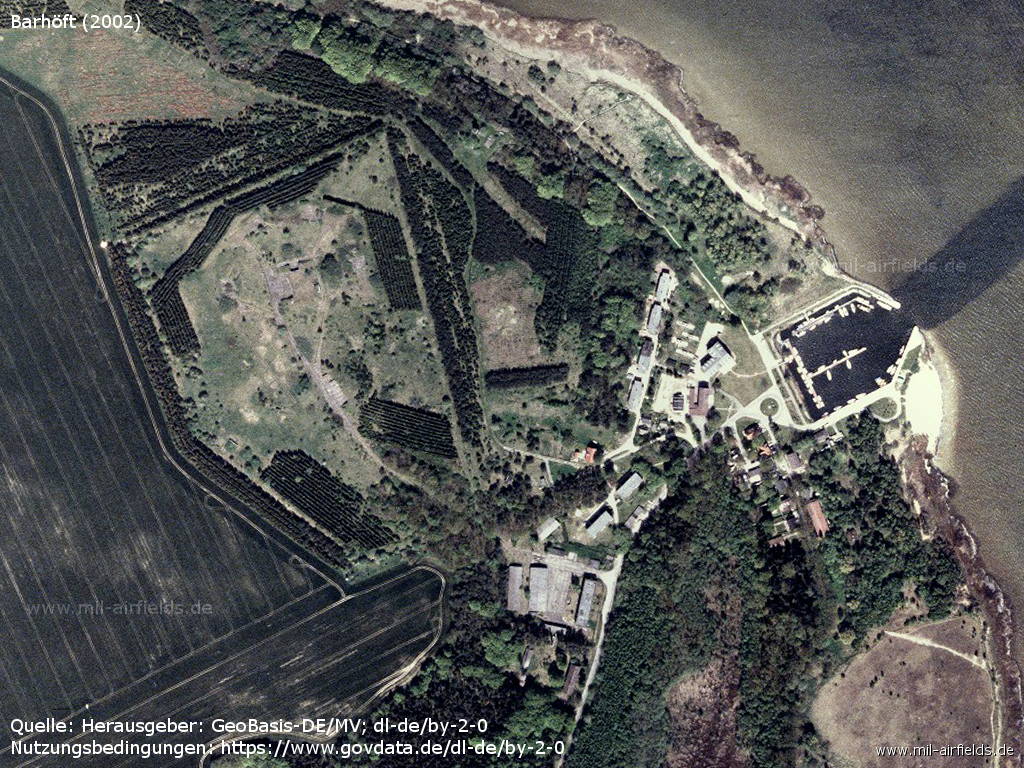
Overview (2002)
Source: Landesamt für innere Verwaltung M-V, Amt für Geoinformation, Vermessung und Katasterwesen - www.geoportal-mv.de, Data licence Germany – attribution – version 2.0, www.govdata.de/dl-de/by-2-0, http://www.geoportal-mv.de/
Enlargement: Former technical zone
Enlargement: Former barracks
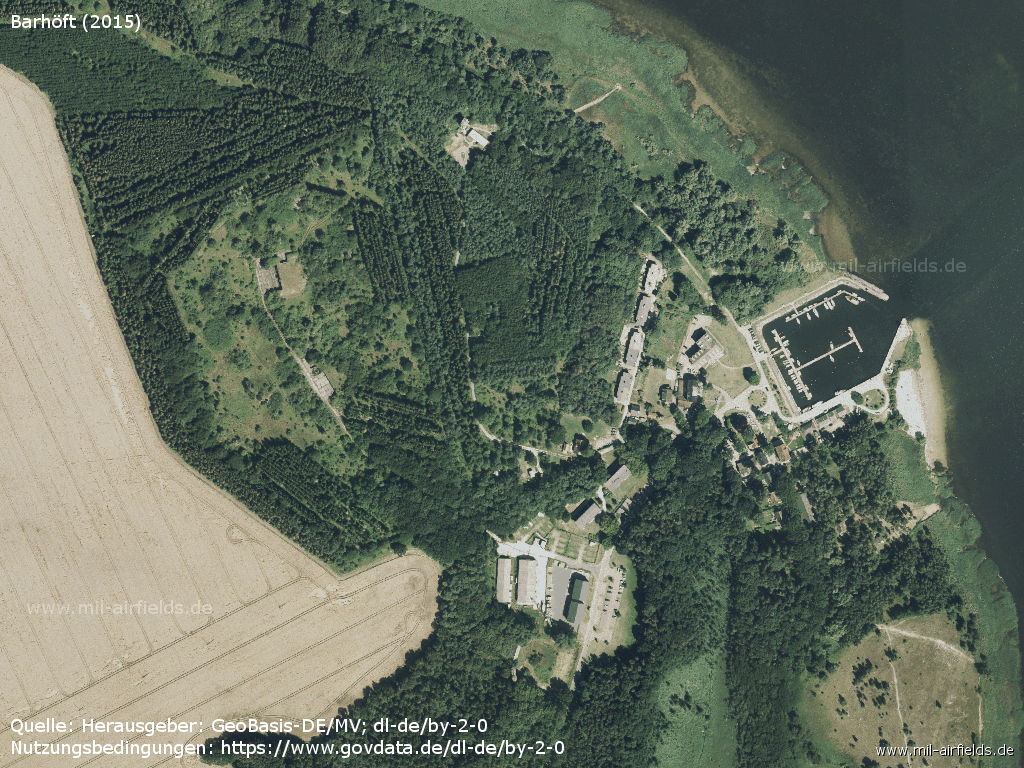
State (2015)
Airfields in the vicinity
- 152°/8km Parow: Airfield
- 231°/9km Gross Mohrdorf: Airfield (Groß Mohrdorf)
Categories
Military Airfields GermanyMilitary Airfields in former East GermanyHelipads of former National People's ArmyRecommended
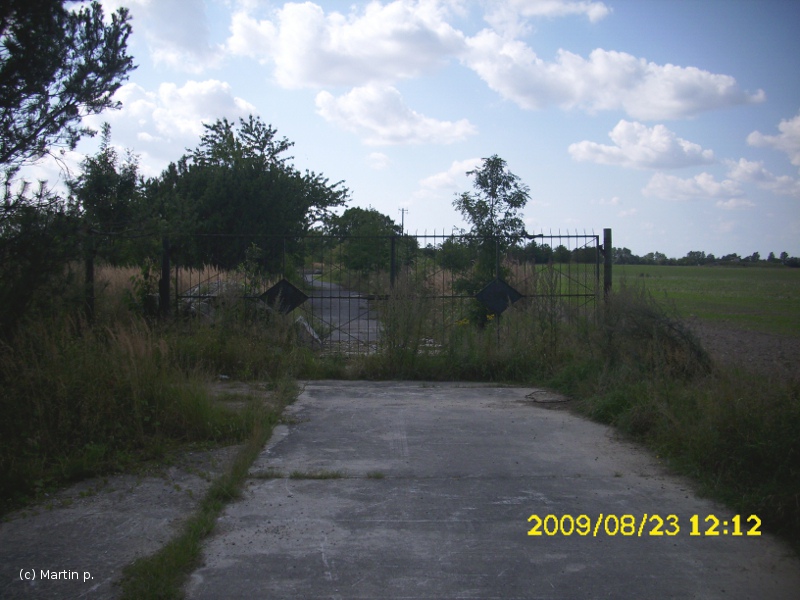
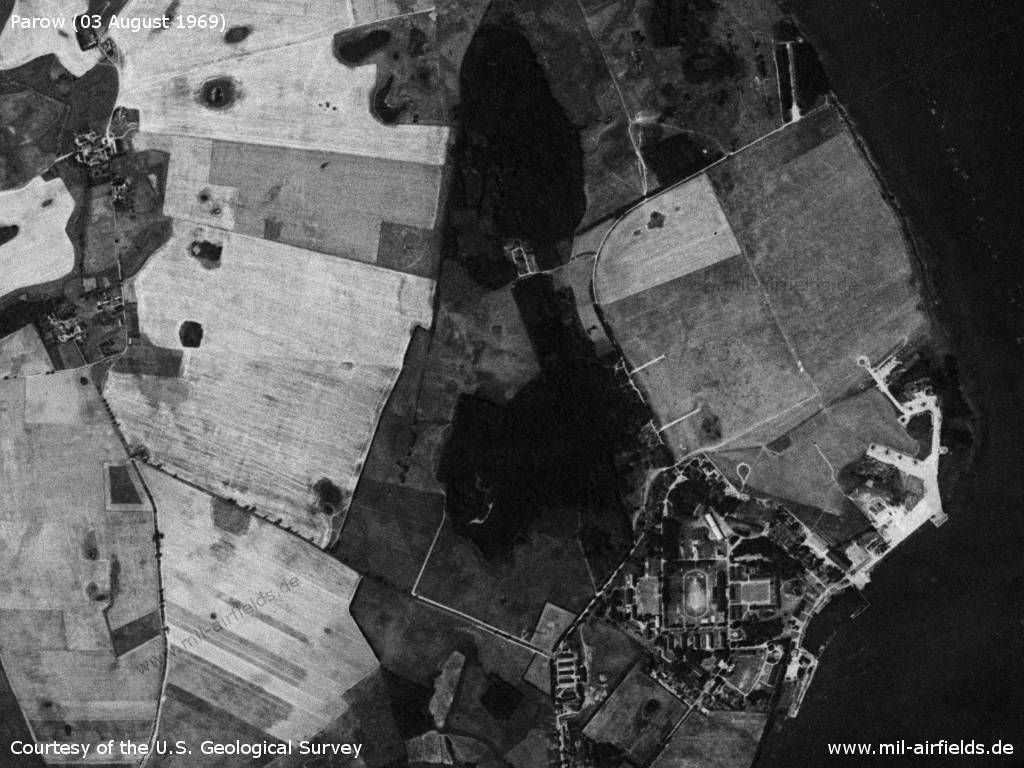
Image credits are shown on the respective target page, click on the preview to open it.
 Follow mil-airfields on Facebook