For historical information only, do not use for navigation or aviation purposes!
| Coordinates | N542017 E0124234 (WGS84) Google Maps |
| Elevation | 7 m |
| Former East Germany (GDR) | District of Rostock |
| Federal state | Mecklenburg-Vorpommern (Mecklenburg-Western Pomerania) |
| Region | Baltic Sea, Darß peninsula |
| Location indicator | EDXB (196x), ETBH (-199x), EDBH (199x-) |
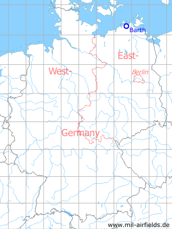
Germany during the Cold War Map
The history of the Cold War airfields: Barth
General
Barth airfield was built in the mid-1930s as a Luftwaffe air base. By the end of the Second World War, most of the air base's buildings had been destroyed, but the runway was still intact. In the following years the airfield remained unused until about 1951, when it started to serve as a firing range for the Soviet Air Force. According to the CIA, the regiments stationed in Damgarten in particular practised here. From the end of the 1950s, Barth was served by the East German Interflug airline in the GDR's domestic air traffic with Il-14 and later An-24 aircraft. When domestic air traffic was discontinued in 1975, Barth served as an agricultural airfield until 1989/1990. After the fall of communism, the Ostseeflughafen Stralsund-Barth (Baltic Sea airport of Stralsund-Barth) developed from it.
Location of airfield
The airfield is located 3 km south-southwest of Barth city center.
During World War II
Use
Luftwaffe airbase.
Situation
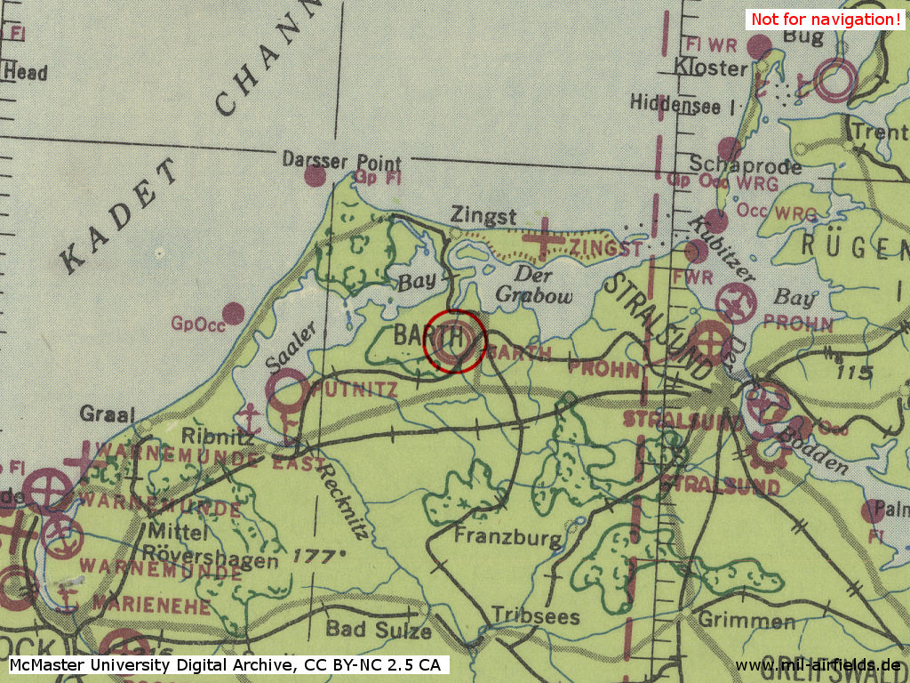
Barth air base in World War II on a US map from 1943
Source: McMaster University Library Digital Archive, Lizenz: Creative Commons Attribution-NonCommercial 2.5 CC BY-NC 2.5 CA
Overview
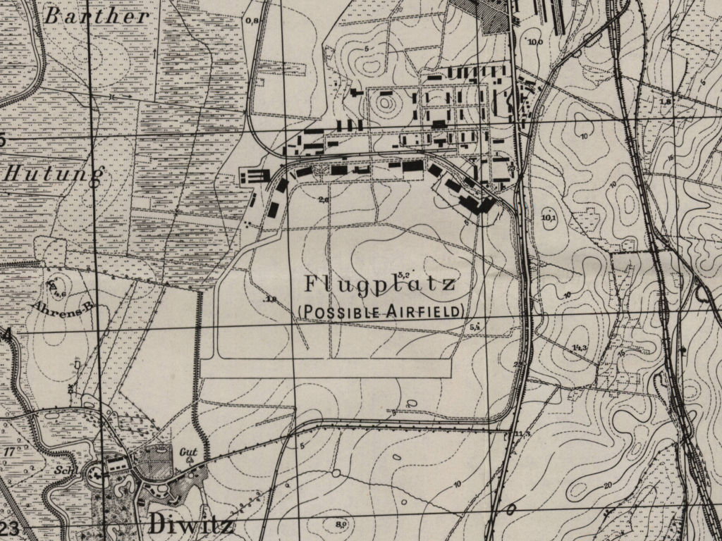
Barth airfield on a US map from 1952 - Buildings of the former air base are visible in the north. In the east and south, the narrow-gauge railroad Franzburger Kreisbahn is passing around the airfield, which also served the air base. At the bottom left is the village of Diwitz
Source: AMS M841 GSGS 4414, Courtesy Harold B. Lee Library, Brigham Young University
During the Cold War
In the 1950s
Overview
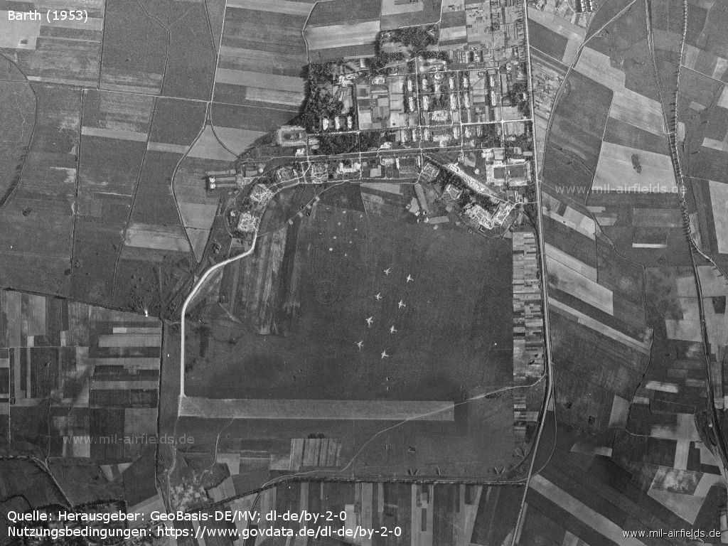
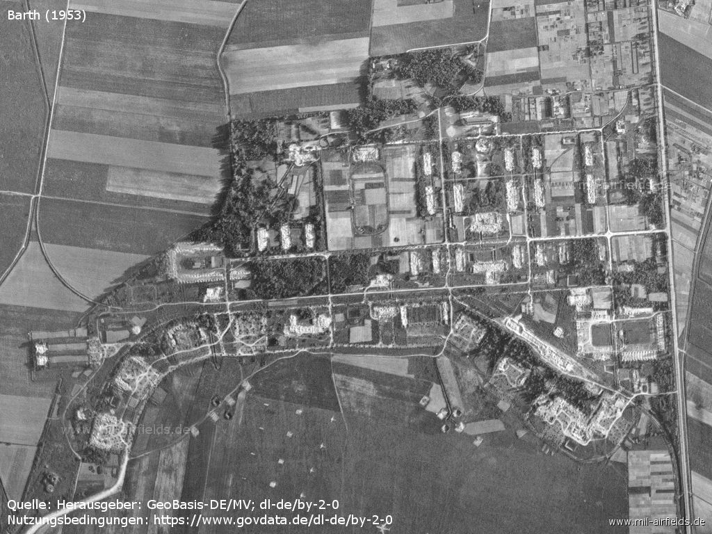
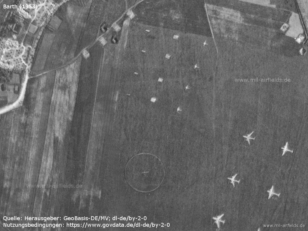
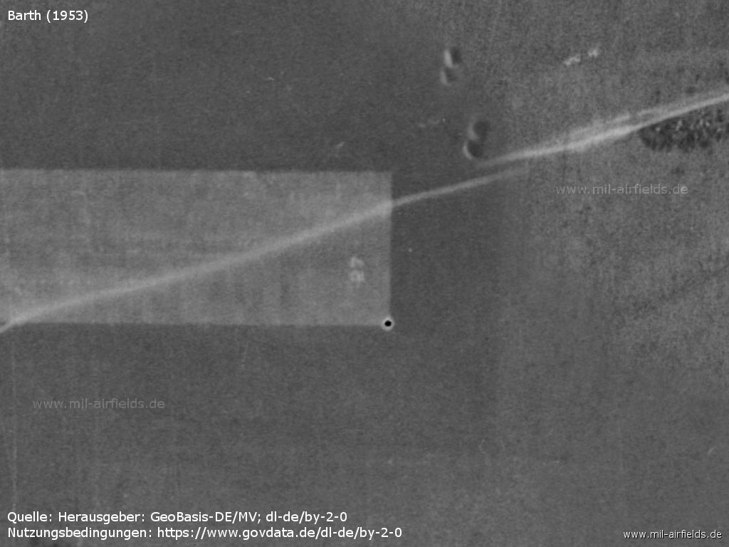
Aerial picture from 1953 - To the north are the remains of the air base barracks. The airfield serves as a firing range, for this purpose airplane silhouettes are applied.
Source: Landesamt für innere Verwaltung M-V, Amt für Geoinformation, Vermessung und Katasterwesen - www.geoportal-mv.de, Data licence Germany – attribution – version 2.0, www.govdata.de/dl-de/by-2-0, http://www.geoportal-mv.de
Enlargement: Former barracks - The buildings were demolished after World War II, only the foundations are still visible.
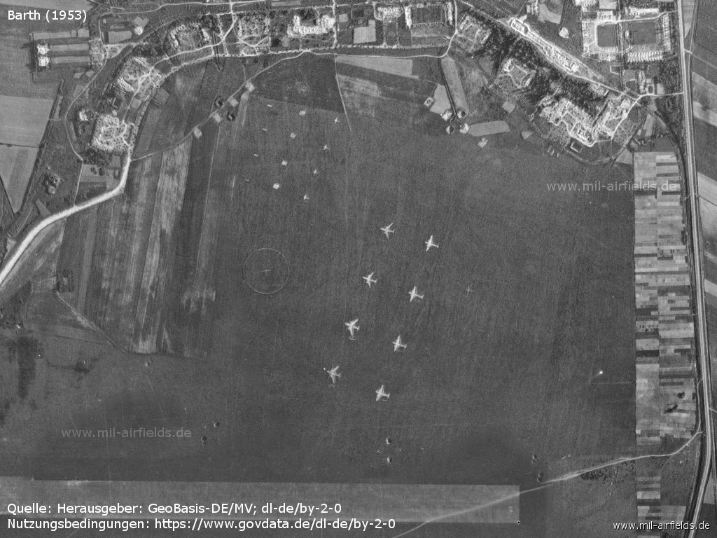
Enlargement: Airfield
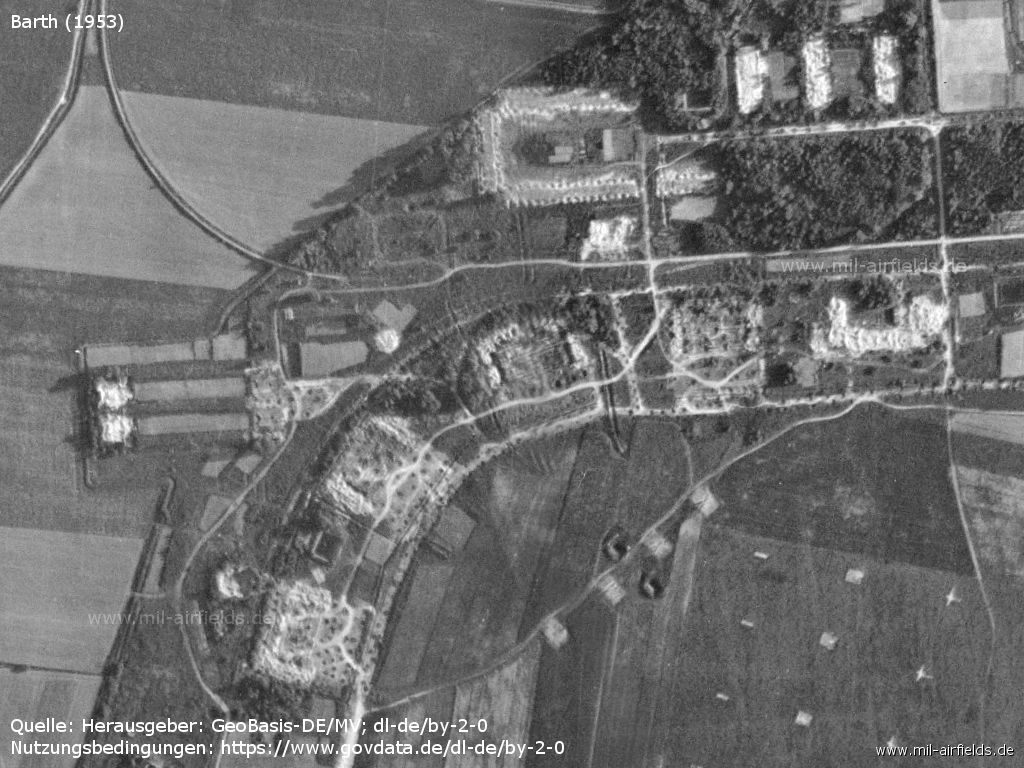
Former aircraft hangars in the northwest
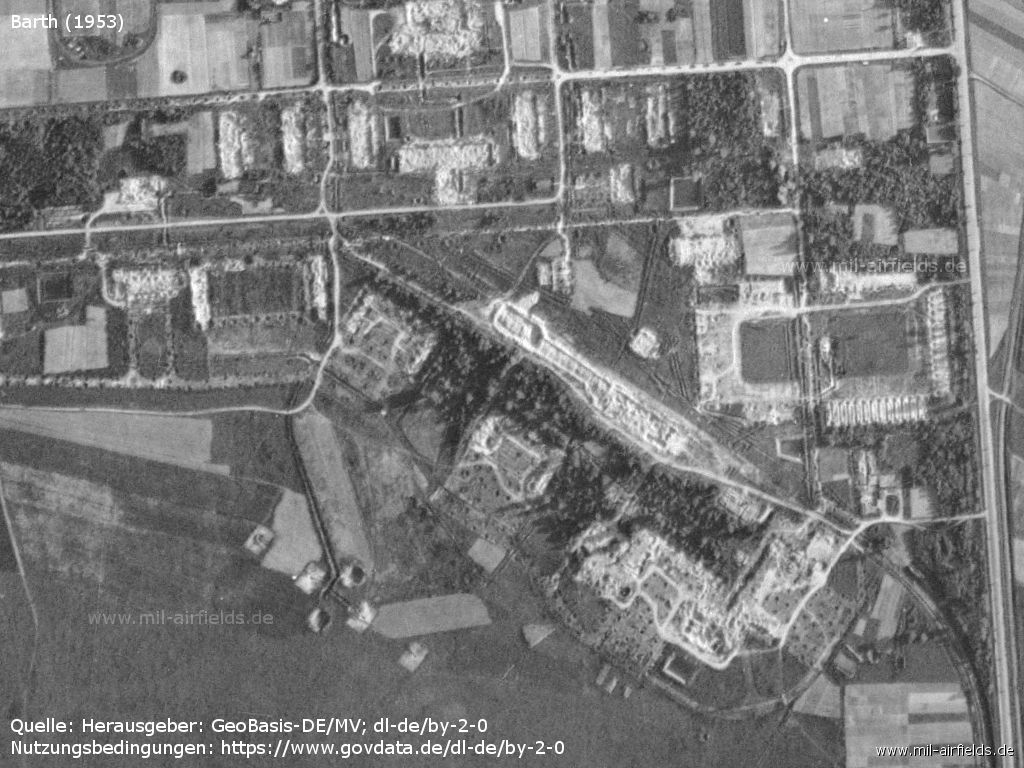
Demolished buildings in the northeast
Targets and target circle on the shooting range
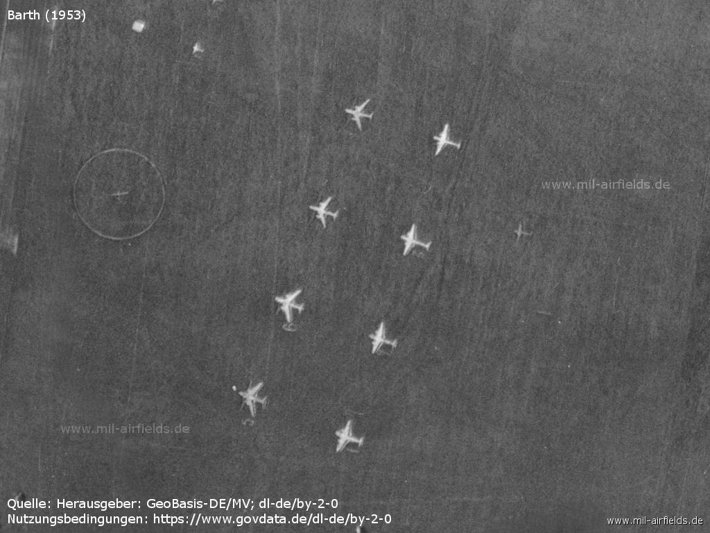
Airplane silhouettes - The targets are numbered consecutively. The right row starts at the bottom with "1", the left row with "5".
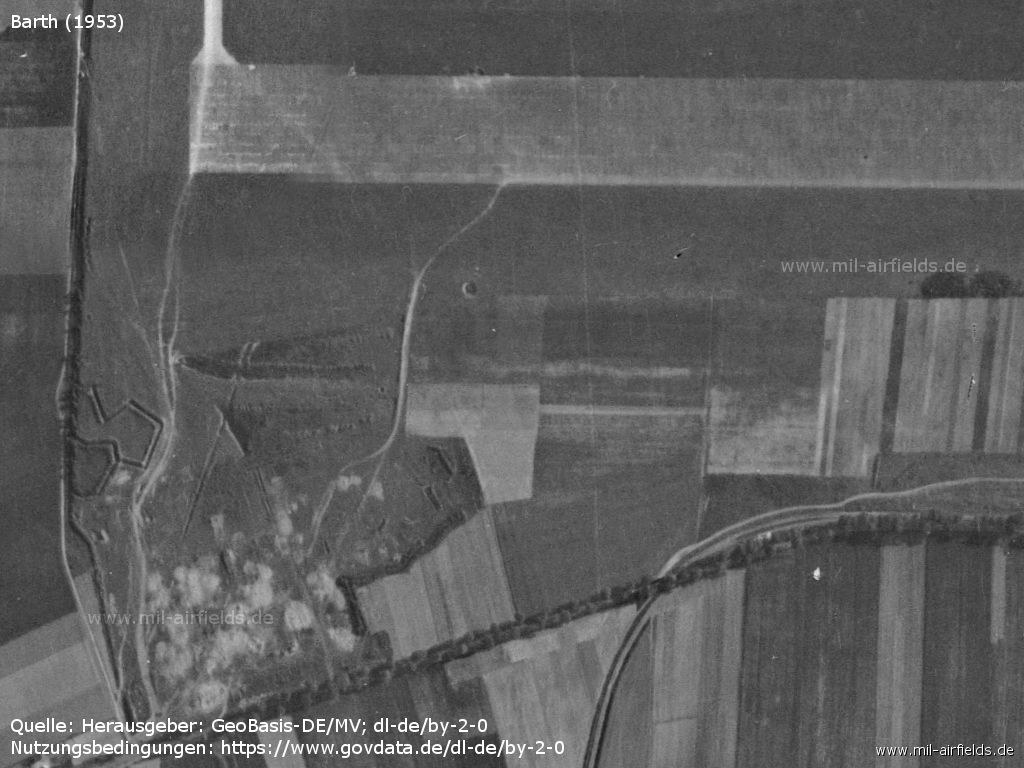
Western end of the runway. - There are some trenches recognizable.
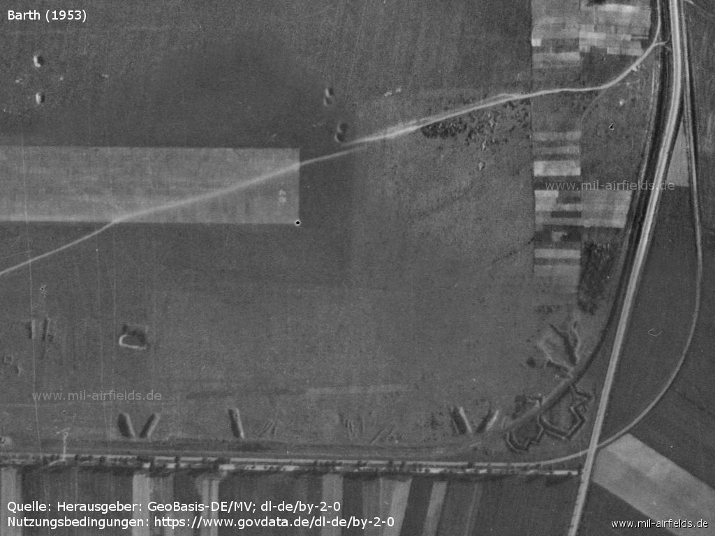
Eastern end of the runway.
Runway number 27 - According to a CIA report, the number was painted in yellow.
In the 1960s
Information from the East German Aeronautical Information Publication from the mid-1960s
For historical information only, do not use for navigation or aviation purposes!
Use
East German domestic airport.
Overview
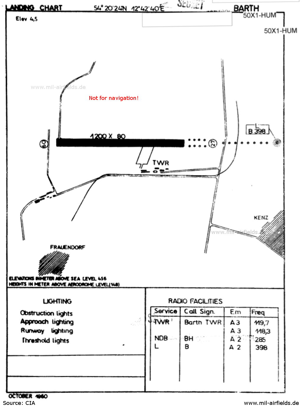
Landing chart from 1960 - The runway has a width of 80 m.
Source: Luftfahrthandbuch der DDR / CIA
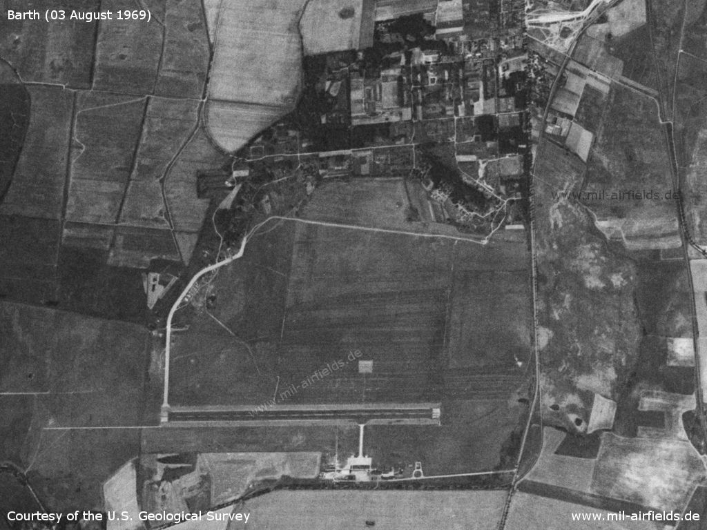
Satellite image from 03 August 1969 - The basic structure of the old air base facilities in the north is still clearly visible. The western railway siding from the north is also clearly visible. However, the new facilities are located south of the runway.
Source: U.S. Geological Survey
Runways
- 09/27: 1200m x 83m Concrete
- 18/36: 600m x 60m Grass
Taxiways, aprons
Taxiways: concrete, width 15 m
Lights
Approach and runway lights.
Radio beacons
- Locator: 285 "BH", 272°/4817 m to threshold 27
- Locator/Middle Marker: 398 "B", 272°/1141 m to threshold 27
Radio communication
- Tower HF: 3023.5, VHF: 124.1, 119.7
Telephone
Barth 503
Teletype
013628 INTERFLUG BAT
Weather station
The meteorological station at Barth airport had the international index number 10180. It only works at certain times, consultation was only possible in German language.
Airspace and procedures
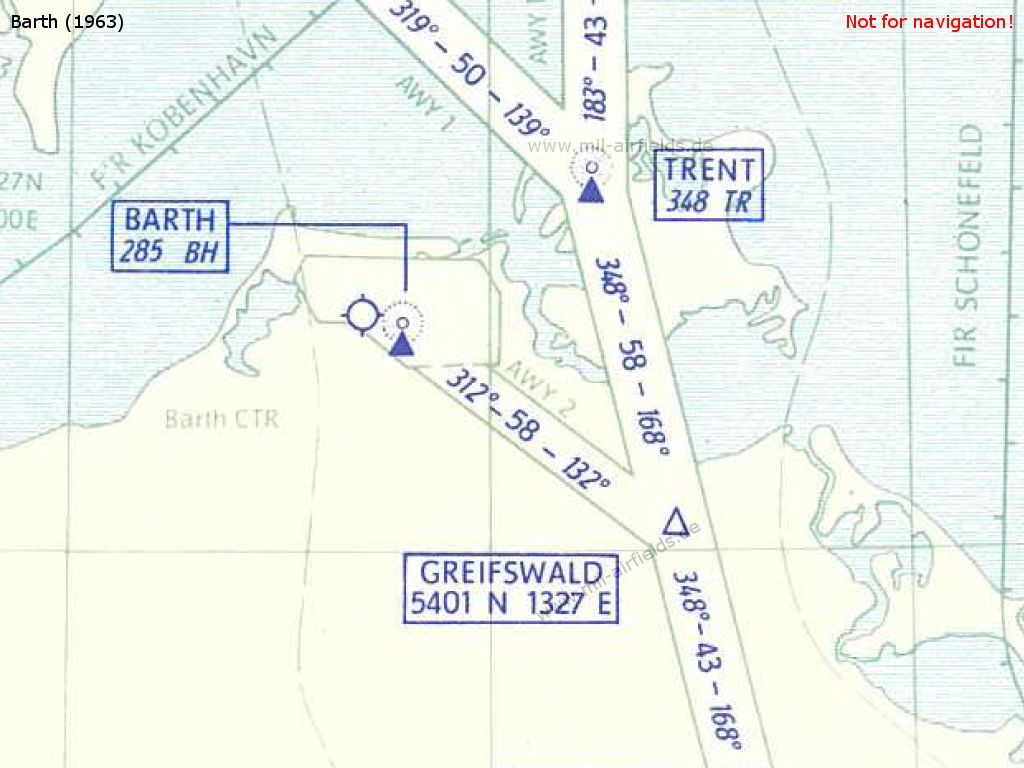
The airspace in 1963 - The 58 km long airway 2 (AWY 2) leads from the reporting point GREIFSWALD to the Barth "BH" radio beacon. It connects the airport with airway 1 (AWY 1), which crosses the entire GDR in north-south direction.
Source: Luftfahrthandbuch der DDR
The transition height was defined as 400 m.
The Barth control zone had an upper limit of 1200 m.
Timetable
Summer timetable 1962
In the summer of 1962, the East German Deutsche Lufthansa serves Barth Airport several times a day with Il-14 aircraft on domestic routes from GDR cities.
Days: 1=Monday ... 7=Sunday
DH = Deutsche Lufthansa der DDR
DH = Deutsche Lufthansa der DDR
Ilyushin Il-14
Dresden (Klotzsche) - Barth
- DH121 - Il-14:
123456– | Dresden 09:20 - 10:55 Barth - DH122 - Il-14:
123456– | Barth 11:15 - 12:50 Dresden - DH124 - Il-14:
12345–– | Barth 16:05 - 17:40 Dresden
Erfurt (Bindersleben) - Barth
- DH161 - Il-14:
123456– | Erfurt 09:00 - 11:00 Barth - DH162 - Il-14:
123456– | Barth 15:10 - 17:10 Erfurt
Leipzig (Mockau) - Barth
- DH141 - Il-14:
123456– | Leipzig 08:35 - 10:10 Barth - DH142 - Il-14:
123456– | Barth 06:20 - 07:55 Leipzig - DH143 - Il-14:
123456– | Leipzig 12:15 - 13:50 Barth - DH144 - Il-14:
123456– | Barth 09:40 - 11:15 Leipzig - DH145 - Il-14:
12345–– | Leipzig 17:00 - 17:40 Schönefeld 18:00 - 19:05 Barth - DH146 - Il-14:
123456– | Barth 14:40 - 16:15 Leipzig
Schönefeld (Berlin) - Barth
- DH101 - Il-14:
1–––––– | Schönefeld 05:00 - 06:05 Barth - DH102 - Il-14:
123456– | Barth 11:20 - 12:25 Schönefeld - DH103 - Il-14:
123456– | Schönefeld 07:35 - 08:40 Barth - DH104 - Il-14:
12345–– | Barth 17:10 - 18:15 Schönefeld - DH105 - Il-14:
12345–– | Schönefeld 14:40 - 15:45 Barth - DH107 - Il-14:
12345–– | Schönefeld 15:45 - 16:50 Barth
Departures and arrivals by time
| Days | Time | Dep/Arr | Flight | Aircraft type | to/from |
|---|---|---|---|---|---|
| 1–––––– | 06:05 | Arr | DH101 | Il-14 | Schönefeld |
| 123456– | 06:20 | Dep | DH142 | Il-14 | Leipzig |
| 123456– | 08:40 | Arr | DH103 | Il-14 | Schönefeld |
| 123456– | 09:40 | Dep | DH144 | Il-14 | Leipzig |
| 123456– | 10:10 | Arr | DH141 | Il-14 | Leipzig |
| 123456– | 10:55 | Arr | DH121 | Il-14 | Dresden |
| 123456– | 11:00 | Arr | DH161 | Il-14 | Erfurt |
| 123456– | 11:15 | Dep | DH122 | Il-14 | Dresden |
| 123456– | 11:20 | Dep | DH102 | Il-14 | Schönefeld |
| 123456– | 13:50 | Arr | DH143 | Il-14 | Leipzig |
| 123456– | 14:40 | Dep | DH146 | Il-14 | Leipzig |
| 123456– | 15:10 | Dep | DH162 | Il-14 | Erfurt |
| 12345–– | 15:45 | Arr | DH105 | Il-14 | Schönefeld |
| 12345–– | 16:05 | Dep | DH124 | Il-14 | Dresden |
| 12345–– | 16:50 | Arr | DH107 | Il-14 | Schönefeld |
| 12345–– | 17:10 | Dep | DH104 | Il-14 | Schönefeld |
| 12345–– | 19:05 | Arr | DH145 | Il-14 | Leipzig - Schönefeld |
In the 1970s
For historical information only, do not use for navigation or aviation purposes!
Use
East German domestic airport until 1975, thereafter base for agricultural aviation.
Situation
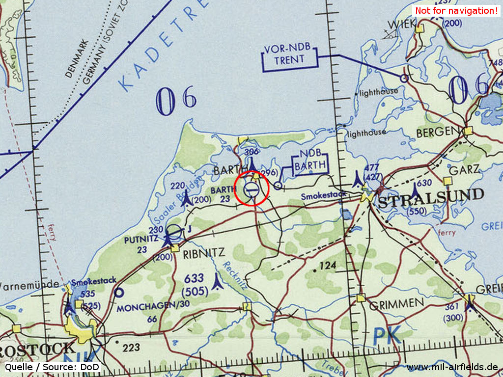
Barth Airport on a map of the US Department of Defense from 1972 - The Soviet air base Damgarten Pütnitz is located about 20 km west-southwest of Barth.
Source: ONC E-2 (1972), Perry-Castañeda Library Map Collection, University of Texas at Austin
Overview
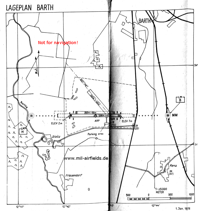
Map of Barth airfield from 1976 - Despite the termination of the passenger traffic, the radio beacons "B" and "H" are still shown. Between each radio beacon and the runway, a simple approach light is shown.
Source: East German agricultural aeronautical information publication
Runways
- 09/27: 1200m x 45m Concrete
- 09/27: 950m x 60m Grass
- 14/32: 700m x 100m Grass
Radio beacons
- Locator/Outer Marker 27: 285 "BH", 4817 m to threshold 27
- Locator/Middle Marker 27: 398 "B", 1141 m to threshold 27
- Locator/Middle Marker 09: 398 "H", 945 m to threshold 09
Radio communication
Barth Tower/Approach: 121.2, 119.7
Teletype
Interflug Telex: 318628 ifbat dd
Airspace and procedures
The Barth control zone was defined by these points: Frauendorf, Velgast, Lüssow, Prohn, Wendisch Langendorf, Wieck, 2 points on the western side of the Darß peninsula, Hermannshof, Frauendorf
In the 1980s
For historical information only, do not use for navigation or aviation purposes!
Use
East German agricultural airfield.
Barth airfield like the agricultural airfield Goorstorf/Bentwisch were planned by East Germany as landing sites for Danish rescue helicopters in case of sea rescue activities. (Source: 1. Durchführungs-Anweisung des Stellvertreters des Ministers und Chefs des Stabes zum Befehl Nr. 15/84 des Ministers des Inneren und Chefs der Deutschen Volkspolizei, Vertrauliche Dienstsache W-B-15/31/84 vom 27.11.1984)
Telephone
Aviation calls: Barth 2503
Interflug, Betrieb Agrarflug: Barth 551
Interflug, Betrieb Agrarflug: Barth 551
Teletype
031 8628 IFB DD
Airspace and procedures
The airfield zone was defined via the points: Frauendorf, Velgast, Kummerow, Nisdorf, Wieck, Fauendorf
During flight operations at Damgarten, at Barth flights were allowed in the northern traffic pattern up to 300 m AAL.
Connections between visual approach and departure routes and local flying routes
In the GDR, visual flights usually had to be carried out on the so-called local flying routes. This network of specified visual flight routes covered the entire GDR and ensured that military airfields, restricted areas, etc. were circumnavigated. In addition, routes were defined for each airfield connecting the airfield with this route network. For Barth they were defined as:
- An- und Abflugpunkt: Nördlich von Kenz auf der Linie Flugplatz - Kummerow, kürzester Flugweg nach der örtlichen Fluglinie Nr. 21 (Streckenabschnitt Tessin - Grimmen)
- An- und Abflugpunkt: Nördlich von Kenz auf der Linie Flugplatz - Kummerow, Kummerow, Stralsund.
(Source: East German agricultural aeronautical information publication, as of 1982)
Today
Use
Regional airport.
Overview
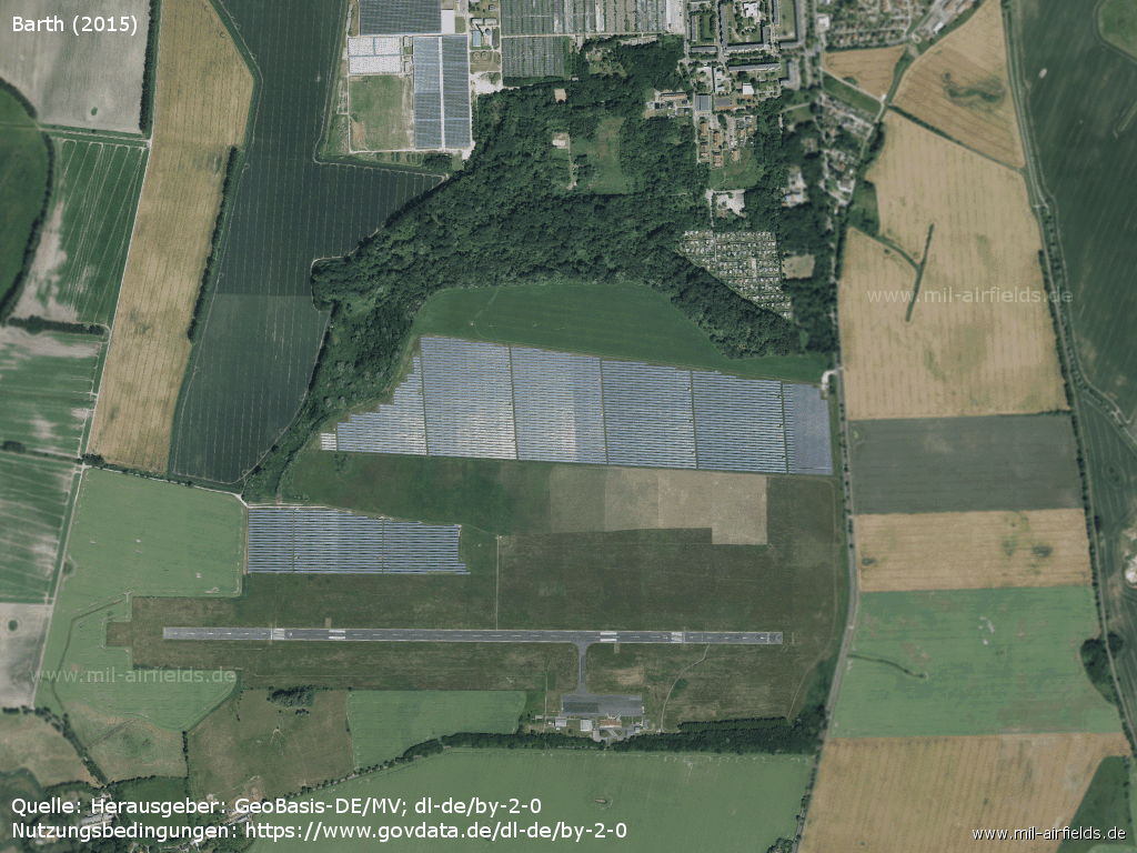
Aerial image 2015
Source: Landesamt für innere Verwaltung M-V, Amt für Geoinformation, Vermessung und Katasterwesen - www.geoportal-mv.de, Datenlizenz Deutschland – Namensnennung – Version 2.0, www.govdata.de/dl-de/by-2-0, http://www.geoportal-mv.de
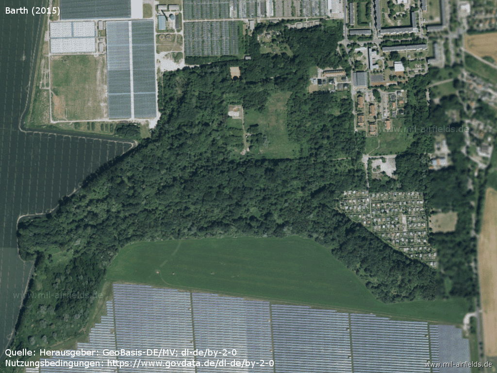
Former northern part
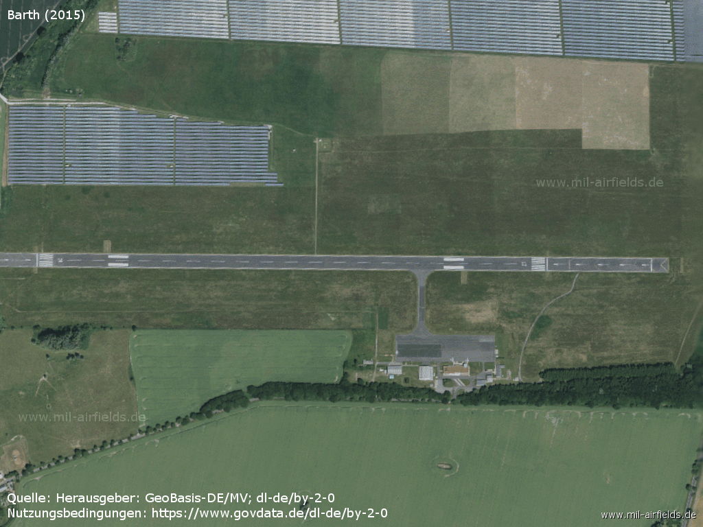
The airport today
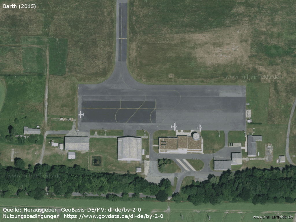
Apron and buildings
Links
- https://www.ostseeflughafen-stralsund-barth.de/ - Ostseeflughafen Stralsund-Barth
Sources
- http://lib.byu.edu/collections/german-maps/ - German Maps (Topographische Karte 1:25,000)
- http://www.geoportal-mv.de - Geoportal MV
- http://www.airvectors.net/ - AirVectors by Greg Goebel
Related topics
Airfields in the vicinity
- 277°/8km Barth: Helipad 3312 (HSLP / HLP 3312)
- 069°/14km Gross Mohrdorf: Airfield (Groß Mohrdorf)
- 262°/15km Saal: Helipad 3365 (FuTK-332)
- 244°/19km Damgarten: Air Base (Puetnitz, Putnitz)
Categories
Military Airfields GermanyAgricultural Airfields in former East GermanyMilitary Airfields in former East GermanyRecommended

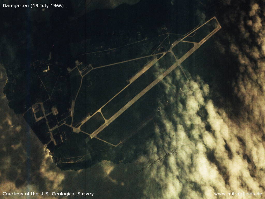
Image credits are shown on the respective target page, click on the preview to open it.
 Follow mil-airfields on Facebook