For historical information only, do not use for navigation or aviation purposes!
| Coordinates | N541551 E0122646 (WGS84) Google Maps |
| Elevation | 23 ft |
| Former East Germany (GDR) | District of Rostock |
| Federal state | Mecklenburg-Vorpommern (Mecklenburg-Western Pomerania) |
| Region | Baltic Sea |
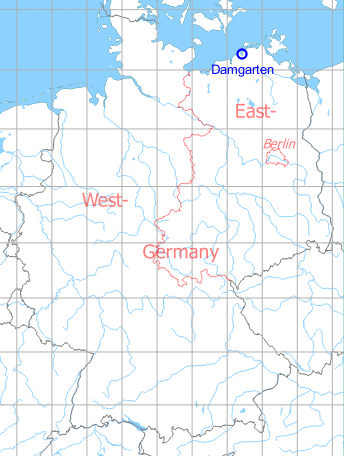
Germany during the Cold War Map
The history of the Cold War airfields: Damgarten
During World War II
Use
Damgarten Pütnitz was a Luftwaffe air base and sea plane station.
Situation
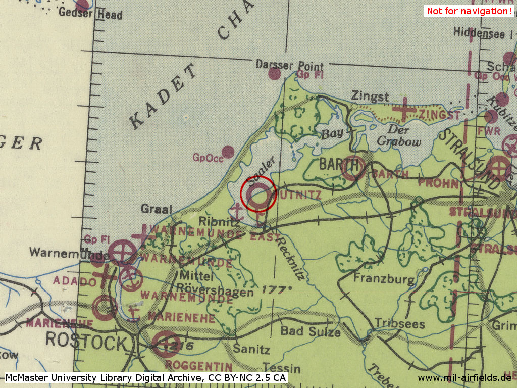
Pütnitz (=Damgarten) air base in World War II on a US map from 1943 - The two anchor symbols in the area indicate seaplane bases. One is the Pütnitz seaplane base, which is connected to the air base. The other is on the southern bank of the lagoon in the Ribnitz area
Source: McMaster University Library Digital Archive, Lizenz: Creative Commons Attribution-NonCommercial 2.5 CC BY-NC 2.5 CA
Overview
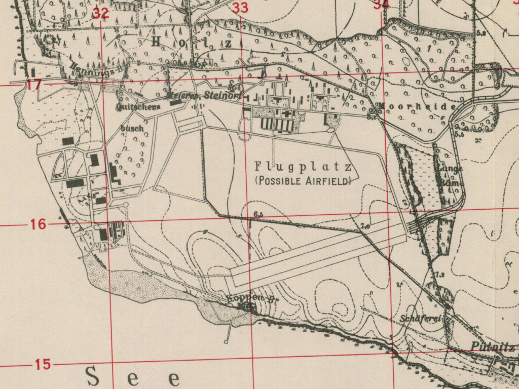
Damgarten Puetnitz air base on a US map from 1952 - The map should show the approximate state of expansion at the end of the war
Source: AMS M841 GSGS 4414, Courtesy Harold B. Lee Library, Brigham Young University
During the Cold War
Use
Soviet forces airbase.
In the 1950s
Units
1954
- Headquarters Soviet fighter division
- Soviet fighter regiment (P. O. Box of the technical unit: 62 313),
- Soviet fighter regiment (P. O. Box of the technical unit: 62 317),
- A total of 45 MiG-15/MiG-15U were counted at the airfield.
Source: BND/Bundesarchiv B 206/3033
(For the P. O. Box numbers the digits 3 and 5 may be confused, because they are difficult to distinguish in the source document)
(For the P. O. Box numbers the digits 3 and 5 may be confused, because they are difficult to distinguish in the source document)
In the 1960s
Overview
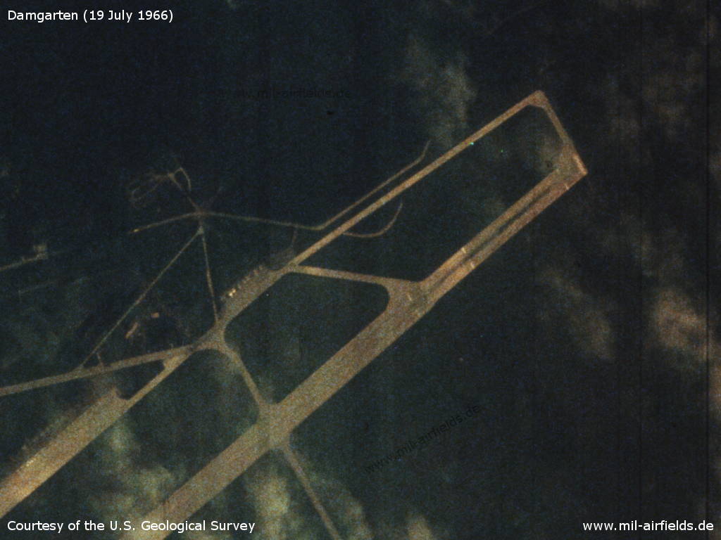
1966
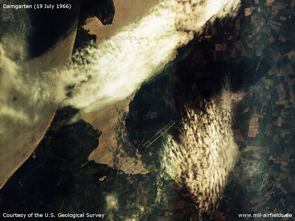
Atmospheric US satellite image from Tuesday 19.07.1966 - It shows the Damgarten airfield, the Saaler Bodden and the Darß peninsula.
Source: U.S. Geological Survey
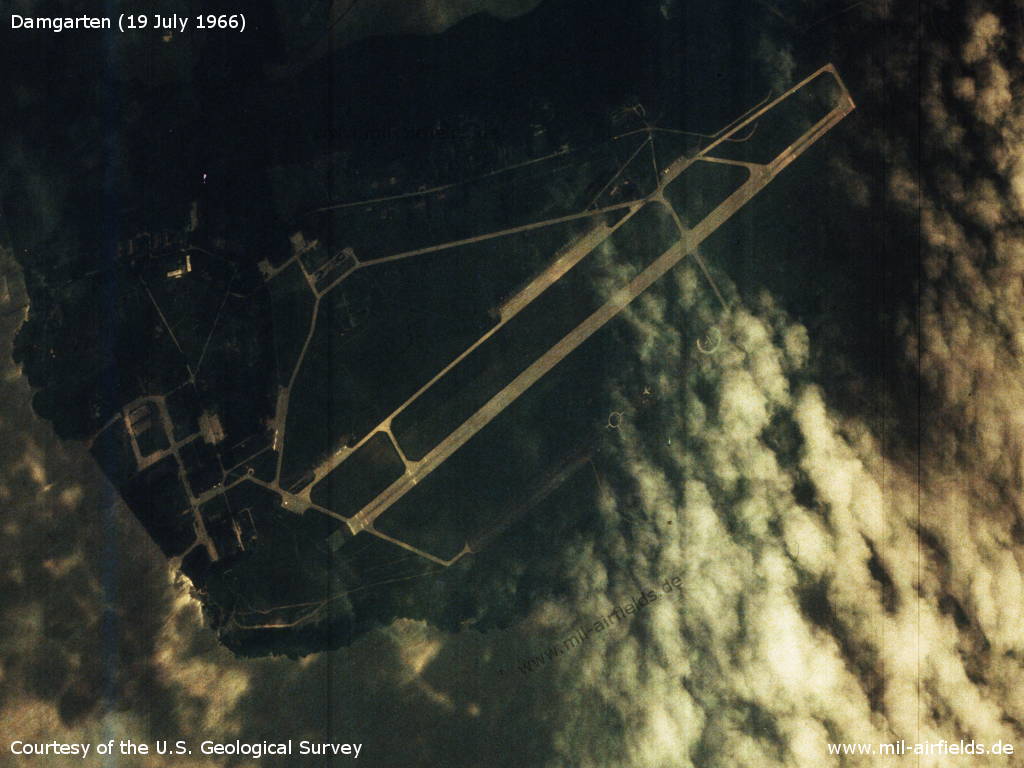
Air Base
Source: U.S. Geological Survey
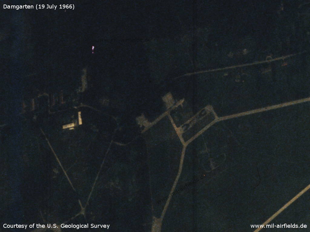
Northern part
Source: U.S. Geological Survey
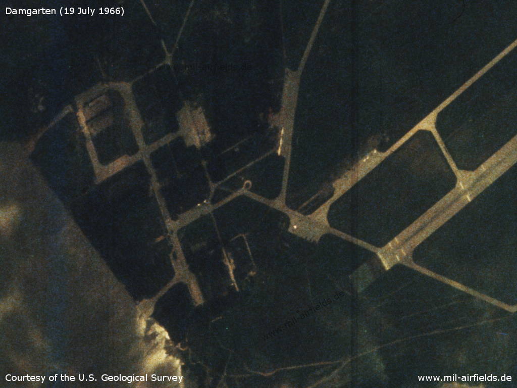
Western part - Some airplanes can be seen. The three above the middle of the picture could be Il-28.
Source: U.S. Geological Survey
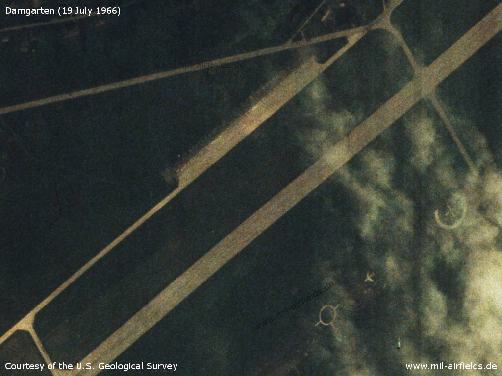
Central part with flight line - Bottom right: Target circles and an airplane silhouette are painted on the old runway.
Source: U.S. Geological Survey
Eastern part
Source: U.S. Geological Survey
1969
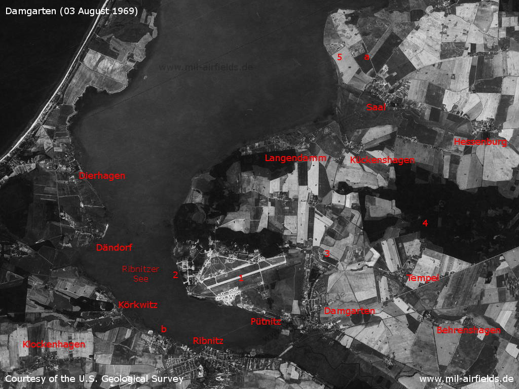
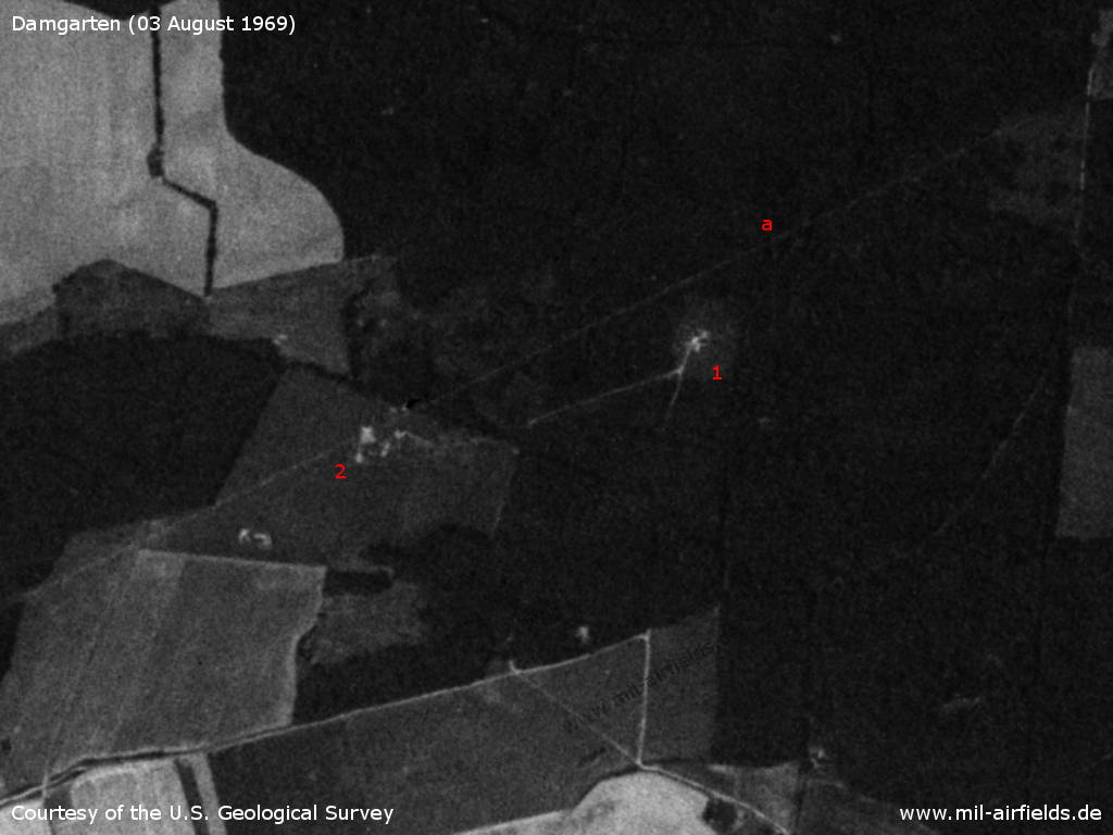
This US satellite image from Sunday 03 August 1969 shows the Soviet air base and its vicinity. - 1: airfield; 2: former seaplane base; 3: inner radio beacon; 4: outer radio beacon; 5: surface-to-air missile (SAM) site near Saal; a: East German radar site; b: former seaplane base in Lake Ribnitz for the Walther-Bachmann-Flugzeugbau; Places: Behrenshagen, Damgarten, Dändorf, Dierhagen, Hessenburg, Klockenhagen, Körkwitz, Kückenshagen, Langendamm, Pütnitz, Ribnitz, Saal.
Source: U.S. Geological Survey
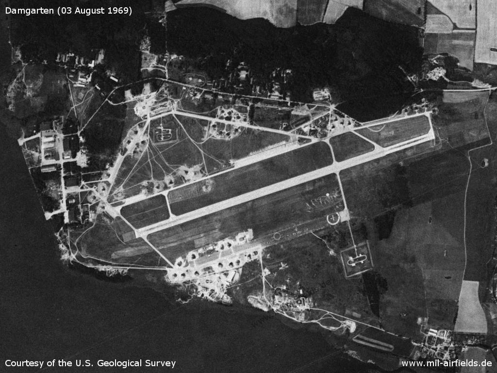
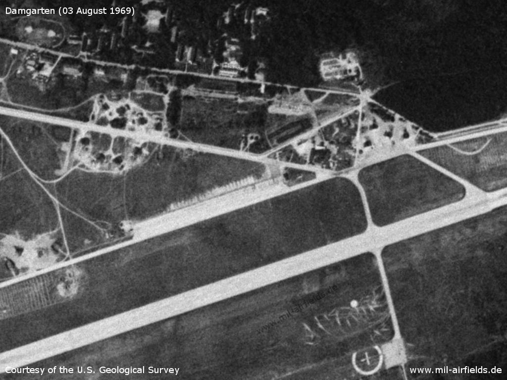
The airfield in the general view - The runway is 2,500 meters long. To the south is the old runway. Clearly visible are the recently built aircraft shelters, which are scattered all over the field.
Source: U.S. Geological Survey
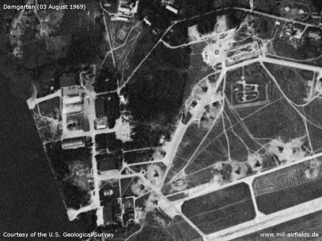
The northwestern part of the base. On the left side on the shore are the buildings of the former seaplane base Seefliegerhorst Pütnitz.
Source: U.S. Geological Survey
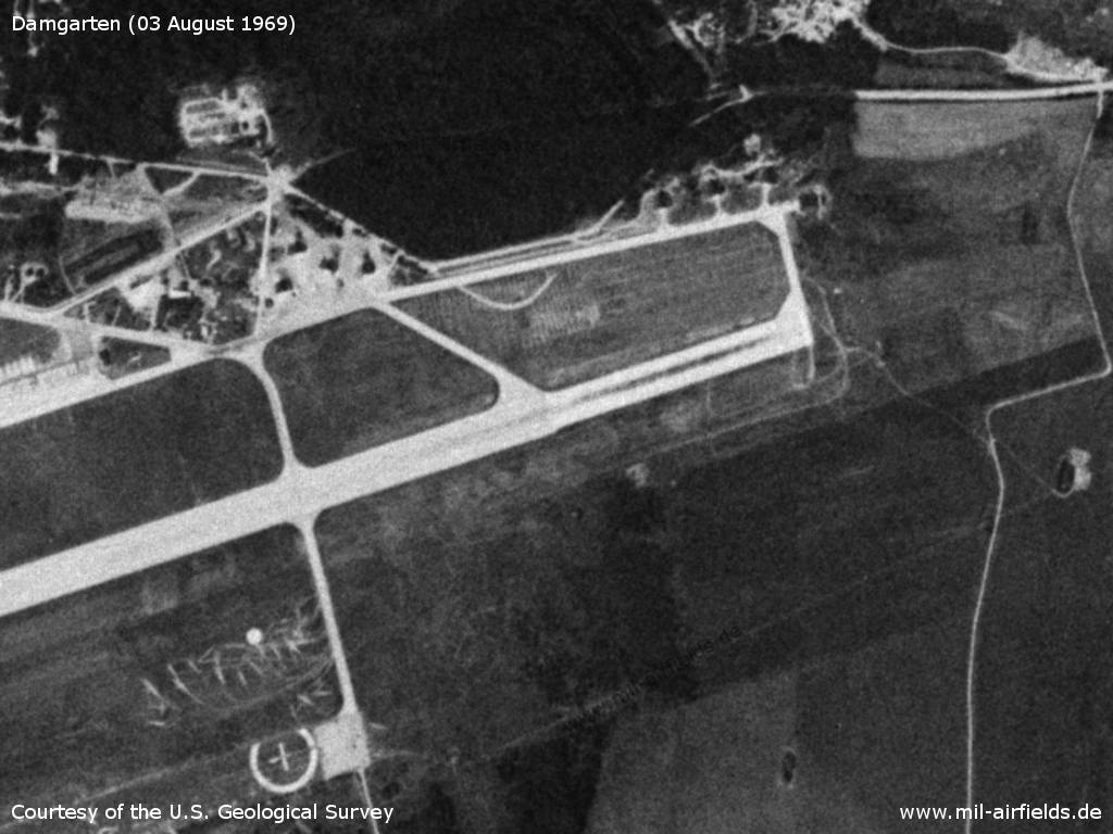
Northern part
Source: U.S. Geological Survey
Eastern end of the runway - Initially, the runway was only 2,000 m long and ended approximately in the middle of the picture. Later it was extended by 500 m to the northeast. However, the width was reduced from 60 m to 50 m, which can be seen on the picture.
Source: U.S. Geological Survey
Southern part
Source: U.S. Geological Survey
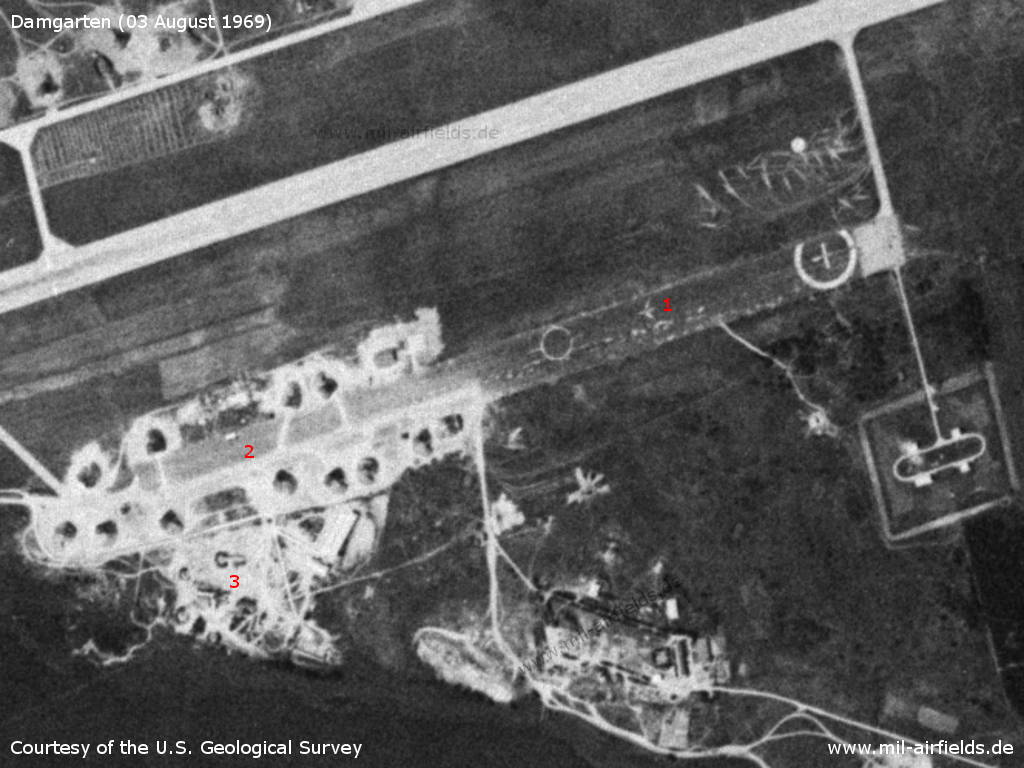
Inner radio beacon, approx. 950 m east of the runway - 1: Inner radio beacon/marker (actually it is the Middle Marker in western terms); 2: Chain of masts in the approach sector; 3: The connecting railway leads north from Damgarten station and then turns west to the airfield; a: The white line is only an artefact in the photo and is not identical with the approach path.
Source: U.S. Geological Survey
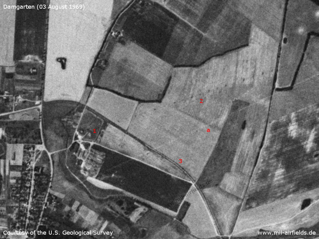
Outer radio beacon, approx. 3940 m east of the runway - 1: Presumably outer radio beacon / outer marker; 2: Presumed position of the outer radio beacon when the runway was 500 m shorter; a: also on this section the white line is only an artefact and not identical with the approach course.
Source: U.S. Geological Survey
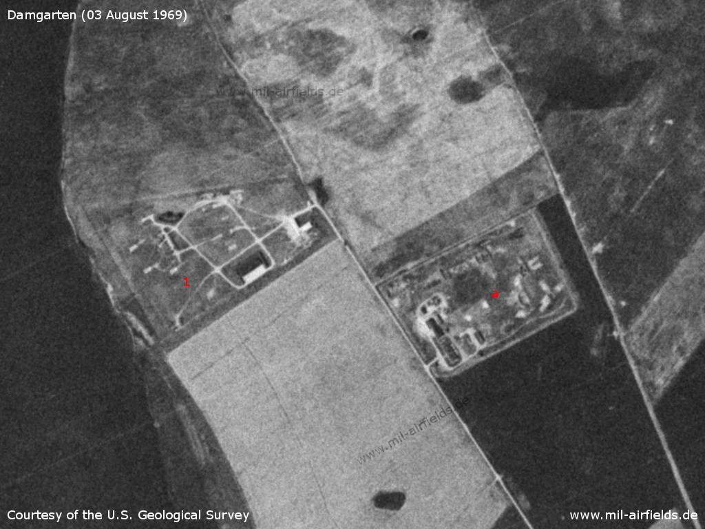
About 7 km northeast of the field near Saal is another surface-to-air missile (SAM) site - 1: Soviet SAM site with S-125 Neva (NATO: SA-3 Goa); 2: Radar site of a radio-technical company 287 (FuTK-287) of the National People's Army of the GDR
Source: U.S. Geological Survey
In the 1970s
Situation
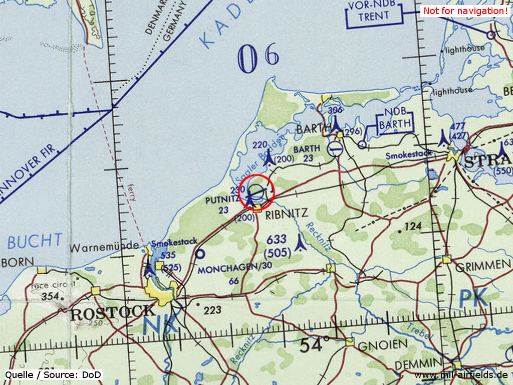
Damgarten Air Base on a map of the US Department of Defense from 1972
Source: ONC E-2 (1972), Perry-Castañeda Library Map Collection, University of Texas at Austin
Overview
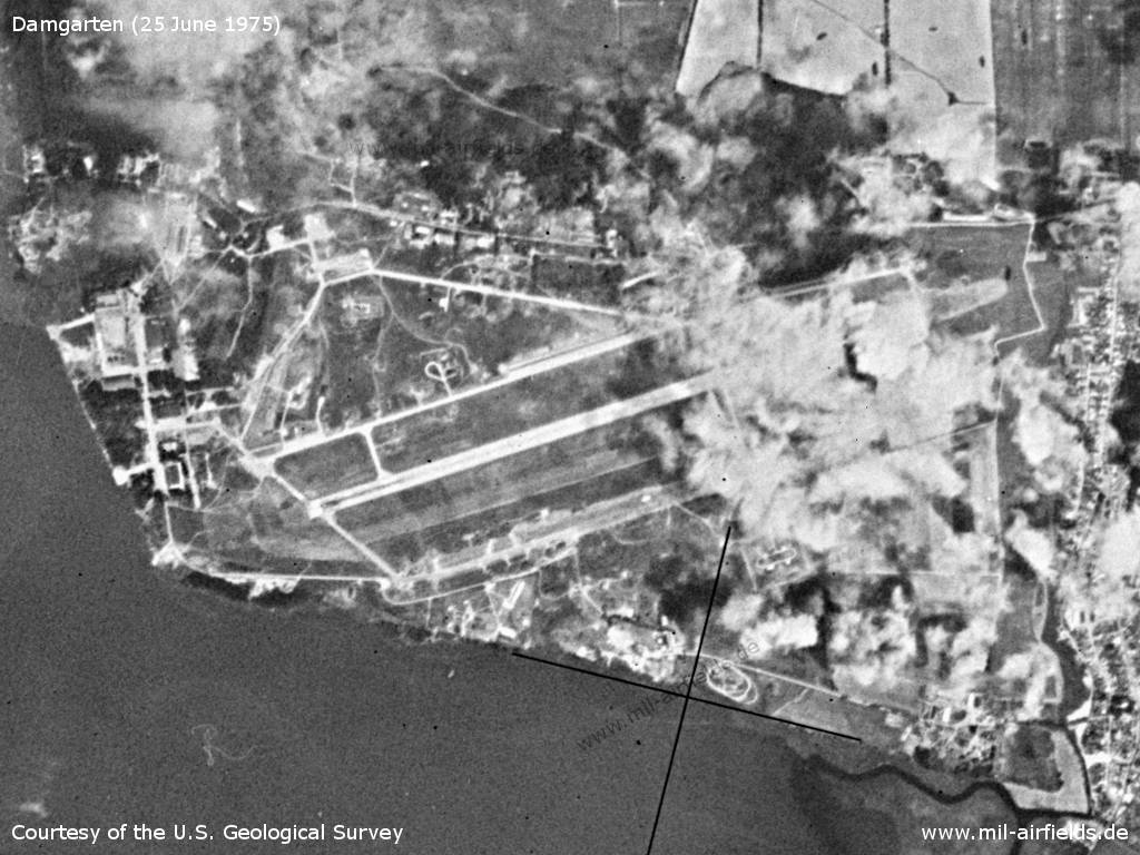
Wednesday 25 June 1975
Source: U.S. Geological Survey
In the 1980s and early 1990s
Runways
- 07/25: 2600m
Radio beacons
- LOM 25: 325 "MA"
- LMM 25: 668 "M"
- LMM 07: 325 "NW"
Radio communication
The call signs were MELODRAMA (1980) and SOBOL (1990).
Units
773 IAP: MiG-29, MiG-29UB, MiG-23UB;
Target towing unit with Il-28
Target towing unit with Il-28
Today
Use
Closed.
Situation
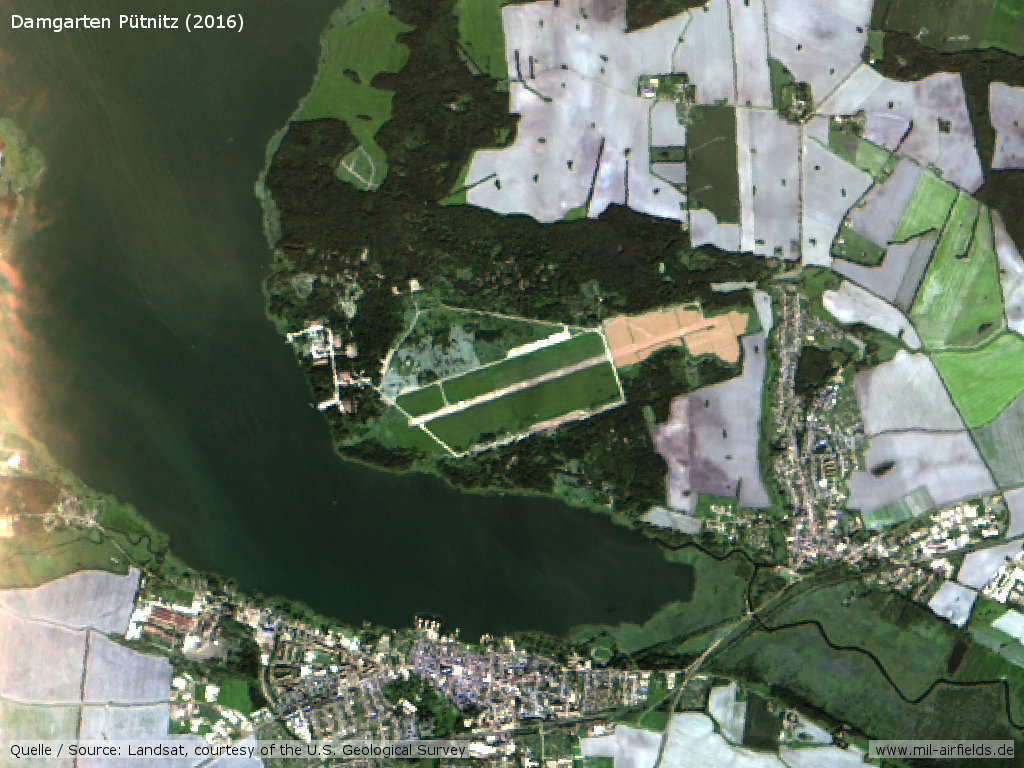
Landsat image from 2016 - Open object in Google Maps
Links
- http://www.16va.be/page_flightline_65obae.html - Detailed aerial picture with analysis
Bibliography
- /USMLM 1966/:
United States Military Liaison Mission: "Unit History 1966"
Related topics
Airfields in the vicinity
- 022°/7km Saal: Helipad 3365 (FuTK-332)
- 045°/13km Barth: Helipad 3312 (HSLP / HLP 3312)
- 229°/17km Purkshof: Airfield (HSLP 4402)
- 064°/19km Barth: Airport (Stralsund-Barth Airport)
- 235°/19km Rövershagen: Helipad 3305 (HSLP / HLP 3305)
- 222°/20km Klein Kussewitz: Helipad 3029 (HSLP / HLP 3029)
Categories
Military Airfields GermanyMilitary Airfields in former East GermanyAirfields of the Soviet Forces in GermanyRecommended
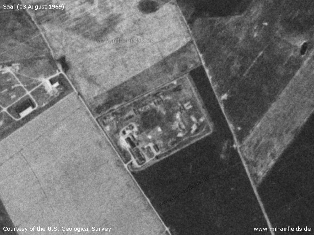
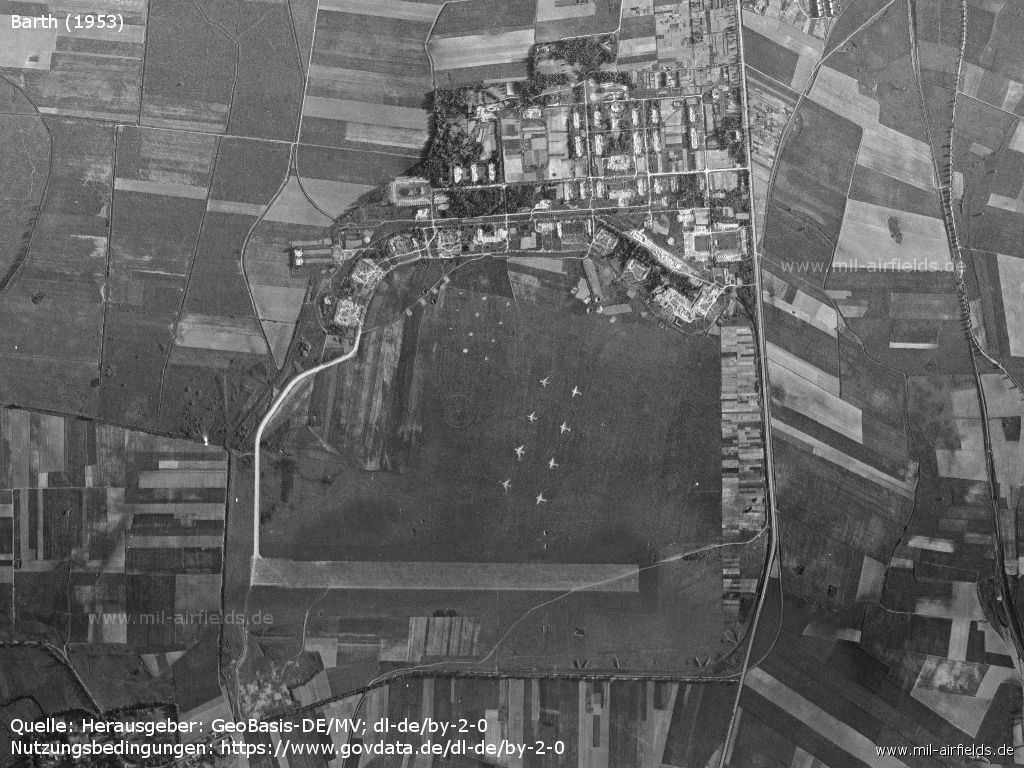
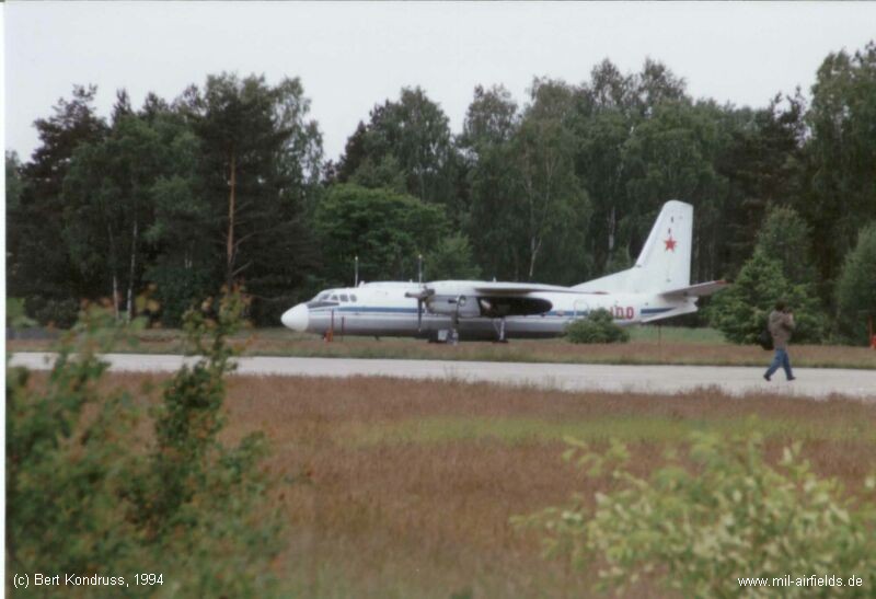
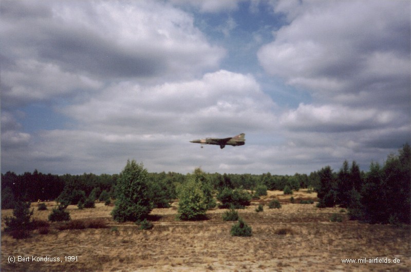
Image credits are shown on the respective target page, click on the preview to open it.
 Follow mil-airfields on Facebook