For historical information only, do not use for navigation or aviation purposes!
| Coordinates | N541002 E0121248 (WGS84) Google Maps |
| Former East Germany (GDR) | District of Rostock |
| Federal state | Mecklenburg-Vorpommern (Mecklenburg-Western Pomerania) |
Germany during the Cold War Map
The history of the Cold War airfields: Rövershagen
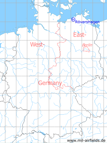
Location of airfield
2 km southwest of Rövershagen.
Usage during the Cold War
Helipad 3305 for command post of 43rd Anti-Aircraft Missile Brigade (43. FRBr.) and for Anti-Aircraft Missile Unit 4323 (FRA-4323, Hinrichshagen) of former East German Air Force (NVA LSK/LV).
Use today
Closed.
Runways, taxiways, aprons
Dimensions: 60 m x 50 m,
main takeoff and landing direction: 180°,
surface: concrete,
usable without crop damage,
capacity: 1 helicopter.
main takeoff and landing direction: 180°,
surface: concrete,
usable without crop damage,
capacity: 1 helicopter.
Telephone
Stabsnetz S1 6448-11
Airspace and procedures
Usable at day and night during good weather conditions.
Alert time: 60 minutes.
Alert time: 60 minutes.
Obstacles
Antennas: distance 50 m, height 32 m.
Airfields in the vicinity
- 105°/2km Purkshof: Airfield (HSLP 4402)
- 161°/5km Klein Kussewitz: Helipad 3029 (HSLP / HLP 3029)
- 199°/6km Bentwisch: Agricultural Airfield (Goorstorf)
- 242°/10km Rostock: Marienehe Airfield
- 135°/15km Sanitz: Helipad 3306 (HSLP 3306)
- 172°/15km Bandelstorf: Agricultural Airfield
- 253°/15km Admannshagen: Agricultural Airfield
- 271°/15km Nienhagen: Anti-aircraft Missile Unit 4332 (National People's Army Helipad 3320)
- 183°/16km Kavelstorf: Highway Strip (Autobahnabschnitt ABA)
- 054°/19km Damgarten: Air Base (Puetnitz, Putnitz)
 Follow mil-airfields on Facebook