Nienhagen: Anti-aircraft Missile Unit 4332
National People's Army Helipad 3320
For historical information only, do not use for navigation or aviation purposes!
| Coordinates | N541009 E0115858 (WGS84) Google Maps |
| Former East Germany (GDR) | District of Rostock |
| Federal state | Mecklenburg-Vorpommern (Mecklenburg-Western Pomerania) |
| Region | Baltic Sea |
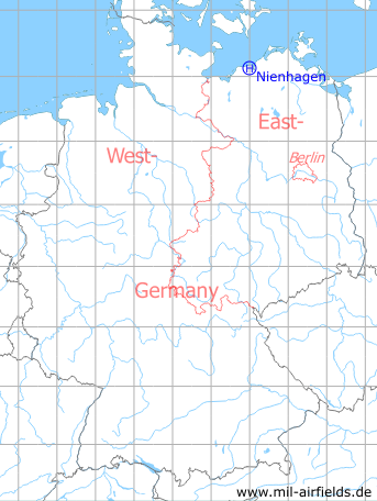
Germany during the Cold War Map
The history of the Cold War airfields: Nienhagen Helipad
General
At the beginning of the 1970s, an anti-aircraft missile site for missiles of the Soviet type S-125 Newa (NATO designation SA-3 Goa) of the East German National People's Army has been built northeast of Nienhagen, directly on the Baltic Sea coast. The unit stationed here was first called Anti-aircraft Missile Unit 436 (FRA-436), later FRA-4332. There was also a helipad here, which is described below. With the German reunification, the site was closed. Today there is a residential area and the Technopark Nienhagen.
Location of airfield
1,8 km northeast of Nienhagen.
During the Cold War
In the 1970s
Overview
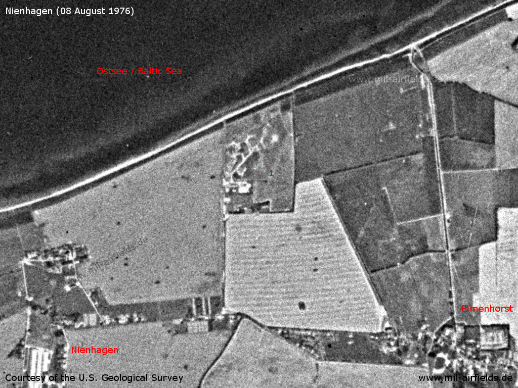
Nienhagen Anti-aircraft Missile Unit 436 on a US satellite image from 08 August 1976 - 1: SAM site. Places: Elmenhorst, Nienhagen.
Source: U.S. Geological Survey
In the 1980s and early 1990s
Use
Helipad 3320 for Anti-aircraft missile unit 4332 (FRA-4332) of former East German Air Force (NVA LSK/LV).
Runways, taxiways, aprons
Dimensions: 65 m x 170 m,
main takeoff and landing direction: 0° - 360°,
surface: grass,
capacity: 1 helicopter.
main takeoff and landing direction: 0° - 360°,
surface: grass,
capacity: 1 helicopter.
Telephone
Stabsnetz S1 6442-a
Airspace and procedures
Usable at day during good weather conditions.
Alert time: 40 minutes.
Alert time: 40 minutes.
Obstacles
Antenna: distance 250 m, height 30 m.
Unit hierarchy in 1989
- Ministry of National Defense (MfNV)
-- National People's Army (NVA)
--- Air Force/Air Defense (LSK/LV)
---- 3rd Air Defense Division (3. LVD)
----- 43rd Anti-aircraft Missile Brigade (43. FRBr)
------ Anti-aircraft Missile Unit 4332 (FRA-4332)
-- National People's Army (NVA)
--- Air Force/Air Defense (LSK/LV)
---- 3rd Air Defense Division (3. LVD)
----- 43rd Anti-aircraft Missile Brigade (43. FRBr)
------ Anti-aircraft Missile Unit 4332 (FRA-4332)
Address:
Post box 84227
Post box 84227
Installation:
Military installation number: 01/922
Military installation number: 01/922
Today
Use
Closed.
The site was transformed into a residential area and to the Technopark Nienhagen. Here are the streets: At the Ostend, Am Rondell, Am Sanddorn, Mittel-Straße, Nord-Straße, Parkstraße, Süd-Straße, Zur Steilküste
Overview
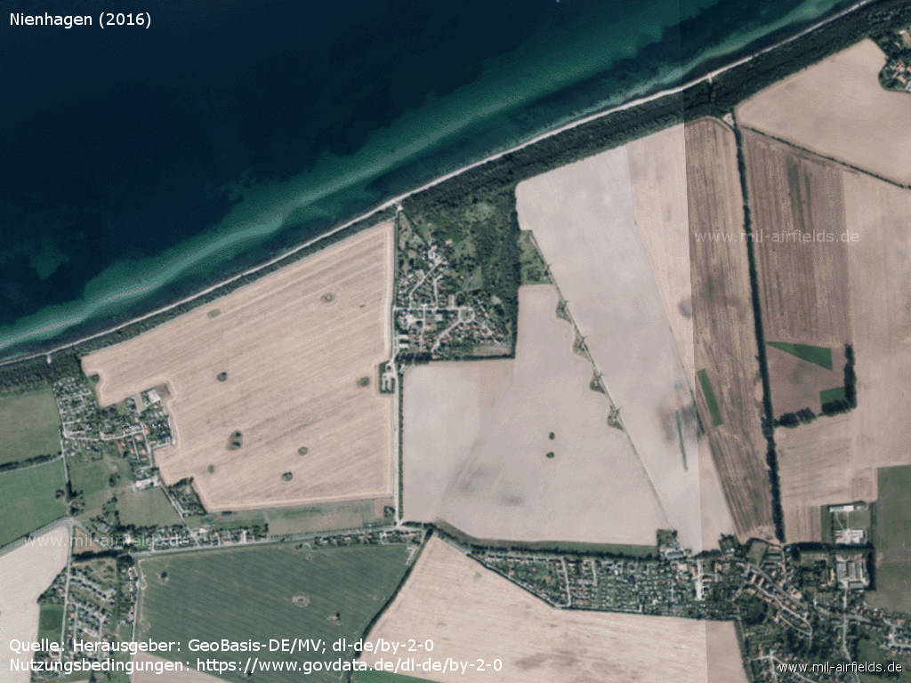
Aerial image (2016)
Source: Landesamt für innere Verwaltung M-V, Amt für Geoinformation, Vermessung und Katasterwesen - www.geoportal-mv.de, Data licence Germany – attribution – version 2.0, www.govdata.de/dl-de/by-2-0
Links
- https://lostplacewunderland.wordpress.com/2019/04/... - NVA – FRA 4332 Nienhagen current state (2019, German language)
Airfields in the vicinity
- 174°/5km Admannshagen: Agricultural Airfield
- 128°/8km Rostock: Marienehe Airfield
- 112°/14km Bentwisch: Agricultural Airfield (Goorstorf)
- 091°/15km Rövershagen: Helipad 3305 (HSLP / HLP 3305)
- 208°/15km Retschow: Helipad 3314 (HSLP / HLP 3314)
- 093°/17km Purkshof: Airfield (HSLP 4402)
- 106°/17km Klein Kussewitz: Helipad 3029 (HSLP / HLP 3029)
- 259°/20km Bastorf: Helipad 3322 (HSLP / HLP 3322)
Categories
Military Airfields GermanyMilitary Airfields in former East GermanyHelipads of former National People's ArmyRecommended

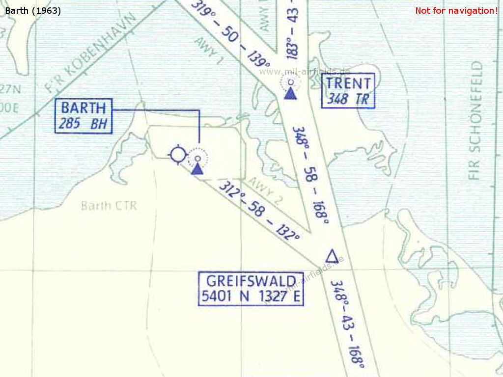
Image credits are shown on the respective target page, click on the preview to open it.
 Follow mil-airfields on Facebook