Rostock: Marienehe Airfield
For historical information only, do not use for navigation or aviation purposes!
| Coordinates | N540730 E0120442 (WGS84) Google Maps |
| Former East Germany (GDR) | District of Rostock |
| Federal state | Mecklenburg-Vorpommern (Mecklenburg-Western Pomerania) |
| Region | Baltic sea |
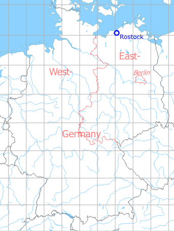
Germany during the Cold War Map
The history of the Cold War airfields: Rostock Marienehe
During World War II
Use
Airfield of Heinkel aircraft company.
Situation
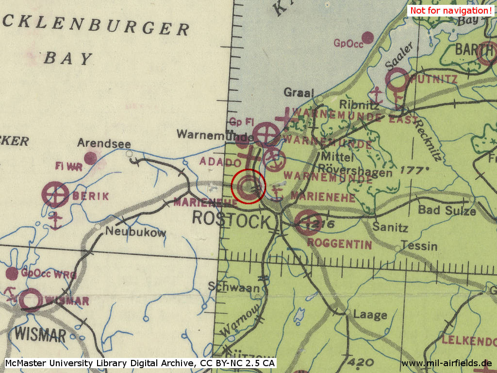
During the Cold War
Use
Short time usage by East German Forces as helicopter base. Thereafter airfield of the paramilitary organization Gesellschaft für Sport und Technik (GST). Later the airfield was closed to build the Fischkombinat fish factory.
Timeline
● The harbor basin was built from 1950 to 1952.
● The grass has been removed from all runways at Marienehe airfield, which will be used for motorcycle and car races. The first training for the races was held on the airfield on 25 March 1951.
(Sources: CIA)
Overview
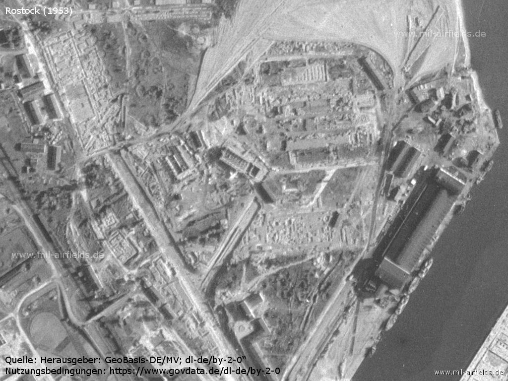
1953
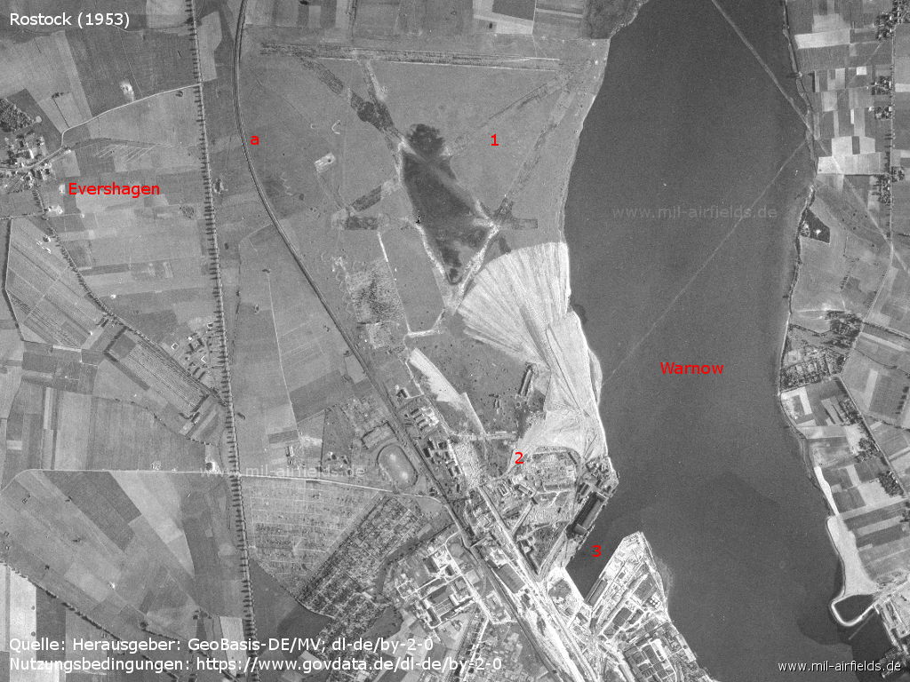
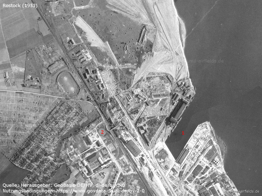
Aerial picture of the former Ernst Heinkel Flugzeugwerke aircraft factory - 1: airfield, 2: area of the former aircraft works, 3: newly built fishing port; a: Rostock - Warnemünde railway line. Places: Evershagen. River Warnow.
Source: Landesamt für innere Verwaltung M-V, Amt für Geoinformation, Vermessung und Katasterwesen - www.geoportal-mv.de, Data licence Germany – attribution – version 2.0, www.govdata.de/dl-de/by-2-0
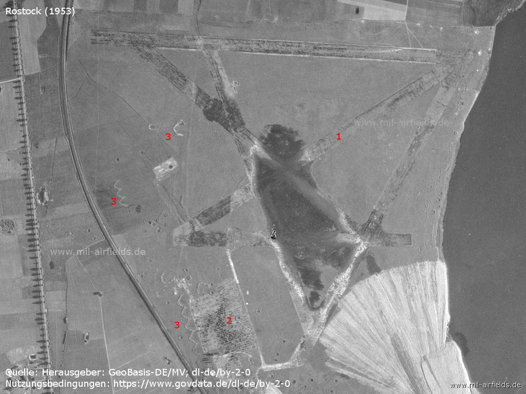
Airfield - 1: runways, 2: former airplane ramp, 3: former aircraft revetments
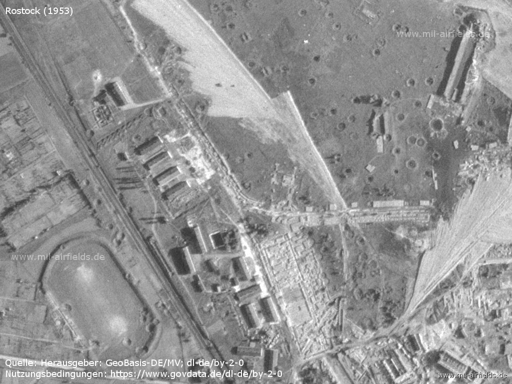
Former aircraft works, now fish combine under construction - 1: newly built harbour basin, 2: tram stop
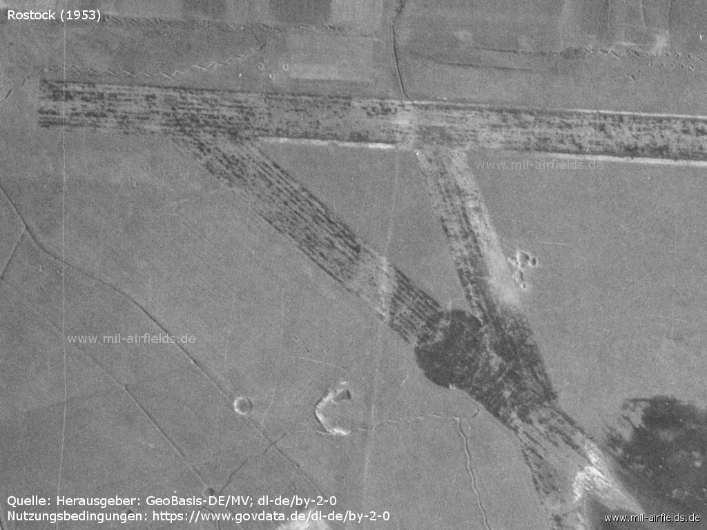
Runways
Ramp - 1: Here a mast casts a shadow
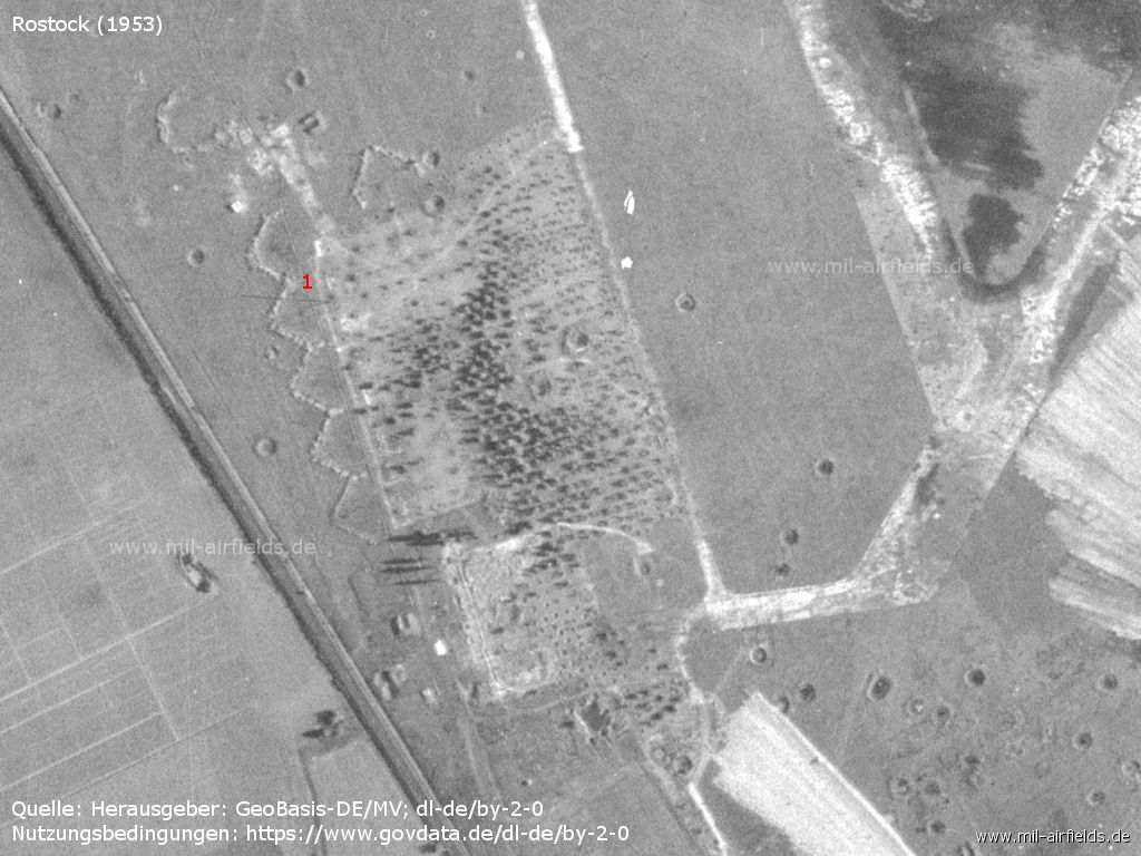
Buildings - In the area there are still many bomb craters from the Second World War.
Construction site Fish Combine
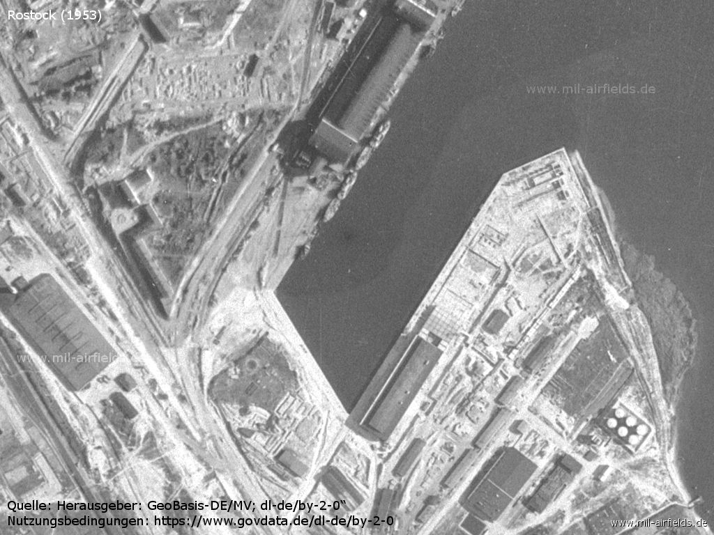
New fishing port
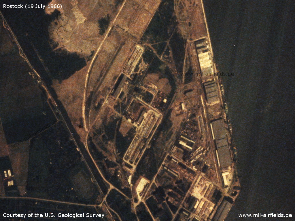
1966

The former airfield and the former Ernst Heinkel Flugzeugwerke aircraft factory on a US satellite image from 19 July 1966
Source: U.S. Geological Survey
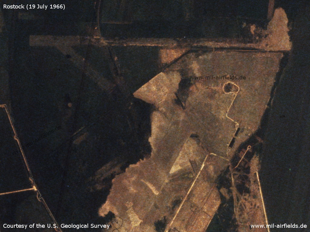
In the north there are still the remains of the runways.
Source: U.S. Geological Survey
Source: U.S. Geological Survey
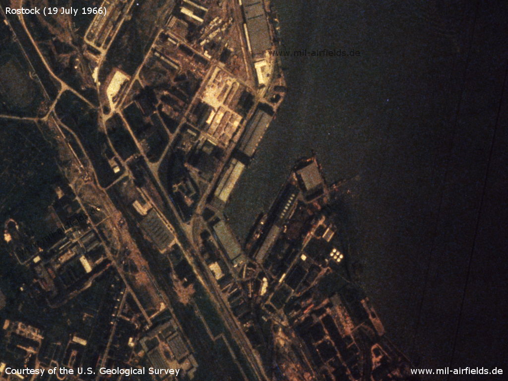
Fishing harbor
Source: U.S. Geological Survey
Radio communication
The East German radio call sign was LEO.
Today
Use
Closed. The area has been overbuilt with industrial objects. Some relics of the airfield respectively of the factory can still be found.
Overview
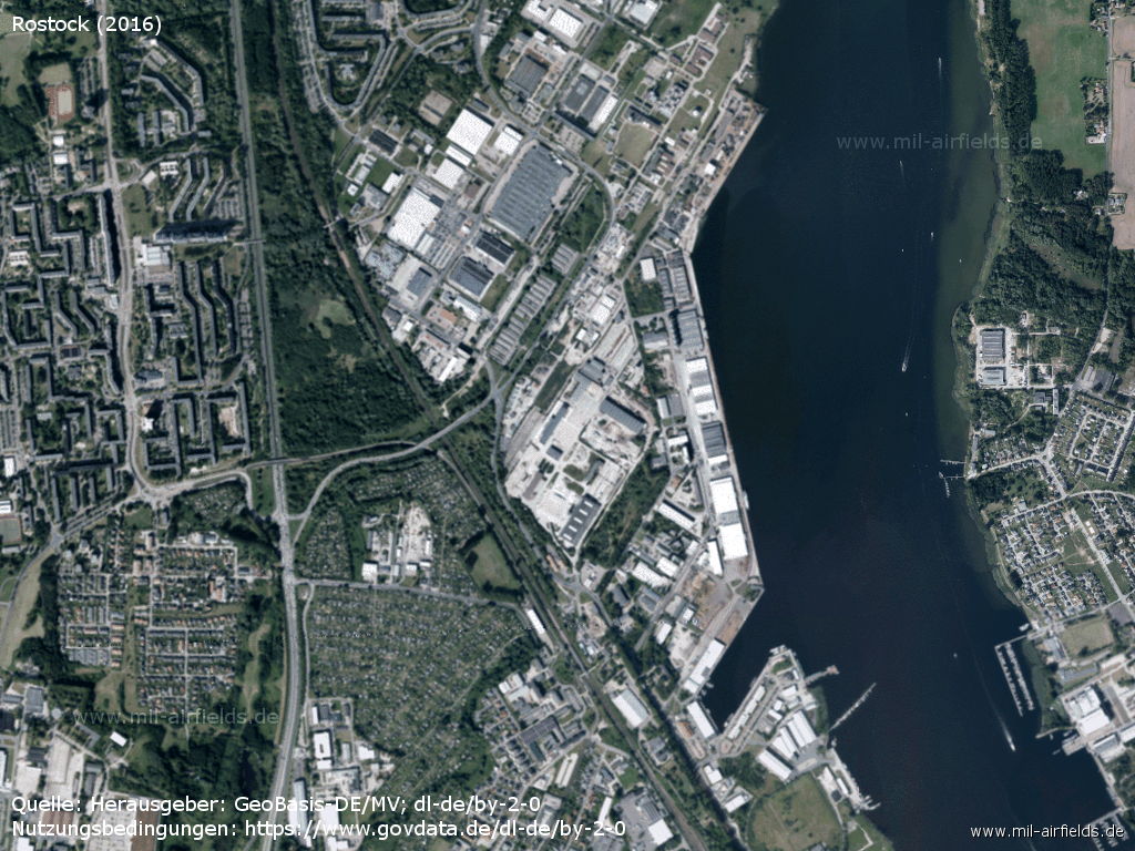
The area today (2016)
Source: Landesamt für innere Verwaltung M-V, Amt für Geoinformation, Vermessung und Katasterwesen - www.geoportal-mv.de, Data licence Germany – attribution – version 2.0, www.govdata.de/dl-de/by-2-0
Sources
- http://www.geoportal-mv.de/portal/ - GeoPortal.MV
- https://www.usgs.gov/ - USGS: U.S. Geological Survey
Related topics
Airfields in the vicinity
- 272°/6km Admannshagen: Agricultural Airfield
- 095°/7km Bentwisch: Agricultural Airfield (Goorstorf)
- 308°/8km Nienhagen: Anti-aircraft Missile Unit 4332 (National People's Army Helipad 3320)
- 062°/10km Rövershagen: Helipad 3305 (HSLP / HLP 3305)
- 089°/10km Klein Kussewitz: Helipad 3029 (HSLP / HLP 3029)
- 070°/12km Purkshof: Airfield (HSLP 4402)
- 144°/14km Kavelstorf: Highway Strip (Autobahnabschnitt ABA)
- 134°/15km Bandelstorf: Agricultural Airfield
- 239°/15km Retschow: Helipad 3314 (HSLP / HLP 3314)
- 107°/20km Sanitz: Helipad 3306 (HSLP 3306)
Categories
Military Airfields GermanyMilitary Airfields in former East GermanyAir bases of former National People's ArmyRecommended
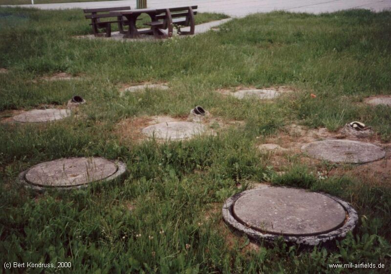
Image credits are shown on the respective target page, click on the preview to open it.
 Follow mil-airfields on Facebook