For historical information only, do not use for navigation or aviation purposes!
| Coordinates | N540419 E0122223 (WGS84) Google Maps |
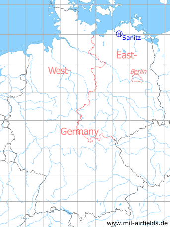
Germany during the Cold War Map
The history of the Cold War airfields: Sanitz
Location of airfield
Southwestern corner of Sanitz.
Usage during the Cold War
Helipad 3306 for 43rd Anti-Aircraft Missile Brigade (43. FRBr.) of former East German Air Force (NVA LSK/LV).
Use today
Closed.
Runways, taxiways, aprons
Dimensions: 80 m x 100 m,
main takeoff and landing direction: 270°,
surface: grass,
usable without crop damage,
capacity: 1 helicopter.
main takeoff and landing direction: 270°,
surface: grass,
usable without crop damage,
capacity: 1 helicopter.
Telephone
Stabsnetz S1 6428-88
Airspace and procedures
Usable at day during good weather conditions.
Alert time: 40 minutes.
Alert time: 40 minutes.
Obstacles
School building, smokestack: height 20 m.
Airfields in the vicinity
- 241°/9km Bandelstorf: Agricultural Airfield
- 305°/11km Klein Kussewitz: Helipad 3029 (HSLP / HLP 3029)
- 246°/12km Kavelstorf: Highway Strip (Autobahnabschnitt ABA)
- 294°/13km Bentwisch: Agricultural Airfield (Goorstorf)
- 321°/13km Purkshof: Airfield (HSLP 4402)
- 316°/15km Rövershagen: Helipad 3305 (HSLP / HLP 3305)
- 200°/18km Laage: Airfield / Air Base (Rostock Airport)
- 287°/20km Rostock: Marienehe Airfield
 Follow mil-airfields on Facebook