For historical information only, do not use for navigation or aviation purposes!
| Coordinates | N540133 E0121202 (WGS84) Google Maps |
| Former East Germany (GDR) | District of Rostock |
| Federal state | Mecklenburg-Vorpommern (Mecklenburg-Western Pomerania) |
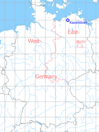
Germany during the Cold War Map
The history of the Cold War airfields: Kavelstorf
Location of airfield
Today's Autobahn A19 at the Kreuz Rostock interchange.
During the Cold War
Use
Highway strip prepared for aircraft operations.
Overview
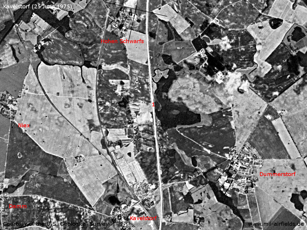
The motorway near Kavelstorf on a US satellite image from 25 June 1975 - 1: At this time the motorway in this area is already straight, but the parking areas are still missing. Places: Damm, Dummerstorf, Hohen Schwarfs, Kavelstorf, Niex.
Source: U.S. Geological Survey
Today
Use
Closed.
Overview
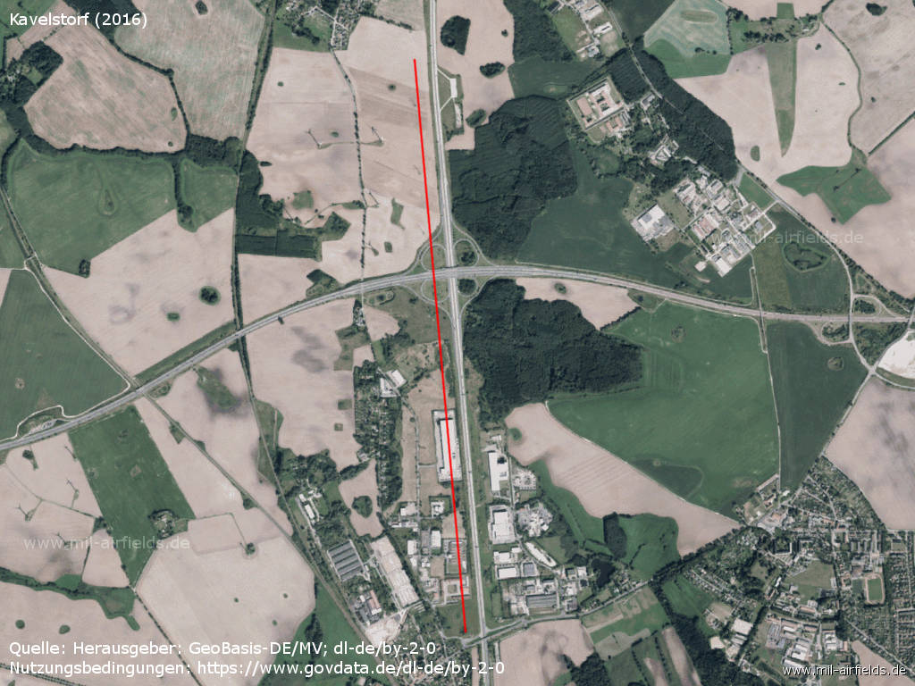
Kreuz Rostock interchange with Autobahn A19 and A20 - The former highway strip is marked by a red line. It is largely deconstructed, only the northern car park is still visible on the eastern side. A bit north of the center, the newly built Autobahn A 20 crosses.
Source: Landesamt für innere Verwaltung M-V, Amt für Geoinformation, Vermessung und Katasterwesen - www.geoportal-mv.de, Data licence Germany – attribution – version 2.0, www.govdata.de/dl-de/by-2-0
Images
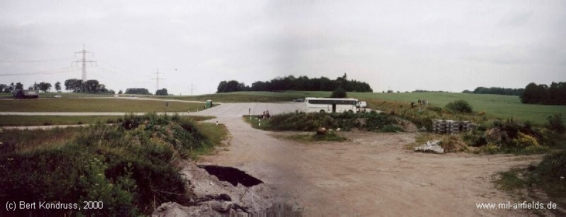
Northern car park - On the right side the blast wall is visible.
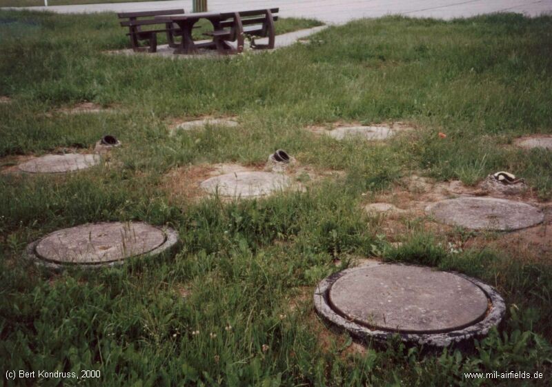
Installations at the car park
Airfields in the vicinity
- 080°/3km Bandelstorf: Agricultural Airfield
- 012°/11km Klein Kussewitz: Helipad 3029 (HSLP / HLP 3029)
- 355°/11km Bentwisch: Agricultural Airfield (Goorstorf)
- 065°/12km Sanitz: Helipad 3306 (HSLP 3306)
- 157°/13km Laage: Airfield / Air Base (Rostock Airport)
- 324°/14km Rostock: Marienehe Airfield
- 012°/15km Purkshof: Airfield (HSLP 4402)
- 003°/16km Rövershagen: Helipad 3305 (HSLP / HLP 3305)
- 309°/18km Admannshagen: Agricultural Airfield
Categories
Highway Strips WorldwideMilitary Airfields GermanyMilitary Airfields in former East GermanyHighway Strips in former East GermanyRecommended
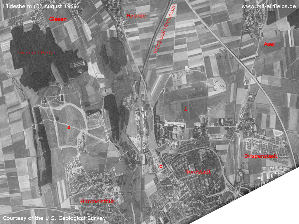
Image credits are shown on the respective target page, click on the preview to open it.
 Follow mil-airfields on Facebook