For historical information only, do not use for navigation or aviation purposes!
| Coordinates | N521047 E0095644 (WGS84) Google Maps |
| Elevation | 290 ft |
| Location indicator | EDCD (Heer), EDUH (AAC), EDVM |
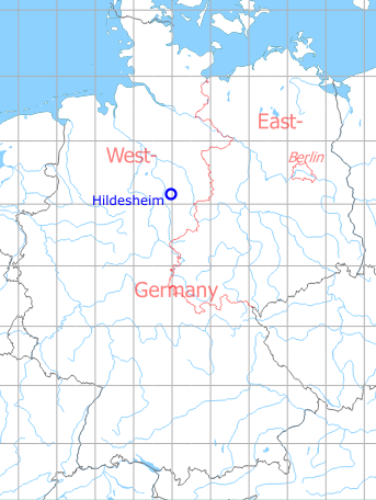
Germany during the Cold War Map
The history of the Cold War airfields: Hildesheim
Location of airfield
3 km north-northwest of Hildesheim.
During the 1920s/1930s
Use
Hildesheim opened in 1927 as an airport. Later conversion into a Luftwaffe air base.
Situation
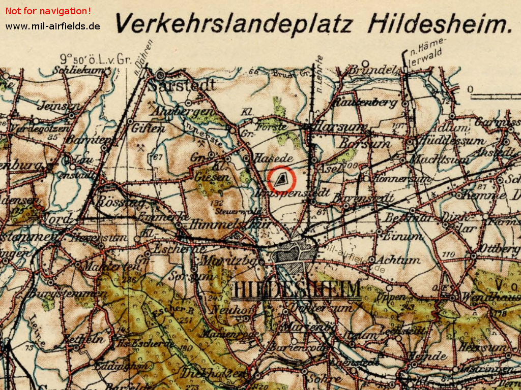
Map from the 1920s
Overview
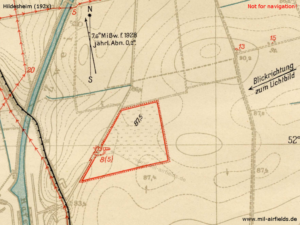
Map from the 1920s
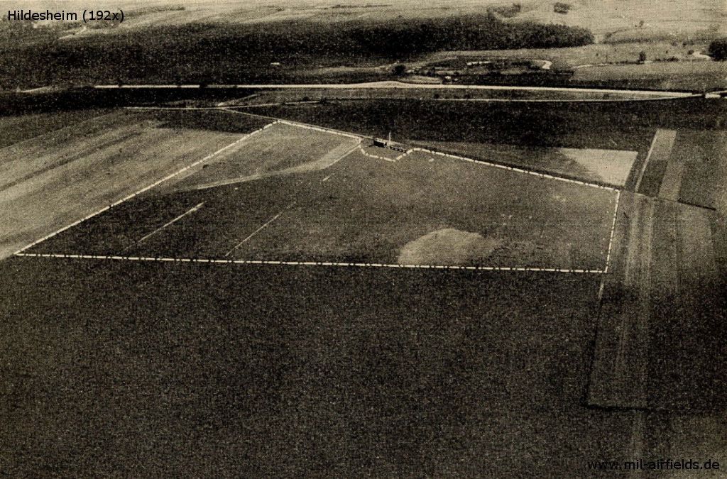
Aerial picture from the 1920s, looking west-southwest
Runways
Good sod on heavy clay soil. Shortest rolling distance: 450 m in direction north-south.
Landing sign is constantly displayed during scheduled air traffic. Maneuvering area boundary marked by red and white panels.
/FHB 1928/
Lights
No permanent night lighting. On request at flight dispatch, landing fires with green, white and red fires in line parallel to the wind direction. Land from from green over white to red, to the right of the row. In addition, the administrative building is illuminated and windsock mast is marked by warning fires.
/FHB 1928/
Installations
Workshops:
Open during scheduled air transport to make small repairs. Workbench and vices available. Electricity: 220 V AC. Spare parts for BMV IV and Siemens engines in stock.
Open during scheduled air transport to make small repairs. Workbench and vices available. Electricity: 220 V AC. Spare parts for BMV IV and Siemens engines in stock.
Fuel Equipment:
For 1000 l of standard fuel of the Deutsche Luft Hansa A. G.
For 1000 l of standard fuel of the Deutsche Luft Hansa A. G.
Accommodation of passengers:
In the city.
In the city.
First aid in case of accidents:
Is provided by the flight dispatcher. Medical room available. Nearest doctor in Hildesheim (3,7 km distance).
Is provided by the flight dispatcher. Medical room available. Nearest doctor in Hildesheim (3,7 km distance).
Passport:
Passport inspection by police watch.
Passport inspection by police watch.
/FHB 1928/
During World War II
Use
Luftwaffe air base.
Situation
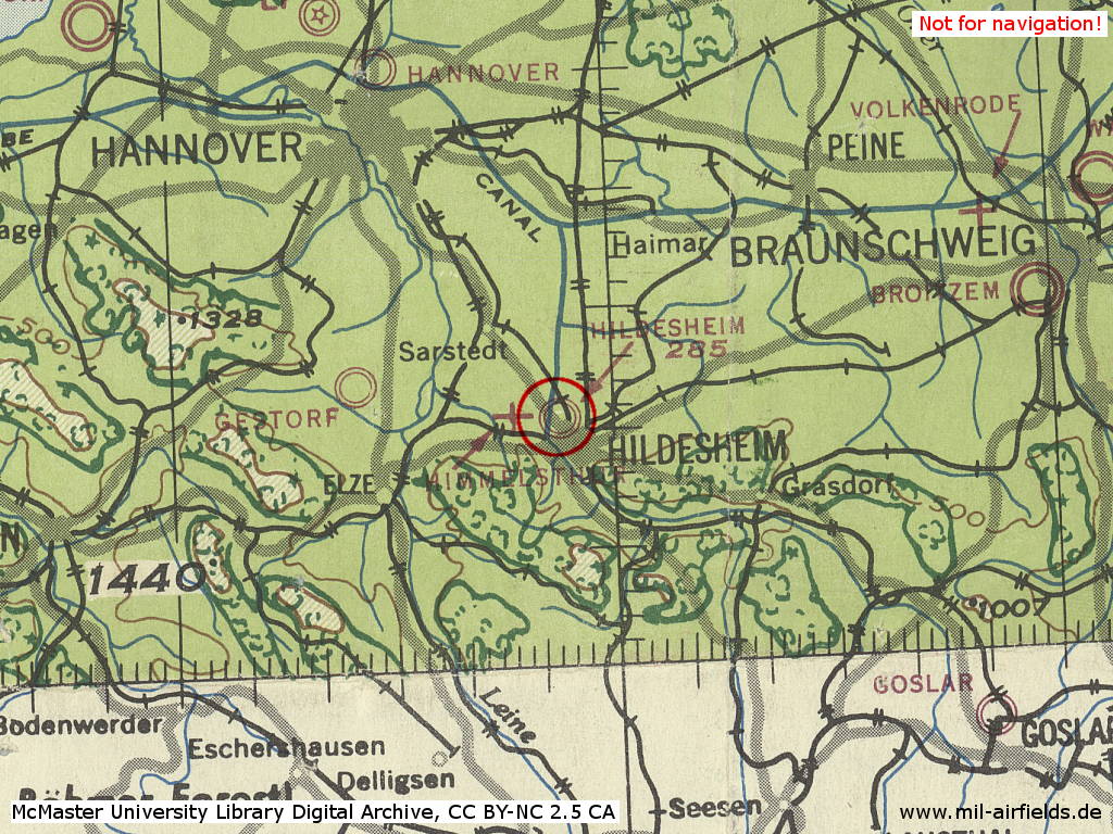
Hildesheim Airfield in World War II on a US map from 1943
Source: McMaster University Library Digital Archive, License: Creative Commons Attribution-NonCommercial 2.5 CC BY-NC 2.5 CA
Overview
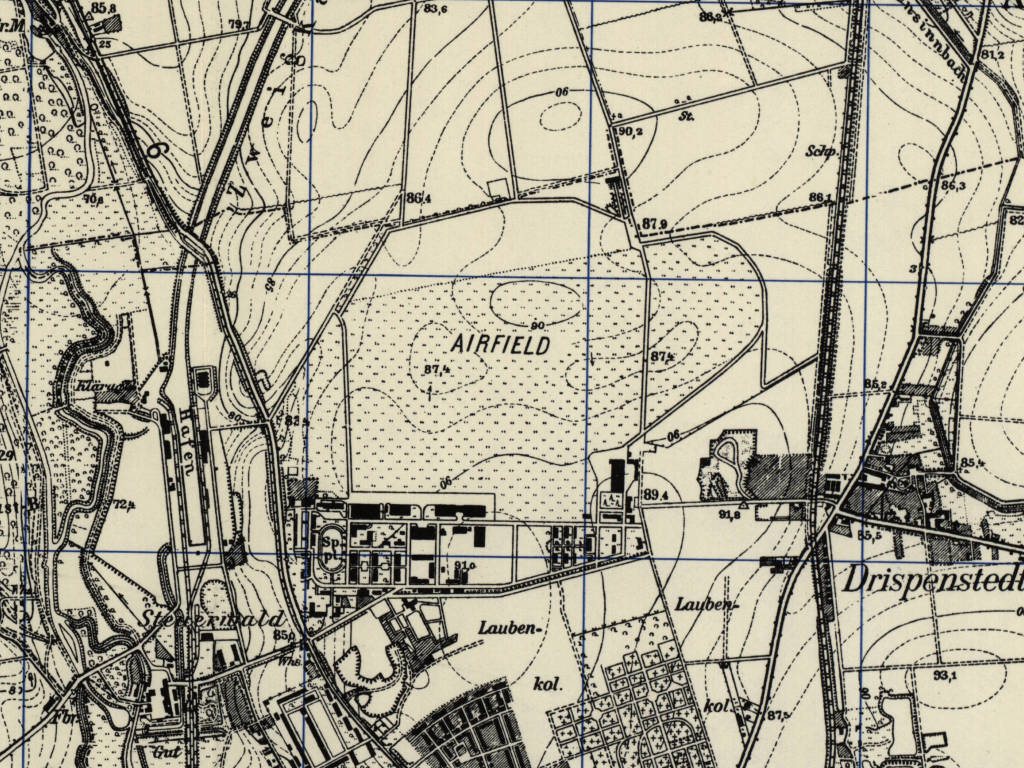
Hildesheim Airfield on a US map from 1951 - The state of expansion should correspond to the 1940s
Source: AMS M841 GSGS 4414, Courtesy Harold B. Lee Library, Brigham Young University
During the Cold War
German Army Airfield (1962-1979)
Overview
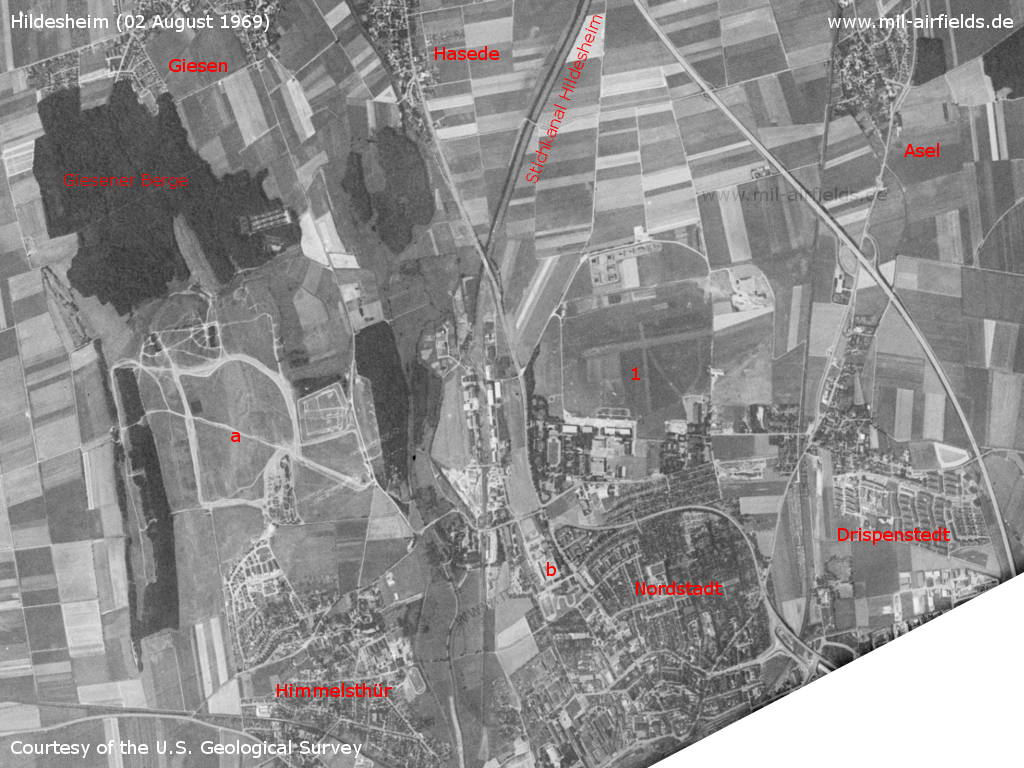
The north of Hildesheim on a US satellite image from 02 August 1969 - 1: airfield. Other objects: a: Osterberg training area. Until about the mid-1960s there was also a glider airfield here; b: barracks. Places: Asel, Drispenstedt, Giesen, Hasede, Himmelsthür, Nordstadt. Traffic: Motorway A7, Hildesheim Stichkanal canal.
Source: U.S. Geological Survey
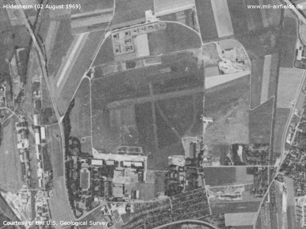
Hildesheim Airfield
Source: U.S. Geological Survey
Radio communication
- Tower 282.8, 257.8, 250.3, 122.1, 42.4
Airspace and procedures
Operating times: Monday till Friday 07:00Z - 16:00Z, except holidays, for military aircraft; Saturday 13:00Z - sunset and Sunday and on holidays 08:00Z - sunset; other times after prior permission; glider flying Saturday, Sunday and on holidays.
During military operation hours, the field is a controlled aerodrome.
Units
1962-1979: German Army aviation with Heeresfliegerstaffel 1 / Heeresfliegerbataillon 1 / Heeresfliegerstaffel 1, 1979 relocated to Rheine-Bentlage.
Army Air Corps (1979 -)
Runways
Data for the year 1981
- 08/26: 766 m Grass
Radio communication
- Hildesheim Info 122.0, 42.4
Telephone
05121-504236
Airspace and procedures
Operating times: Monday till Friday 07:30Z - 15:30Z
Glider flying Saturday, Sunday and on holidays
Glider flying Saturday, Sunday and on holidays
Aircraft should avoid overflying Hildesheim town and Groß Giesen.
Traffic circuit in the north.
Helicopter approaches from the south.
Obstacles
Antennae 2000 ft southwest of the helicopter landing site, height 141 ft, and 2625 ft east of aerodrome, height 100 ft, both lit at night.
Units
1990: Army Air Corps (AAC); 1 Rgt mit 651 Sq, 652 Sq und 661 Sq (Gazelle AH 1, Lynx AH 1)
Today
Use
General aviation.
Links
- http://www.flugplatz-hildesheim.de - Flugplatz Hildesheim
- http://www.relikte.com/hildesheim/index.htm - Der Fliegerhorst Hildesheim
Categories
Military Airfields GermanyMilitary Airfields in former West GermanyAirfields of the British Army AAC in GermanyGerman Army AirfieldsRecommended
Image credits are shown on the respective target page, click on the preview to open it.
 Follow mil-airfields on Facebook