For historical information only, do not use for navigation or aviation purposes!
| Coordinates | N515627 E0085417 (WGS84) Google Maps |
| Elevation | 636 ft |
| Location indicator | EDUD (196x-199x), ETUD (199x), EDLJ |
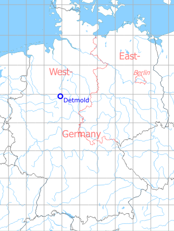
Germany during the Cold War Map
The history of the Cold War airfields: Detmold
Location of airfield
Northeastern corner of Detmold.
During World War II
Use
Luftwaffe airbase (Fliegerhorst).
Situation
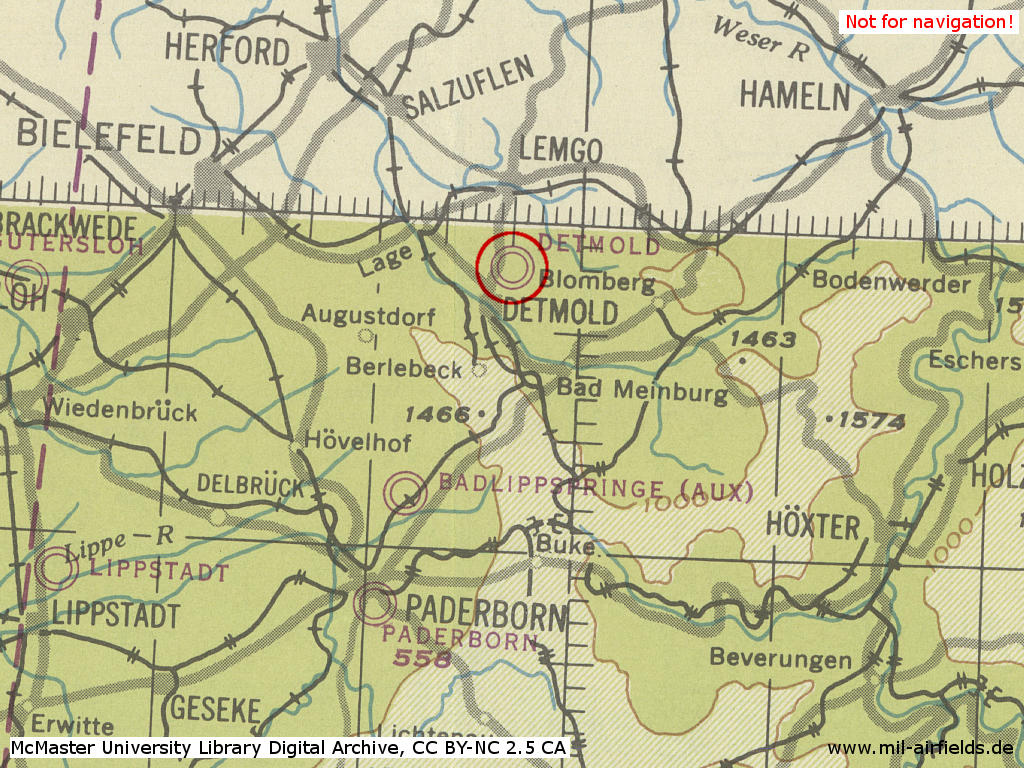
Detmold Air Base in World War II on a US map from 194x
Source: McMaster University Library Digital Archive, Lizenz: Creative Commons Attribution-NonCommercial 2.5 CC BY-NC 2.5 CA
Overview
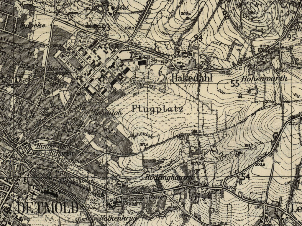
Former Detmold Air Base on a US map from 1954
Source: AMS M841 GSGS 4414, Courtesy Harold B. Lee Library, Brigham Young University
During the Cold War
Use
BAOR / Army Air Corps airfield.
1970s
Radio communication
Approach Control: 255.1, 257.8, 122.1
Tower: 251.6, 257.8, 121.7, 121.1
UHF direction finder via Approach Control: 255.1, 257.8, 251.6
Telephone
05231 / 28086, Extension 319.
Airspace and procedures
Prior Permission Required (PPR) except for BAOR aircraft.
Operated Monday to Friday 0700-1600Z.
Glider flying from 1600Z until sunset and on weekends from sunrise to sunset.
Traffic pattern for aircraft and helicopter in 700 ft QFE.
Aircrafts shall avoid overflying of Detmold town and barracks.
Helipad located 210 ft east of threshold runway 27 and 150 ft south of main runway. All landings and take-offs are to be made from this position.
1980s and early 1990s
Runways
- 09/27: 361m x 18m Asphalt
Lights
Beacon with ident "DL".
Radio communication
Tower: 122.75, 278.1, 369.625 (Advisory only).
UHF direction finder via Tower: 278.1, 255.1 (limited facility, not available Fridays after 1000Z).
Glider operations: 130.4
Telephone
05231/29284
later: 05231 / 747 - 319/309.
later: 05231 / 747 - 319/309.
Airspace and procedures
Strictly Prior Permission Required (PPR) except for BAOR aircraft.
Operated Monday to Friday 0700-1600Z, other times by arrangement with 1 h notification.
Glider flying on weekends and holidays.
Aircrafts shall avoid overflying of Detmold town and barracks below 1500 ft.
Helicopter approaches and departures are to be made from/to south or east.
Units
654 Sq , 659 Sq, 669 Sq (4 Rgt) Gazelle AH 1, Lynx AH 1/AH 7.
Images
Overview
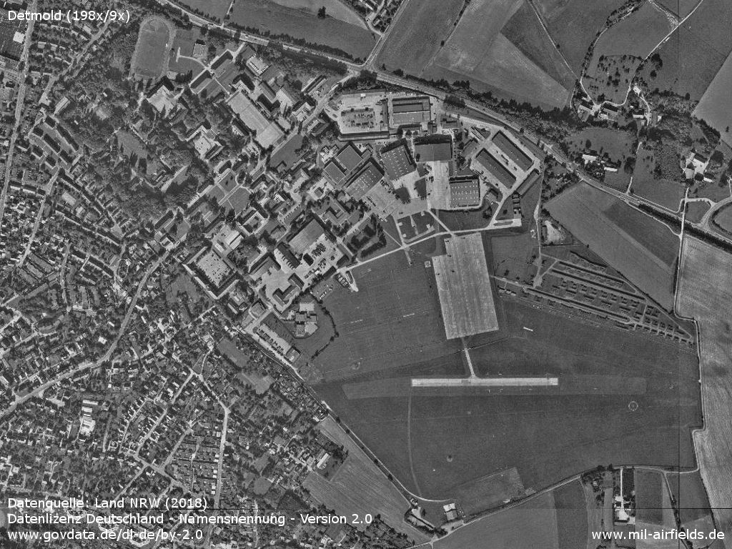
Hobart Barracks and airfield
Source: Land NRW (2018)
Datenlizenz Deutschland - Namensnennung - Version 2.0 (www.govdata.de/dl-de/by-2-0)
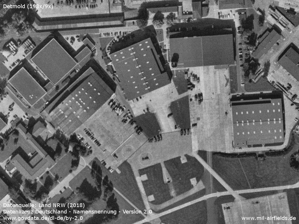
Hobart barracks and airfield
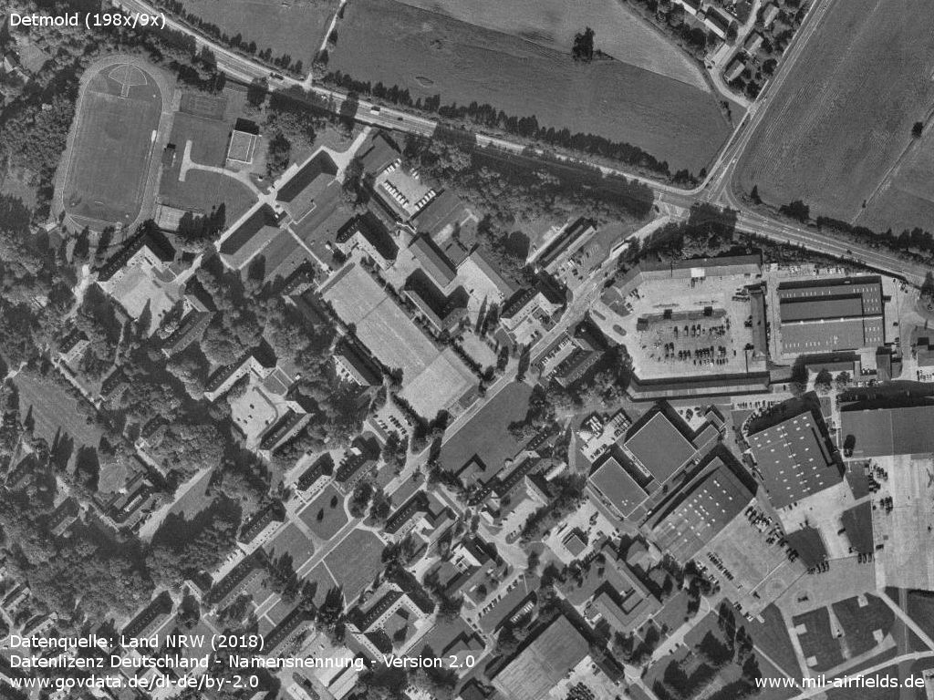
Northwestern part of the barracks
Source: Land NRW (2018)
Datenlizenz Deutschland - Namensnennung - Version 2.0 (www.govdata.de/dl-de/by-2-0)
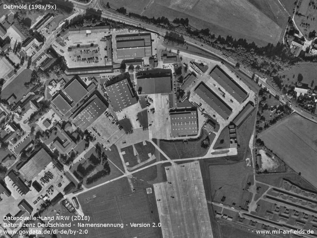
Northern part, hangars and ramp
Source: Land NRW (2018)
Datenlizenz Deutschland - Namensnennung - Version 2.0 (www.govdata.de/dl-de/by-2-0)
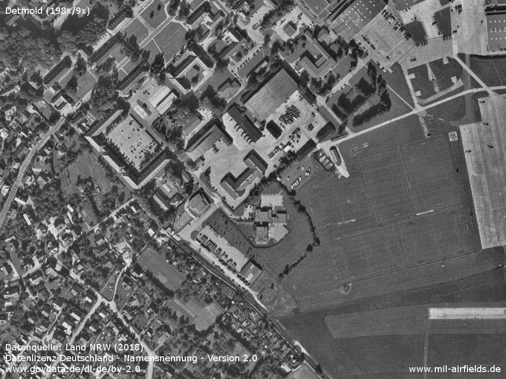
Western part
Source: Land NRW (2018)
Datenlizenz Deutschland - Namensnennung - Version 2.0 (www.govdata.de/dl-de/by-2-0)
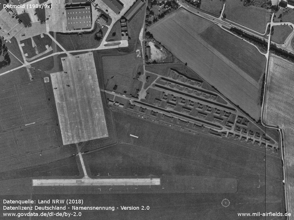
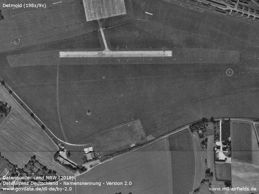
Ramp and runway
Source: Land NRW (2018)
Datenlizenz Deutschland - Namensnennung - Version 2.0 (www.govdata.de/dl-de/by-2-0)
Southern part with runways
Source: Land NRW (2018)
Datenlizenz Deutschland - Namensnennung - Version 2.0 (www.govdata.de/dl-de/by-2-0)
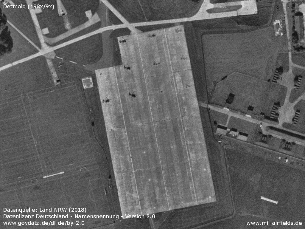
Enlargement: Airfield
Hangars - There is a helicopter slightly below the center of the picture.
Source: Land NRW (2018)
Datenlizenz Deutschland - Namensnennung - Version 2.0 (www.govdata.de/dl-de/by-2-0)
Ramp with helicopters
Source: Land NRW (2018)
Datenlizenz Deutschland - Namensnennung - Version 2.0 (www.govdata.de/dl-de/by-2-0)
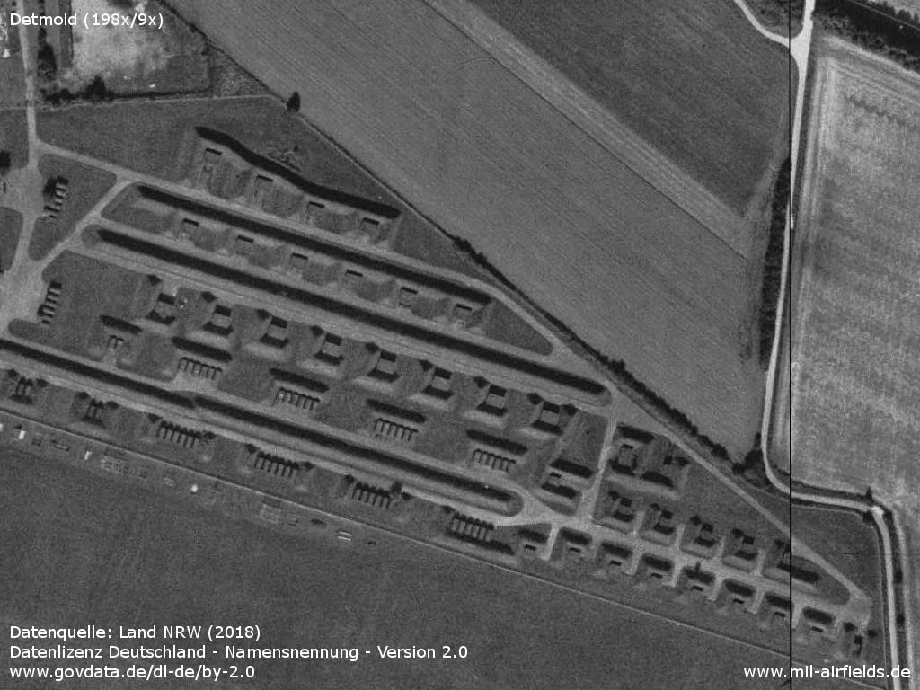
Ammunition dump
Source: Land NRW (2018)
Datenlizenz Deutschland - Namensnennung - Version 2.0 (www.govdata.de/dl-de/by-2-0)
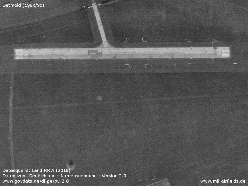
Paved runway 09/27 and grass runway
Source: Land NRW (2018)
Datenlizenz Deutschland - Namensnennung - Version 2.0 (www.govdata.de/dl-de/by-2-0)
Today
Use today
General aviation.
Airfields in the vicinity
- 018°/39km Bückeburg: Airbase (RAF Bückeburg)
Categories
Military Airfields GermanyMilitary Airfields in former West GermanyAirfields of the British Army AAC in GermanyRecommended

Image credits are shown on the respective target page, click on the preview to open it.