Werl: Airfeld
For historical information only, do not use for navigation or aviation purposes!
| Coordinates | N513422 E0075441 (WGS84) Google Maps |
| Elevation | 269 ft |
| Federal state | Nordrhein-Westfalen (North Rhine-Westphalia) |
| Location indicator | EDCW |
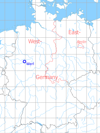
Germany during the Cold War Map
The history of the Cold War airfields: Werl
General
In the middle of the 1930s, a Luftwaffe Fliegerhorst (air base) was built in the north of Werl. After the World War II, the site was used by Belgian units. On a small part in the northwest of the former air base, an airfield for the Belgian army aviation was established. Beside the army aviation, the area was also occupied by other units, among them was a special weapons site of the US Army. After the withdrawal of the troops at the beginning of the 1990s, the site was converted into the KonWerl industrial estate. Individual buildings have been preserved.
During World War II
Use
Luftwaffe air base (Fliegerhorst).
Situation
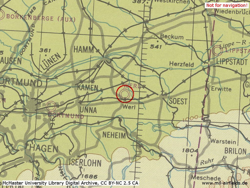
Werl Air Base in World War II on a US map from 1944
Source: McMaster University Library Digital Archive, License: Creative Commons Attribution-NonCommercial 2.5 CC BY-NC 2.5 CA
Overview
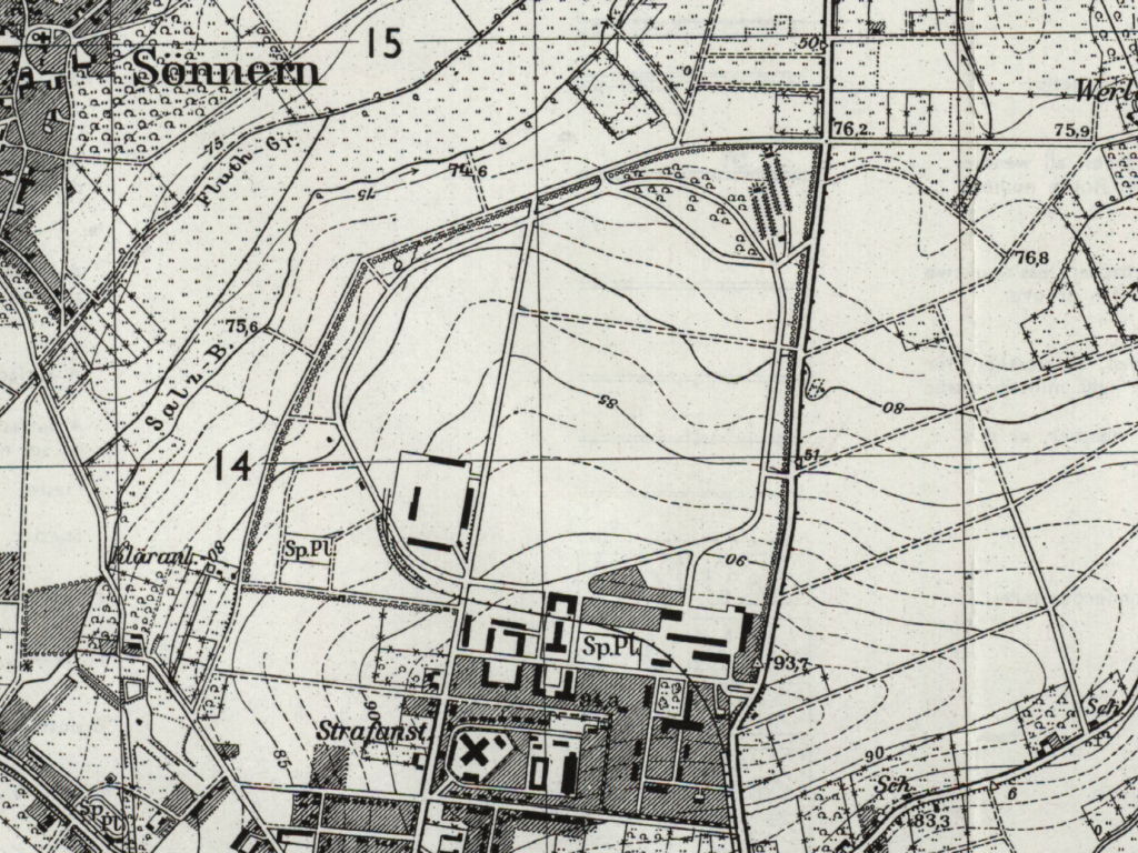
Werl Airfeld on a US map from 1955. - The basic structure of the air base is visible, but buildings and hangars are missing. Shown is the railway siding, which leads east past Werl and ends in the southwest corner of the air base.
Source: AMS M841 GSGS 4414, Courtesy Harold B. Lee Library, Brigham Young University
Sources
During the Cold War
Usage during the Cold War
Belgian Army aviation base (1956-1994).
In the 1970s
Overview
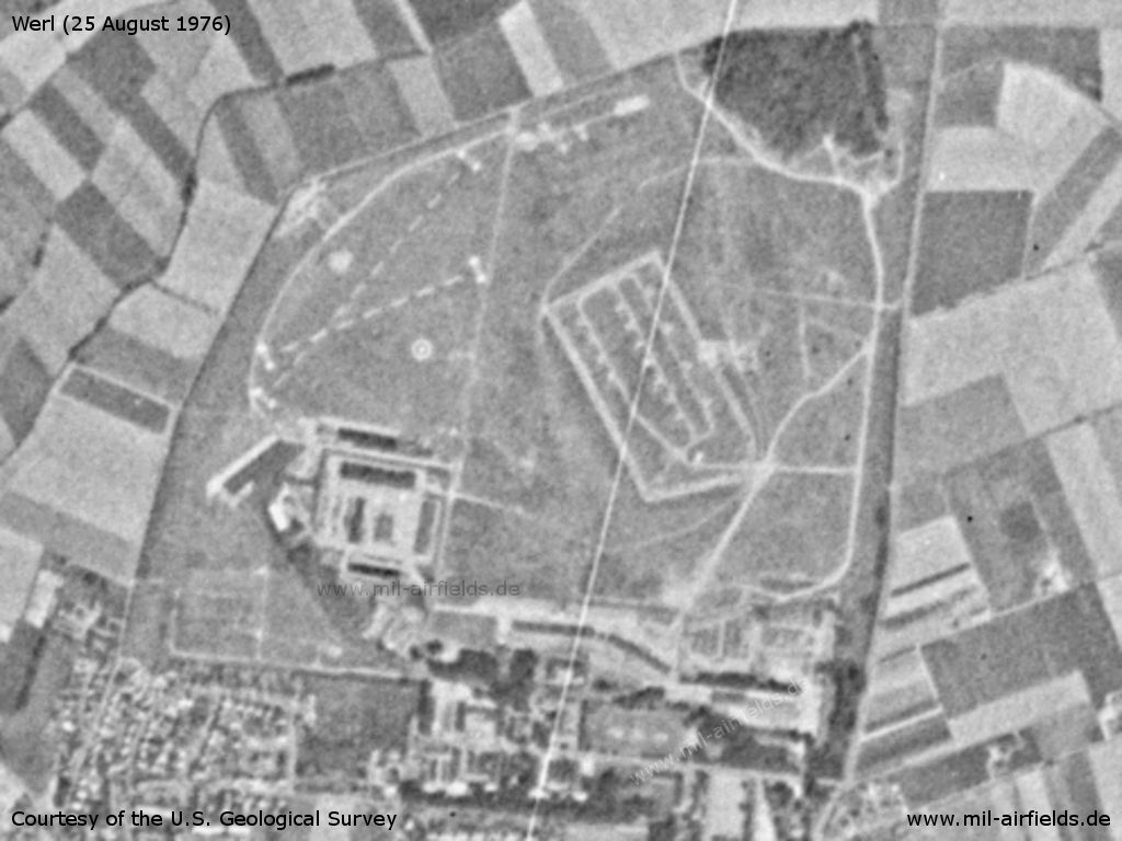
US satellite image from 25 August 1976: Barracks, ammunition dump, airfield - At the top left you can see the two crossed runways.
Source: U.S. Geological Survey
In the 1980s and early 1990s
Overview
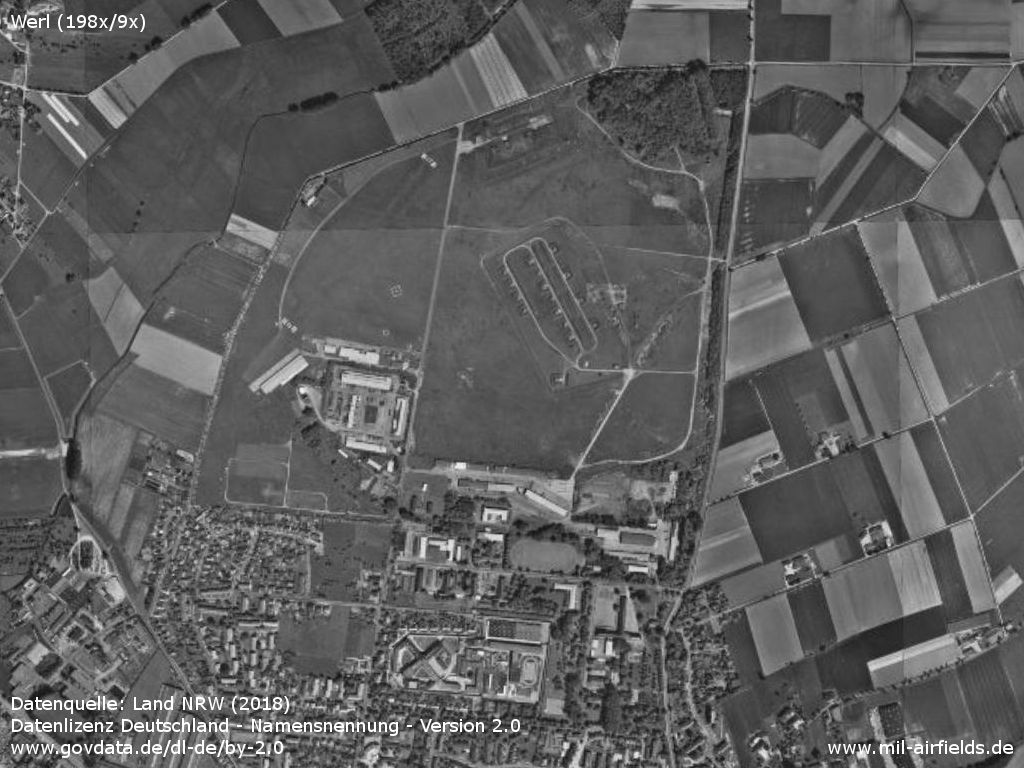
The Werl military area between 1988 and 1994 - In the southwest, the oval structure of the former Fliegerhorst can still be seen. However, the Belgian airfield is limited to the northwestern corner.
Source: Datenquelle: Land NRW (2018)
Datenlizenz Deutschland - Namensnennung - Version 2.0
www.govdata.de/dl-de/by-2.0
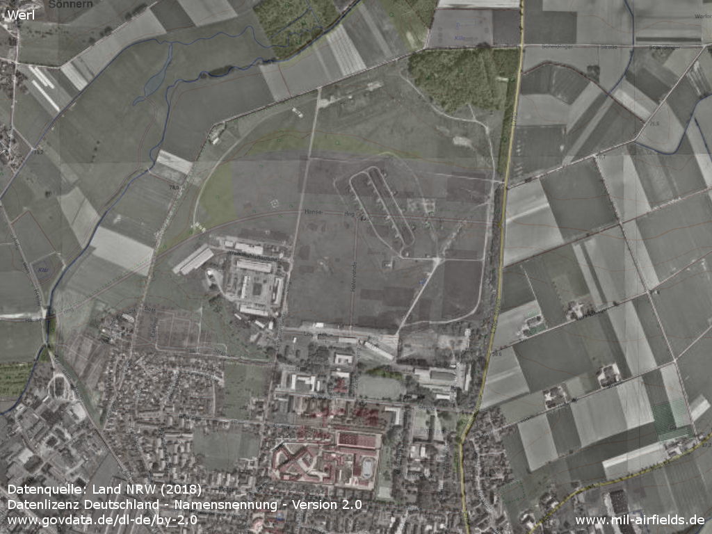
For orientation the same aerial photo over a current map - The situation can be seen with regard to the present streets Hansering, Langenwiedenweg, Hafervöhde, Lohdiecksweg and Belgische Straße.
Source: Datenquelle: Land NRW (2018)
Datenlizenz Deutschland - Namensnennung - Version 2.0
www.govdata.de/dl-de/by-2.0
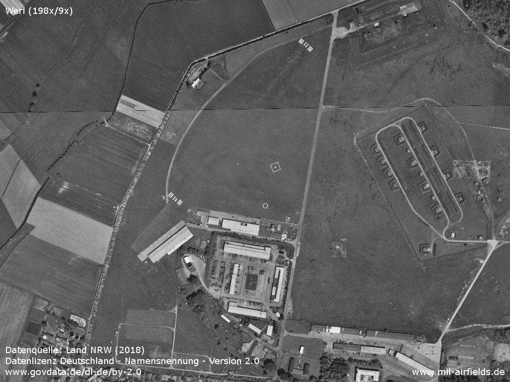
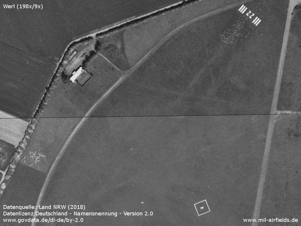
The airfield - The marked runway 04/22 is approx. 570 m long
Source: Datenquelle: Land NRW (2018)
Datenlizenz Deutschland - Namensnennung - Version 2.0
www.govdata.de/dl-de/by-2.0
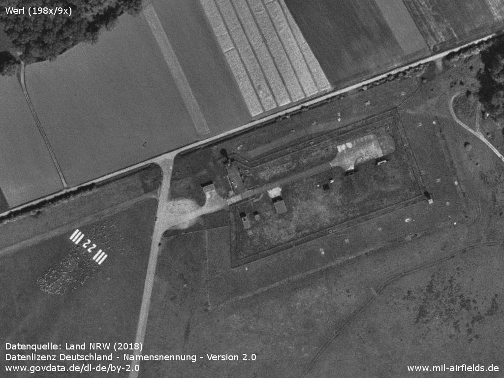
Special ammunition storage (SAS) - The approach to runway 22 passes close to the nuclear weapons store.
Source: Datenquelle: Land NRW (2018)
Datenlizenz Deutschland - Namensnennung - Version 2.0
www.govdata.de/dl-de/by-2.0
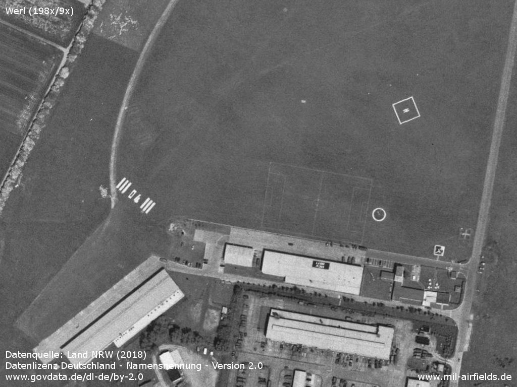
Movement area - Meanwhile, the second runway 07/25 has been decommissioned, the markings are barely visible.
Source: Datenquelle: Land NRW (2018)
Datenlizenz Deutschland - Namensnennung - Version 2.0
www.govdata.de/dl-de/by-2.0
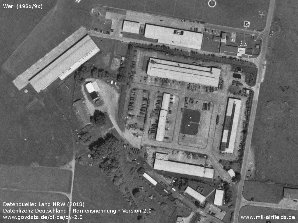
Hangar - Approach for runway 04 is close to a hangar. It still exists, stands at the end of today's Walkmühlenstraße and functions as an indoor playground.
Source: Datenquelle: Land NRW (2018)
Datenlizenz Deutschland - Namensnennung - Version 2.0
www.govdata.de/dl-de/by-2.0
Railway siding - From the southeast, an arched siding leads to the installation. The US Army radio tower appears to have already been dismantled.
Source: Datenquelle: Land NRW (2018)
Datenlizenz Deutschland - Namensnennung - Version 2.0
www.govdata.de/dl-de/by-2.0
Runways
Data for the year 1990:
- 04/22: 544 m x 40 m Grass
Units
1956-1994: 17 Sq/17 Btl (Alouette II) (relocated to Liège Bierset: Airfield in 1994).
Today
Use
Closed.
Overview
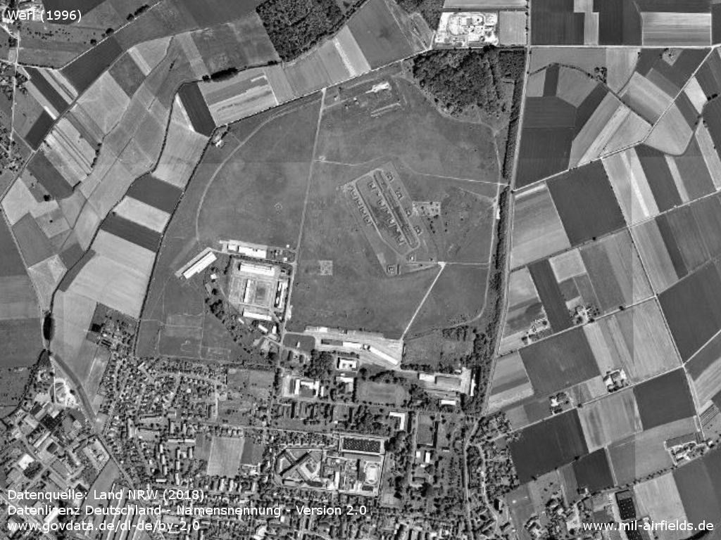
In 1996, the old structures were still largely intact
Source: Datenquelle: Land NRW (2018)
Datenlizenz Deutschland - Namensnennung - Version 2.0
www.govdata.de/dl-de/by-2.0
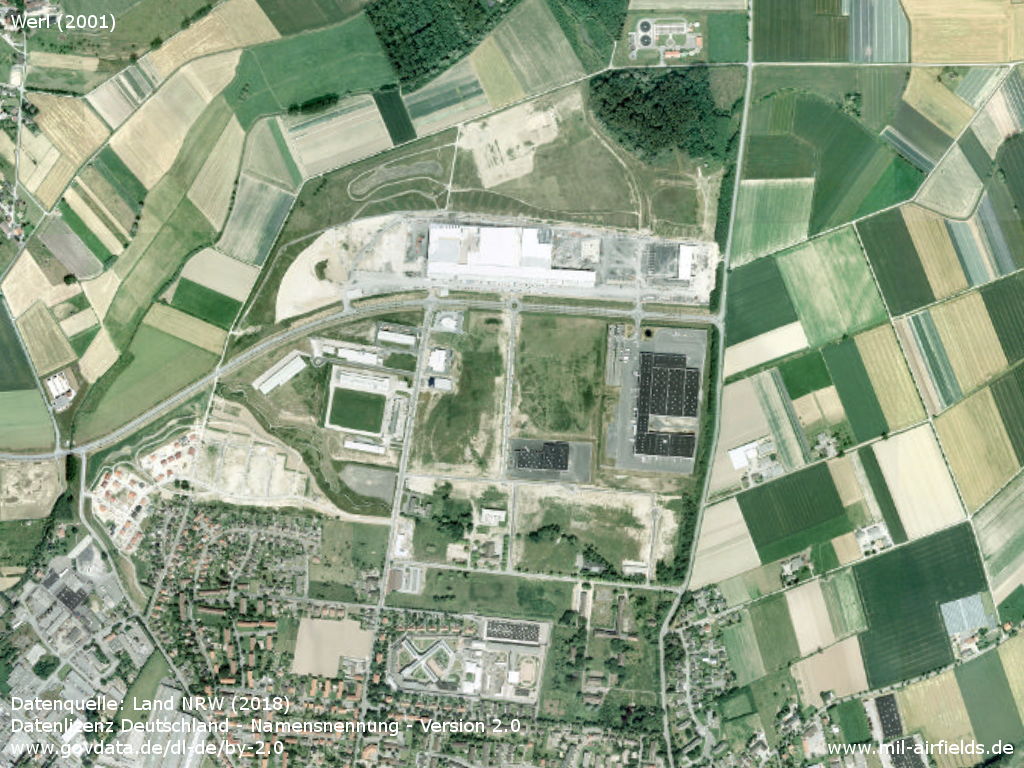
In 2001 the area had already changed considerably. - Large-scale construction work is still in progress.
Source: Datenquelle: Land NRW (2018)
Datenlizenz Deutschland - Namensnennung - Version 2.0
www.govdata.de/dl-de/by-2.0
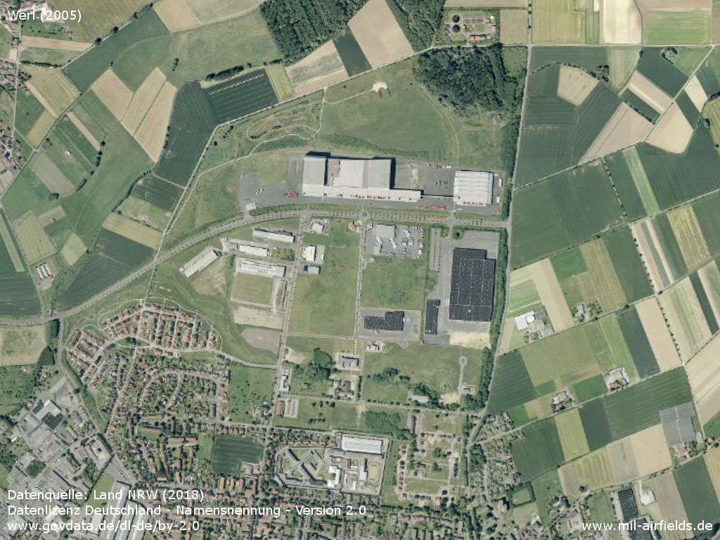
In 2005, major construction work was completed.
Source: Datenquelle: Land NRW (2018)
Datenlizenz Deutschland - Namensnennung - Version 2.0
www.govdata.de/dl-de/by-2.0
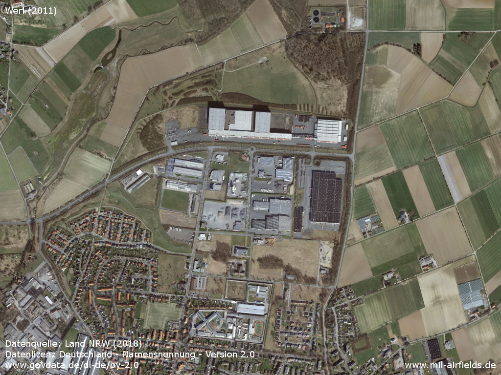
Situation 2011 - By 2011, further commercial buildings had been added. In addition, the prison was extended to the north.
Source: Datenquelle: Land NRW (2018)
Datenlizenz Deutschland - Namensnennung - Version 2.0
www.govdata.de/dl-de/by-2.0
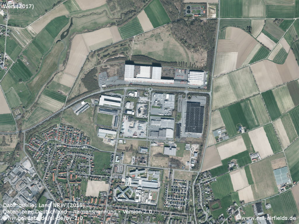
By 2017, the development had become even denser. In addition, the prison was further extended.
Source: Datenquelle: Land NRW (2018)
Datenlizenz Deutschland - Namensnennung - Version 2.0
www.govdata.de/dl-de/by-2.0
Sources
- https://lib.byu.edu/collections/german-maps/ - Brigham Young University Library
- https://digitalarchive.mcmaster.ca/ - McMaster University Library Digital Archive
- https://www.geoportal.nrw/ - Geoportal NRW
Links
- https://www.youtube.com/watch?v=o8-sFlDbaJE - Pictures of Werl airfield
- https://www.youtube.com/watch?v=uSg06Ik_ZRA - Werl Airshow 1966
Airfields in the vicinity
Recommended
Image credits are shown on the respective target page, click on the preview to open it.
 Follow mil-airfields on Facebook