Kawich Range: Altenburg Air Base as Target
Rachel, Nevada, close to "Area 51"
For historical information only, do not use for navigation or aviation purposes!
| Coordinates | N372420 W1161418 (WGS84) Google Maps |
The history of the Cold War airfields: Target Airfield near Rachel, Nevada
General
In the northern part of the Nevada Test and Training Range (NTTR), USA, there is a replica of the former Soviet airfield Altenburg, East Germany, about 175 km (110 miles) away from Berlin. The replica in Nevada is used as a training target.
According to old satellite images, the facility was built between 1974 and 1976, probably in 1976.
Location of airfield
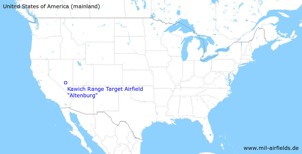
70 km north-northeast von Beatty, Nevada, 50 km southwest of Rachel, Nevada and 43 km northwest of the center of Area 51.
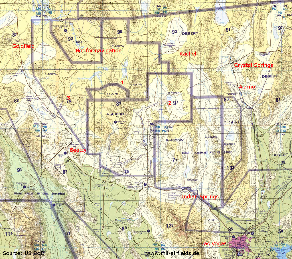
Nevada Test and Training Range north of Las Vegas an a map from 1993 - The map covers an area of about 250 km (155 miles) in east-west direction and 220 km (137 miles) in north-south direction. Numerous nuclear weapons were also tested here. 1: Airfield replica; 2: Groom Lake ("Area 51") Air Force Test Center; 3: Tolicha Peak. Places: Alamo, Beatty, Crystal Springs, Indian Springs, Goldfield, Rachel.
Source: U.S. Defense Mapping Agency Aerospace Center, via Perry-Castañeda Library
Map Collection, The University of Texas at Austin
During the Cold War
In the 1970s
Overview
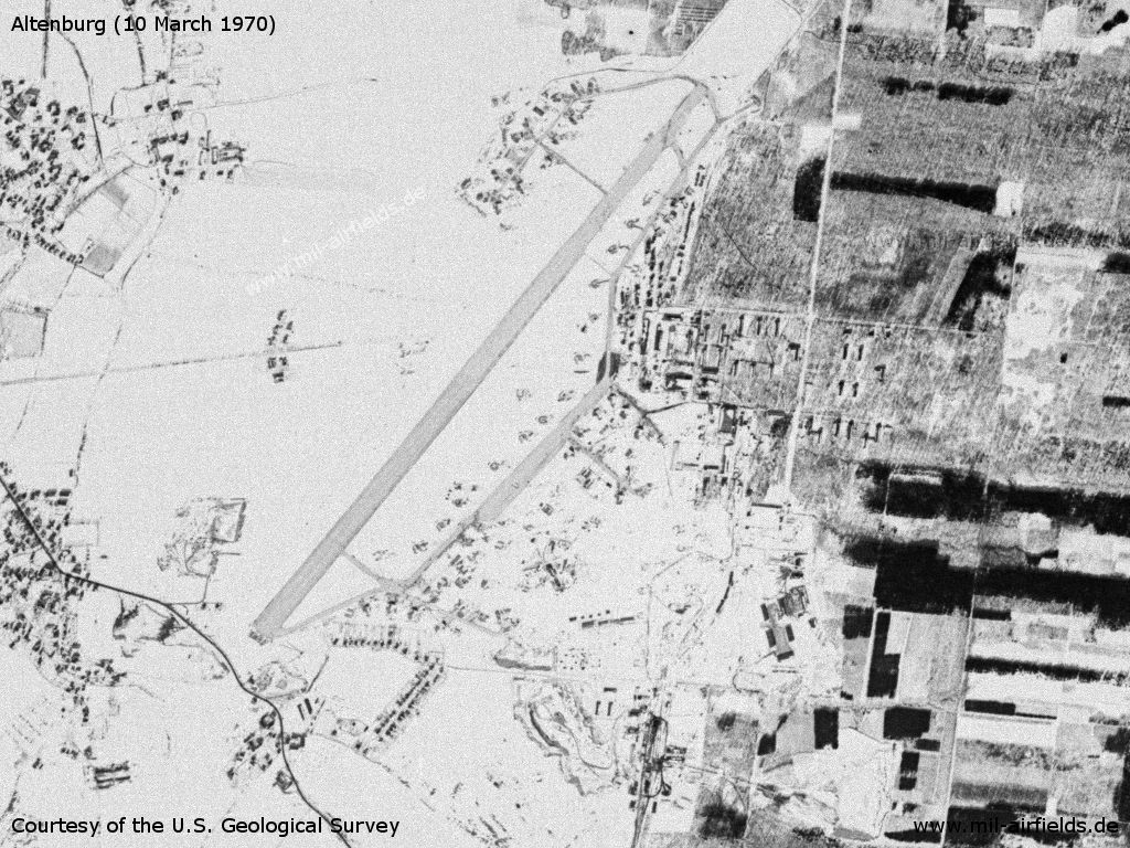
The original Altenburg Airfield in East Germany on 10 March 1970 in snow.
Source: U.S. Geological Survey
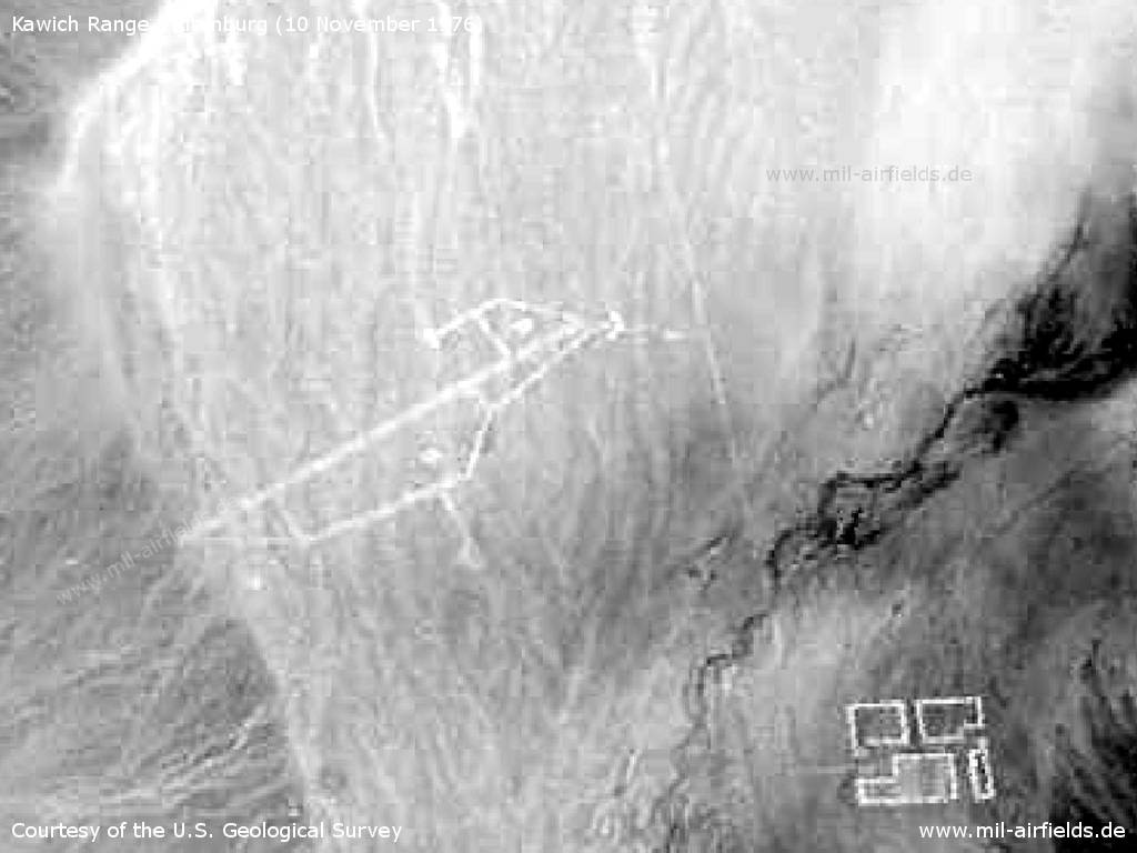
The copied airfield in Kawich Valley, Nevada, on a satellite image from 10 November 1976
Source: U.S. Geological Survey
In the 1980s and early 1990s
Overview
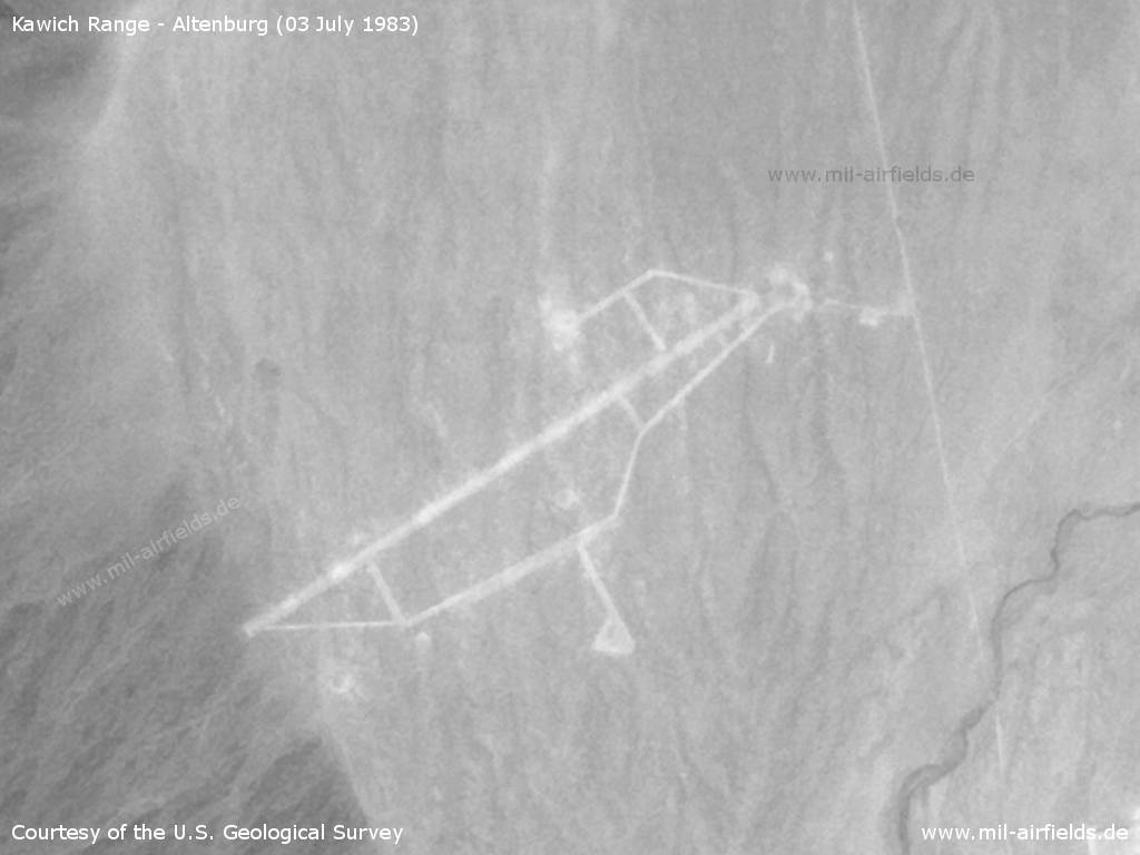
The air base replica in Nevada on an arial image from 03 July 1983 - The runway is turned clockwise by approx. 20° compared to the original.
Source: U.S. Geological Survey
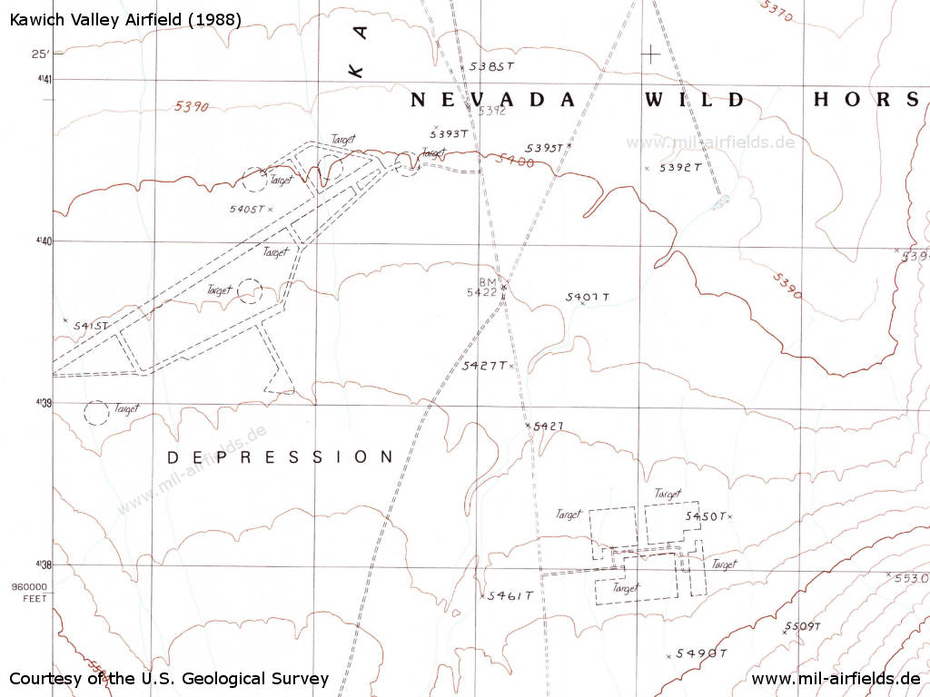
Map with target markings (1988)
Source: U.S. Geological Survey
Today
Overview
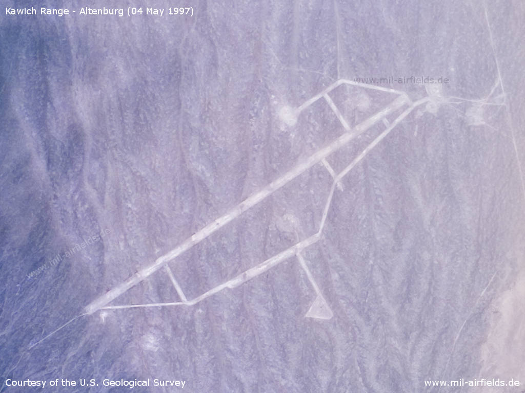
The replica in Nevada on an arial image from 04 May 1997
Source: U.S. Geological Survey
Sources
- https://www.usgs.gov/ - USGS: U.S. Geological Survey
Warning!
Never enter active military installations without prior approval. It is dangerous, it is illegal and you can be punished for it.
References
- Learn more about the original Soviet airfield in Germany:
Altenburg Air Base
- In Range 76, about 50 km to the west, another East German airfield was rebuilt even twice:
Range 76: Altes Lager Air Base as Target.
Recommended
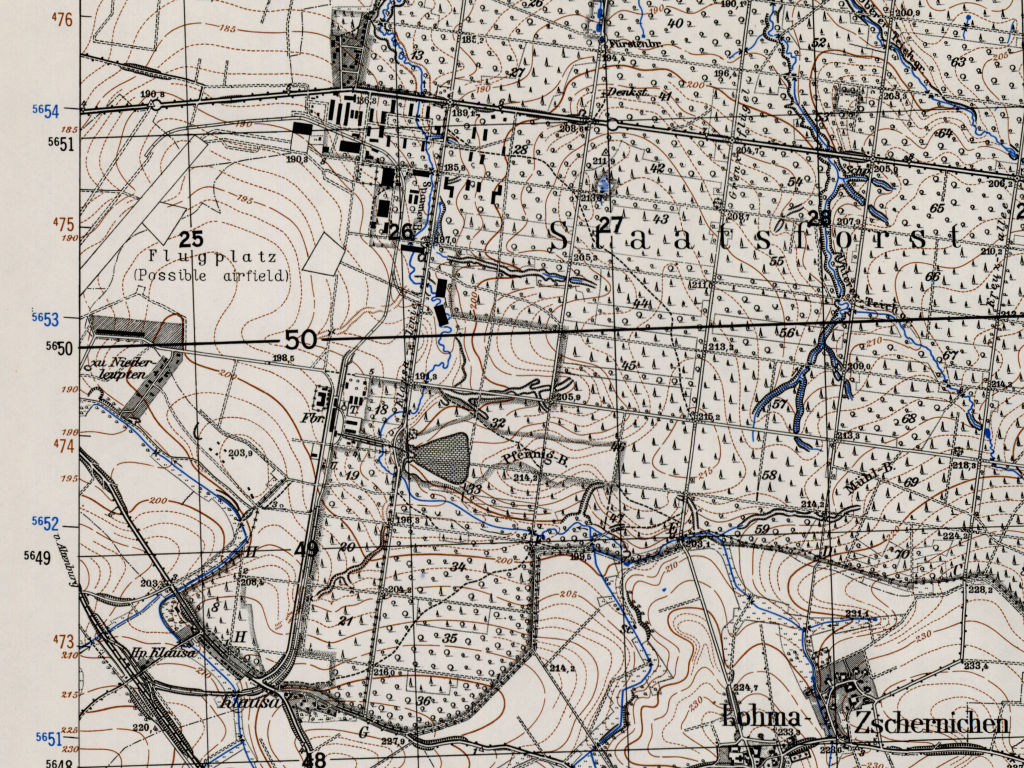
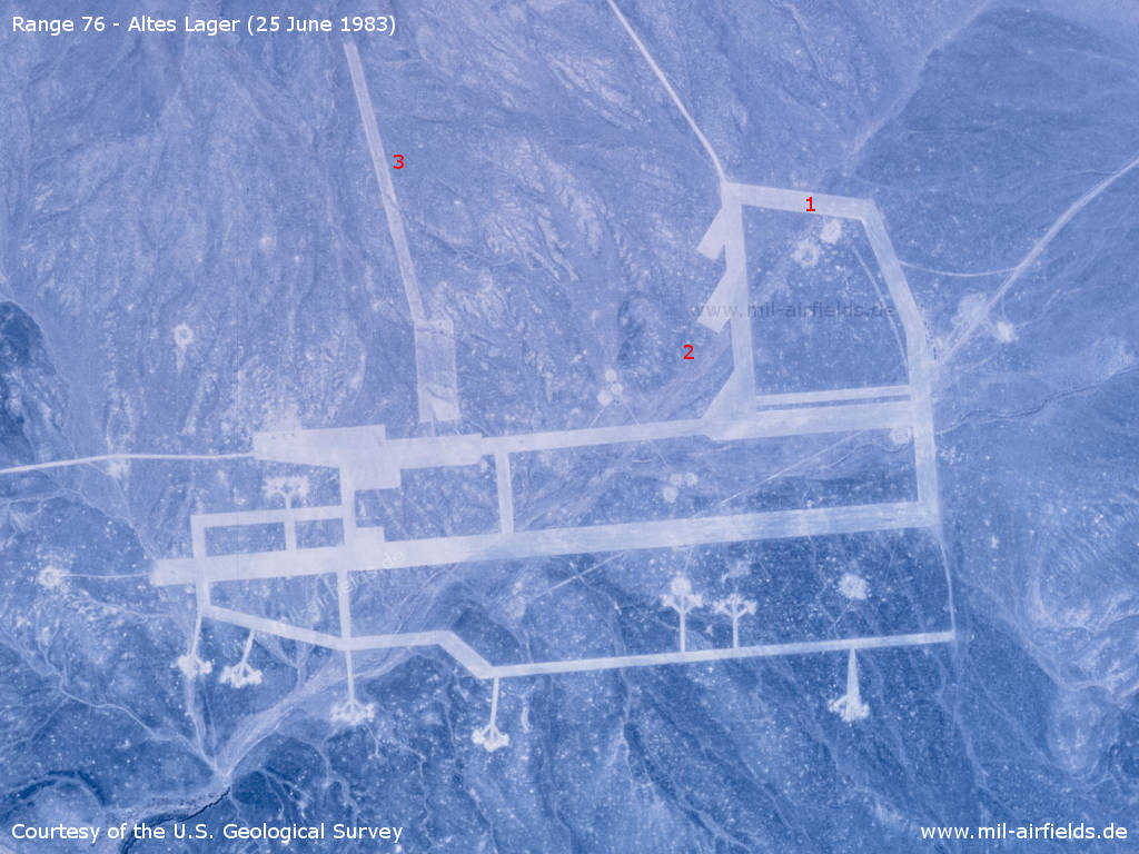
Image credits are shown on the respective target page, click on the preview to open it.
 Follow mil-airfields on Facebook