For historical information only, do not use for navigation or aviation purposes!
| Coordinates | N495114 E0083512 (WGS84) Google Maps |
| Elevation | 360 ft |
| Location indicator | EDES (1990) |
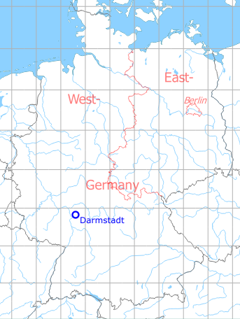
Germany during the Cold War Map
The history of the Cold War airfields: Darmstadt
Location of airfield
Griesheim
During World War II
Use
Airfield.
During the Cold War
Use
US Army airfield, closed 1993.
In the 1950s
Additional information
Airfield Survey in 1953
In 1953, survey tours took place in southern Germany to identify future air bases for the German Air Force. Old airfields were visited and assessed, if a field can be used, if technical facilities and housing are available und if an extension of the runway up to 2500 m or 3000 m is possible.
For Darmstadt-Griesheim was found: The airfield with 1500 m x 1000 m has a solid, but partially sketchy sod with minor bumps. The existing runway 085°/265° with a length of 870 m and a width of 21.5 m has a PSP surface and receives a new bituminous underfloor. The taxiways are okay. The field is occupied by 15 small US Army planes. An extension to 3000 m is possible only to the west, with minor earth movements.When doing so, the road from Griesheim to the municipal water works must be relocated and two aerial cables in the east must be rerouted.
In the 1960s
Radio communication
Tower: 118.0, 121.5, 37.6
(1963)
Telephone
800 - 765
(1963)
Airspace and procedures
Strict adherence to published traffic pattern is mandatory at Darmstadt AAF due to close proximity of other installations and German community. All aircraft will use south traffic patterns for runway 25, or at least 1/2 mile south of runway centerline.
Hours of operation:
Monday - Friday: 07:00Z - 11:00Z, 12:00Z - 16:00Z
Saturday: 07:00Z - 11:00Z
Sunday & holiday: on request.
Monday - Friday: 07:00Z - 11:00Z, 12:00Z - 16:00Z
Saturday: 07:00Z - 11:00Z
Sunday & holiday: on request.
(1963)
Installations
Crash truck available from 06:00Z to 17:00Z
(1963)
In the 1970s
Situation
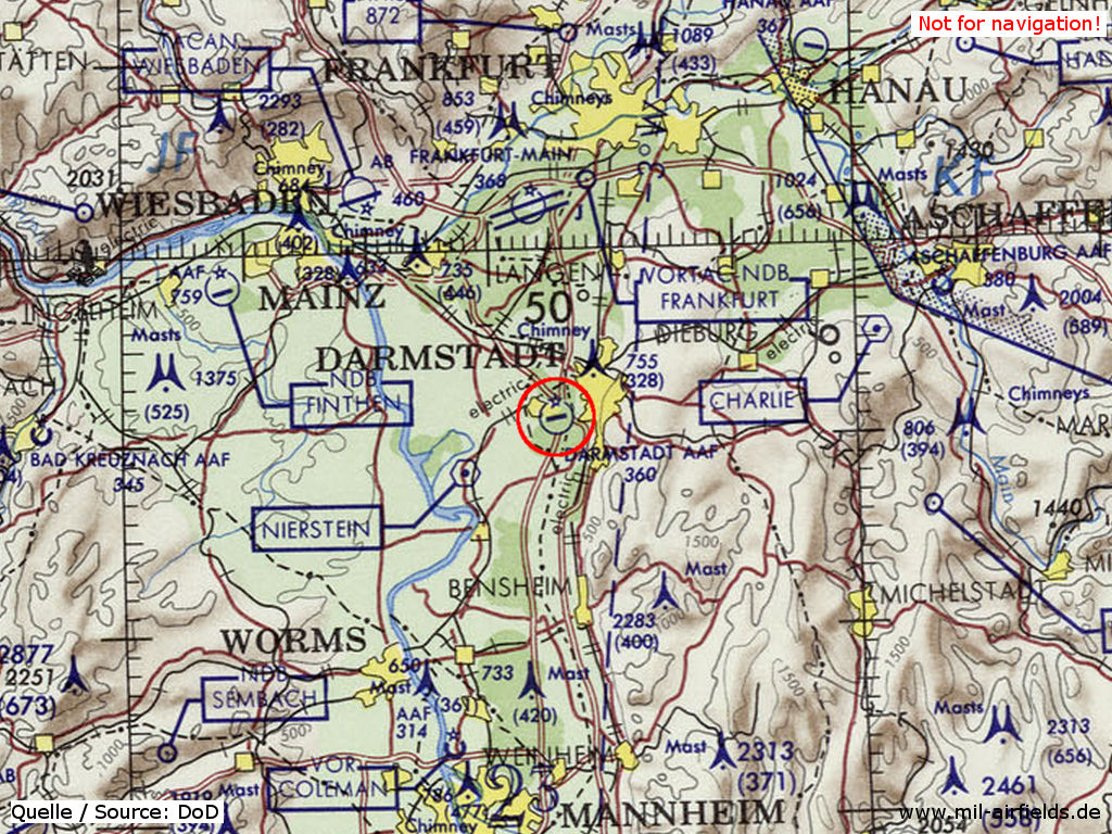
Darmstadt Army Airfield AAF on a map of the US Department of Defense from 1972 - (ONC E-2 (1972), Perry-Castañeda Library Map Collection, University of Texas at Austin /PCL MC/)
Overview
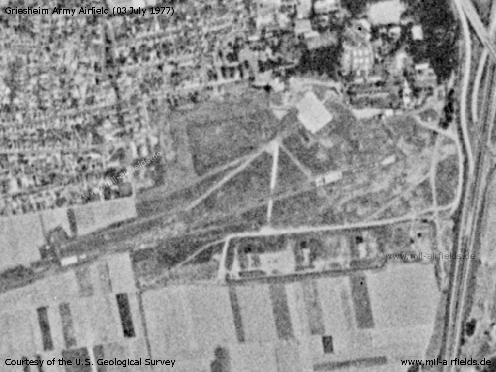
Darmstadt Army Airfield AAF on a US satellite image from 03 July 1977
Source: U.S. Geological Survey
Runways
Data for the year 1971:
- 07/25: 1097 m x 20 m Asphalt
Data for the year 1977:
First 600' of runway 25 are closed, except for emergencies.
Fixed-wing aircraft are prohibited from night landings.
Occasional civilian pedestrians and equipment crossing the runway.
It is unsafe to taxi off the runway and taxiways due to soft ground and large holes.
Telephone
2376-764/800/829
(1977)
In the 1980s and early 1990s
Situation
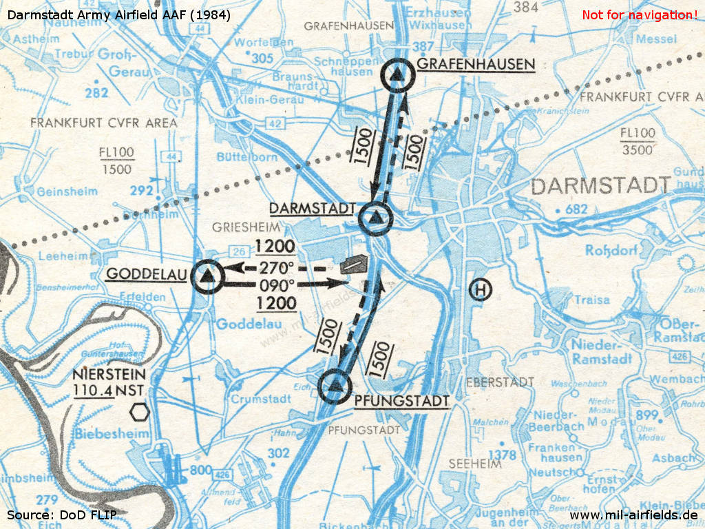
Visual approach and departure routes (1984)
Overview
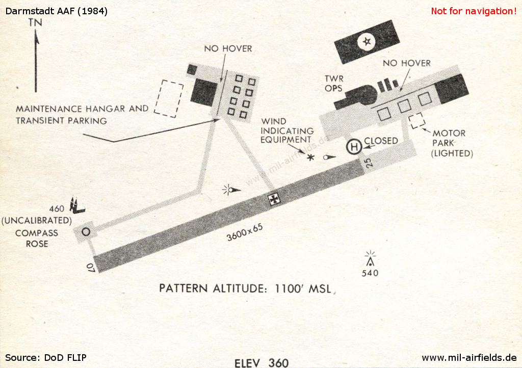
Airfield (1984)
Runways
Data for the year 1990:
- 07/25: 973 m x 21 m Asphalt
Telephone
ETS 348-5800/5831/5832
Units
159th Med Co (7th Med Com) 15 UH-60A (1990)
Installations
The airfield had an area of 90 ha.
Images
Pictures from 15 September 1982 taken during exercise Reforger '82. Source: DoD
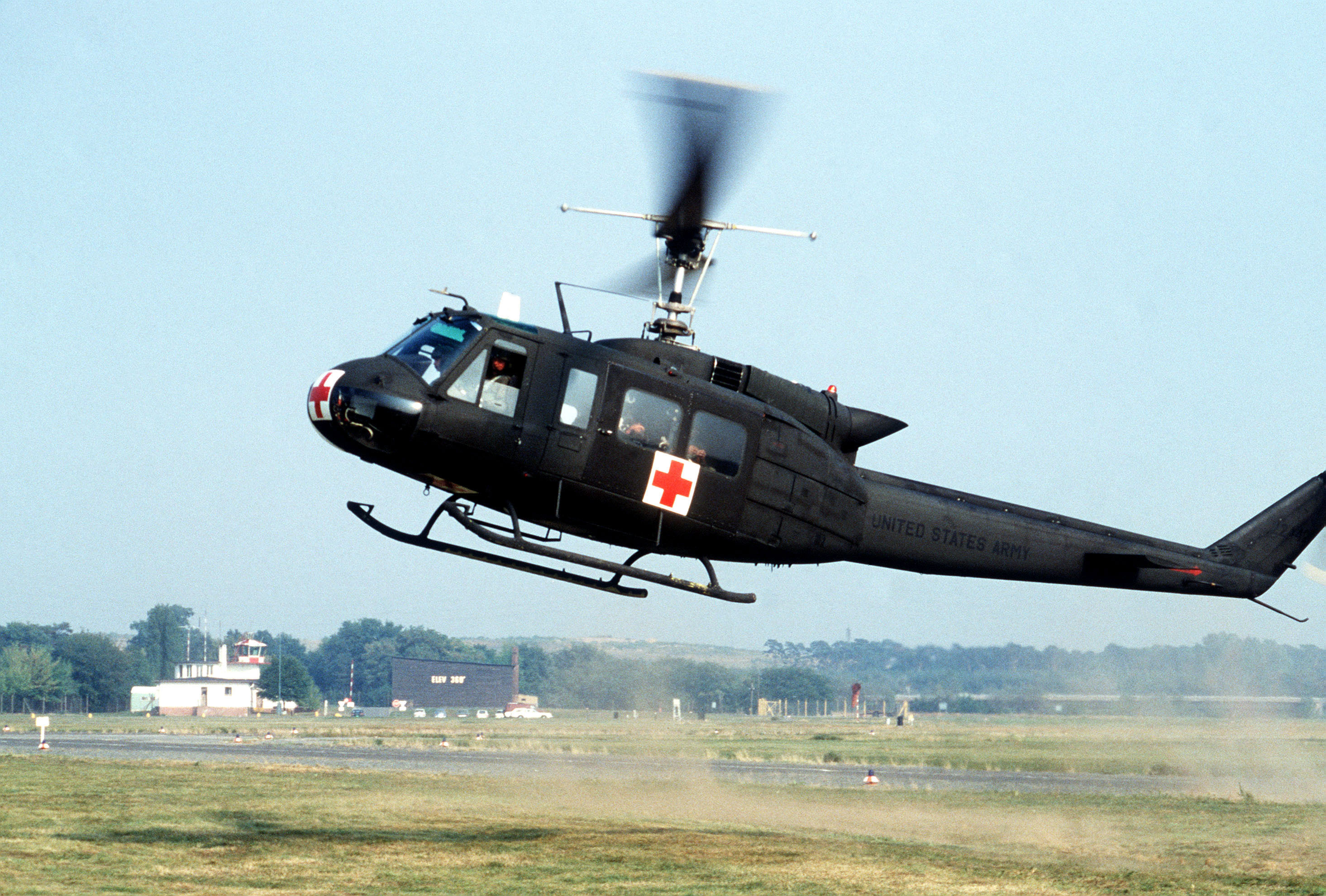
A helicopter UH-1 Iroquois landing to deliver "patients" to the 32nd Combat Support Hospital during exercise Reforger '82. Scene Camera Operator: Hackman
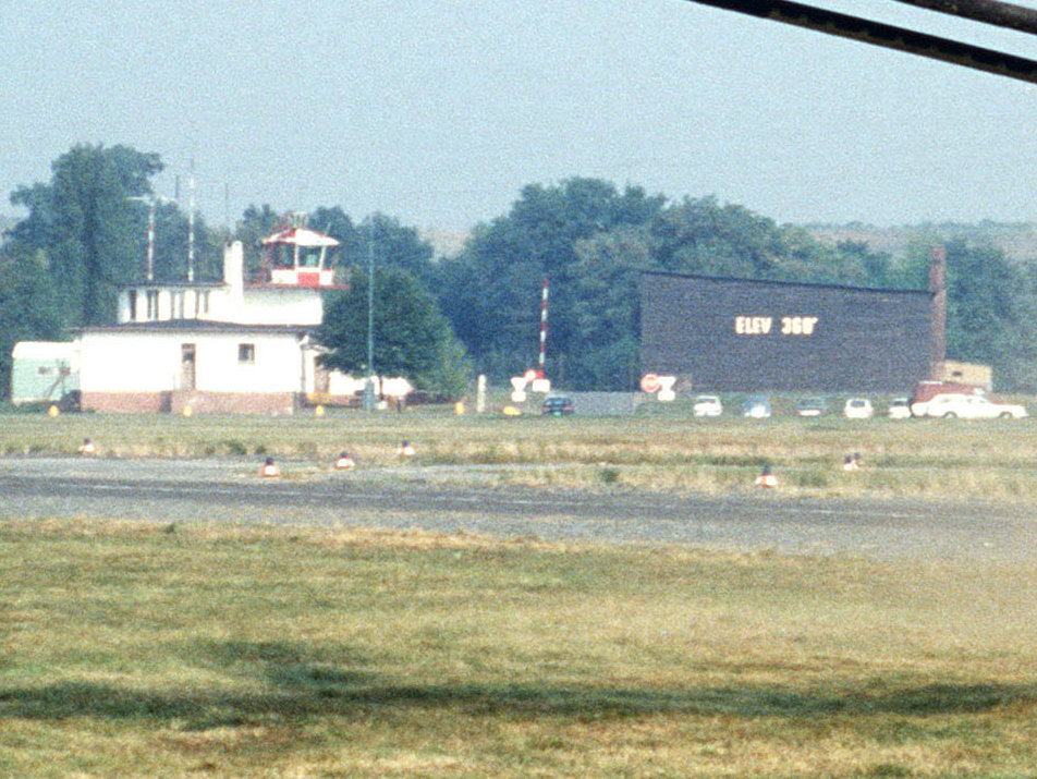
Enlargement: Control tower
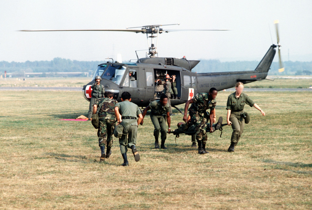
Medics from the 32nd Combat Support Hospital carry a "patient" on a litter, from a UH-1 Iroquois helicopter to a Mobile Army Surgical Hospital (MASH). Scene Camera Operator: Lynchard

Aerial view of the 32nd Combat Support Hospital. Scene Camera Operator: Hackman
Today
Use
Closed.
Airfields in the vicinity
- 355°/20km Frankfurt/M: Rhein/Main Air Base, Airport
- 268°/21km Dexheim: Anderson Barracks Army Heliport AHP (Army Heliport AHP)
- 219°/27km Worms: US Army Heliport AHP (US Army Heliport AHP)
- 004°/29km Frankfurt/M: Rebstock Airport
- 320°/29km Wiesbaden: Air Base, Army Airfield (Erbenheim)
- 068°/30km Babenhausen: Army Airfield
Categories
Military Airfields GermanyMilitary Airfields in former West GermanyUS Army Airfields and Heliports in GermanyRecommended
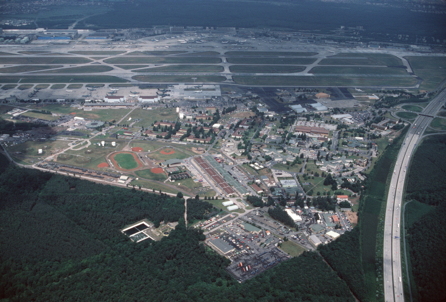
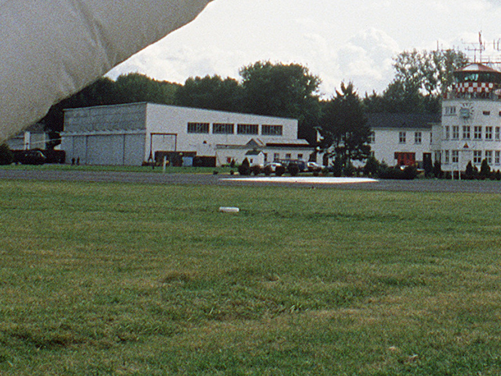
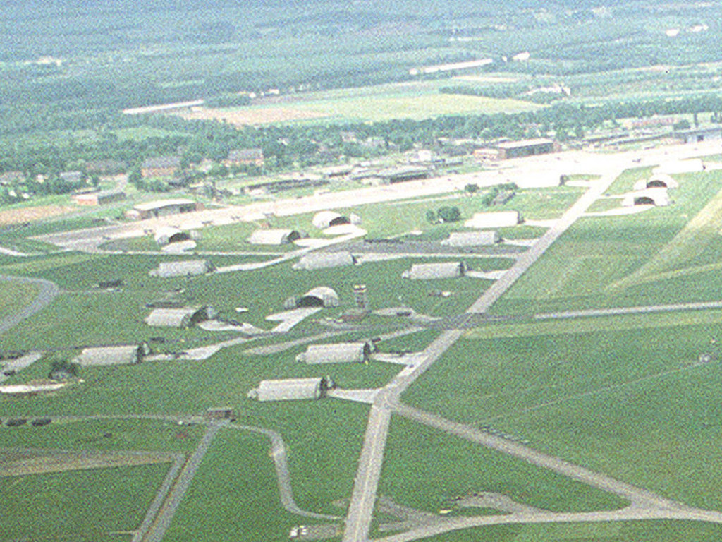
Image credits are shown on the respective target page, click on the preview to open it.
 Follow mil-airfields on Facebook