For historical information only, do not use for navigation or aviation purposes!
| Coordinates | N520000 E0120845 (WGS84) Google Maps |
| Elevation | 269 ft |
| Former East Germany (GDR) | District of Magdeburg |
| Federal state | Sachsen-Anhalt (Saxony-Anhalt) |
| Location indicator | EDUZ |
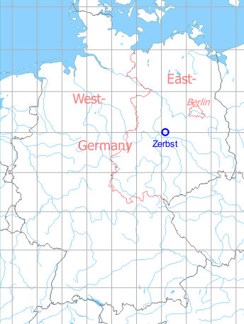
Germany during the Cold War Map
The history of the Cold War airfields: Zerbst
Location of airfield
About 5 km northeast of the center of Zerbst.
During World War II
Use
Luftwaffe air base.
Situation
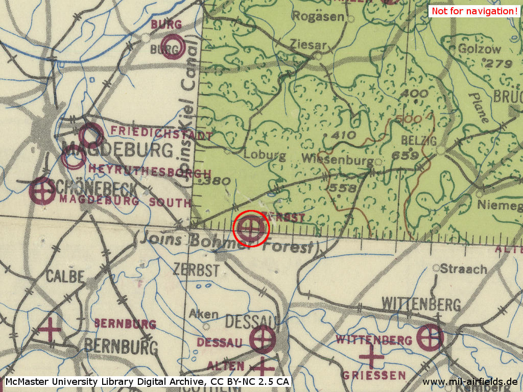
Zerbst Air Base in World War II on a US map from 1943
Source: McMaster University Library Digital Archive, License: Creative Commons Attribution-NonCommercial 2.5 CC BY-NC 2.5 CA
Overview
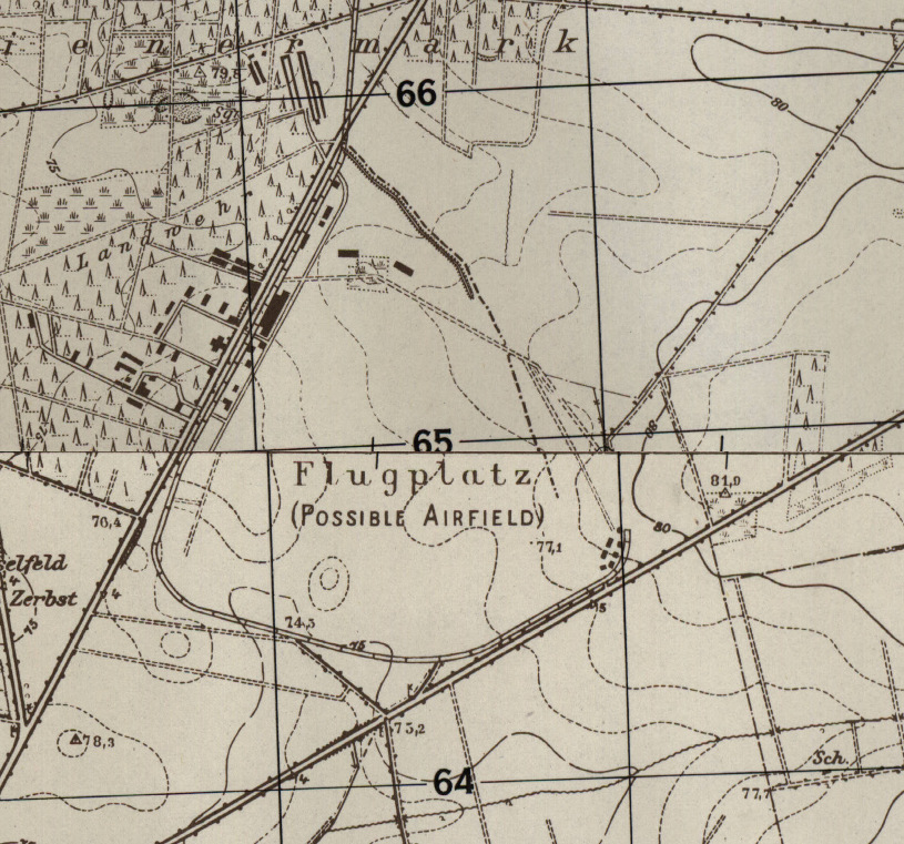
Zerbst airfield on a US map from 1952
Source: AMS M841 GSGS 4414, Courtesy Harold B. Lee Library, Brigham Young University
During the Cold War
Use
Soviet air base.
In the 1950s
Units
Units in 1954
- Headquarters Soviet fighter division
- Soviet fighter regiment (P. O. Box of the technical unit: 62 512),
- Soviet reconnaissance regiment with Ilyushin Il-10
- A total of 20 MiG-15/MiG-15U were counted at the airfield.
Source: BND/Bundesarchiv B 206/3033
(For the P. O. Box numbers the digits 3 and 5 may be confused, because they are difficult to distinguish in the source document)
(For the P. O. Box numbers the digits 3 and 5 may be confused, because they are difficult to distinguish in the source document)
In the 1960s
Overview
Satellite image 03 May 1969
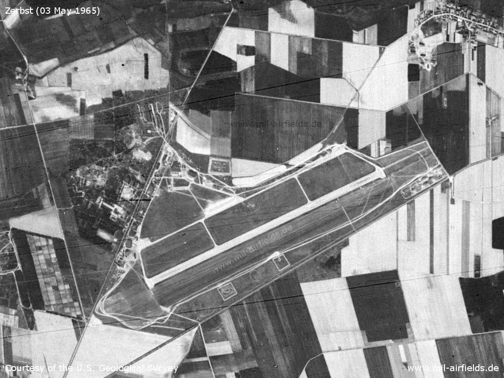
Source: U.S. Geological Survey
Satellite image 06 February 1969
In comparison with the 1965 image, the following changes are visible:
- Extension of the central flight line to the west
- Redesign of the area south of the runway
- There are more aircraft revetments recognizable
- Construction of the ammunition depot in the northwest
- Redesign of the dump in the middle of the field on the north side
- Construction of a SAM site approx. 6 km west of the airfield
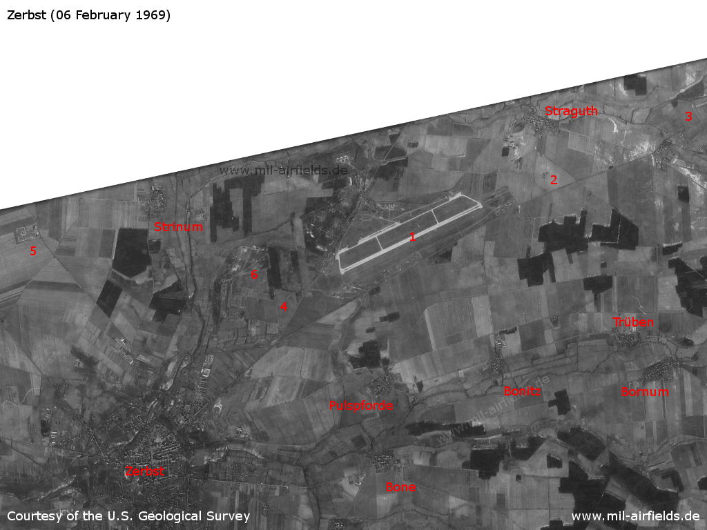
1: Air base; 2: inner radio beacon east; 3: outer radio beacon east; 4: inner radio beacon west; 5: surface-to-air missile (SAM) site; 6: training area. Places: Bone, Bonitz, Bornum, Pulspforde, Straguth, Strinum, Trüben, Zerbst.
Source: U.S. Geological Survey
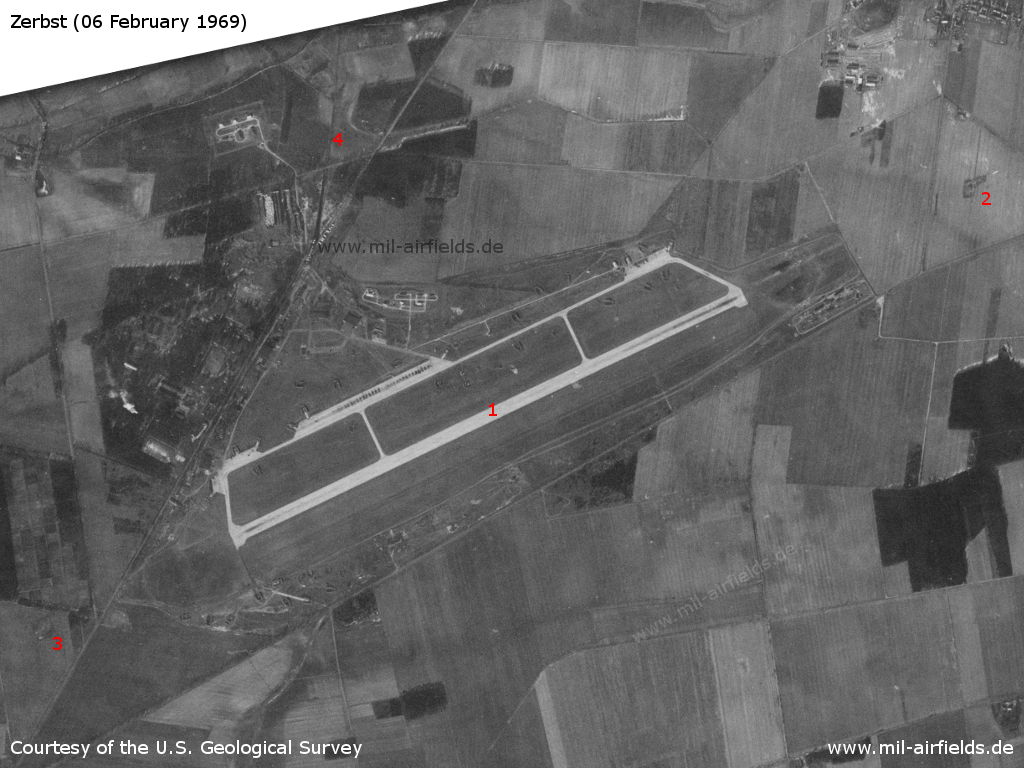
1: Airfield; 2: inner radio beacon east; 3: inner radio beacon west; 4: railway siding from Lindau.
Source: U.S. Geological Survey
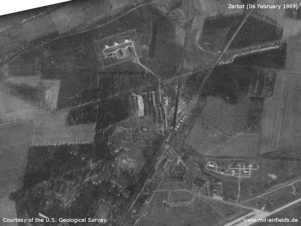
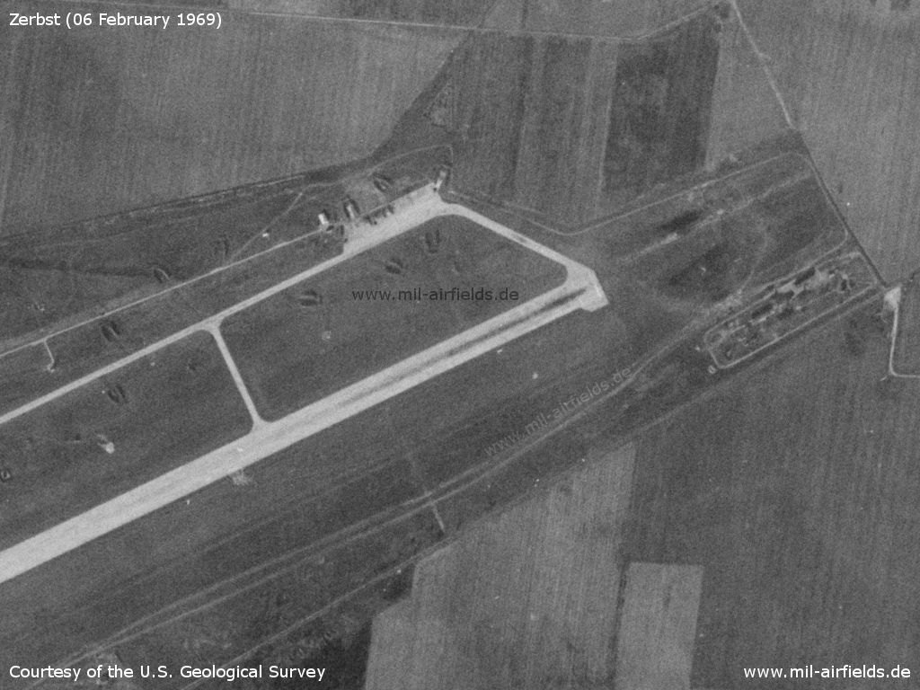
Northern part of the field with ammunition depot
Source: U.S. Geological Survey
Western part
Source: U.S. Geological Survey
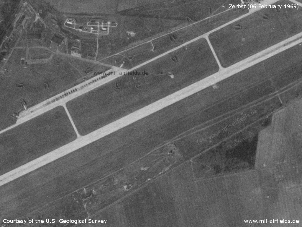
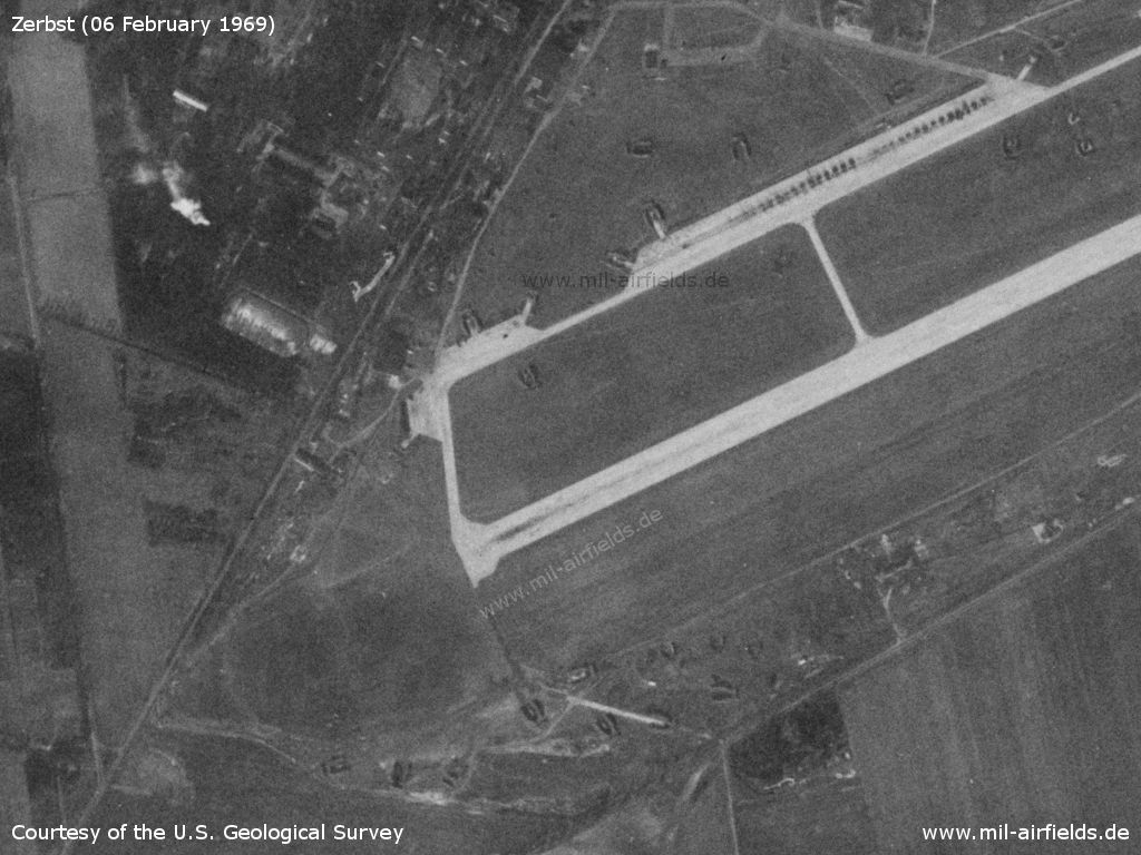
Central part, flight line
Source: U.S. Geological Survey
Eastern part
Source: U.S. Geological Survey
1: Inner radio beacon east
Source: U.S. Geological Survey
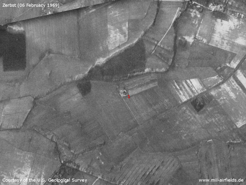
1: Outer radio beacon east
Source: U.S. Geological Survey
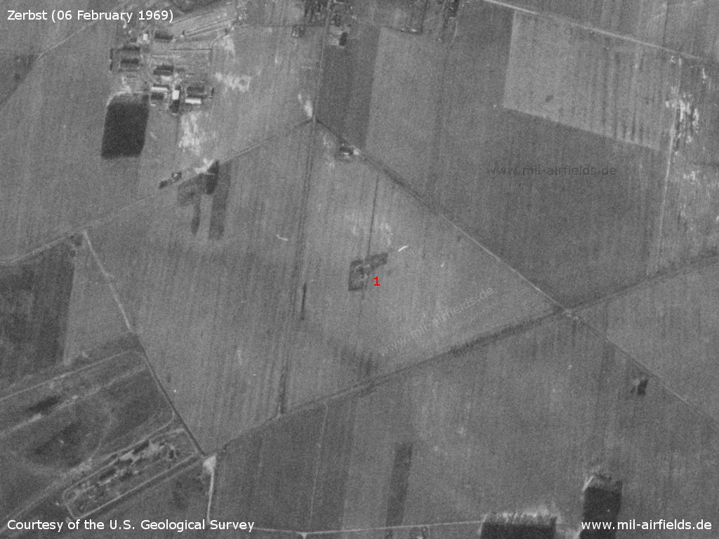
1: Inner radio beacon west
Source: U.S. Geological Survey
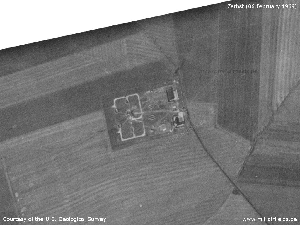
Surface-to-air missile (SAM) site
Source: U.S. Geological Survey
History
- 1966
Observation by the US Military Liaison Mission: "New and improved air defense equipment was introduced into aircraft, ordnance, and electronic inventories. The most significant was the twin-jet (Yak-28P) FIREBAR interceptor aircraft with ANAB air-to-air missiles. This was the first time the FIREBAR was observed deployed outside the USSR. To date only the Zerbst air defense regiment is known to be equipped with this new fighter." (Source: USMLM Unit History 1966) - February 1966
Observation by the US Military Liaison Mission: "The deployment of an air defense regiment from Zerbst to Koethen was observed" (Source: USMLM Unit History 1966)
Images
Yak-28P FIREBAR, probably from Zerbst, in 1966 Source: USMLM History 1966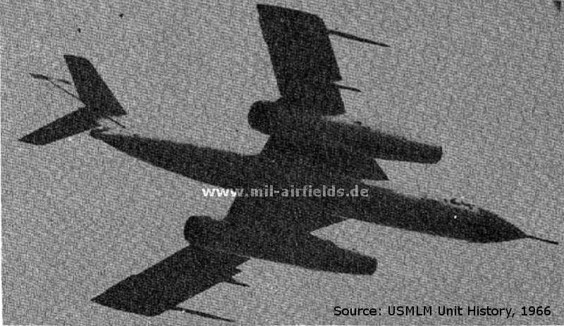
In the 1970s
Situation
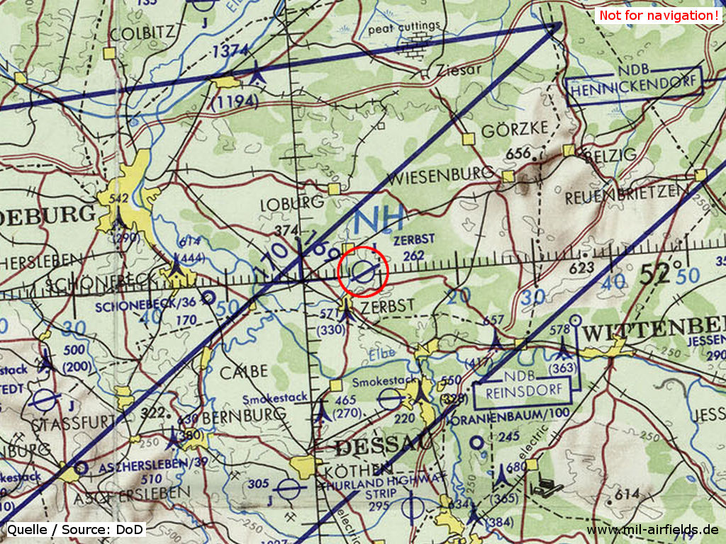
Zerbst Air Base on a map of the US Department of Defense from 1972 - The blue lines mark the allied air corridors from and to Berlin. Zerbst is located below the southern corridor
Source: ONC E-2 (1972), Perry-Castañeda Library Map Collection, University of Texas at Austin
Overview
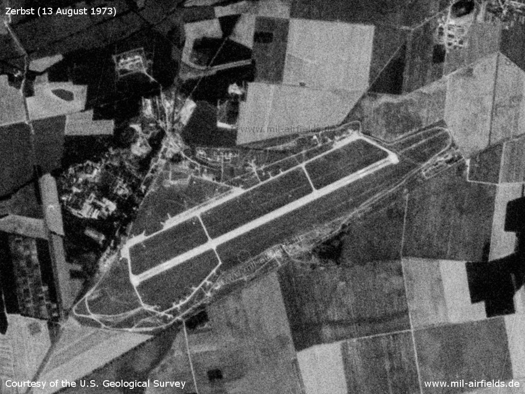
Zerbst Air Base, 13 August 1973 - In comparison with the previous pictures, closed aircraft shelter have been established. In the south a special schelter loop was built.
Source: U.S. Geological Survey
In the 1980s and early 1990s
Runways
- 07/25: 2500 m x 60 m Concrete
- 07/25: 2500 m x 75 m Grass
Radio beacons
- LOM 25: 708 "KJ", 3890m
- LMM 25: 345 "K", 1270m
- LOM 07: 708 "ZB", 5100m
- LMM 07: 345 "Z", 950m
- RSBN: Channel 17
- PRGM: Channel 20
Radio communication
Call sign: KARJETNIJ (КАРЕТНЫЙ)
Units
1990: 35 IAP (MiG-29, MiG-29UB, MiG-23UB)
Today
Use
General aviation (EDUZ).
Links
- http://www.sachsenschiene.net/bunker/flp/flp_34.ht... - Sachsenbunker
Bibliography
- Ries, Karl; Dierich, Wolfgang: "Fliegerhorste und Einsatzhäfen der Luftwaffe" Motorbuch Verlag Stuttgart, 1993 - Allied Map
- United States Military Liaison MissionUnited States Military Liaison Mission: "Unit History 1966Unit History 1966"
- Freundt, Lutz: "Sowjetische Fliegerkräfte in Deutschland 1945-1994, Band 3" Edition Freundt Eigenverlag, Diepholz 1999 - Description, pictures, aerial pictures
- Freundt, Lutz (Hrsg.), Büttner, Stefan: "Rote Plätze - Russische Militärflugplätze in Deutschland 1945 - 1994" AeroLit Verlag, 2007 - Description, pictures, aerial pictures
- Haderer, Toni: "Der Militärflugplatz Zerbst" Extrapost -Verlag für Heimatliteratur Zerbst, 2002
Related topics
Airfields in the vicinity
- 264°/14km Flötz: Agricultural Airfield (Gödnitz, Zerbst)
- 002°/16km Groß Lübars: Airfield (Altengrabow)
- 026°/16km Schweinitz: Airfield
- 170°/19km Dessau: Airfield (Alten, Junkers-Flugzeugwerk)
Categories
Military Airfields GermanyMilitary Airfields in former East GermanyAirfields of the Soviet Forces in GermanyRecommended

Image credits are shown on the respective target page, click on the preview to open it.
 Follow mil-airfields on Facebook