Erfurt: Bindersleben Airport
Fliegerhorst Erfurt-Bindersleben, Аэродром Эрфурт, Flughafen Erfurt-Weimar
For historical information only, do not use for navigation or aviation purposes!
| Coordinates | N505848 E0105725 (WGS84) Google Maps |
| Elevation | 1036 ft |
| Former East Germany (GDR) | District of Erfurt |
| Federal state | Thüringen (Thuringia) |
| Location indicator | EDXE, ETEF (-1995), EDDE (1995-) |
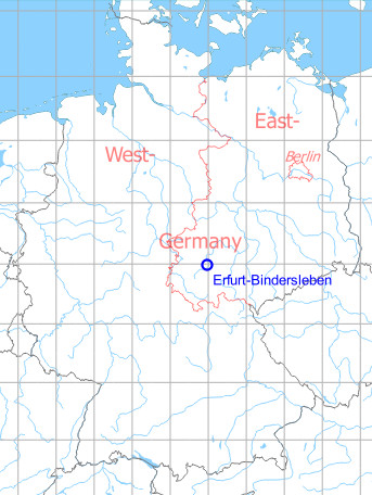
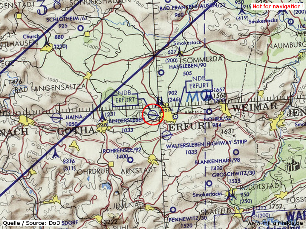
Germany during the Cold War Map
The history of the Cold War airfields: Erfurt-Bindersleben
Contents
Page 2: Erfurt Airport, East Germany/GDR, 1945 - 1990 ← you are here
During the Cold War
Use
Soviet military airfield, later civilian airport; sometimes military use during exercises.
History
- 1949
The field is unoccupied, but used for exercises. (Source: CIA) - July/August 1950
The airfield is used for airborne exercises. (Source: CIA) - 1952
Construction of a runway with Pierced Steel Planks (PSP). - 1952
Stationing of a Soviet alert squadron with 4 to 6 aircraft MiG-15. - June/July 1953
During an airborne landing exercise, Soviet transport aircraft and cargo gliders make extensive flight movements. (Source: CIA) - October 1953
Temporary deployment of Soviet ground attack regiments from Brandenburg-Briest und Brandenburg Neuendorf during an exercise. (Source: CIA) - Fall 1954
During an exercise, , Il-10 ground attack aircraft and other jet aircraft are temporarily stationed in Erfurt. (Source: CIA) - May 1955
There are additional MiG-15/MiG-17 at the field. (Source: CIA) - 1957/58
The flying units of the Soviet Air Force leave the airfield and Erfurt is handed over to GDR authorities. - 24 May 1958
During an exercise, 2 MiG planes from the Altenburg fighter regiment, 13 MiGs from Großenhain and 25 MiGs from Merseburg land on the field in the morning. All aircraft leave the airfield again in the afternoon. (Source: CIA) - 1976
Im Jahr 1976 werden in Erfurt 96.000 Passagiere abgefertigt. - 1980
Termination of the East German domestic air traffic - 11.11.1985
Sitzung des Nationalen Verteidungsrates: Für den Flughafen Erfurt ist die Verlängerung der Start- und Landebahn mit 20 Mio M im Plan der Bauinvestitionen enthalten, jedoch ohne Termin. (Quelle: Bundesarchiv) - 1988
Stationierung des Interflug-Betriebsteils Waldflug auf dem Flughafen Erfurt. - 1988
Installation of an instrument landing system (ILS) of the Soviet type SP-80
In the 1950s
Overview
Image source, unless otherwise noted: GDI-Th, Freistaat Thüringen, TLVermGeo, www.geoportal-th.de, Datenlizenz Deutschland – Namensnennung – Version 2.0, www.govdata.de/dl-de/by-2-0
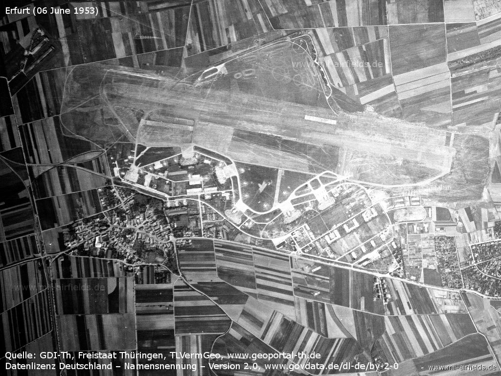
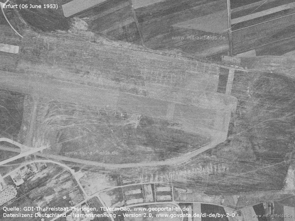
The Soviet air base Erfurt-Bindersleben on 06 June 1953
In the north the remains of the aircraft revetments are still visible.
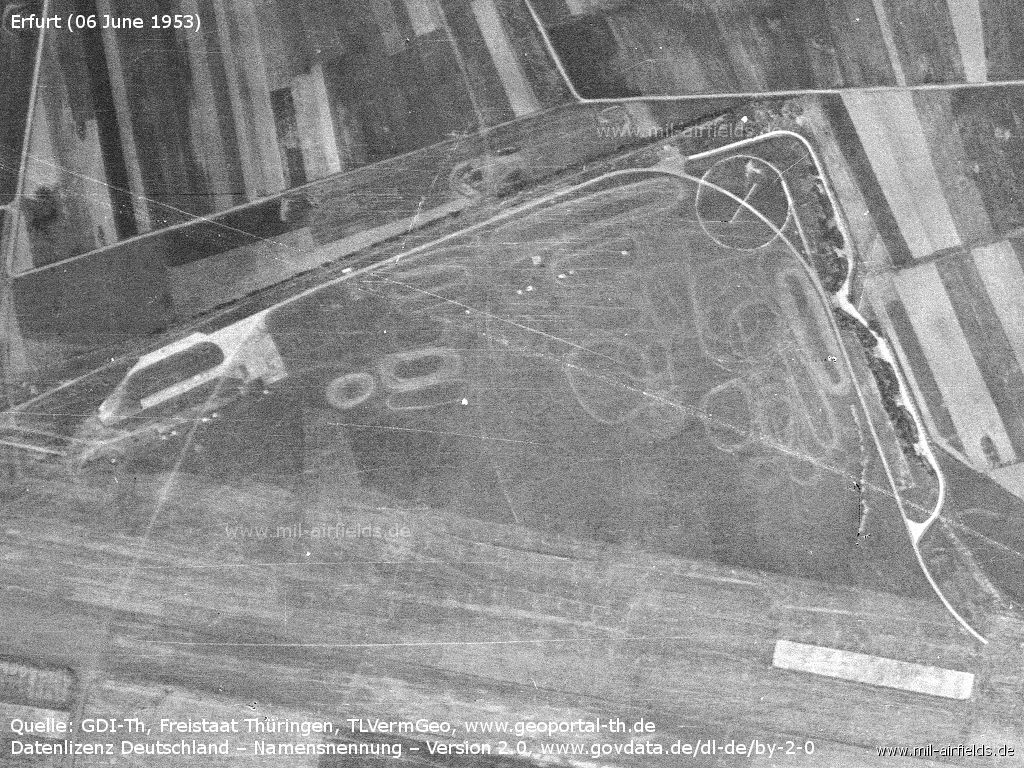
In the northern tip you can find the target cross, characteristic for Soviet airfields at that time.

Southwestern part - The halls have been demolished. However, new aircraft revetments have been built along the taxiway.
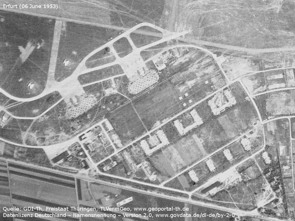
Southeastern part - Four Soviet MiG-15 of an alert squadron stand on the apron of the former easternmost hangar.
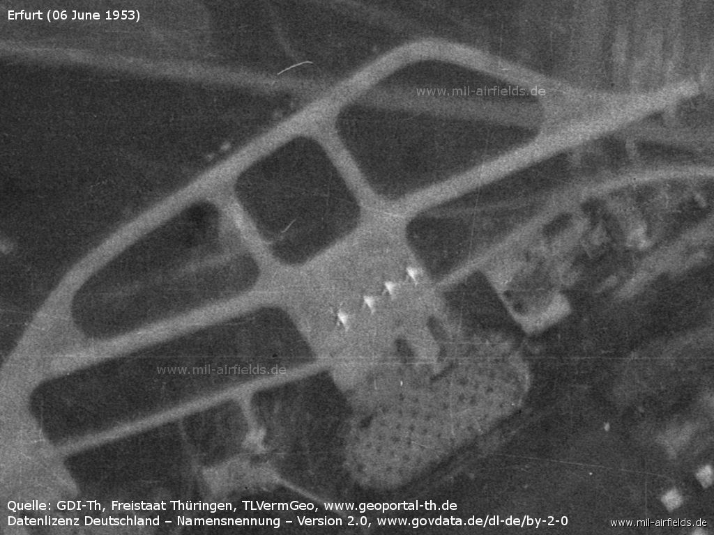
Enlargement of a different image from the same day: Four Soviet fighter aircraft
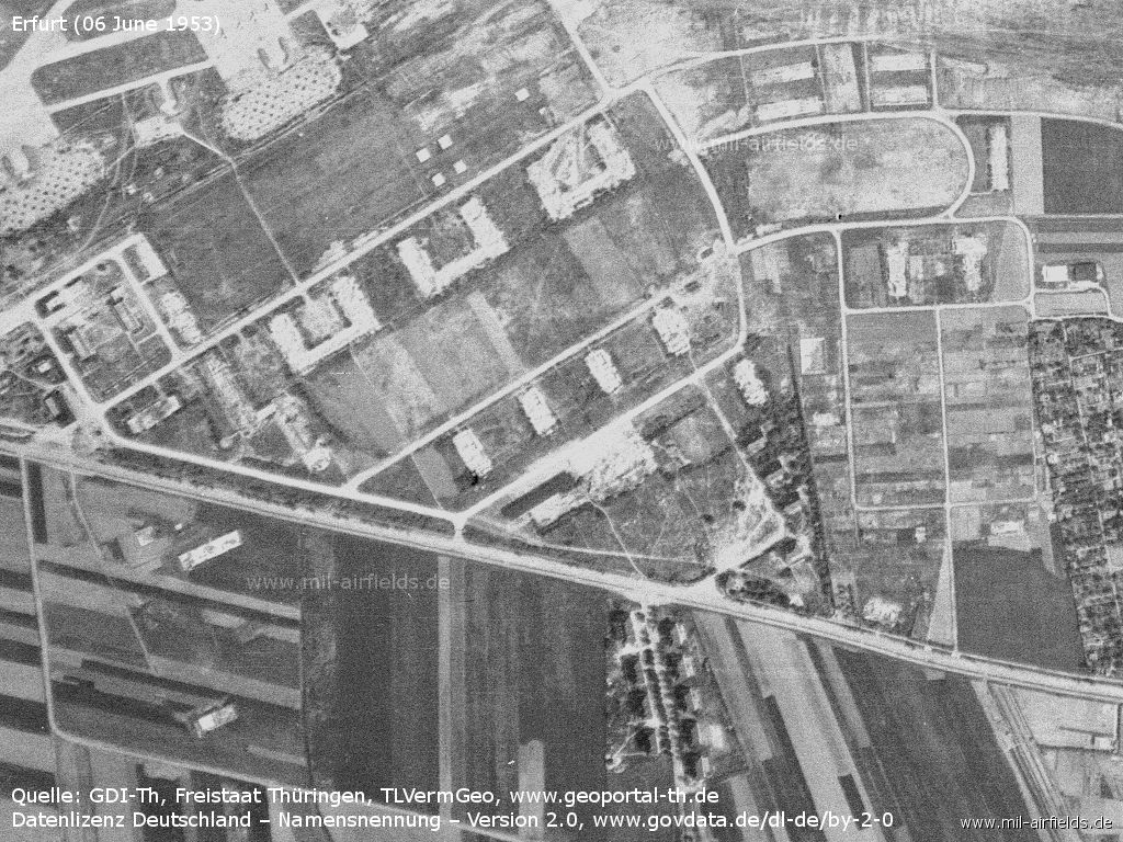
Only a few buildings of the former barracks remain - While the barracks south of the Binderslebener Landstraße were demolished (left), the buildings further east survived.
Eastern beginning of the runway
Units
1954
- Soviet alert unit of the Merseburg fighter division
- A total of 4 MiG-15/MiG-15U were counted at the airfield.
Source: BND/Bundesarchiv B 206/3033
- A total of 4 MiG-15/MiG-15U were counted at the airfield.
Source: BND/Bundesarchiv B 206/3033
Images
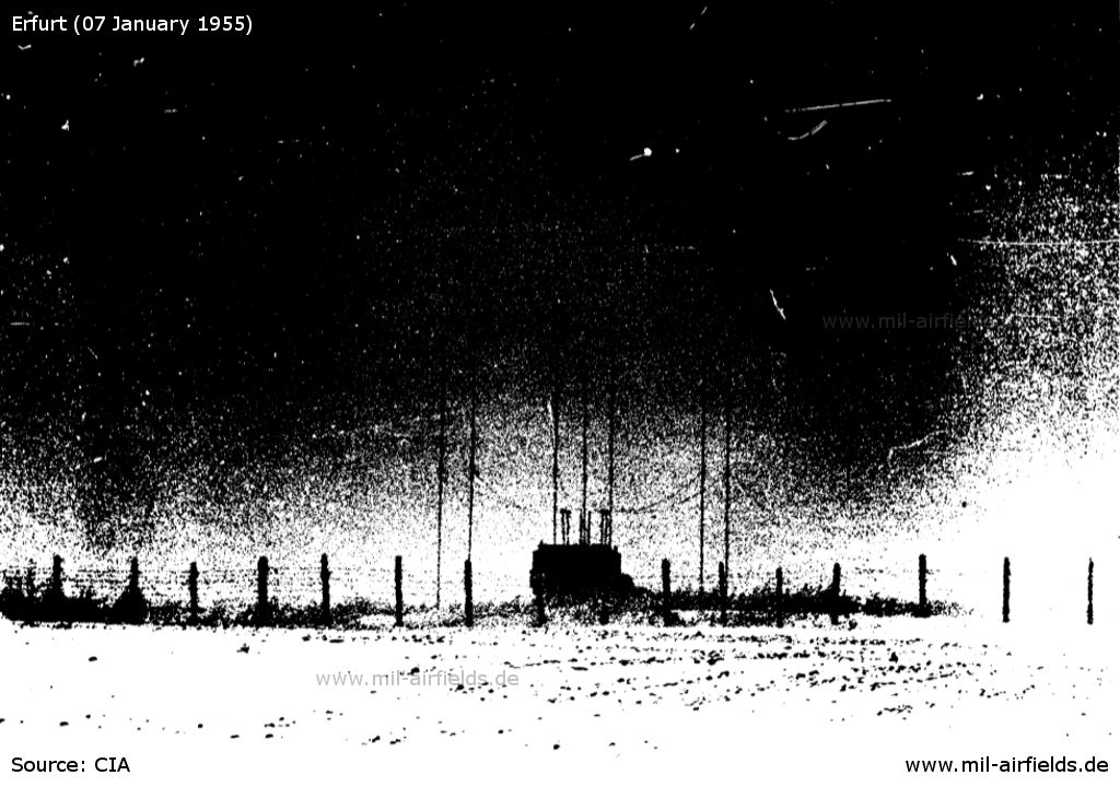
Already in spring 1954 an interesting Soviet direction finder (Adcock?) came to Erfurt. - It stood south of the eastern beginning of the runway and was photographed on 07.01.1955 by an agent for the CIA from 400 m distance.
Source: CIA
In the 1960s
Overview
1965
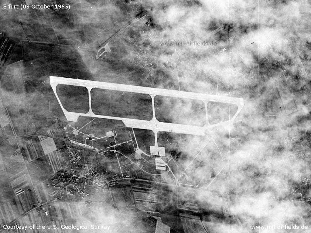
US satellite picture from 03 October 1965
Source: U.S. Geological Survey
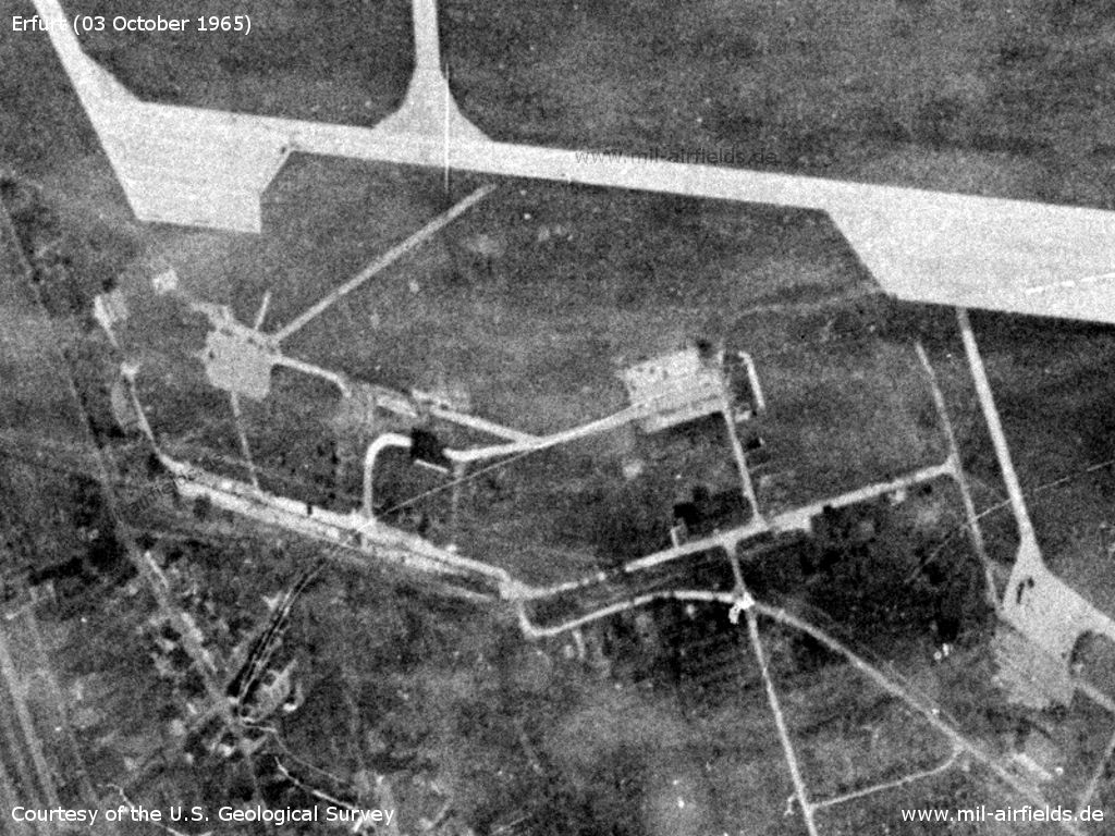
Southwest area - The basic structures of the old Luftwaffe air base with the hangar aprons are still recognizable.
Source: U.S. Geological Survey
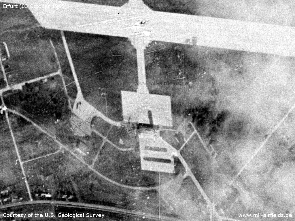
Southern part a with small apron, terminal and control tower
Source: U.S. Geological Survey
1967
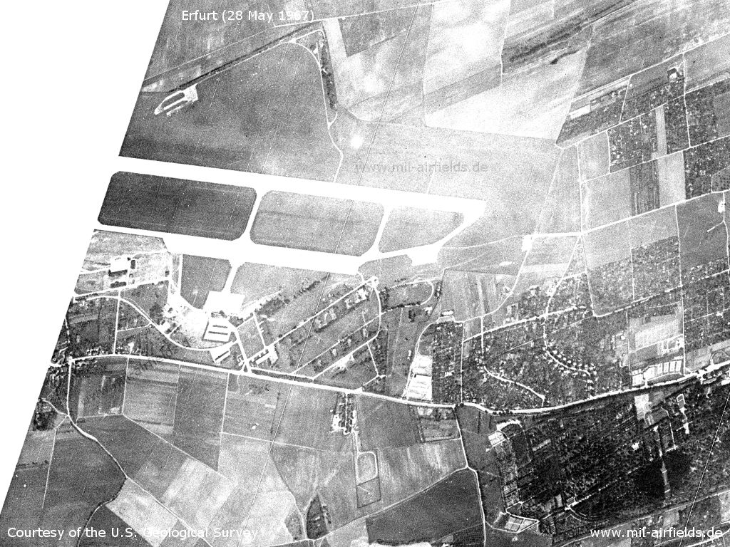
The aerodrome on 28 May 1967
Source: U.S. Geological Survey
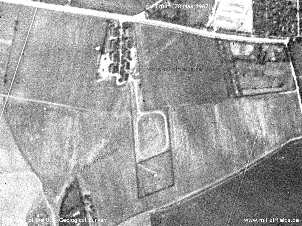
Enlargement: The Soviet direction finder - The fencing around the area and the various sections are clearly visible. At the top at the road is the barracks area. The area surrounded by a path in the middle could be an antenna field. The area below could be a circular antenna with a building in the centre that can be reached via a path from the top left.
Source: U.S. Geological Survey
1969
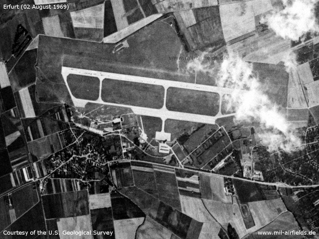
The airport on 02 August 1969
Source: U.S. Geological Survey
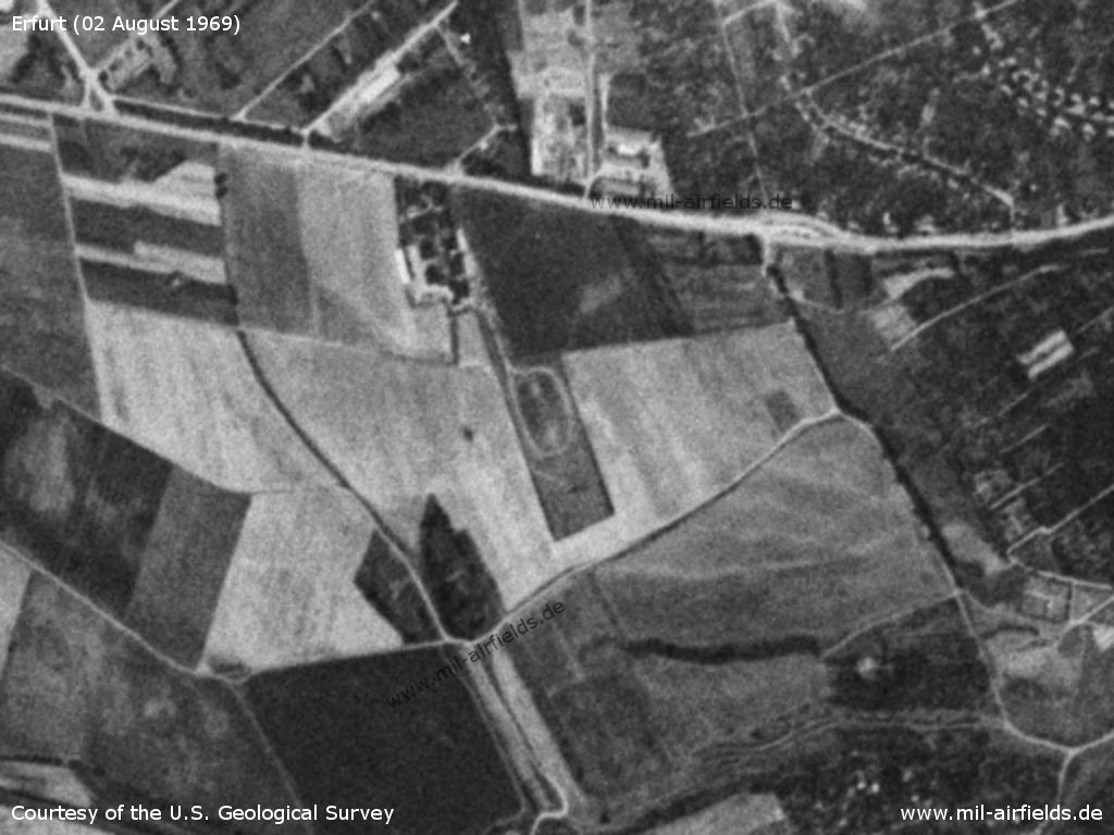
Enlargement: The Soviet direction finder
Source: U.S. Geological Survey
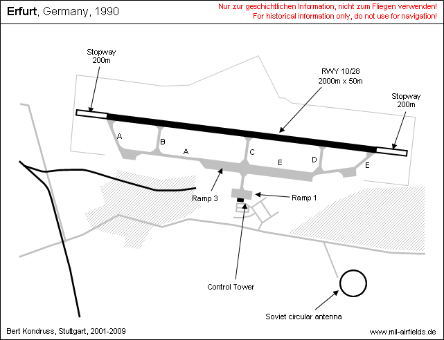
Runways
- 10/28: 2000 m x 50 m Concrete
Helicopter landing area: on taxiway E, 200 m east of intersection with taxiway C.
Taxiways, aprons
Taxiways: Concrete, width 18 m.
Radio beacons
- LMM 28: 330 kHz "R", 280°/1,02 km zur threshold runway 28
- KGSP 28: 110,3 / 335,0, Glide path angle 2.7°
- LOM 28: 410 kHz "RF", 280°/7,39 km to threshold runway 28
Communication
- Erfurt Tower Shortwave: 3023,5 kHz; VHF: 124.1, 119.7 MHz
- Erfurt Homer (direction finder) 124.1, 119.7
The direction finder was located in the northern tip of the triangular bulge of the airfield to the north.
Weather station
The meteorological station at Erfurt Airport had the index number 10554.
In the 1970s
Situation
Erfurt Bindersleben Airport on a map of the US Department of Defense from 1972 - The blue lines mark the southern corridor from and to Berlin
Source: ONC E-2 (1972), Perry-Castañeda Library Map Collection, University of Texas at Austin
Overview
March 1970
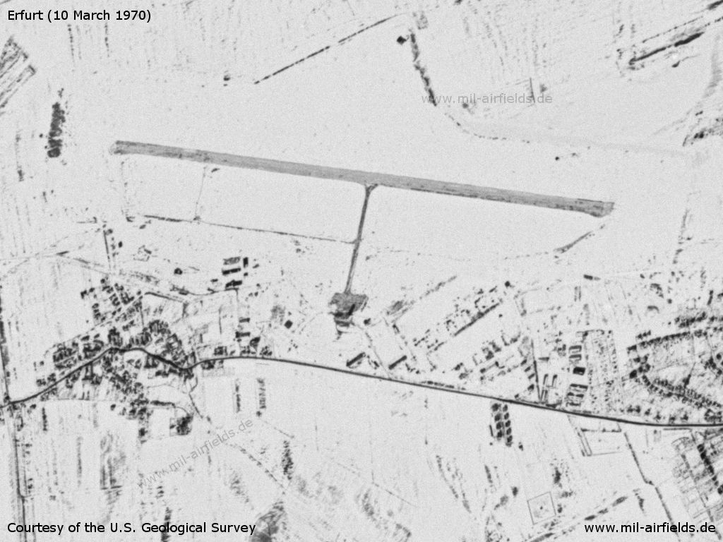
10 March 1970 - There's snow, only the taxiway between the runway and the apron is cleared.
Source: U.S. Geological Survey
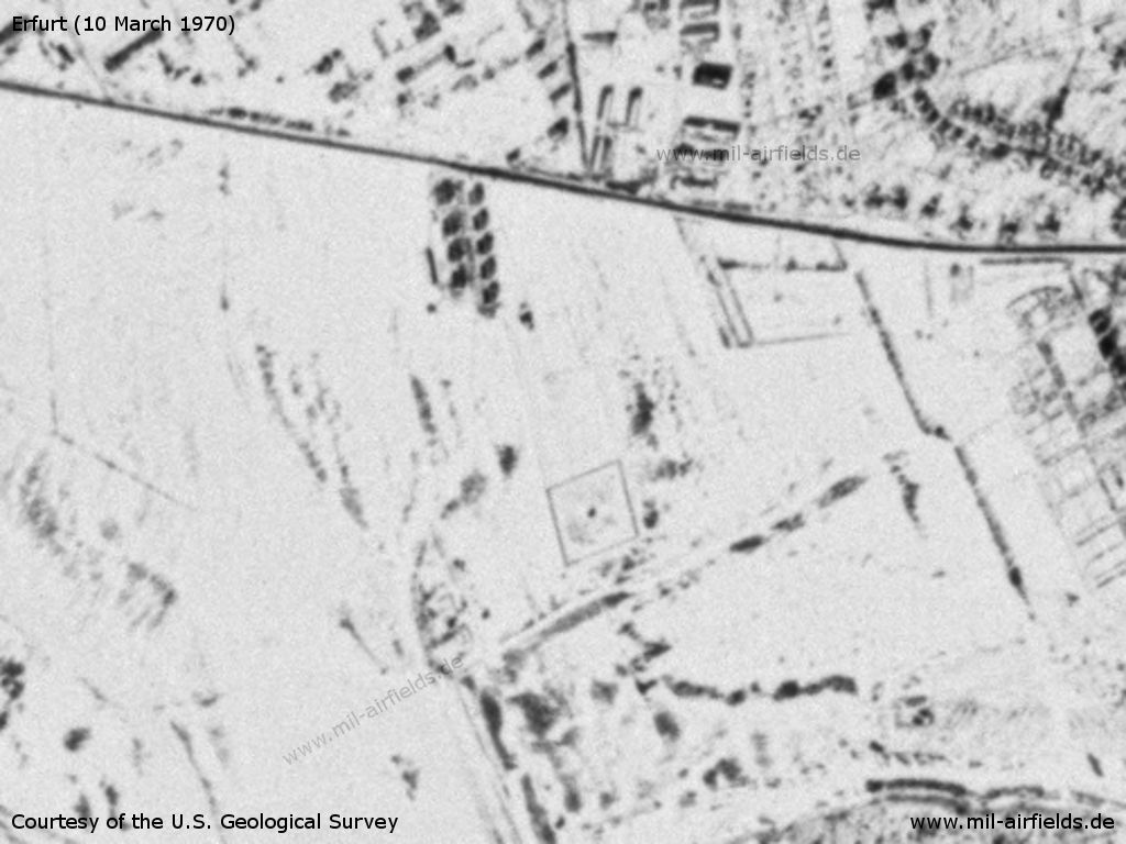
The Soviet direction finder - Now only the fence around the probably circular antenna in the south is visible.
Source: U.S. Geological Survey
November 1970
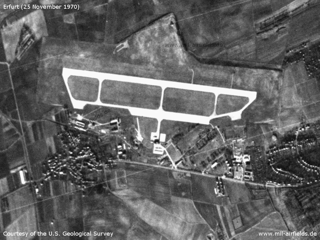
Erfurt Bindersleben Airport on a US satellite image from 25 November 1970 - The image is a little bit distorted.
Source: U.S. Geological Survey
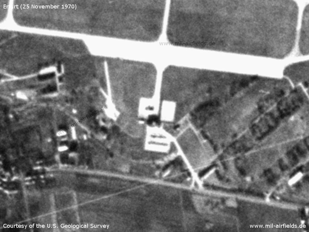
Enlargement - The dark area in the center of the picture is the terminal and the control tower with shadows. To the north of it is the apron, on which apparently there is an airplane.
Source: U.S. Geological Survey
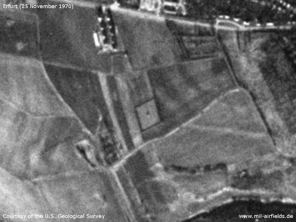
Area southeast of the field. - The square object could already be a direction finder, but smaller than in the 1980s.
Source: U.S. Geological Survey
1976
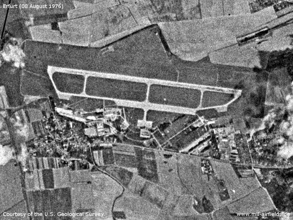
The airport on 08 August 1976
Source: U.S. Geological Survey
Runways
- 10/28: 2000 m x 50 m
- 10/28: 1200 m x 100 m Gras Emergency strip north of main runway
Images
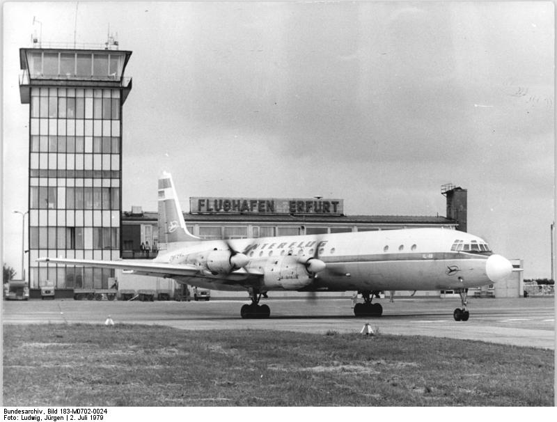
Interflug Il-18 at Erfurt (1979) - ADN-ZB Ludwig-2.7.79 After extensive reconstruction of the runway and the terminal, the first aircraft leaves for Budapest.
Source: Bundesarchiv, Bild 183-M0702-0024 / CC-BY-SA 3.0
In the 1980s and early 1990s
Overview
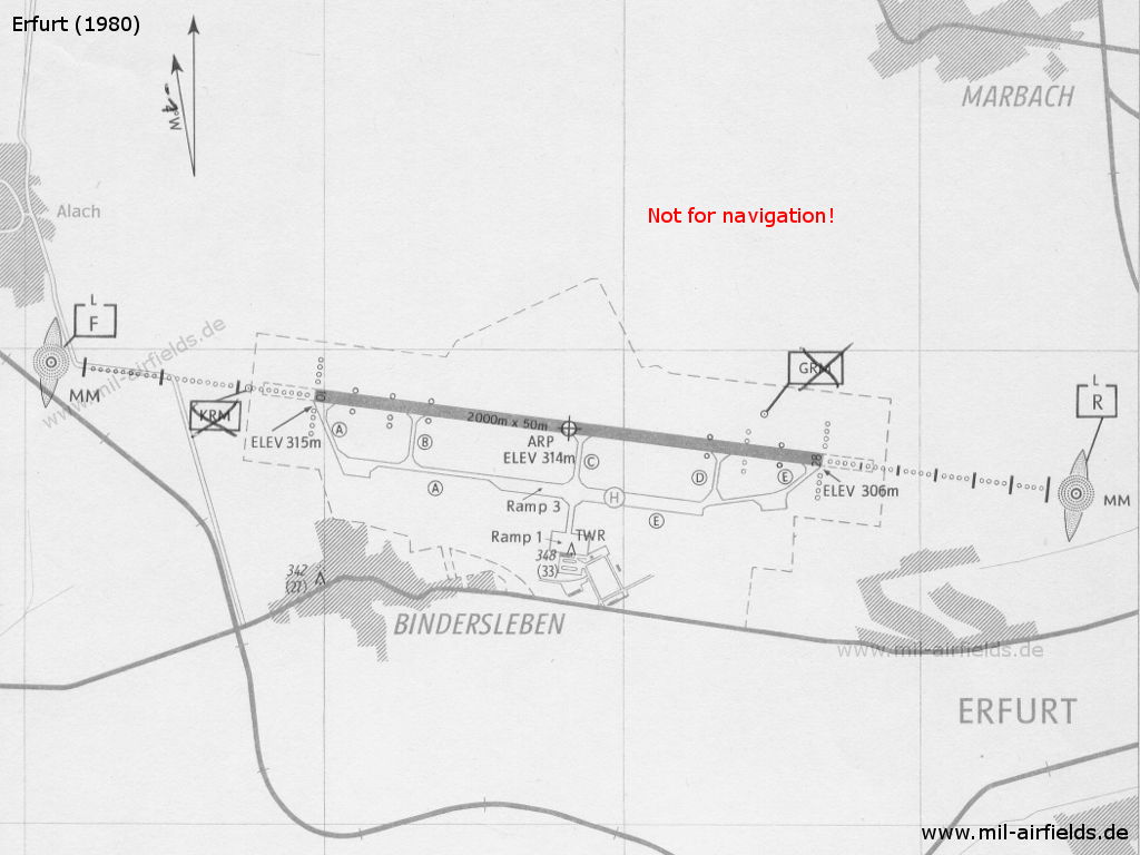
Map of Erfurt Airport 1980
Source: Ministerium für Verkehrswesen der DDR
1981
Image source, unless otherwise noted: GDI-Th, Freistaat Thüringen, TLVermGeo, www.geoportal-th.de, Datenlizenz Deutschland – Namensnennung – Version 2.0, www.govdata.de/dl-de/by-2-0
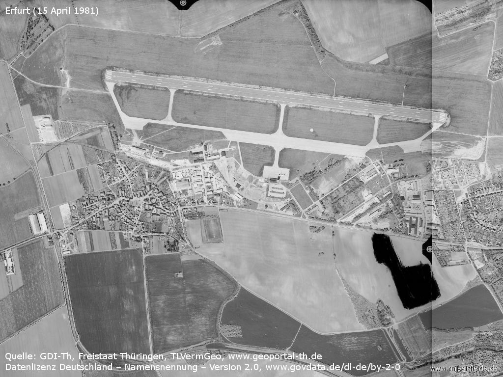
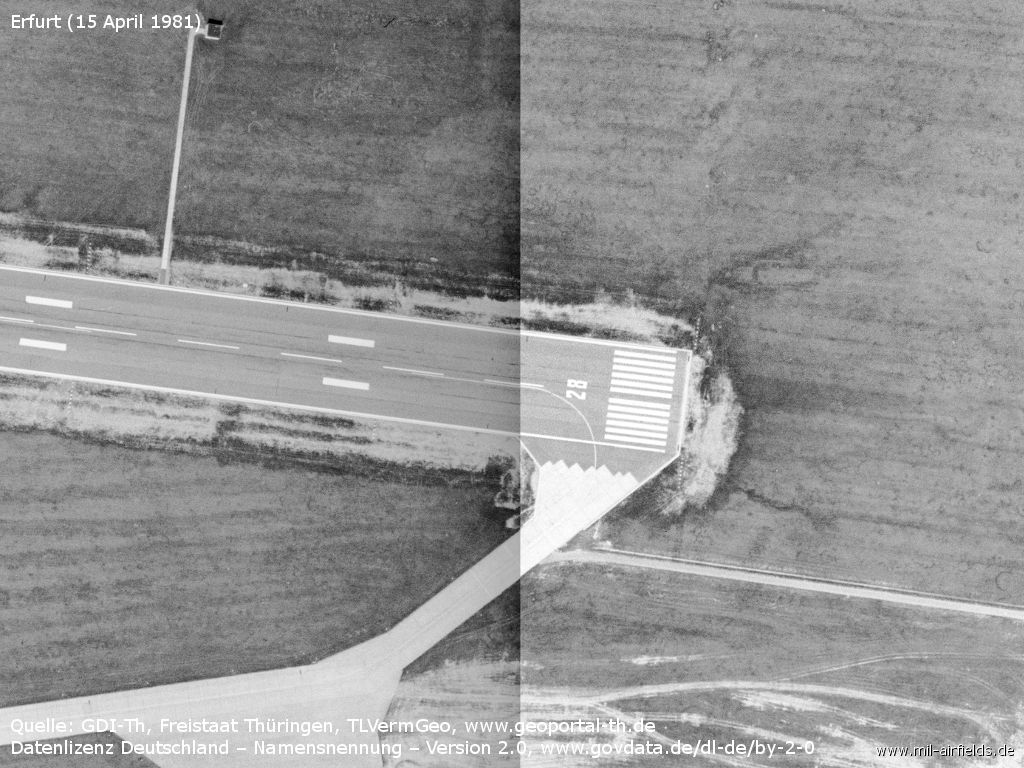
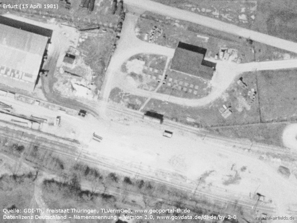
The airfield on 15 April 1981 - The area of the Soviet naval direction finder is censored.
Western approach path with approach lights
Runway 10
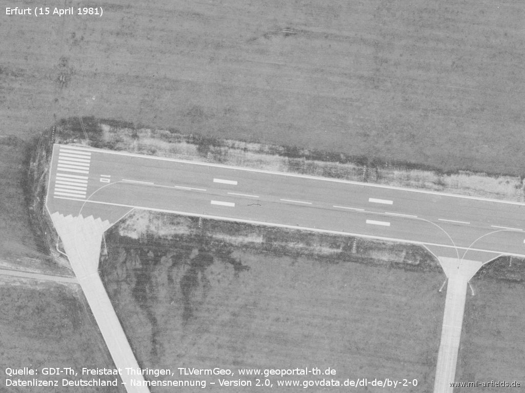
Western part of the runway - There are hardly any signs of rubber abrasion on the runway.
Relics in the northwest
Southwestern part - Railway siding with side ramp and tank farm
Buildings and ramp areas of agricultural aviation
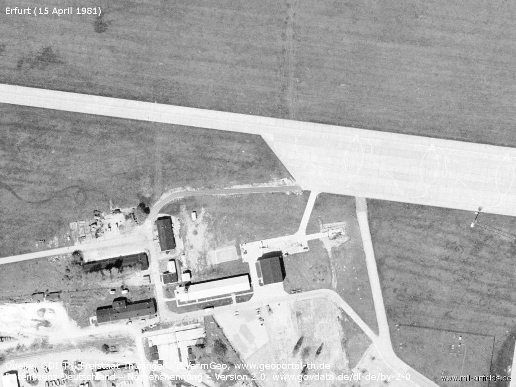
Hangar
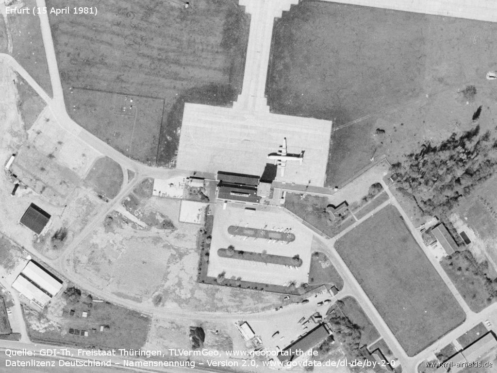
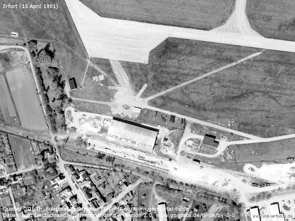
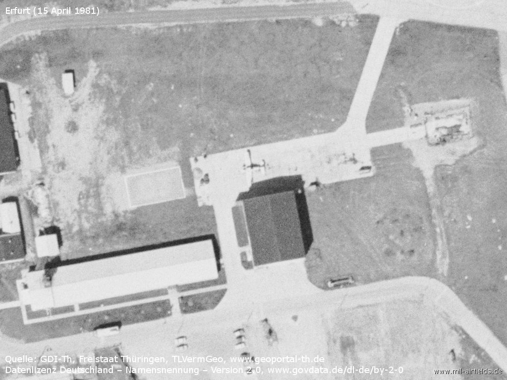
Terminal and apron - There's an Il-18 on the apron.
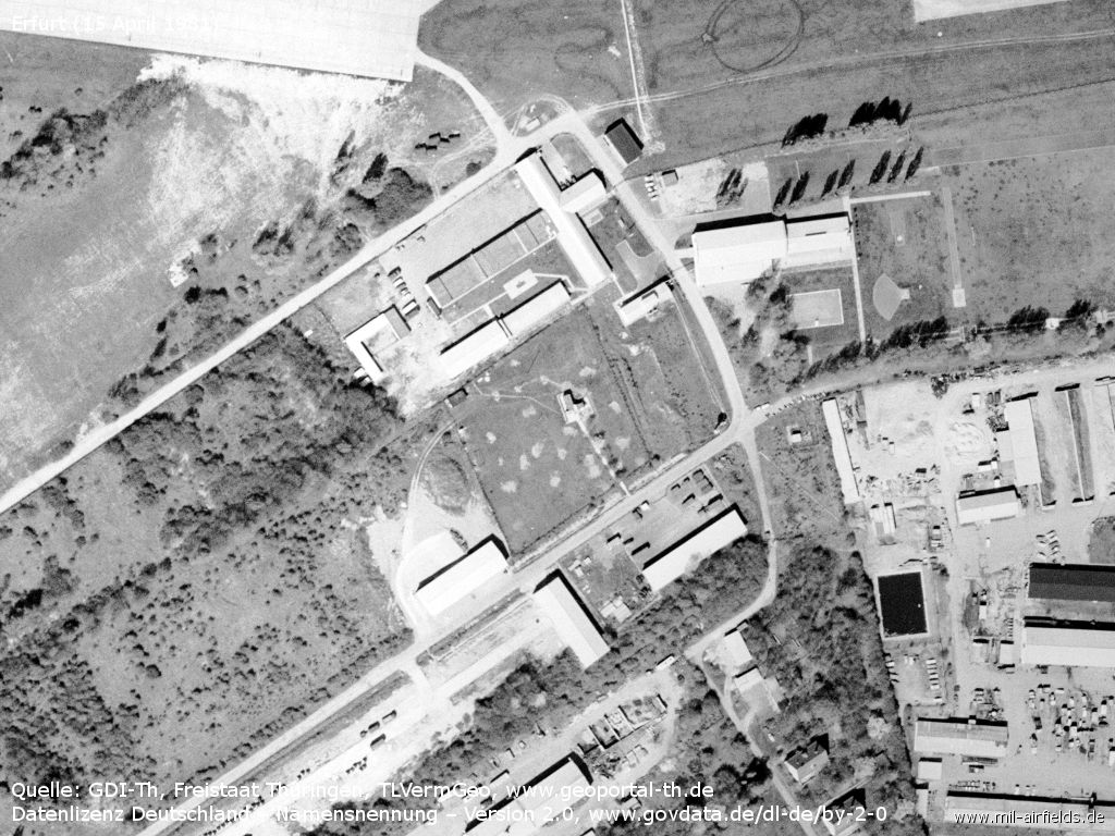
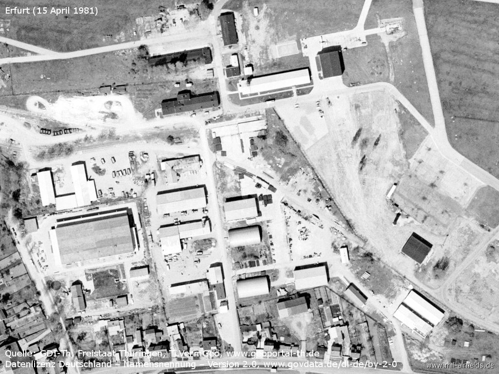
Southeastern part
The runway seems to be little used, here too there are hardly any signs of abrasion.
Detail: siding with tank car
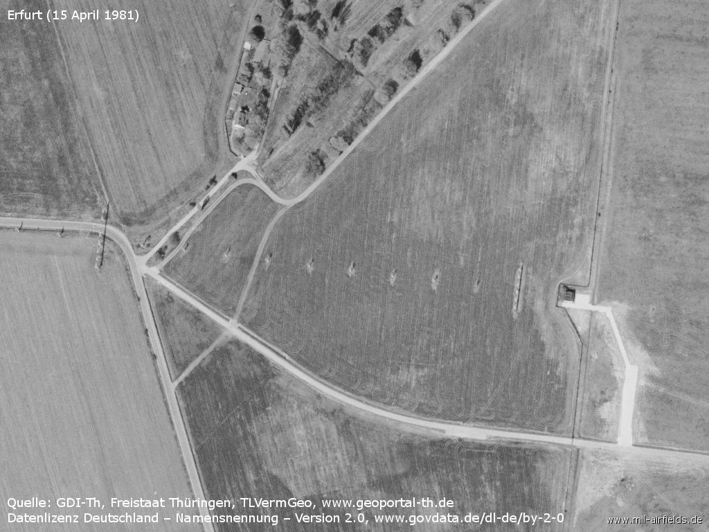
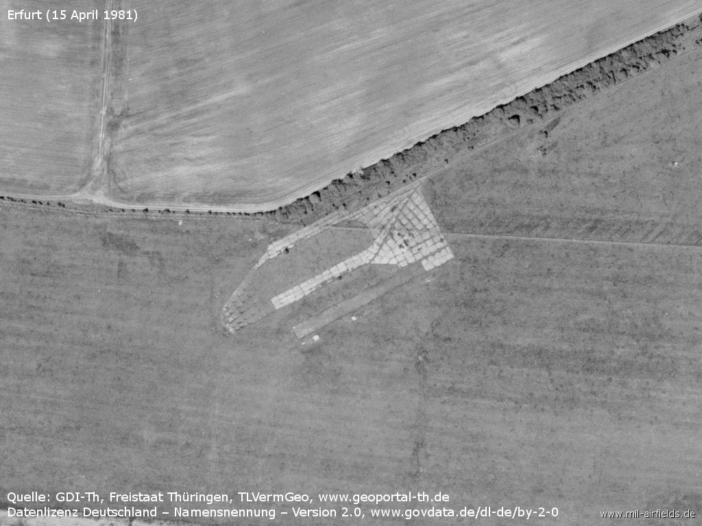
Agricultural aviation base with hangar and parked plane
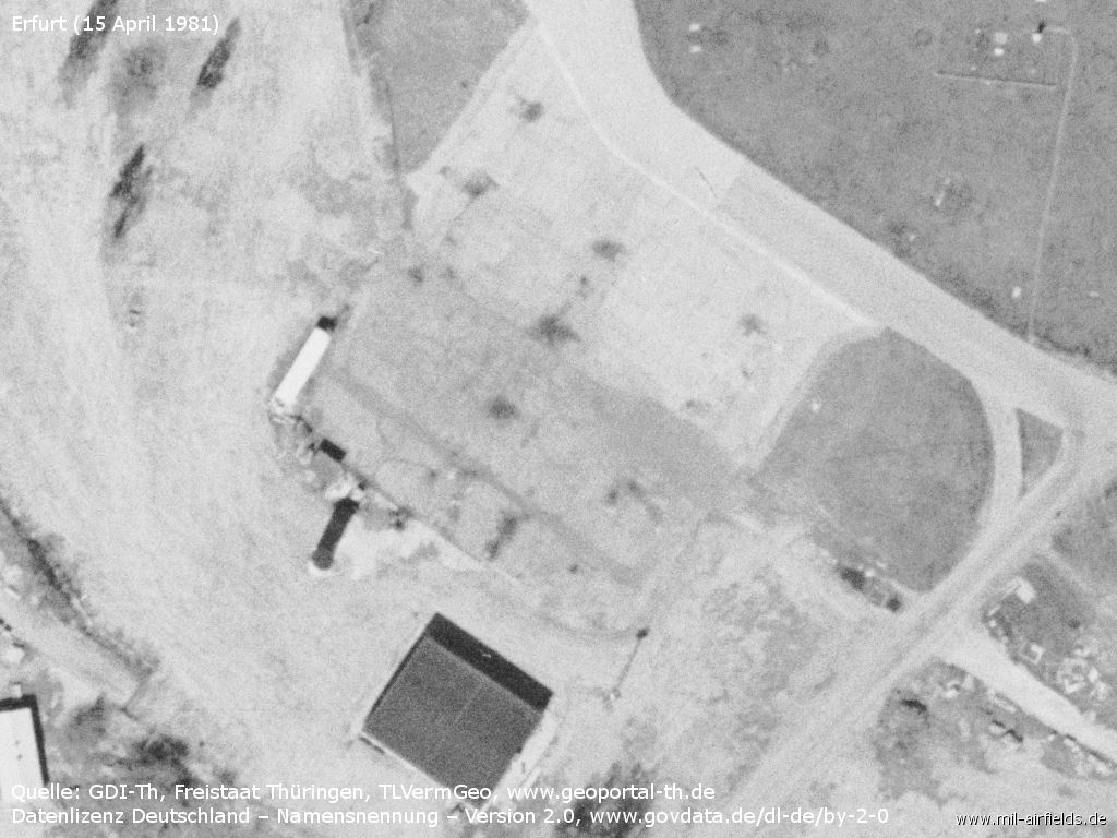
Agricultural aviation base, a former hangar apron of the air base.
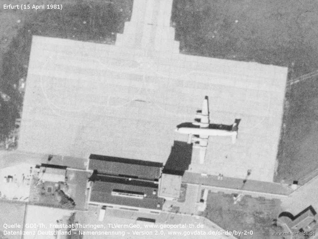
Apron a Ilyushin Il-18, control tower and terminal building
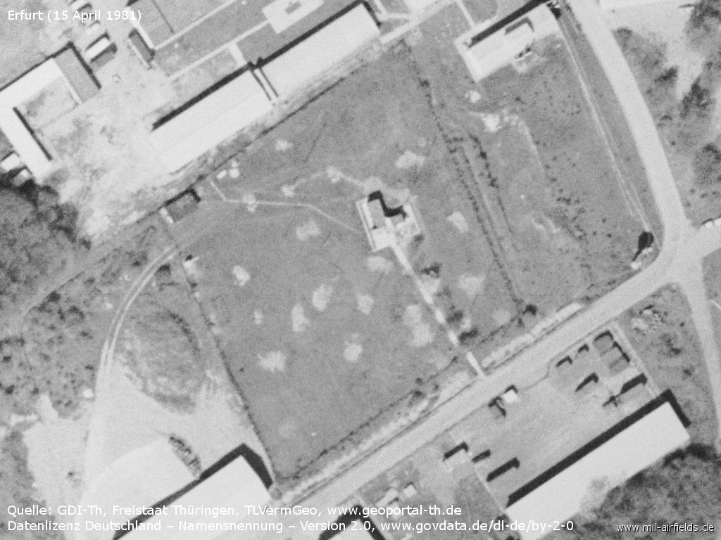
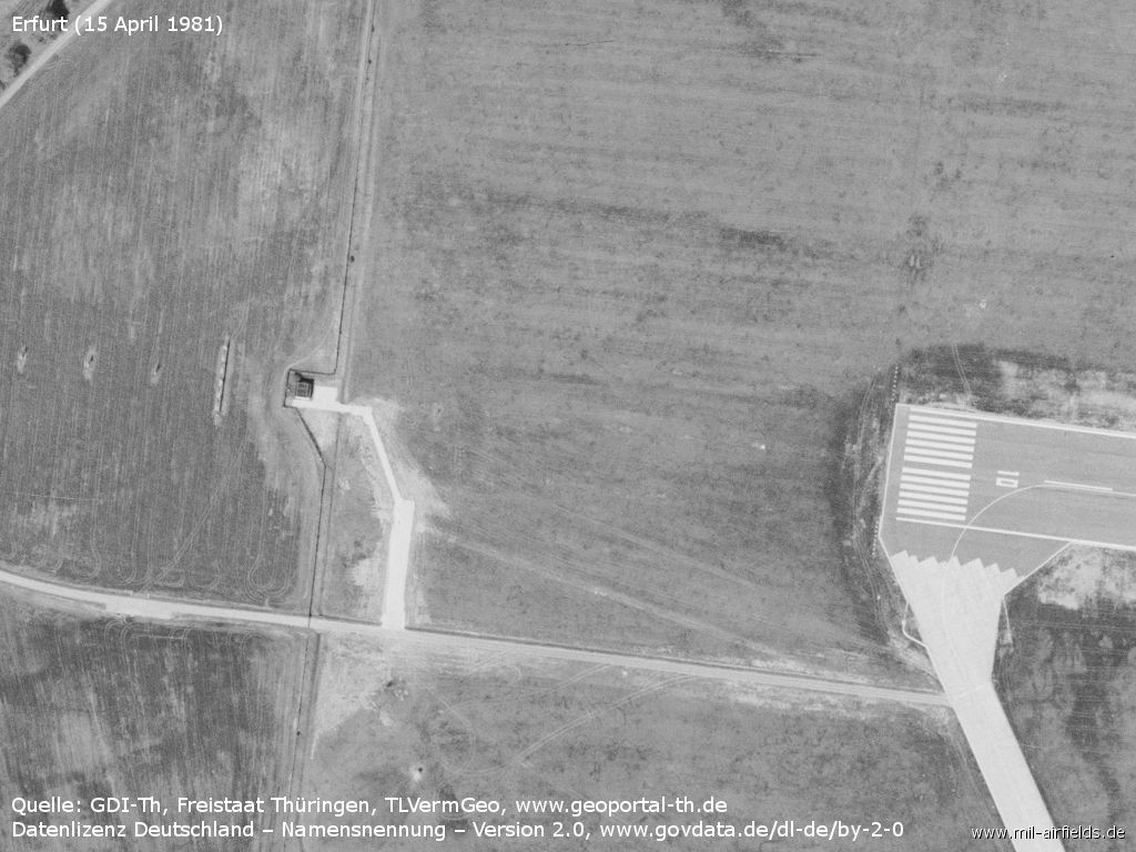
Antenna field in the southeast?
Middle marker, ca. 1 km to the east of the runway
1986
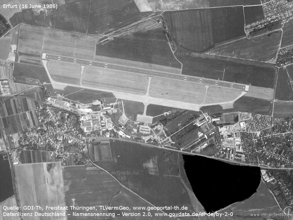
Erfurt on 16 June 1986
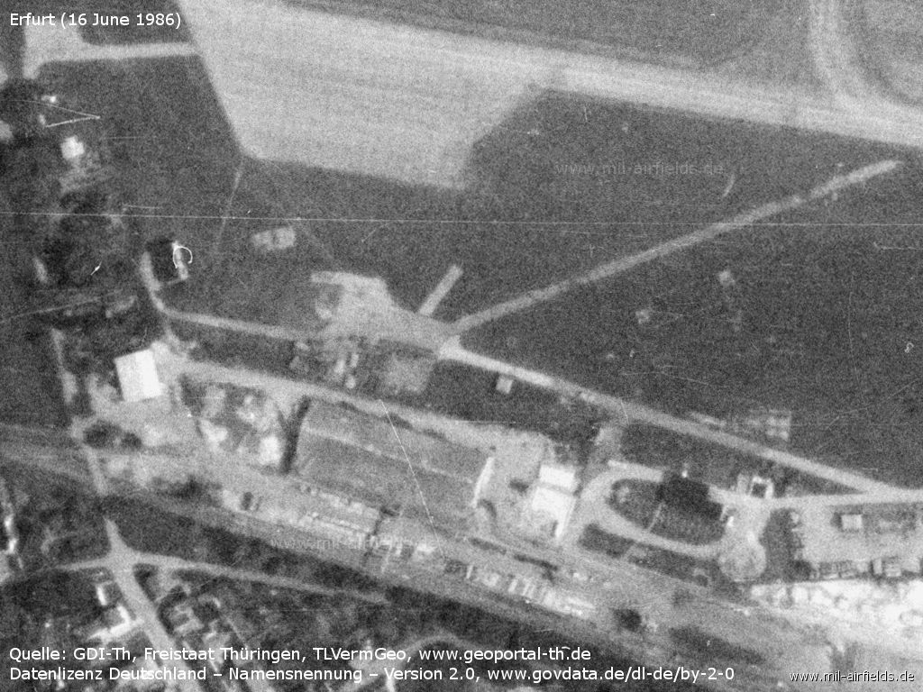
Fuel dump
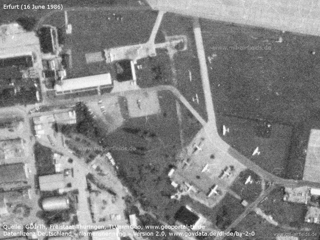
Agricultural aviation base
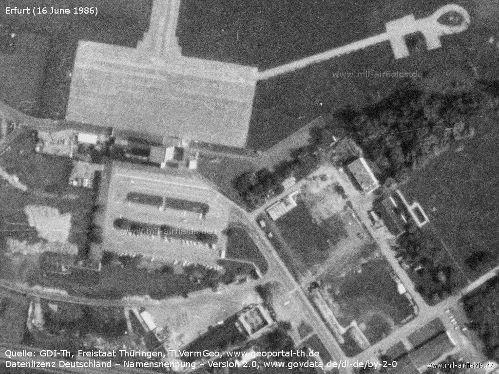
Terminal, control tower and apron
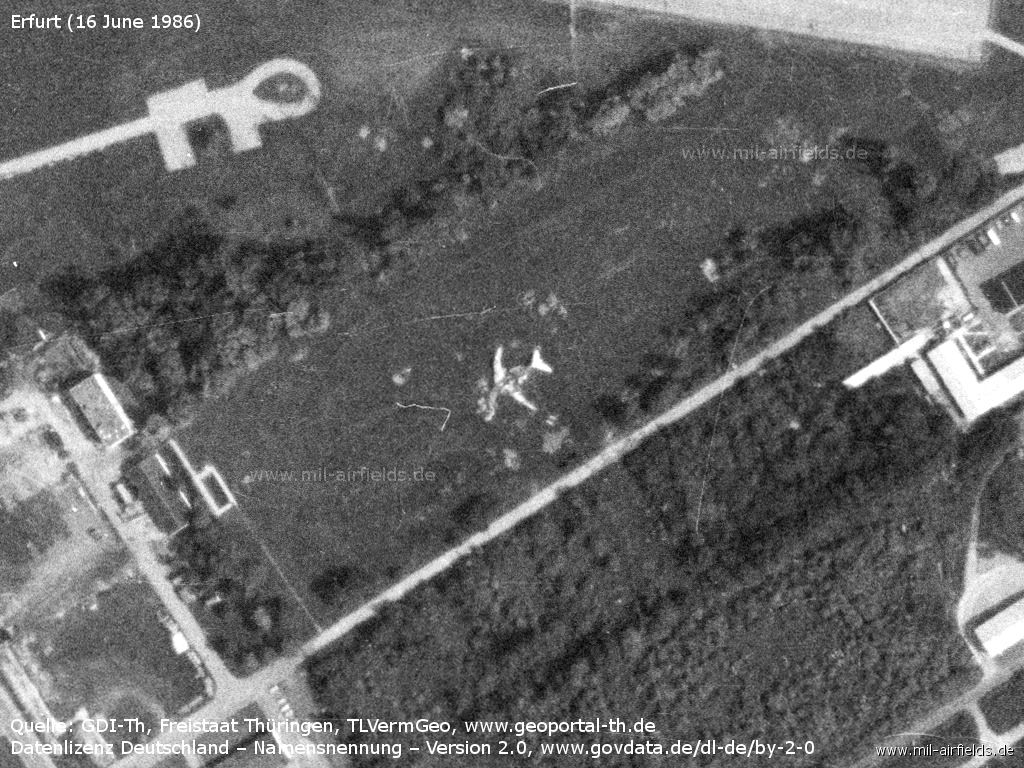
Destroyed aircraft Tupolev Tu-134 - This is probably the Tu-134 DDR-SCG of Interflug, which burned down in 1985 during a fire drill. Pictures of that exercise can be found in the Stasi-Mediathek, see link below.
Runways
- 10/28: 2000 m x 50 m Asphalt
Wegen der nur 2.000 m langen Start- und Landebahn konnte Erfurt nur für Flugzeuge bis zur Il-18 genutzt werden. Für Tu-134 und Tu-154 war der Platz nur bedingt zugelassen. Die DDR plante, im Jahr 1993 die Landebahn um 500 m zu verlängern - 150 m nach Osten und 350 nach Westen.
Taxiways, aprons
There were 2 parking positions on ramp 2 in front of the terminal building and 4 positions on ramp 3, west of taxiway C.
Radio beacons
Data for the year 1984:
- KGSP 28 (SP-50): 110,3
- LOM 28: 410 "RF", 7388m to THR
- LMM 28: 330 "R", 1017m to THR
- LOM 10: 306 "FR", 5461m to THR
- LMM 10: 330 "F", 1050m to THR
KGSP was an instrument landing system of the soviet type SP-50. Even though it used the same radio frequencies, is was not compatible with the ICAO ILS. The system at Erfurt was in use until ca. 1984. A new ILS was installed in 1988.
Data for the year 1990:
- ILS 28: 109.9 "IRF"
- LOM 28: 410 "RF", 7388m to THR
- LMM 28: 330 "R", 1017m to THR
- LOM 10: 306 "FR", 5461m to THR
- LMM 10: 330 "F", 1050m to THR
Radio communication
Erfurt Approach/Tower: 121.2 (198x)
In a Soviet radio communication list, the call sign "PROIMA" is listed for Erfurt.
Telephone
Phone numbers in the public phone system during the 1980s
Airport: 5390
Air traffic control: 539349, 539350, 24474
Interflug: Commercial airline, operations Erfurt: 0061/51456; Agricultural aviation Erfurt: 0061/66693-95, 66609
Phone numbers in the S1 state communication net in 1988
The passport check unit (Passkontrolleinheit, PKE) at the airport was connected as extension 2659 to the Stasi secret police regional headquarter. The number of the teletype in the S1 net and in the Stasi network was +739-489-44-c.
Teletype
Airport: 061424 (1989); Interflug: 61259 (1973)
Hours of operations
"Die Betriebszeiten der Anflugkontrolle Erfurt richten sich nach den Anforderungen des Luftverkehrs. Sie sind auf der Grundlage des Flugsicherungsflugplans in Übereinstimmung mit anderen interessierten Institutionen durch den Betrieb Flugsicherung der Interflug festzulegen und durch NOTAM zu veröffentlichen." (Quelle: Anweisung für den zivilen Flugsicherungsdienst in der DDR (AFD) 1988)
Airspace
Nahbereich Erfurt TMA in den 1980er Jahren:
Seitliche Begrenzung: Sömmerda - Buttstädt - Magdala - Lengefeld - Arnstadt - Goldbach - Döllstädt - Sömmerda; Höhenbereich: 300 m AAL - FL80 (2450 m STD)
Kontrollzone Erfurt in den 1980er Jahren:
Seitliche Begrenzung: Kreis um den Flughafenbezugspunkt mit Radius 10 km; Höhenbereich: vom Boden bis 300 m AAL.
Zuständigkeit der Anflugkontrollstelle Erfurt
Die Erfurt APP war neben dem Nahbereich (TMA) für folgende Luftstraßenabschnitte zuständig: B50 zwischen LUNER und WEMAR, B52 zwischen RF und MAGDA, jeweils bis einschließlich FL110 (3350 m STD).
"Außerhalb der Dienstzeit der APP Leipzig und/oder Erfurt wird der Flugsicherungsdienst für militärische Flüge in den diesen Dienststellen zugeteilten Luftstraßenabschnitten (in und unterhalb FL110/3350 m STD) durch militärische Dienststellen wahrgenommen. Der zivile Flugsicherungskontrolldienst wird für den Flug in den genannten Luftstraßenabschnitten unterbrochen. Die Koordinierung der Flüge ist zwischen den diensthabenden Flugsicherungskontrollstellen direkt durchzuführen. Kontrollierte Flüge ziviler Luftfahrzeuge sind außerhalb der Dienstzeit einer APP innerhalb deren Zuständigkeitsbereich verboten."
(Quelle: Anweisung für den zivilen Flugsicherungsdienst in der DDR 1987)
Connections between visual approach and departure routes and local flying routes
- Lengefeld auf der örtlichen Fluglinie Nr .42
- Arnstadt, kürzester Flugweg nach der örtlichen Fluglinie Nr. 42 (Streckenabschnitt Lengefeld - Steinbach - Hallenberg);
- Siebleben, kürzester Flugweg nach der örtlichen Fluglinie Nr. 11 Schnittpunkt Autobahn (Streckenabschnitt Bad Langensalza und Steinbach - Hallenberg);
- Sömmerda, kürzester Flugweg nach der örtlichen Fluglinie Nr. 11 (Streckenabschnitt Kelbra - Bad Langensalza).
(Quelle: VFR-Handbuch für den Agrarflug DDR 1982)
Standard training routes
Flugstrecke für Überführungsflüge des Betriebes Agrarflug zwischen der Werft Leipzig/Mockau und dem Flughafen Erfurt
Leipzig: Mockau Airport / Airfield - Autobahnabfahrt Taucha - Markkleeberg - Markranstädt - Autobahnabzweig Weimar - Klettbach - weiter gemäß Sichtanflugkarte Erfurt und zurück.
Standardised flight plans
In the GDR, so-called standardised flight plans (STP) could be submitted for recurring flights. In 1989, the following flight plans were defined for Erfurt airport, all for Interflug Betrieb Fernerkundung, Industrie- und Forschungs-Flug (abbreviation for flight plans: FI):
FI72: flight according to instrument flight rules, type of aircraft L-410, from Berlin-Schönefeld to Erfurt, cruising speed 300 km/h, flight level 080, via airway B50, flight time 1:05.
FI73: flight according to instrument flight rules, type of aircraft L-410, from Erfurt to Berlin-Schönefeld, cruising speed 300 km/h, flight level 070, via airway B50, flight time 1:05.
FI80: flight according to instrument flight rules, type of aircraft L-410, from Leipzig Schkeuditz to Erfurt, cruising speed 300 km/h, flight level 080, via airway B50, flight time 0:40.
FI81: flight according to instrument flight rules, type of aircraft L-410, from Erfurt to Leipzig Schkeuditz, cruising speed 300 km/h, flight level 070, via airway B50, flight time 0:40.
FI82: flight according to instrument flight rules, type of aircraft L-410, from Erfurt to Dresden, cruising speed 300 km/h, flight level 090, via airway B52, Flugzeit 0:55.
FI83: flight according to instrument flight rules, type of aircraft L-410, from Dresden to Erfurt, cruising speed 300 km/h, flight level 080, via airway B52, flight time 0:55.
FI88: flight according to instrument flight rules, type of aircraft An-2, from Berlin-Schönefeld to Erfurt, cruising speed 180 km/h, flight level 080, via airway B50, flight time 1:35.
FI89: flight according to instrument flight rules, type of aircraft An-2, from Erfurt nach Berlin-Schönefeld, cruising speed 180 km/h, flight level 070, über Luftstraße B50, flight time 1:35.
FI96: flight according to instrument flight rules, type of aircraft An-2, from Leipzig-Schkeuditz to Erfurt, cruising speed 180 km/h, flight level 080, via airway B50, flight time 0:50.
FI97: flight according to instrument flight rules, type of aircraft An-2, from Erfurt to Leipzig-Schkeuditz, cruising speed 180 km/h, flight level 070, via airway B50, flight time 0:50.
FI97: flight according to instrument flight rules, type of aircraft An-2, from Erfurt to Dresden, cruising speed 180 km/h, flight level 080, via airway B52, flight time 1:15.
FI97: flight according to instrument flight rules, type of aircraft An-2, from Dresden to Erfurt, cruising speed 180 km/h, flight level 080, via airway B52, flight time 1:15.
Coordination with other airfields
Zusammenarbeit zwischen der APP Erfurt und den FSS Nohra und Hassleben
"Die Flugsicherungsstelle des Flugplatzes Nohra ist bei Flugdienst am Flugplatz Nohra verpflichtet, die APP Erfurt über den Beginn und das Ende der Flüge sowie über die Flughöhen zu informieren.
Die APP Erfurt ist bei Flugdienst am Flugplatz Nohra entsprechend der örtlichen Vereinbarung verpflichtet, die Flugsicherungsstelle Nohra über Zeit und Flughöhe des Überfluges des Flugplatzes Nohra durch zivil kontrollierte Luftfahrzeuge zu informieren. Kann keine Nachrichtenverbindung (über Telefon oder bei Ausfall der Telefonverbindung über Funk 124,0 MHz) hergestellt werden, ist die Information über die ATCC an die VHZ zu übermitteln.
Das Flugsicherungsorgan des Flugplatzes Hassleben ist bei Flugdienst am Flugplatz Hassleben verpflichtet, über das Flugsicherungsorgan am Flugplatz Nohra die APP Erfurt über den Beginn und das Ende der Flüge sowie über die Flughöhen zu informieren.
Die APP Erfurt ist verpflichtet, das Flugsicherungsorgan des Flugplatzes Hassleben über das Flugsicherungsorgan des Flugplatzes Nohra über Zeit und Höhe der Flüge im CTR/TMA Erfurt zu informieren.
Bei Starts und Landungen von Luftfahrzeugen auf dem Flugplatz Erfurt beträgt die Flughöhe in den Kunstflugzonen des Flugplatzes Nohra und in der Platzrunde des Flugplatzes Hassleben max. 300 m AGL."
Installations
During the 1980s, a Il-62 DDR-SEH of Interflug was stored at the airfield.
Railway siding
Railway siding from direction Alach to the south western part of the airfield.
Other installations
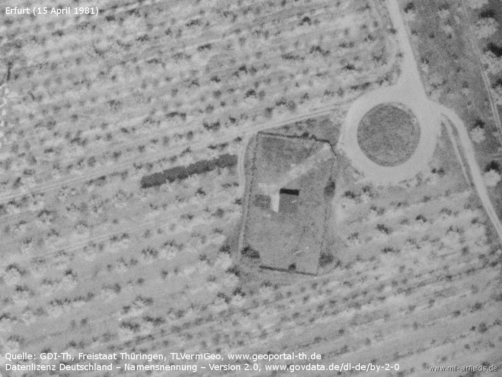
Approx. 400 m southeast of the field was a direction finder of the Soviet Navy. The installation had a circular antenna with a diameter of about 180 m.
In 1980, the CIA searched satellite images in the vicinity of Soviet Naval SIGINT sites for related receiving and transmitting stations. Besides the radio direction finder Poti (today Georgia, N420330 E0414800) the Fix 24/48 facility in Erfurt Bindersleben was searched within a radius of 20 nautical miles. However, no further stations could be identified. (Source: CIA)
Images
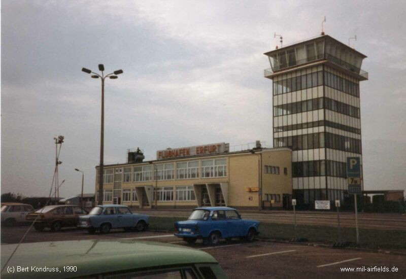
Terminal building and tower (1990)
Contents
Page 2: Erfurt Airport, East Germany/GDR, 1945 - 1990 ← you are here
 Follow mil-airfields on Facebook