Brandenburg: Briest Air Base
For historical information only, do not use for navigation or aviation purposes!
| Coordinates | N522615 E0122714 (WGS84) Google Maps |
| Elevation | 31 m |
| Location indicator | ETBB (198x-), EDUB (2000) |
| Airfield Id | 2134 |
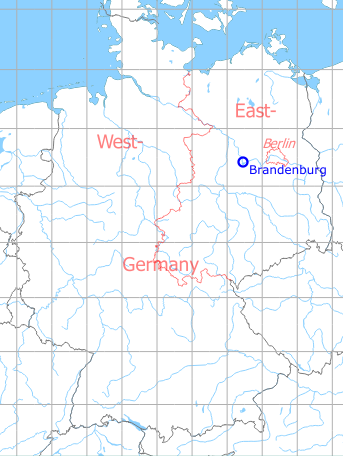
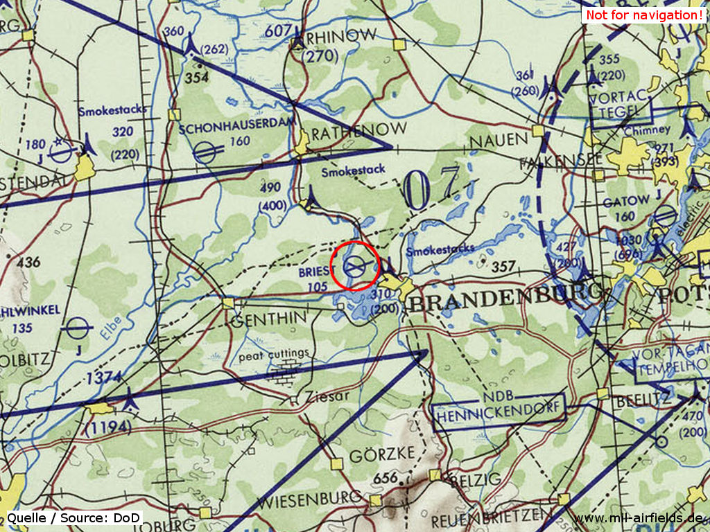
Germany during the Cold War Map
The history of the Cold War airfields: Brandenburg
Contents
Location of airfield
The airfield is located 6.5 km northwest of Brandenburg center and southeast of Briest.
During World War II
Use
Opened between 1912 and 1914. Later Luftwaffe airbase (Fliegerhorst).
Situation
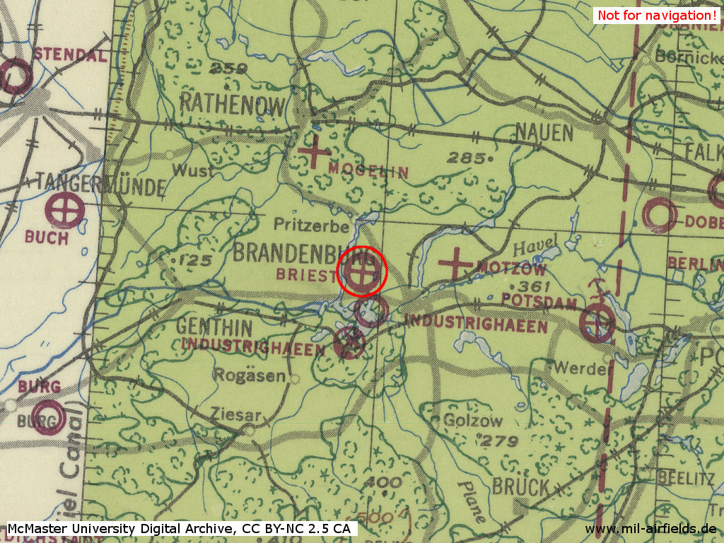
Briest on a US map from 1943
Source: McMaster University Library Digital Archive, License: Creative Commons Attribution-NonCommercial 2.5 CC BY-NC 2.5 CA /MULDA/
During the Cold War
Use
1945 until 1956 used by Red Army / Soviet forces. From 1957 until 1990 used by former East German Air Force (LSK/LV). 1990 .. 1994 used by Bundeswehr.
In the 1950s
Units
1954
- Soviet ground attack regiment (P. O. Box 42 114),
Source: BND/Bundesarchiv B 206/3033
(For the P. O. Box numbers the digits 3 and 5 may be confused, because they are difficult to distinguish in the source document)
Source: BND/Bundesarchiv B 206/3033
(For the P. O. Box numbers the digits 3 and 5 may be confused, because they are difficult to distinguish in the source document)
History
- September/October 1954
Temporary relocation of the Soviet Ground Attack Regiment Brandenburg-Briest to Döberitz (25 September - 05. October 1954)
In the 1960s
Situation
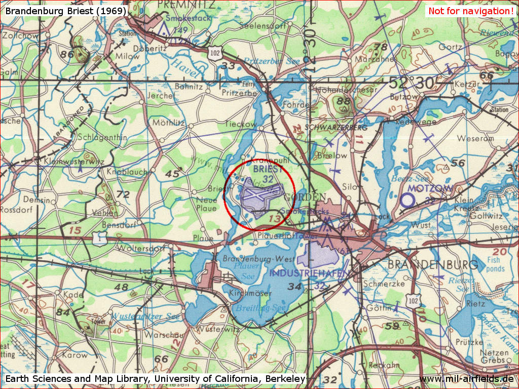
Brandenburg Briest Air Base on a US map from 1969
Source: Earth Sciences and Map Library, University of California, Berkeley
Overview
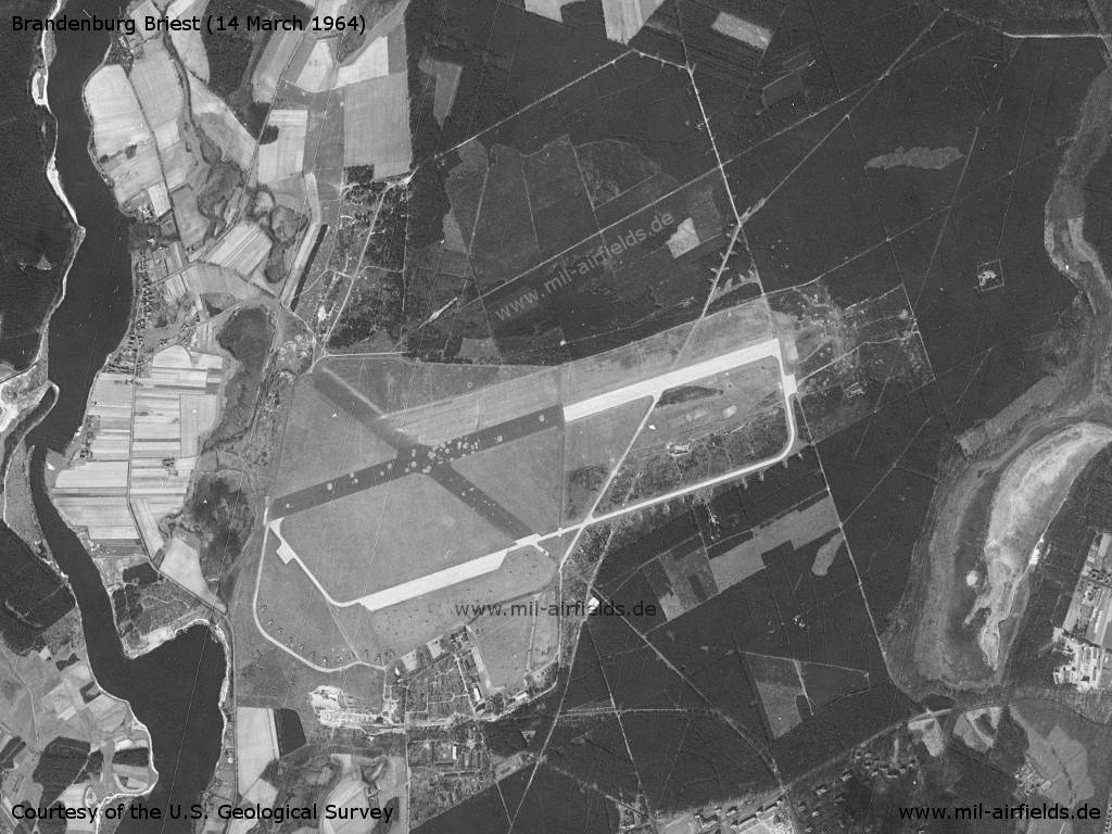
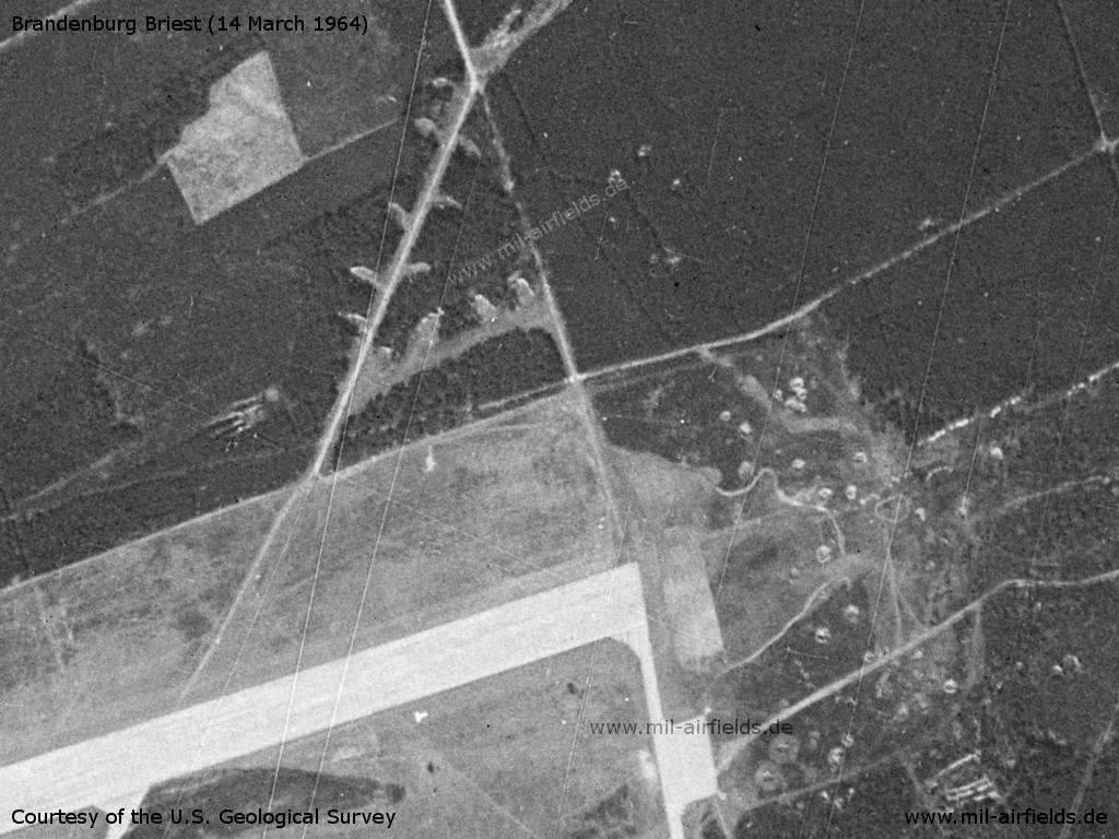
US satellite image from 14 March 1964
Source: U.S. Geological Survey
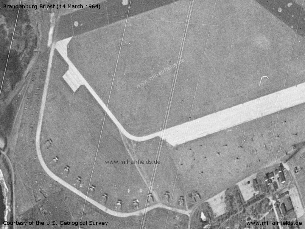
Enlargement: In the south-western part there are numerous aircraft revetments in the southwestern part
Source: U.S. Geological Survey
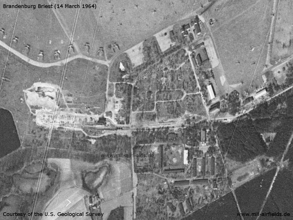
Barracks
Source: U.S. Geological Survey
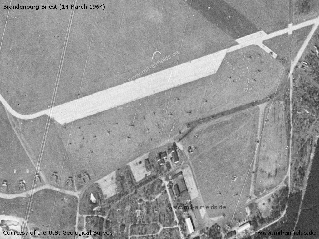
The resolution is impressive for 1964. - Nevertheless, it is difficult to determine the exact number of helicopters. I would say that there are about 40 helicopters in the picture.
Source: U.S. Geological Survey
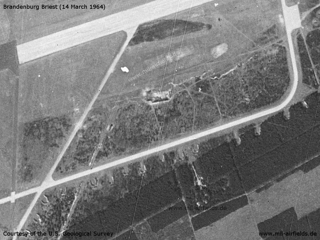
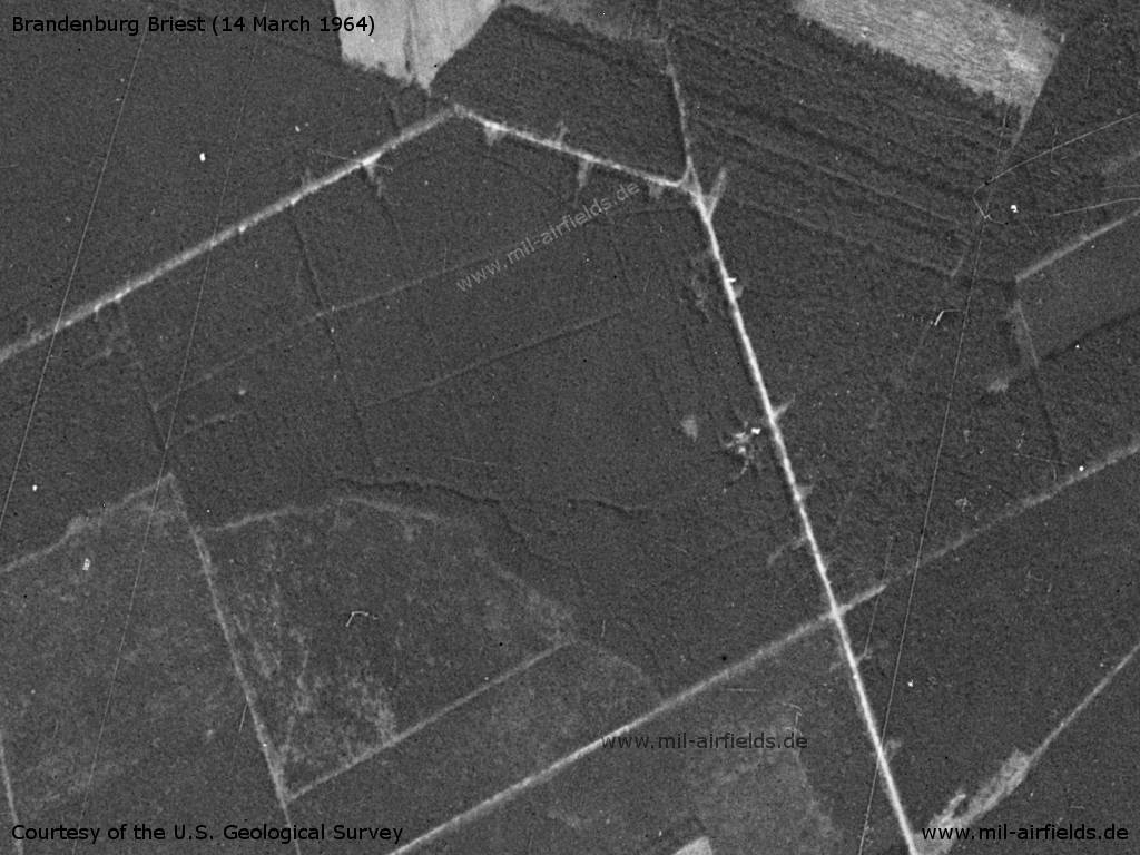
Revetments in the east
Source: U.S. Geological Survey
Eastern end of the runway
Source: U.S. Geological Survey
Dispersal area in the northeast
Source: U.S. Geological Survey
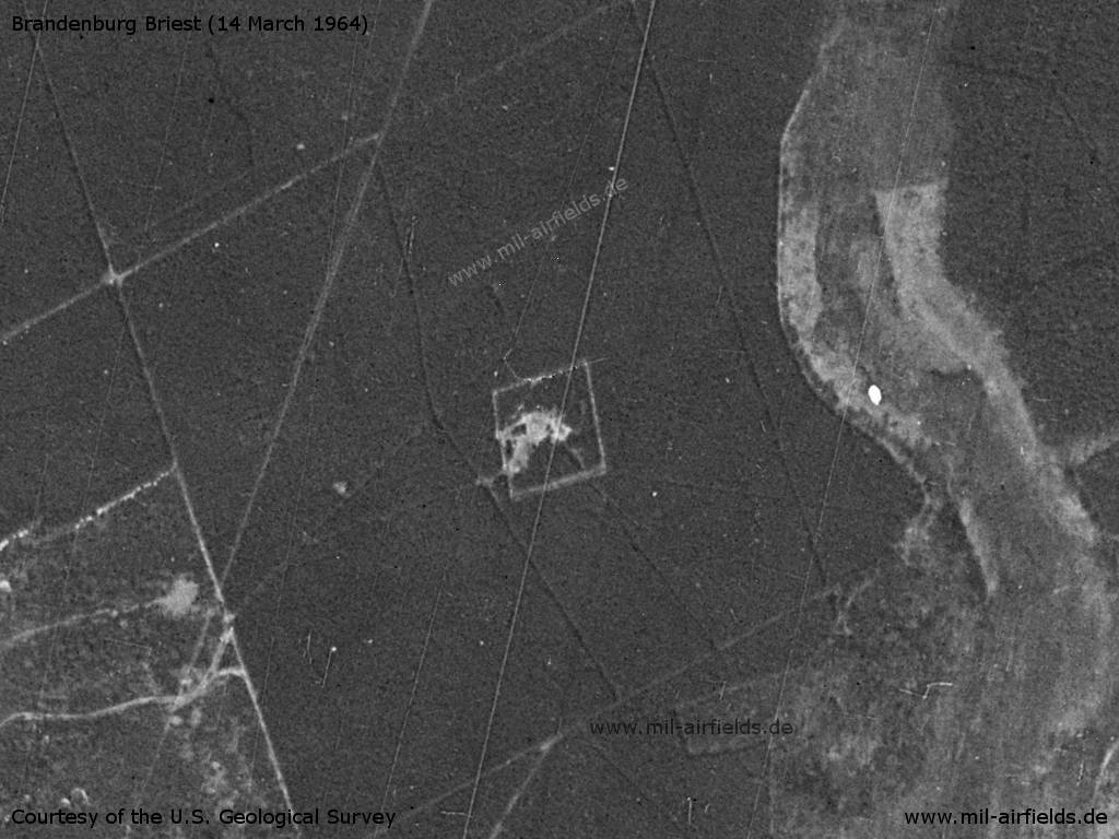
Radio beacon?
Source: U.S. Geological Survey
In the 1970s
Situation
Brandenburg Briest Air Base on a map of the US Department of Defense from 1972 - The blue lines mark the allied air corridors from and to Berlin
Source: ONC E-2 (1972), Perry-Castañeda Library Map Collection, University of Texas at Austin /PCL MC/
In the 1980s and early 1990s
Overview
Brandenburg Briest Air Base on a map in the East German "Directory 012" (Verzeichnis 012, formerly "Top Secret") from about 1989/1990. - Hand-drawn maps were not unusual in the eastern block. Recognizable are the airfield with concrete runway, the taxiways, helicopter hardstands and the location of the RSBN radio beacon.
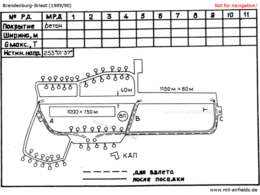
Taxi trackts for take-off and after landing - still from Verzeichnis 012. - The runway consisted of two sections with different widths. In contrast to the common practice on eastern military airfields, the taxiways in Brandenburg were not designated by numbers but by letters.
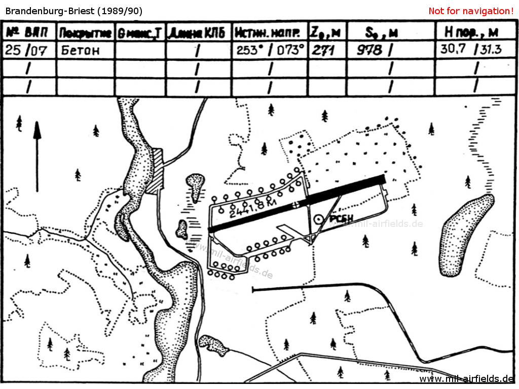
Runways
Data for the 1980s:
Die Start- und Landebahn hatte eine Landebahnbefeuerung. .
Taxiways, aprons
The circular taxiway had no lighting.
Ramp for An-26 at the eastern side of the flightline.
Radio beacons
Data for the 1980s:
Radio communication
Data for the 1980s:
The call sign of the airfield was UNRECHT.
Frequencies: Flight director (Tower): 135,583 (Channel 7) and 124.0 (Channel 1) UNRECHT-START; DF: 130,0 (Channel 4) UNRECHT-PELENG. Position of the DF facility was N522636 E0120108 (S42/83). H24 (1990).
Telephone
Stabsnetz S1 53628, code names in 1990: "Häkelgarn" and "Pilzkunde" (command post).
Microwave radio net (Richtfunknetz, RFN): via district microwave center Potsdam, number 935, code names "Unbehagen" (1978) and "Waagschale" (1987).
Maps
Maps from the former East German military airfield manual "Verzeichnis 012" (formerly "secret").
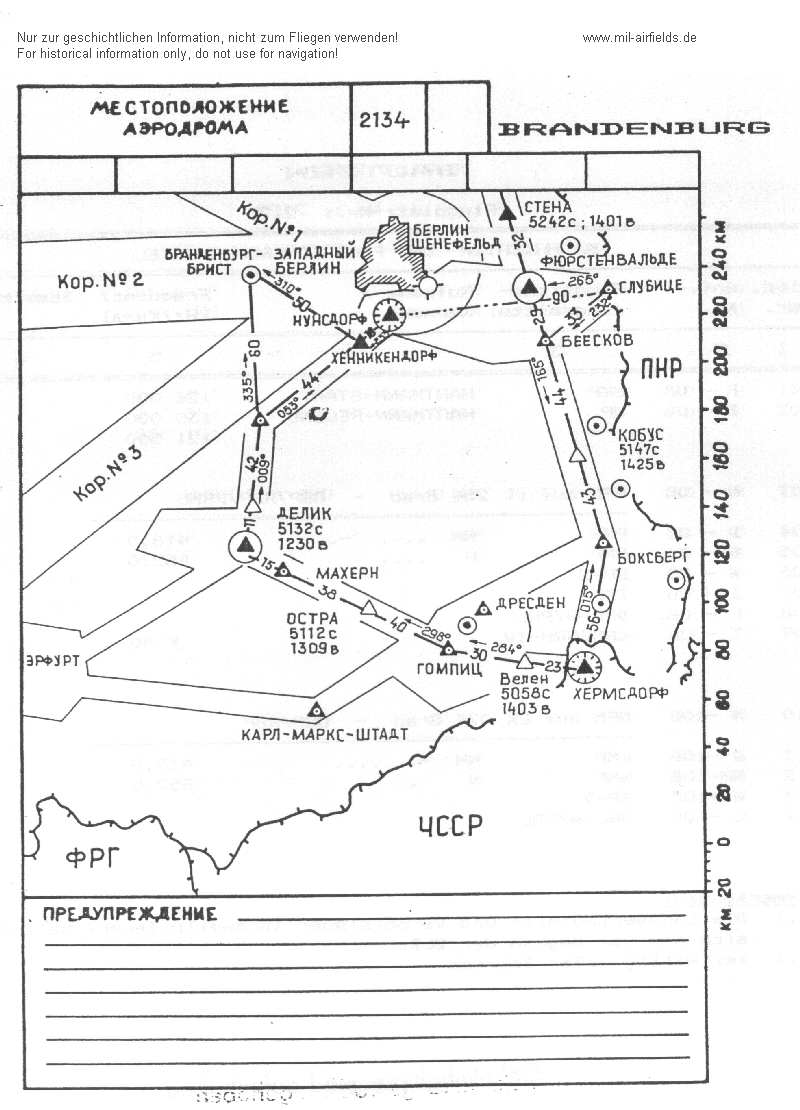
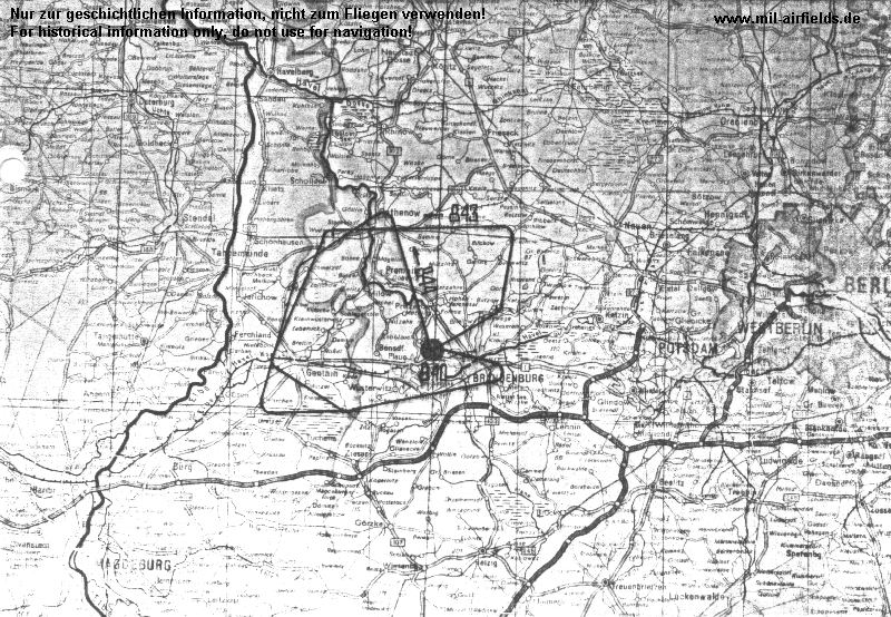
Situation of the airfield with airways, radio beacons, reporting points and other east german airbases
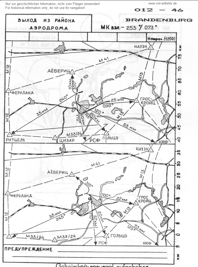
Departure routes to VFR flying routes (dashed lines) and airways (radio beacon HKF)
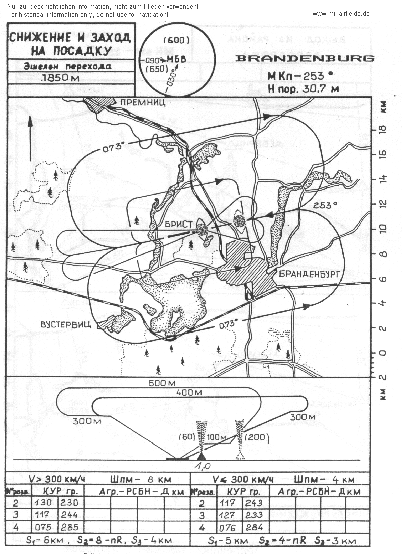
Approach for main landing direction 253°
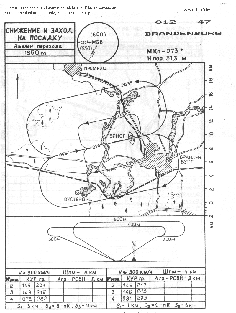
Approach for secondary landing direction 073°
Standard training routes
"Flüge der LSK/LV der NVA und der LSK der GSSD im Rahmen der Gefechtsausbildung sind entsprechend der Grafik der Flugtage / -nächte auf der Grundlage der "Hauptflugregeln zum Fliegen im Luftraum der Deutschen Demokratischen Republik" auf Standardflugstrecken in den dazu festgelegten Flughöhen durchzuführen. ..." (Quelle: "Verzeichnis der Standardflugstrecken der LSK/LV der NVA und der LSK der GSSD"
As of 1989:
843 Brandenburg, Butzow, Buschow, Wudicke, Genthin, Karow, Schmerzke, Brandenburg
Flughöhe: 25 - 600 m
Nur nach Abstimmung mit der VHZ (wenn keine Anflüge zum SP Wittstock in 300 m aus Süd)
Flughöhe: 25 - 600 m
Nur nach Abstimmung mit der VHZ (wenn keine Anflüge zum SP Wittstock in 300 m aus Süd)
844 Brandenburg, Wollin, Parchen, Schmetzdorf, Brandenburg
Flughöhe: 100 - 500 m
Flughöhe: 100 - 500 m
845 Brandenburg, Mögelin, SP Klietz, Wust, Möthlitz, Brandenburg
Flughöhe: 100 bis 300 m
Flughöhe: 100 bis 300 m
846 Brandenburg, Wiesenburg, Coswig, Dessau, Aken, Schönebeck, Niegripp, Genthin, Brandenburg
Flughöhe: 15 bis 500 m
Nur nach Abstimmung mit der VHZ wenn die Strecken 473 oder 543 nicht beflogen werden.
Flughöhe: 15 bis 500 m
Nur nach Abstimmung mit der VHZ wenn die Strecken 473 oder 543 nicht beflogen werden.
847 Brandenburg, Wollin, Parchen, Schmetzdorf, Brandenburg
Flughöhe: 15 bis 500 m
Flughöhe: 15 bis 500 m
848 Brandenburg, Butzow, Roskow. Lucksfleiss, Dretzen, Kade, Groß-Demsin, Briest, Jerchel, Kieck, Brandenburg
Flughöhe: 15 bis 500 m
Flughöhe: 15 bis 500 m
849 Brandenburg, Tremmen, Stechow, Sieversdorf, Strodehne, Hohennauen, Brandenburg
Flughöhe: 100 bis 300 m
(Nur wenn am Landeplatz Rhinow nicht geflogen wird)
Flughöhe: 100 bis 300 m
(Nur wenn am Landeplatz Rhinow nicht geflogen wird)
850 Brandenburg, Tremmen, Stechow, Klessow, Neustadt (Dosse), Sieversdorf, Strodehme, Hohennauen, Brandenburg
Flughöhe: 100 bis 300 m
Flughöhe: 100 bis 300 m
851 Brandenburg, Tremmen, Wollin, Brandenstein, Genthin, Wust, Brandenburg
Flughöhe: 15 bis 300 m
Flughöhe: 15 bis 300 m
Standard Training Routes from Briest
Units
In 1990, the following units were based at Briest:
- Transporthubschraubergeschwader 34 (THG-34, Postfach PF 43814)
- Fliegertechnisches Bataillon 34 (FTB-34, PF 33623)
- Hubschrauberausbildungsgeschwader 35 (HAG-35, PF 78343)
- Fliegertechnisches Bataillon 35 (FTB-35, PF 78374)
- Teile Offiziershochschule der LSK/LV für Militärflieger "Otto Lilienthal" (OHS MF, Postfach 78396)
Real property
The former East German National People's Army installation id of the airfield was 04/029 or 04/034.
The fuel depot has been built between 1962 and 1969.
Installations
Railway siding from southeast.
Today
Use
Closed.
Links
- Die Ausbildung zum Hubschrauberführer der NVA - Flugplatz Briest - Detailed information, map, aerial picture and current pictures from 2005.
- (offline): USMLM Unit History 1982 - Notice about the deployment of all helicopters from Briest to Cottbus
Bibliography
- Ries, Karl; Dierich, Wolfgang: "Fliegerhorste und Einsatzhäfen der Luftwaffe" Motorbuch Verlag Stuttgart, 1993 - Allied map
- Freundt, Lutz: "Sowjetische Fliegerkräfte in Deutschland 1945-1994, Band 1" Freundt Eigenverlag, Diepholz 1998 - Short description about usage by the Red Army. Aerial picture from 1953.
- Bußmann, Kleest, Freundt: ""11-80, katapultieren Sie!"" AeroLit - Verlag und Medienvertrieb, Berlin, 2004 - Short descriptions about accidents at Briest and other airbases.
Related topics
Airfields in the vicinity
- 091°/9km Klein Kreutz: Airfield (Brandenburg-Mötzow, Mühlenfeld)
- 359°/16km Bamme: Agricultural Airfield
- 074°/24km Zachow: Helipad 3119 (HSLP / HLP 3119)
- 313°/29km Schönhauser Damm: Airfield (Schönhausen, Schonhauserdamm)
- 020°/30km Haage: Agricultural Airfield
Categories
Military Airfields GermanyMilitary Airfields in former East GermanyAirfields of the Soviet Forces in GermanyAir bases of former National People's ArmyContents
 Follow mil-airfields on Facebook