For historical information only, do not use for navigation or aviation purposes!
| Coordinates | N533222 E0132828 (WGS84) Google Maps |
| Former East Germany (GDR) | District of Neubrandenburg |
| Federal state | Mecklenburg-Vorpommern (Mecklenburg-Western Pomerania) |

Germany during the Cold War Map
The history of the Cold War airfields: Katzenhagen
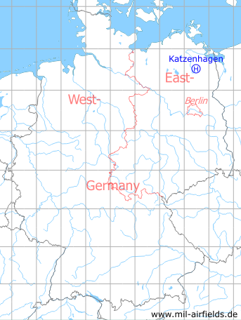
Location of airfield
Katzenhagen, at the railway track.
Usage during the Cold War
Helipad 3302 for Rear Command Post (RFS) of 3rd Air Defence Division (3. LVD) of former East German Air Force (NVA LSK/LV).
Use today
Closed.
Runways, taxiways, aprons
Dimensions: 100 m x 100 m,
main takeoff and landing direction: 45°,
surface: grass,
usable without crop damage,
capacity: 1 helicopter.
main takeoff and landing direction: 45°,
surface: grass,
usable without crop damage,
capacity: 1 helicopter.
Airspace and procedures
Usable at day during good weather conditions.
Alert time: 60 minutes (after establishing)
Alert time: 60 minutes (after establishing)
Obstacles
Timber-forest: direction 180°-310°.
Additional information
Herr Heiko Dudakow konnte diese Angaben zum Dorf Katzenhagen machen: "Das Dorf wurde eigens für die NVA geräumt. Die Bewohner wurden in das benachbarte Neetzka übersiedelt. Die letzten Bewohner verließen ca. 1969-1970 den Ort, zu diesem Zeitpunkt war die NVA schon zwei Jahre stationiert. Danach verschwand der Ort von den ostdeutschen Landkarten."
Vielen Dank, Herr Dudakow für diese Information!
Vielen Dank, Herr Dudakow für diese Information!
Airfields in the vicinity
- 218°/4km Cölpin: Helipad 3301 (HSLP / HLP 3301)
- 270°/5km Pragsdorf: Helipad 3350 (HSLP / HLP 3350)
- 097°/6km Ulrichshof: Helipad 3014 (HSLP / HLP 3014)
- 254°/10km Burg Stargard: Agricultural Airfield, Helipad 3336 (HSLP / HLP 3336, Lindenhof)
- 302°/13km Neubrandenburg: Air Base (Trollenhagen)
- 180°/17km Wendorf: Helipad 3027 (HSLP / HLP 3027)
- 251°/18km Klein Nemerow: Helipad 3006 (HSLP / HLP 3006)
 Follow mil-airfields on Facebook