For historical information only, do not use for navigation or aviation purposes!
| Coordinates | N532905 E0131252 (WGS84) Google Maps |
| Former East Germany (GDR) | District of Neubrandenburg |
| Federal state | Mecklenburg-Vorpommern (Mecklenburg-Western Pomerania) |
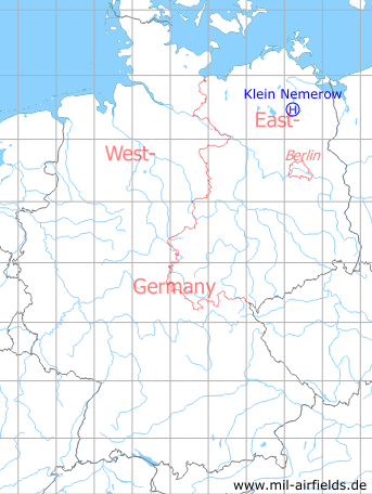
Germany during the Cold War Map
The history of the Cold War airfields: Klein Nemerow
Location of airfield
Southern limits of Klein Nemerow.
Usage during the Cold War
Helipad 3006 for Training camp Tollensesee of former East German Air Force (NVA LSK/LV).
Use today
Closed.
Runways, taxiways, aprons
Dimensions: 100 m x 120 m,
main takeoff and landing direction: 270°,
surface: solid grass,
capacity: 1 helicopter,
main takeoff and landing direction: 270°,
surface: solid grass,
capacity: 1 helicopter,
Telephone
Stabsnetz S1 4322-88
Airspace and procedures
Usable from June 1st until July 30th at day during good weather conditions.
Alert time: 60 minutes.
Alert time: 60 minutes.
Obstacles
Trees: distance 125 m, height 8 m.
Airfields in the vicinity
- 066°/8km Burg Stargard: Agricultural Airfield, Helipad 3336 (HSLP / HLP 3336, Lindenhof)
- 063°/13km Pragsdorf: Helipad 3350 (HSLP / HLP 3350)
- 025°/14km Neubrandenburg: Air Base (Trollenhagen)
- 079°/15km Cölpin: Helipad 3301 (HSLP / HLP 3301)
- 222°/16km Neustrelitz (Нойштрелиц)
- 224°/16km Neustrelitz (Нойштрелиц)
- 070°/18km Katzenhagen: Helipad 3302 (HSLP / HLP 3302)
- 122°/20km Wendorf: Helipad 3027 (HSLP / HLP 3027)
 Follow mil-airfields on Facebook