For historical information only, do not use for navigation or aviation purposes!
| Coordinates | N531823 E0124512 (WGS84) Google Maps |
| Elevation | 220 ft |
| Location indicator | EDAX (2000) |
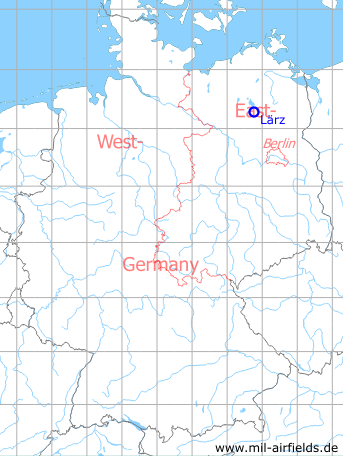
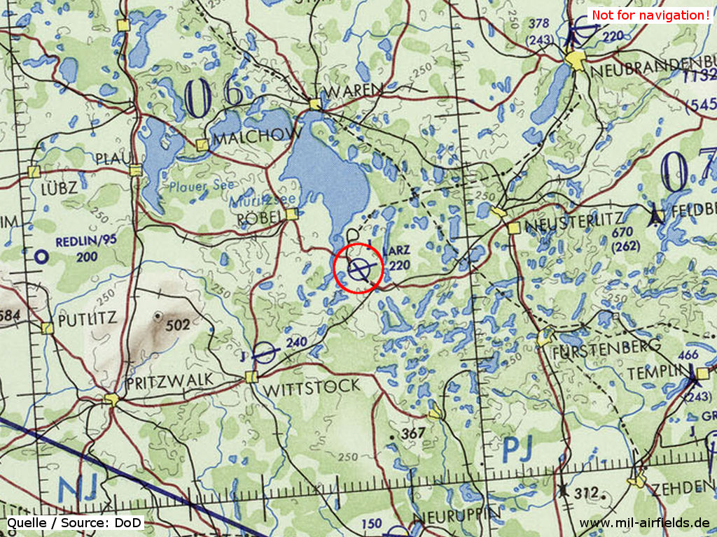
Germany during the Cold War Map
The history of the Cold War airfields: Lärz
During the Cold War
Use
Soviet/russian airbase until 1993.
In the 1950s
Units
1954
- Headquarters Soviet fighter division
- Soviet fighter regiment (P. O. Box 62 351),
- Soviet fighter regiment (P. O. Box 62 335),
- A total of 54 MiG-15/MiG-15U were counted at the airfield.
Source: BND/Bundesarchiv B 206/3033
(For the P. O. Box numbers the digits 3 and 5 may be confused, because they are difficult to distinguish in the source document)
In the 1960s
Situation
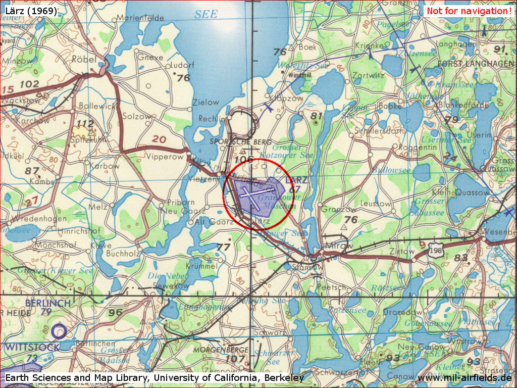
Lärz Air Base on a US map from 1969
Source: Earth Sciences and Map Library, University of California, Berkeley
Overview
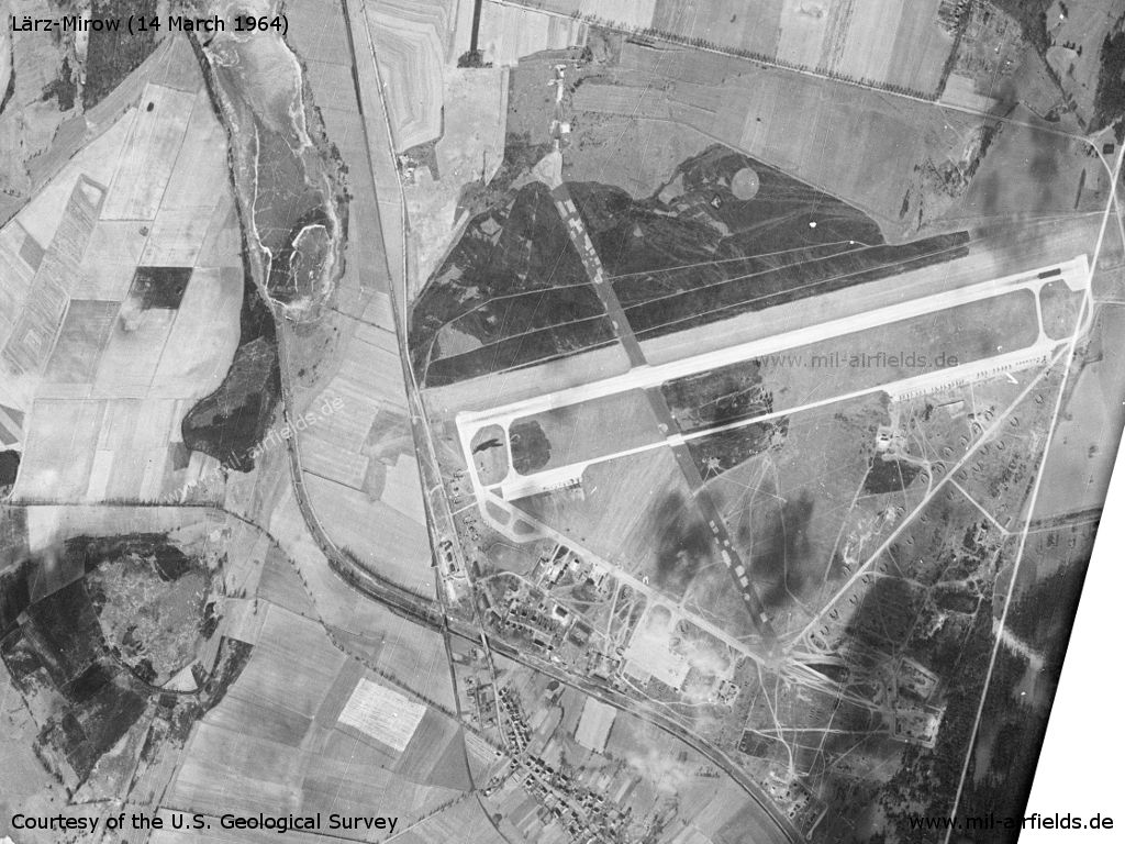
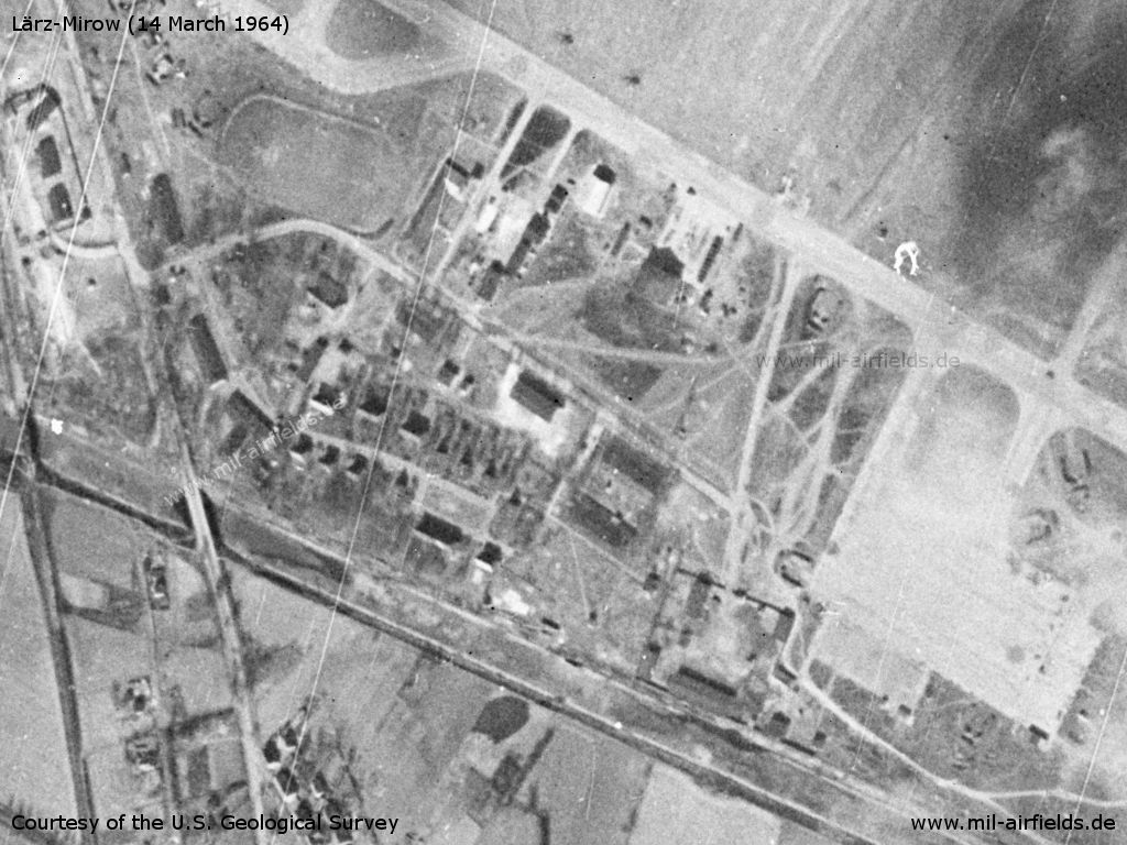
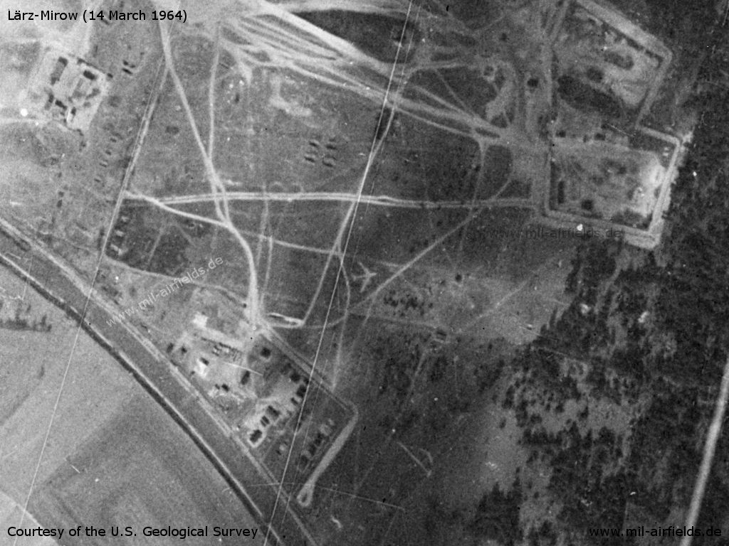
Lärz Soviet Air Base on a US satellite image from 14 March 1964
Source: U.S. Geological Survey
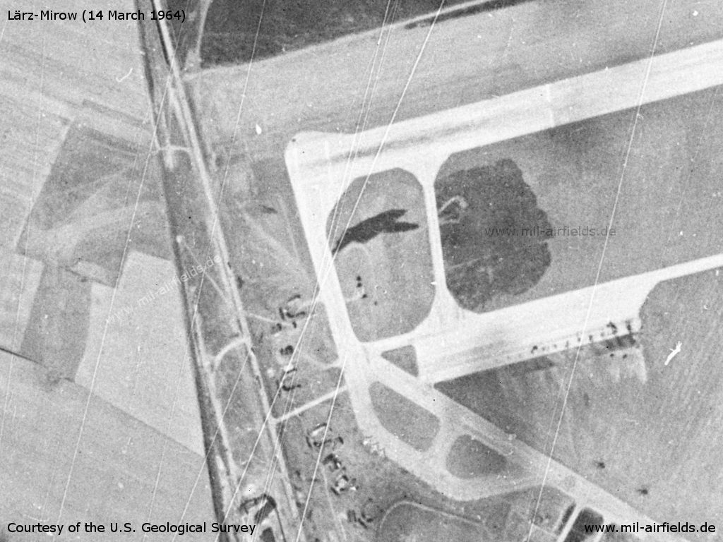
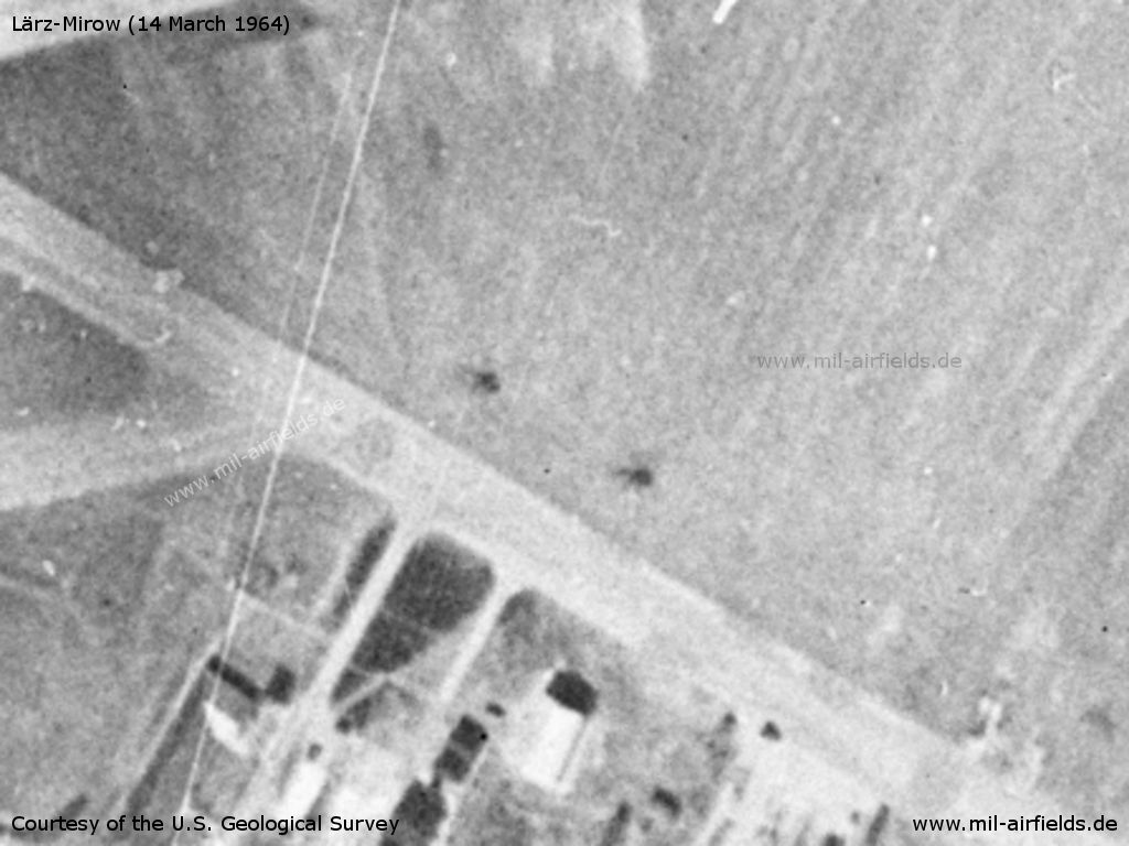
Western end of the runway
Source: U.S. Geological Survey
Buildings and installations - There are two helicopters on the top of the picture
Source: U.S. Geological Survey
Enlargement: The two helicopters
Source: U.S. Geological Survey
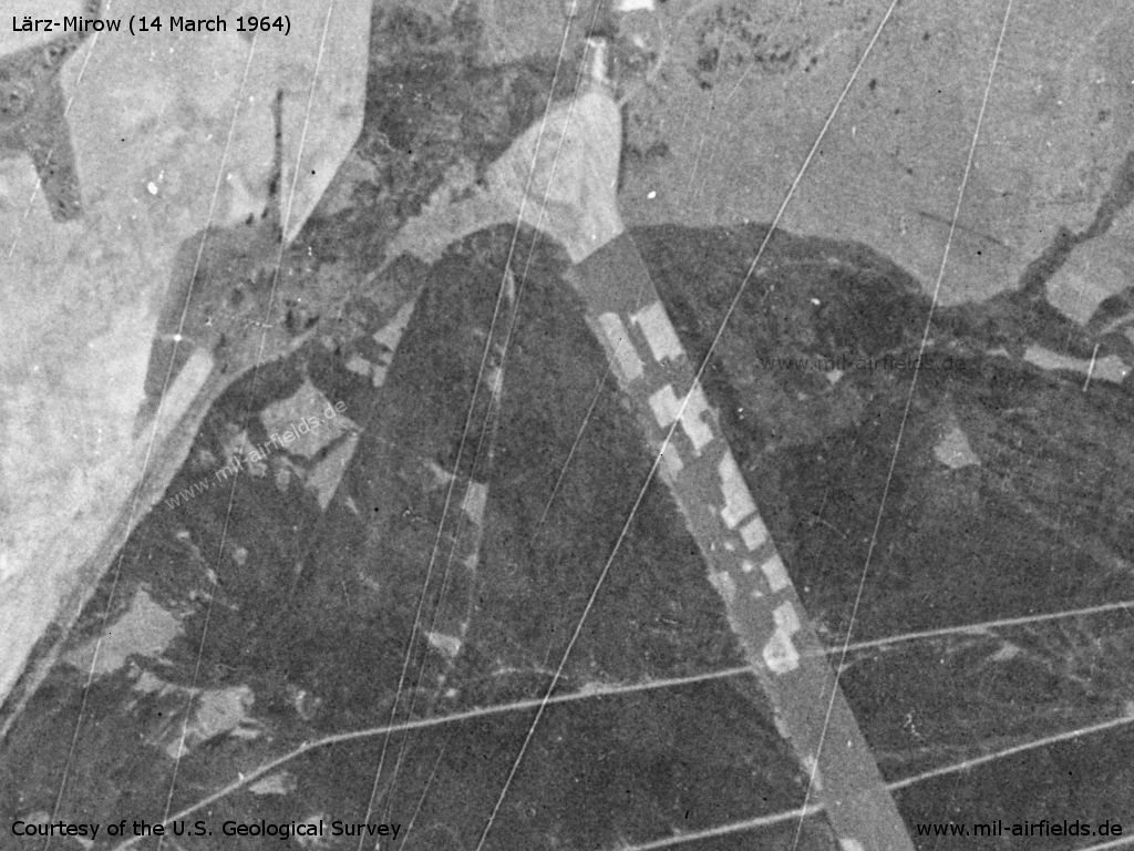
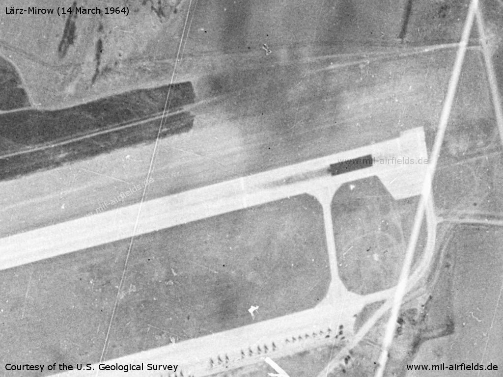
Northern end of the closed runway
Source: U.S. Geological Survey
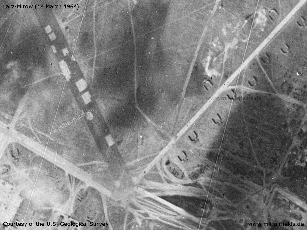
Intersection of the two runways and additional installations
Source: U.S. Geological Survey
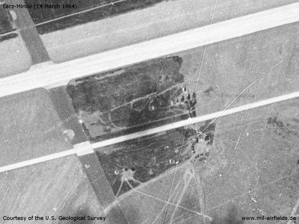
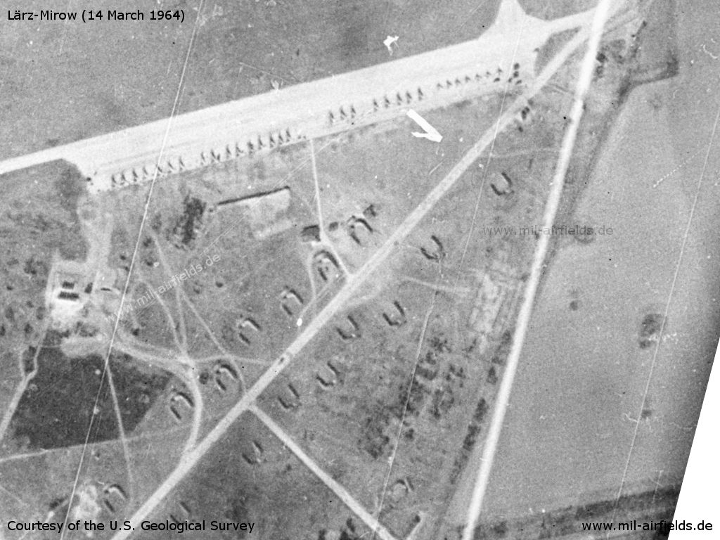
Area in the south with aircraft revetments
Source: U.S. Geological Survey
Area in the south - In the middle of the image there is an aircraft silhouette, which was probably applied as a target.
Source: U.S. Geological Survey
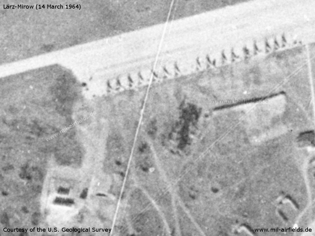
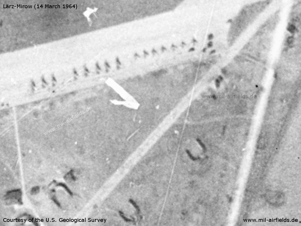
Flight line with figther aircraft
Source: U.S. Geological Survey
Enlargement: 16 fighter
Source: U.S. Geological Survey
Enlargement: 8 larger and 7 smaller aircraft
Source: U.S. Geological Survey
Eastern end of the runway
Source: U.S. Geological Survey
In the 1970s
Situation
Lärz air base on a map of the US Department of Defense from 1972
Radio beacons
Data for the 1970s:
- LOM 26: 476 "BÄ"
- LMM 26: 965 "B"
- LOM 08: 476 "ÜK"
- LMM 08: 965 "Ü"
In the 1980s/early 1990s
Runways
Data for the year 1990:
- 08/26: 2500 m
Radio communication
Call signs: BRANNAJA (ca. 1970), GUSAR (1980s..1990s)
Standard training routes
"Flüge der LSK/LV der NVA und der LSK der GSSD im Rahmen der Gefechtsausbildung sind entsprechend der Grafik der Flugtage / -nächte auf der Grundlage der "Hauptflugregeln zum Fliegen im Luftraum der Deutschen Demokratischen Republik" auf Standardflugstrecken in den dazu festgelegten Flughöhen durchzuführen. ..." (Quelle: "Verzeichnis der Standardflugstrecken der LSK/LV der NVA und der LSK der GSSD")
As of 1989:
Application Numbers 061 - 080
065 Lärz, Wredenhagen, Liesow, Wismar, Neustadt-Glewe, Schmolde, Schießplatz Retzow, Lärz
Höhe: 300, 600, 1200, 1850 m
Höhe: 300, 600, 1200, 1850 m
066 Lärz, Wredenhagen, Liesow, Wismar, Neustadt-Glewe, Blumenthal, Schießplatz Wittstock, Lärz
Höhe: 300, 600, 1200, 1850 m
Höhe: 300, 600, 1200, 1850 m
068 Lärz, Bredenfelde, Torgelow, Richtenberg, Neukloster, Havelberg, Lärz
Höhe: 6100 m
Abfangabschnitt: Bredenfelde, Neukloster
Höhe: 6100 m
Abfangabschnitt: Bredenfelde, Neukloster
069 Lärz, Wredenhagen, Neukloster, Friedland, Lärz
Höhe: 11900 - 18000 m
Höhe: 11900 - 18000 m
Application Numbers 511 - 520 for helicopter forces
513 Lärz, Höhenzieritz, Bredenfelde, Benz, Düsterförde (10 km W Altthymen) Gramzow Lärz
Höhe: 100 - 600 m
Höhe: 100 - 600 m
Units
Data for the year 1990: 19 GwAPIB: MiG-27, MiG-23UB; Detachment 439 OBVP: Mi-8, Mi-9, Mi-24
Real property
SAM site near Friedrichshof (Blohmberg)
Today
Use
General Aviation, Aviation Museum.
Links
Bibliography
- Freundt, Lutz: "Sowjetische Fliegerkräfte in Deutschland 1945-1994, Band 2" Freundt Eigenverlag, Diepholz 1999 - Description, pictures, map, aerial pictures (1953, 1991)
- Freundt, Lutz: "Sowjetische Fliegerkräfte in Deutschland 1945-1994, Band 4" Edition Freundt Eigenverlag, Diepholz 2000 - Corrections, picture
- Freundt, Lutz (Hrsg.), Büttner, Stefan: "Rote Plätze - Russische Militärflugplätze in Deutschland 1945 - 1994" AeroLit Verlag, 2007 - Description, map, picture, aerial pictures (1953, 1990, 1991)
- Fülber, Marcus: "Red Stars Over Europe" Concord Publications Co, Hong Kong, 1993 - Pictures of MiG-23 and MiG-27 at Larz
Airfields in the vicinity
- 349°/5km Rechlin: Helipad 1014 (HSLP / HLP 1014)
- 309°/18km Groß Kelle: Agricultural Airfield
- 233°/19km Wittstock: Air Base (Wittstock/Dosse, Alt Daber, Аэродром Витшток)
- 066°/21km Neustrelitz (Нойштрелиц)
- 068°/21km Neustrelitz (Нойштрелиц)
 Follow mil-airfields on Facebook