For historical information only, do not use for navigation or aviation purposes!
| Coordinates | N530444 E0134701 (WGS84) Google Maps |
| Former East Germany (GDR) | District of Neubrandenburg |
| Federal state | Brandenburg |
| Airfield Id | 3026 |
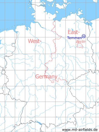
Germany during the Cold War Map
The history of the Cold War airfields: Temmen
Location of airfield
1.1 km southeast of Neu Temmen.
Usage during the Cold War
Helipad 3026 for Microwave Site 6 (RFB-6) of former East German Air Force (NVA LSK/LV).
Use today
Closed.
Runways, taxiways, aprons
Dimensions: 500 m x 200 m,
main takeoff and landing direction: 90°,
surface: grass, agricultural area,
usable without crop damage,
capacity: 1 helicopter.
main takeoff and landing direction: 90°,
surface: grass, agricultural area,
usable without crop damage,
capacity: 1 helicopter.
Telephone
Stabsnetz S1 4323-88
Airspace and procedures
Usable at day during good weather conditions.
Alert time: 60 minutes.
Alert time: 60 minutes.
Obstacles
Forrest: direction 0° - 360°, distance 500 m, height 30 m;
Antenna: direction 90°, height 20 m.
Antenna: direction 90°, height 20 m.
Airfields in the vicinity
- 252°/17km Templin: Air Base (Schorfheide, Groß Dölln)
- 094°/21km Pinnow: Helipad 3031 (HSLP / HLP 3031)
 Follow mil-airfields on Facebook