For historical information only, do not use for navigation or aviation purposes!
| Coordinates | N495516 E0105454 (WGS84) Google Maps |
| Elevation | 823 ft |
| Federal state | Bayern (Bavaria) |
| Location indicator | EDEJ (-1995), ETEJ (1995-), EDQA |
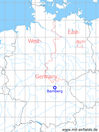
Germany during the Cold War Map
The history of the Cold War airfields: Bamberg
During World War II
Use
Airfield.
During the Cold War
Use
US Army airfield with joint civil use for general aviation.
Situation
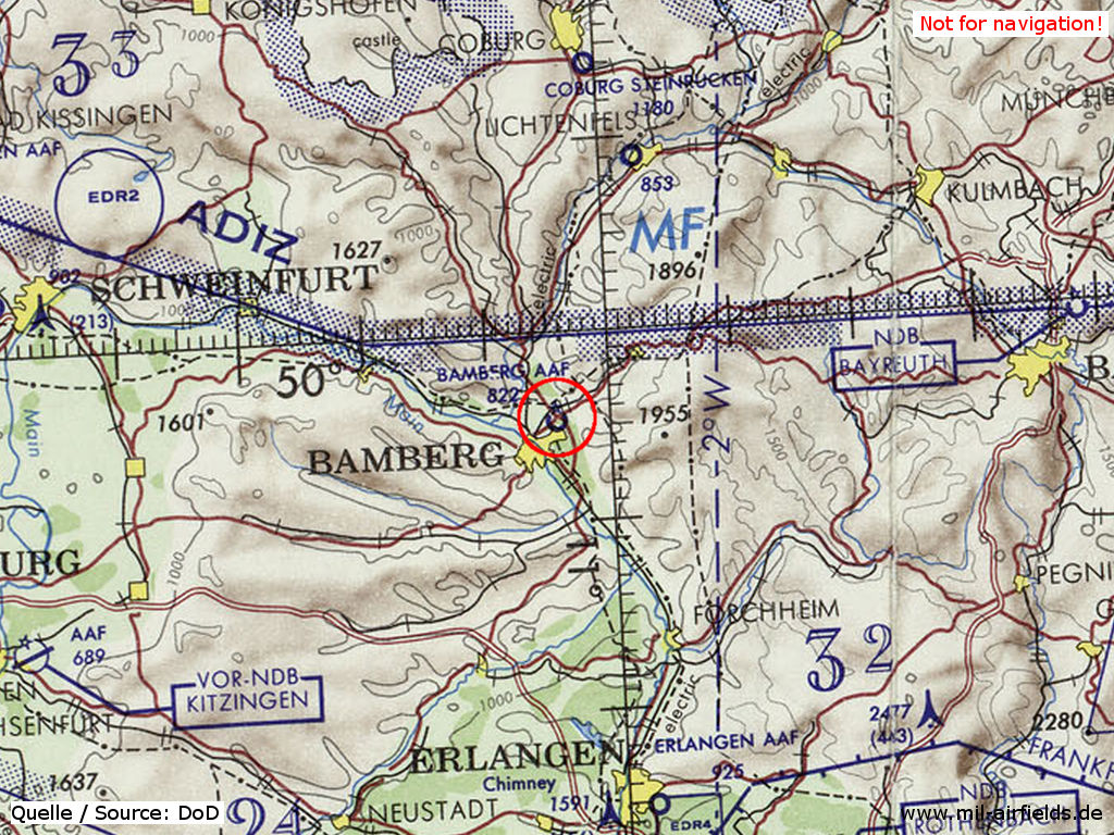
Bamberg Army Airfield AAF on a map of the US Department of Defense from 1972
Source: ONC E-2 (1972), Perry-Castañeda Library Map Collection, University of Texas at Austin
Overview
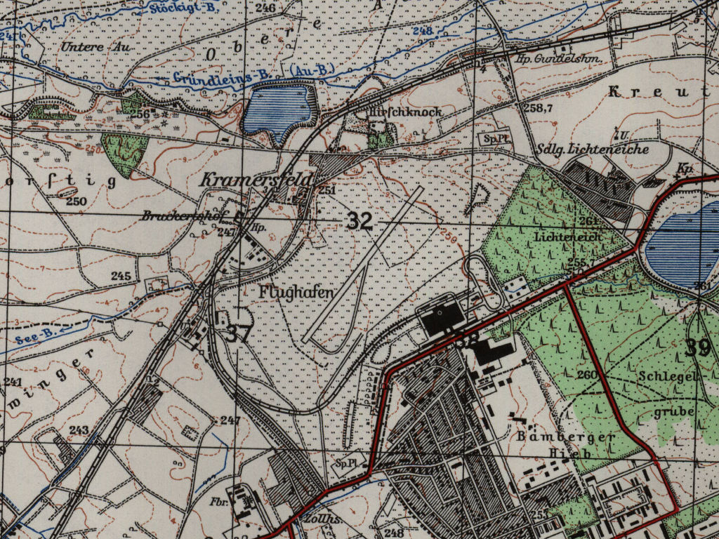
Bamberg airfield on a US map from 1954
Source: AMS M841 GSGS 4414, Courtesy Harold B. Lee Library, Brigham Young University
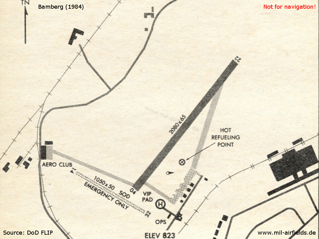
Map from 1984
Source: US DoD
Runways
Data for the year 1971:
- 04/22: 620 m x 20 m
- 14/32: 305 m x 15 m closed
Telephone
Military 2652-8869 (198x)
ETS/DSN 469-8869/8636 (199x)
ETS/DSN 469-8869/8636 (199x)
Units
Det. 501st Combat Avn Bat (1988)
Today
Use
Special airfield / general aviation.
Overview
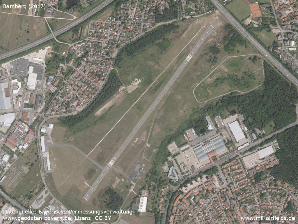
Aerial image (2017)
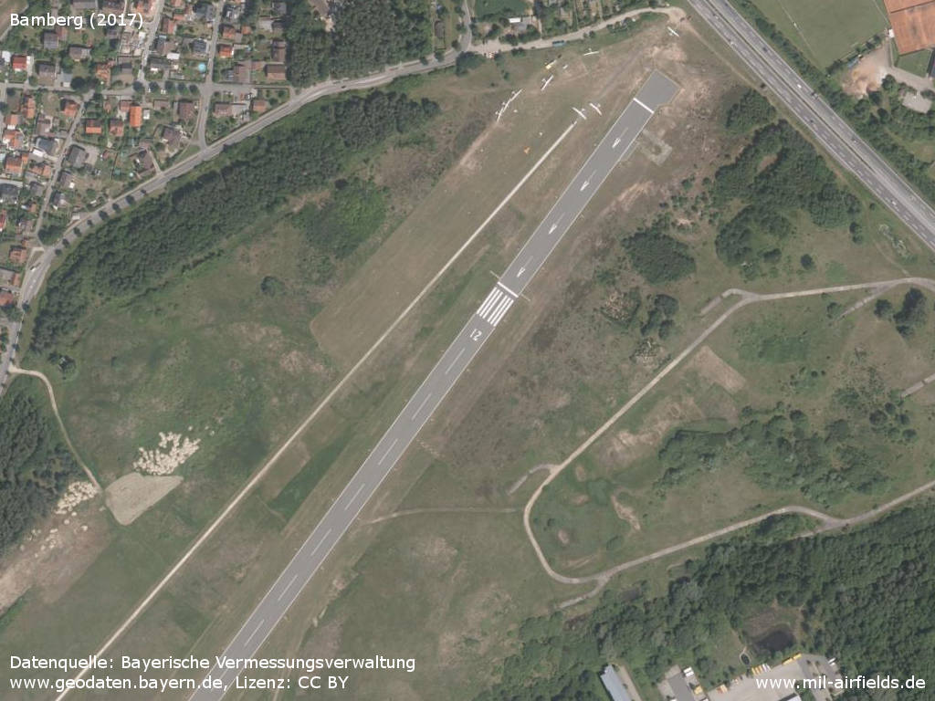
Northeastern part
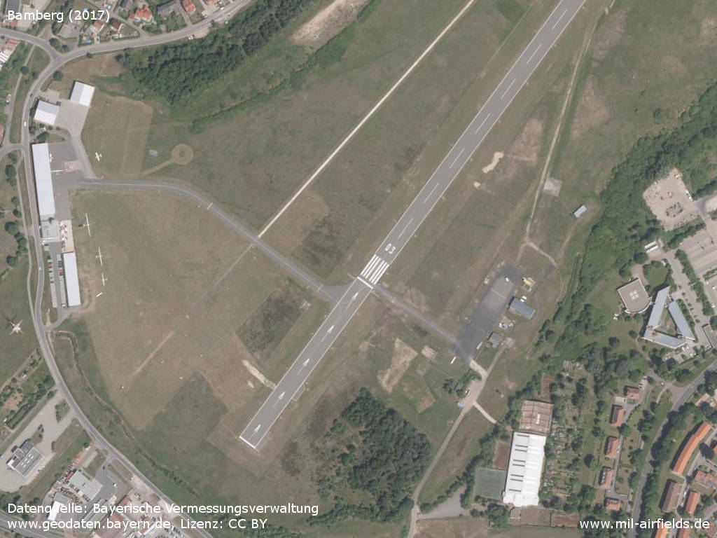
Southwestern part
Sources
- https://geoportal.bayern.de/ - Geoportal Bayern
Links
- https://www.aeroclub-bamberg.de/ - Aero-Club Bamberg e.V.
Airfields in the vicinity
- 168°/38km Erlangen: Army Airfield AAF (Ferris Barracks Army Heliport AHP)
- 176°/47km Fürth: Army Airfield AAF (Nürnberg-Fürth Airport, Atzenhof, Monteith Barracks Army Heliport Furth)
- 177°/49km Fürth: Industrieflughafen Airport (Nuremberg-Fürth Industriehafen Airfield, Fürth Industrie)
- 176°/51km Fürth: Dambach Housing Area Helipad
- 081°/52km Bayreuth: Army Airfield AAF (Bindlach, Christensen Barracks)
Categories
Military Airfields GermanyMilitary Airfields in former West GermanyUS Army Airfields and Heliports in GermanyRecommended
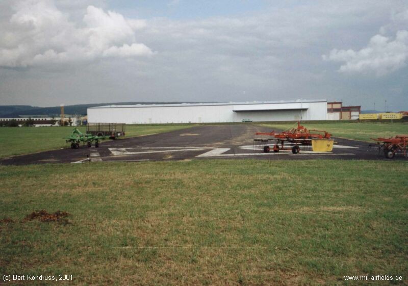
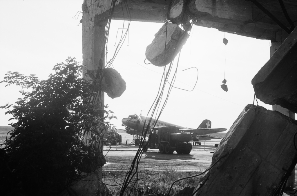
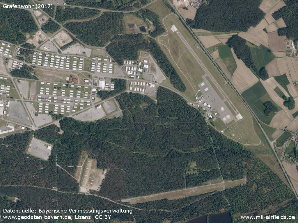
Image credits are shown on the respective target page, click on the preview to open it.
 Follow mil-airfields on Facebook