For historical information only, do not use for navigation or aviation purposes!
| Coordinates | N535947 E0124249 (WGS84) Google Maps |
| Elevation | 75' |
| Former East Germany (GDR) | District of Neubrandenburg |
| Federal state | Mecklenburg-Vorpommern (Mecklenburg-Western Pomerania) |
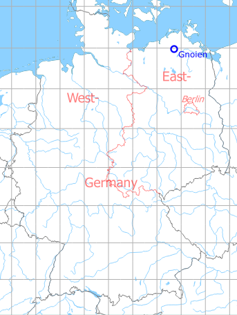
Germany during the Cold War Map
The history of the Cold War airfields: Gnoien
During the Cold War
Use
Gnoien-Warbelow was built at the end of the 1960s as an auxiliary airfield for the Air Force/Air Defence (LSK/LV) of the National People's Army (NVA) of the GDR. It was assigned to Fighter Wing 2 (JG-2), stationed in Neubrandenburg/Trollenhagen. In the NVA it had the airfield number 2021.
In the 1960s
Overview
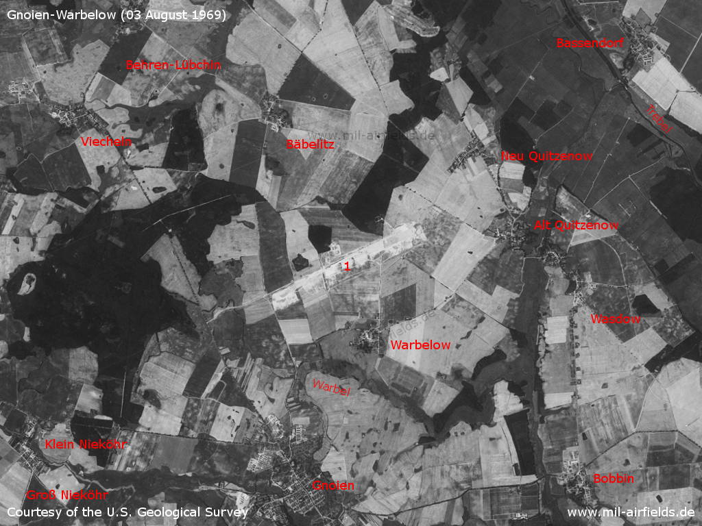
Gnoien and surroundings on a US satellite image from Sunday 03 August 1969 - 1: airfield. Places: Bäbelitz, Bassendorf, Behren-Lübchin, Bobbin, Groß Nieköhr, Klein Nieköhr, Neu Quietzenow, Viecheln, Warbelow, Wasdow. Rivers: Trebel, Warbel.
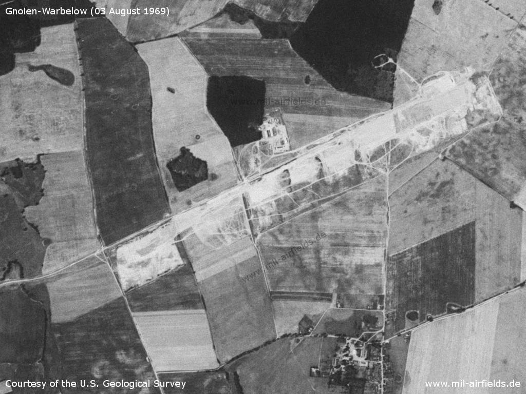
Enlargement: Gnoien Warbelow Airfield - At that time, the facilities are still under construction. Remarkable: For the airfield, earthworks were carried out in the western direction up to the path leading in the south-eastern direction. However, the airfield later extended about 360 m further to the west, this area is still untouched here.
Source: U.S. Geological Survey
History
- 1969
The US Military Liaison Mission notices that an East German airfield is under construction at Gnoien. (Source: USMLM 1969)
In the 1970s
Overview
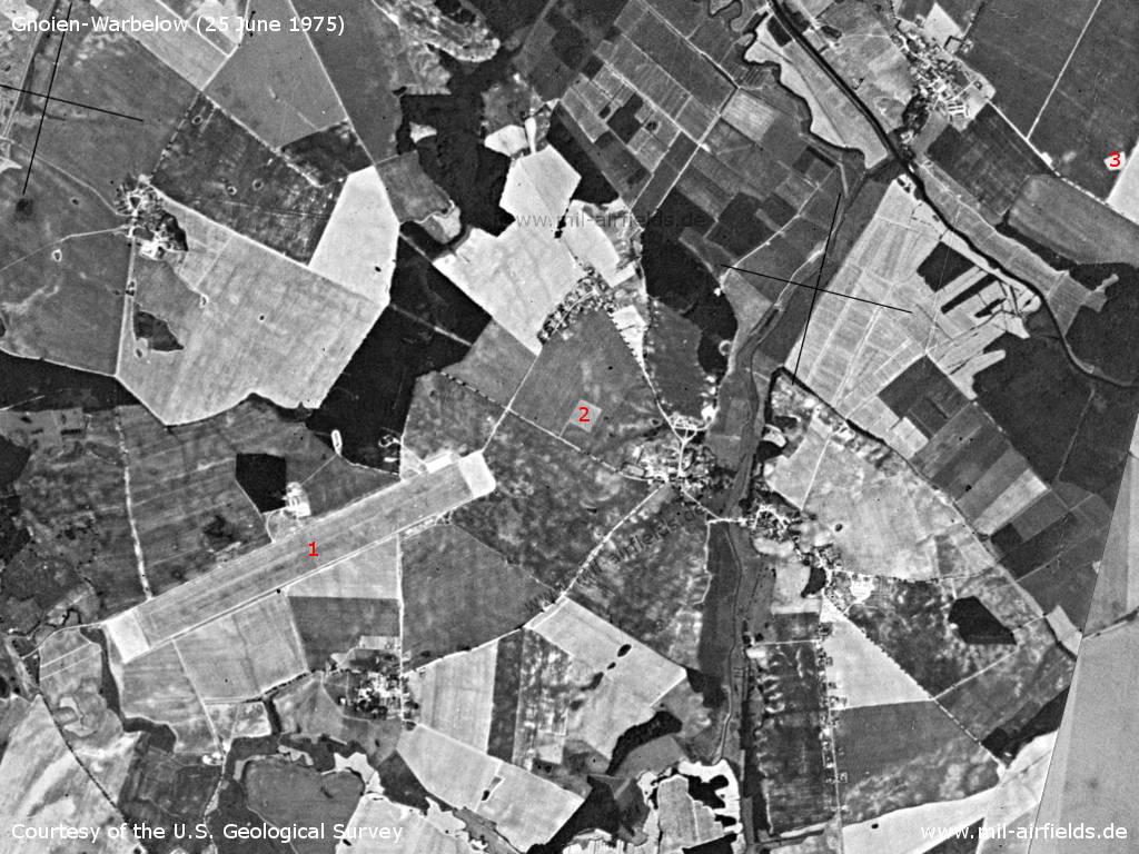
Gnoien, Wednesday 25 June 1975 - 1: Airfield; 2: inner radio beacon? 3: outer radio beacon?
Source: U.S. Geological Survey
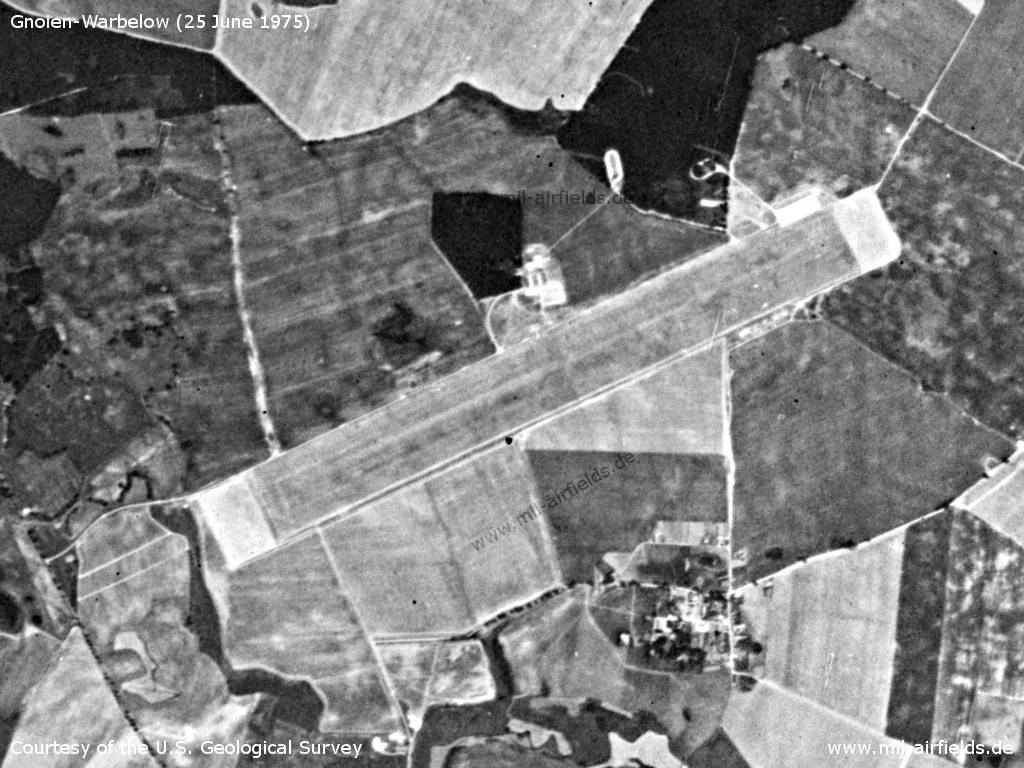
Enlargement: Airfield
Source: U.S. Geological Survey
History
- August 2nd, 1972
Observation by the US Military Liaison Mission: "Four FISHBED and a CRATE were deployed to Gnoien sod strip on 2 August during (an) Air Defense Exercise ... This was the first observation of aircraft utilization of this auxiliary field, which was initially identified under construction in May 1969." (Source: USMLM 1972)
In the 1980s and early 1990s
Runways
- 07/25: 2360 m x 80 m Grass
Radio beacons
- LOM 25: 643 "WL", 4900 m
- LMM 25: 312 "W", 950 m
- LOM 07: 643 "LW", 4200 m
- LMM 07: 312 "L", 1200 m
Die Kennungen der Funkfeuer wurden, wie im Warschauer Pakt üblich, aus dem ersten und letzten Buchstaben des Rufzeichens abgeleitet (WENZEL).
Radio communication
The radio call sign for air traffic control was WENZEL.
Units
Feldflugplatzkommando 2 (FFlpK-2, PF 65262)
Real property
| Installation Id | Object | Area | Quarters | Address |
|---|---|---|---|---|
| 03/080 | Flugplatz | 160,6 ha | ||
| 01/951 | Radio beacon | 0,1 ha | (Warbelow/Bassendorf) | |
| 01/952 | Funkfeuer | 0,2 ha | (Warbelow/Bassendorf) |
History
- 1988
Observation by the US Military Liaison Mission: "At the Gnoien Auxiliary Airfield, arresting gear are in place ... These oibservations suggest the Soviets and East Germans have not abandoned the use of auxiliary airfields, but in fact are making improvements at these strips for safer operations." (Source: USMLM 1988)
Today
Use
Airfield closed, area used by Bundeswehr as anti-aircraft missile training base.
Overview
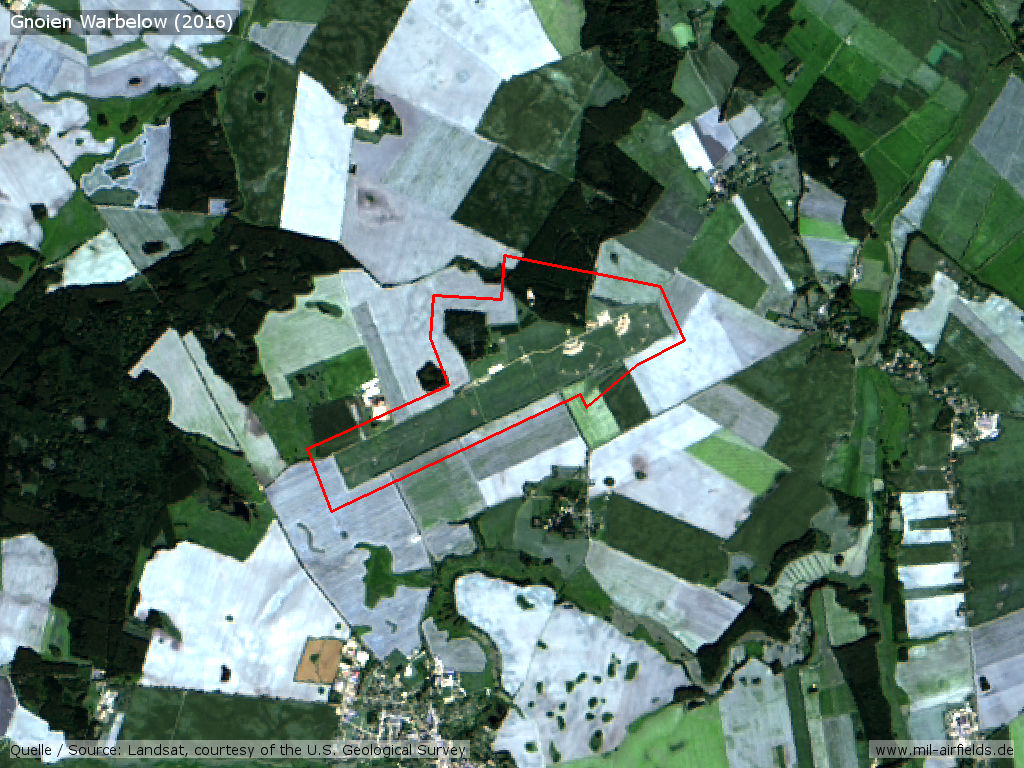
Landsat image from 2016
Sources
- https://www.usgs.gov/ - USGS U.S. Geological Survey
Bibliography
- /USMLM 1969/:
United States Military Liaison Mission: "Unit History 1969" - /USMLM 1972/:
United States Military Liaison Mission: "Unit History 1972" - /USMLM 1988/:
United States Military Liaison Mission: "Unit History 1988"
Airfields in the vicinity
- 107°/21km Wotenick: Agricultural Airfield (Demmin)
- 291°/24km Sanitz: Helipad 3306 (HSLP 3306)
- 066°/27km Grimmen: Appelshof Agricultural Airfield
- 042°/29km Abtshagen: Anti-aircraft missile unit 4321 (Helipad 3310)
- 113°/29km Sanzkow: Helipad 3040 (HSLP / HLP 3040)
- 044°/30km Abtshagen: Agricultural Airfield
- 253°/30km Laage: Airfield / Air Base (Rostock Airport)
Categories
Military Airfields GermanyMilitary Airfields in former East GermanyAir bases of former National People's ArmyRecommended
Image credits are shown on the respective target page, click on the preview to open it.
 Follow mil-airfields on Facebook