Giebelstadt: Air Base, Army Airfield AAF
For historical information only, do not use for navigation or aviation purposes!
| Coordinates | N493853 E0095800 (WGS84) Google Maps |
| Elevation | 979 ft |
| Federal state | Bayern (Bavaria) |
| Location indicator | DBGS (195x), EDAG, EDEU (-1995), ETEU (1995-), EDQG (200x-) |
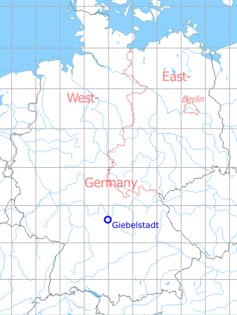
Germany during the Cold War Map
The history of the Cold War airfields: Giebelstadt
Location of airfield
The airfield is located ca. 1 km southeast of Giebelstadt.
During World War II
Use
Luftwaffe airbase.
Situation
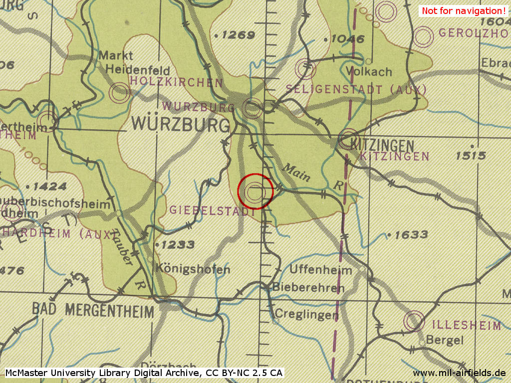
Giebelstadt Air Base in World War II on a US map from 1944 - (McMaster University Library Digital Archive, License: Creative Commons Attribution-NonCommercial 2.5 CC BY-NC 2.5 CA /MULDA/)
During the Cold War
Use
Temporarily there was a air defence radar site and a Hawk anti-aircraft missile site at the airfield.
US Air Force base (EDAG). Temporarily, Giebelstadt was a base for U-2 aircrafts to conduct reconnaissance flights over eastern Europe. In the late 1960s and early 1970s, the airfield was closed. Later US Army helicopter base (EDEU, ETEU).
In the 1950s
Overview
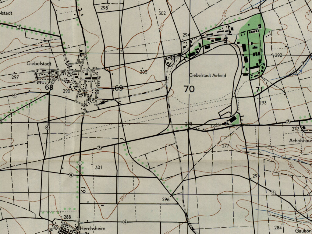
Giebelstadt airfield on a US military map from 1953 - The runway is indicated. The buildings of the old air base in the north-east are clearly visible, as well as the connecting railway, which runs across the runway.
(AMS M841 GSGS 4414, Courtesy Harold B. Lee Library, Brigham Young University /BYU/)
Airspace and procedures
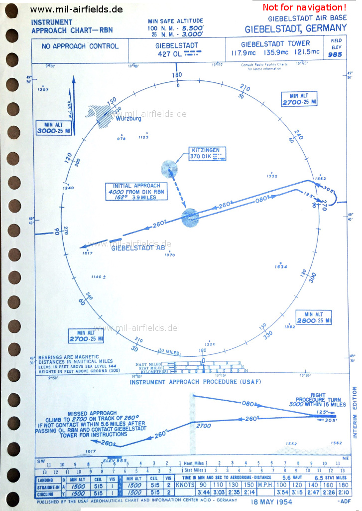
USAF approach chart from 1954
Additional information
Airfield Survey in 1953
In 1953, survey tours took place in Southern Germany to identify future air bases for the German Air Force. Old airfields were visited and assessed, if a field can be used, if technical facilities and housing are available und if an extension of the runway up to 2500 m (8203 ft) or 3000 m (9843 ft) is possible.
For Giebelstadt was documented: A new runway, taxiways and hardstands have been built on the airfield with 2100 m x 600 m (6890 ft x 1969 ft). The movement areas with a concrete runway 08/26 of 2100 m x 60 m (6890 ft x 197 ft) are in good conditions. An extension "stub" west of the road Giebelstadt - Herchsheim with 300 m x 50 m (984 ft x 164 ft) is in preparation. The old installations are mostly destroyed, with the exception of two hangars and some refueling points. The former quarter area is blown up to 90%. An extension to 3000 m (9843 ft) is possible only to the west, with minor earth movements, but with the need to relocate the road B19 Giebelstadt-Herchsheim.
In the 1980s and early 1990s
Overview
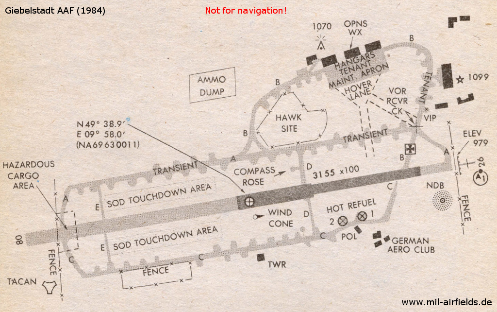
Airfield map from 1984
Runways
Data for the year 1990:
- 08/26: 2133 m x 30 m Concrete/Asphalt
Radio beacons
Data for the year 1990:
- NDB: 507 "GBL", at field
- TACAN: CH47 "GBL", at field
Units
1988: 3rd Combat Avn Bat
1990: I-3 Avn (2 UH-1H); 2-3 Avn (21 AH-1F, 13 OH-58C, 3 UH-1H); 3-3 Avn (21 AH-1F, 13 OH-58C, 3 UH-1H); 23rd TF (15 UH-60A, 3 EH-60C, 6 OH-58A, 6 OH-58D, 6 UH-1H)
1994: A 5 - 159 Avn (CH-47)
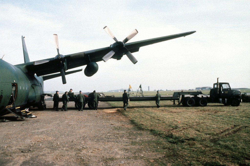
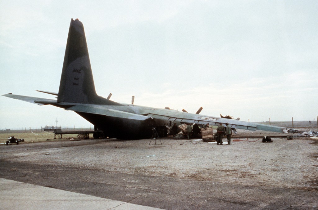
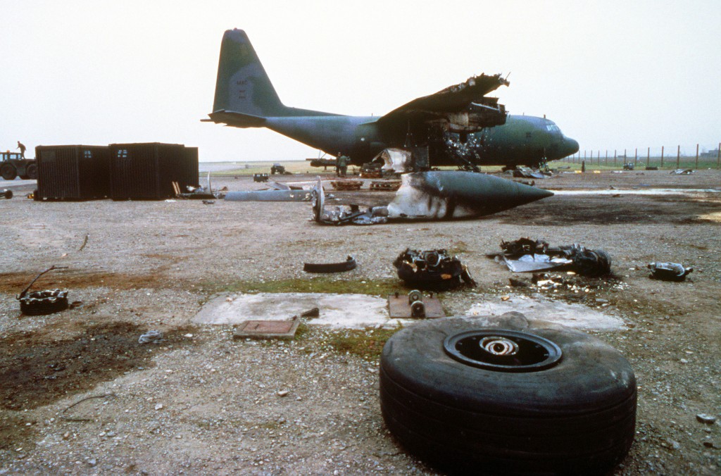
Images
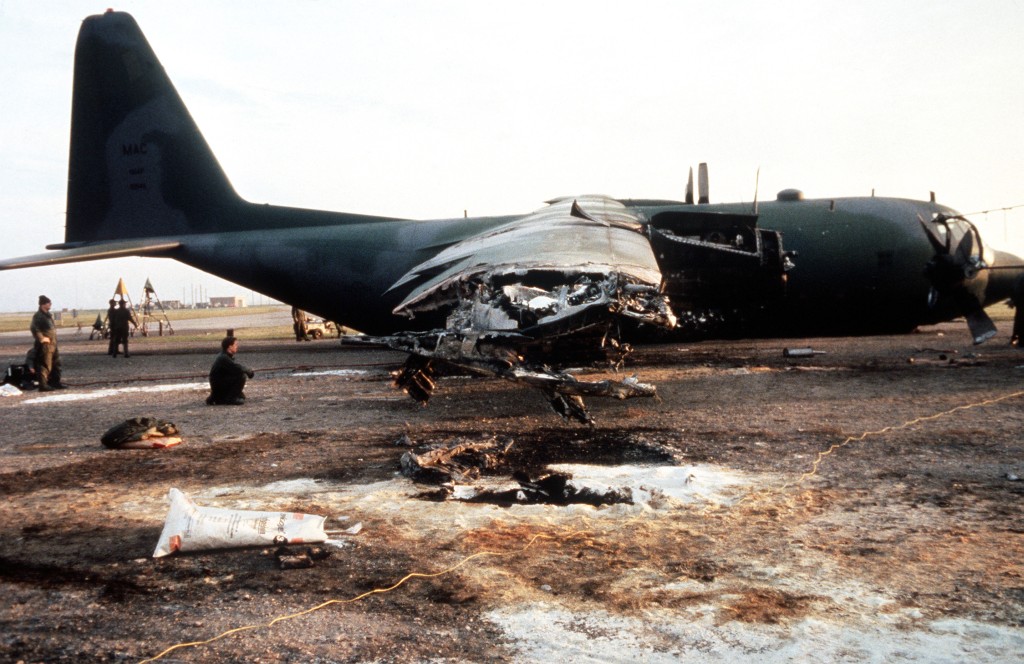
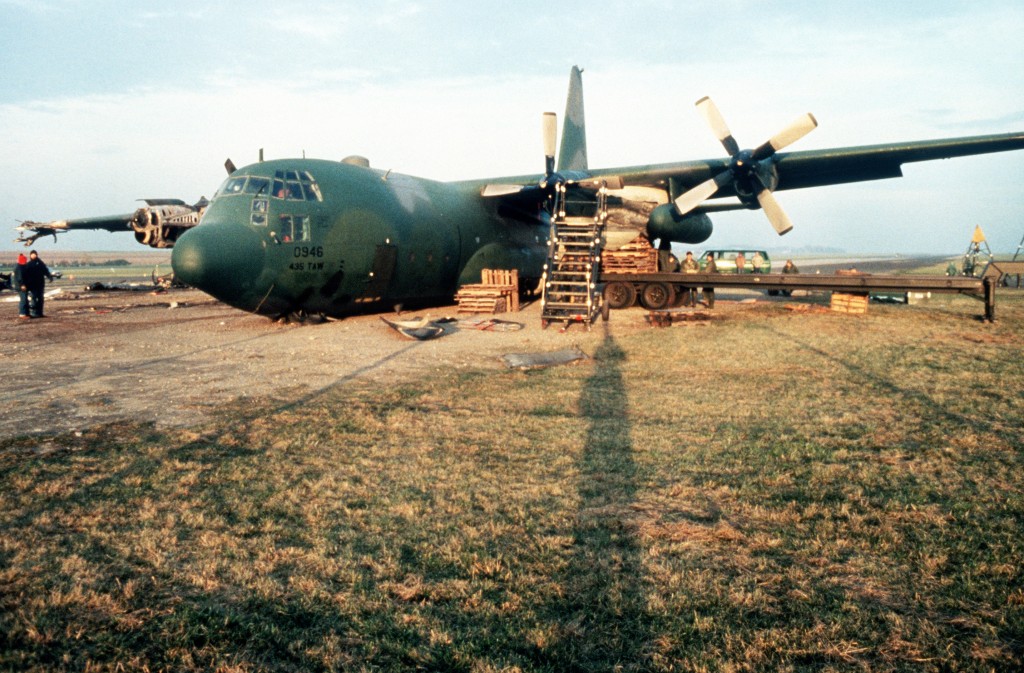
Pictures from 1984 after the crash landing of C-130E Hercules 68-10946 on November 02, 1984.
"Buffeted by high winds on final approach the landing gear collapsed and the number one engine caught fire on touchdown. The propeller disintegrated, three crewmembers were injured, there were no fatalities." (Source: US DoD)
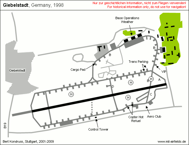
Today
Use
General aviation (EDQG).
Transition to civil use: In a short exposé from 2008, the Bundesanstalt für Immobilienaufgaben (Institute for Federal Real Estate, a government agency) writes the following: Total area of 257 ha, a part of 128 ha have been sold as airfield. On the remaining 129 ha there are, among others, 10 accomodation buildings, 10 office buildings and 11 facility sections. The developed area is about 60.000 m², the floor space ca. 85.000 m². (Source: www.bundesimmobilien.de)
Links
- http://www.fliegerhorste.de/giebelstadt.htm - Giebelstadt
- /BYU/:
http://lib.byu.edu/collections/german-maps/ - German Maps (Topographische Karte 1:25,000)
Bibliography
- Ries, Karl; Dierich, Wolfgang: "Fliegerhorste und Einsatzhäfen der Luftwaffe" Motorbuch Verlag Stuttgart, 1993 - Allied map
- Decker, Karl-Heinz: "Geschichte des Fliegerhorstes Giebelstadt von 1933-1945" J. H. Röll Verlag, 2010
 Follow mil-airfields on Facebook