Berlin: Steinstücken Helipad
For historical information only, do not use for navigation or aviation purposes!
| Coordinates | N522325 E0130742 (WGS84) Google Maps |
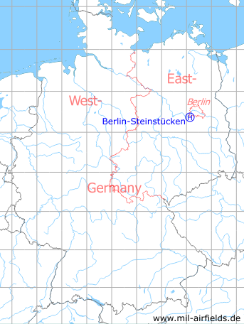
Germany during the Cold War Map
The history of the Cold War airfields: Berlin-Steinstuecken
General
When the city of Berlin was divided into four sectors in 1945, the Steinstücken settlement belonged to the American sector, but as an exclave was completely surrounded by the state of Brandenburg and later by the GDR district of Potsdam. This meant that access was dependent on the arbitrariness of the GDR regime. To supply and protect the settlement, which was attacked several times by GDR troops, this helicopter landing site was set up by the US Army. With an exchange of territories in 1972, Steinstücken was given dedicated access and were thus no longer an exclave, which normalised the situation.
During the Cold War
Situation
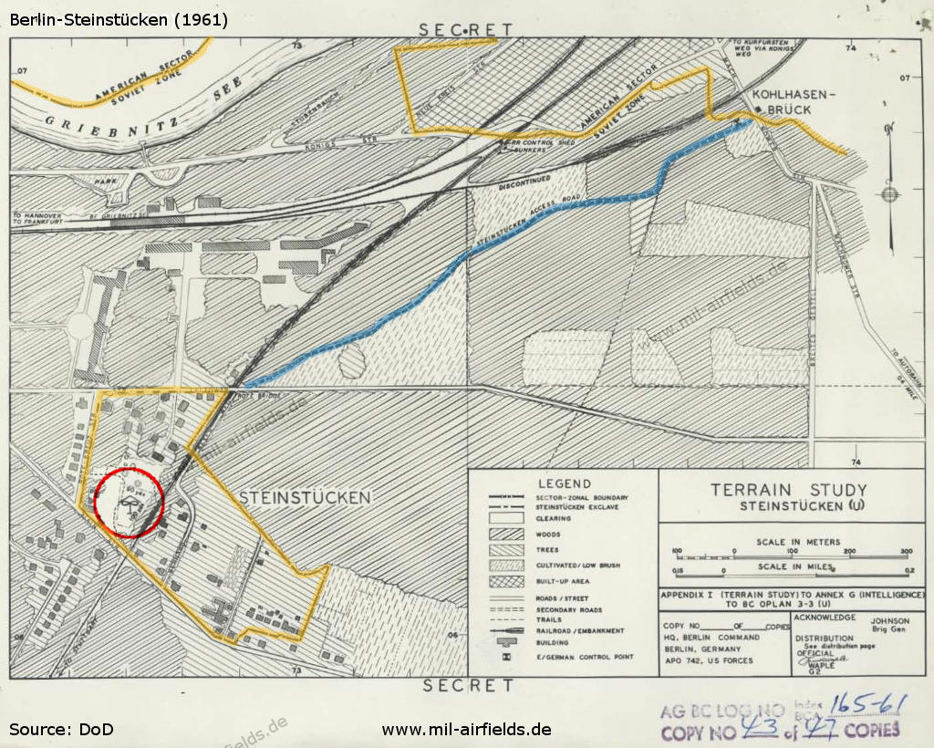
The helicopter landing area marked on a map from the Berlin Command Plan for STEINSTUCKEN (1961, Secret) - Colored by mil-airfields: yellow=Berlin city limits, blue=route to Steinstücken controlled by East Germany.
Source: National Archives
Overview
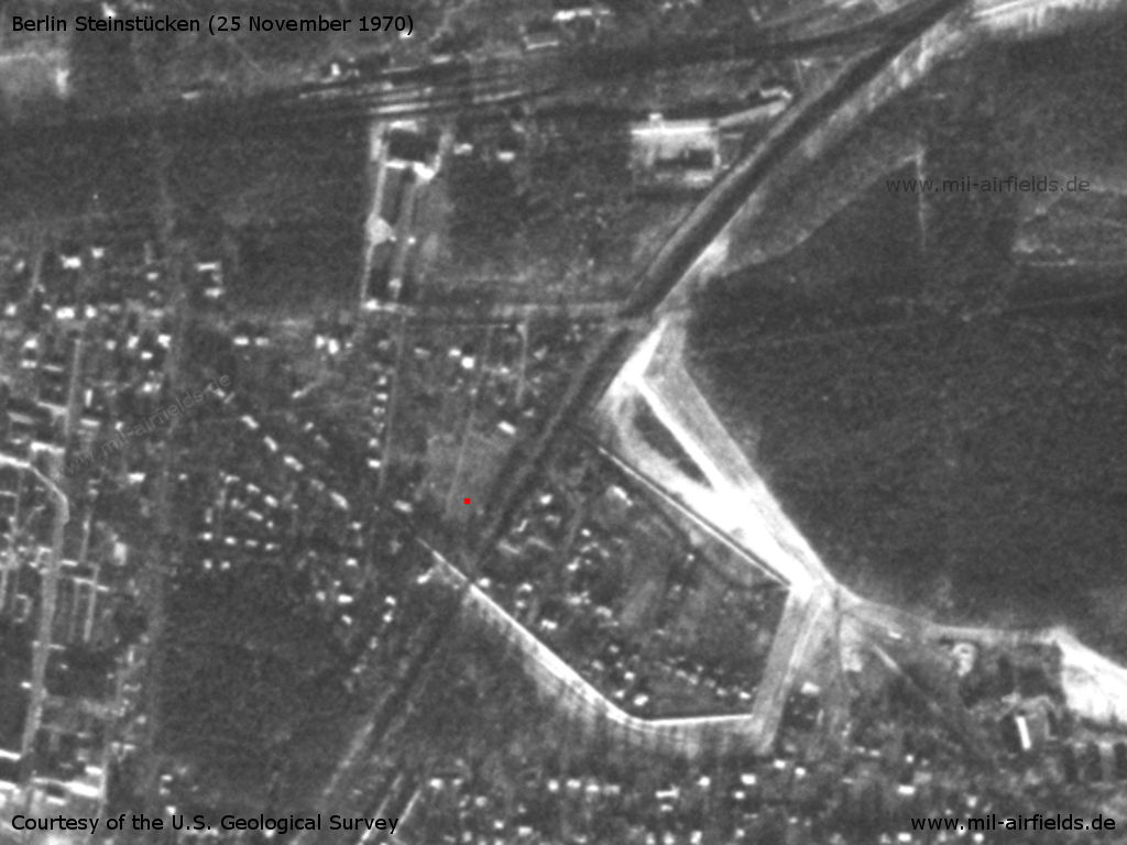
The exclave Berlin Steinstücken on a US satellite image from 25 November 1970 - In the eastern area, the Berlin wall is clearly visible. I marked the helipad with a red dot. The Potsdam-Griebnitzsee railway station is visible at the top of the picture.
Source: U.S. Geological Survey
Today
Use
Closed. For remembrance, the place is named today "Am Landeplatz" ("At the landing ground") and there is a memorial.
Links
- http://helikopterhysteriezwo.blogspot.de/2015/01/m... - Helikopter Hysterie ZWO - Spirit of Steinstücken
Sources
- https://www.archives.gov - National Archives
Airfields in the vicinity
- 004°/9km Berlin: RAF Gatow Airfield (Kladow)
- 192°/9km Saarmund: Airfield (Eichberg, Wilhelmshorst)
- 075°/11km Berlin: Berlin Command Airstrip
- 149°/14km Ludwigsfelde: Helipad 1012 (HSLP 1012)
- 357°/16km Berlin: Staaken Airfield (Dallgow, Dalgow, Аэродром Берлин Штакен)
- 226°/20km Beelitz: Military Hospital Helipad (Beelitz-Heilstätten, Госпиталь Белиц-Хайльштеттен)
- 063°/21km Berlin: Tempelhof Airport (Berlin Tempelhof Central Airport TCA)
 Follow mil-airfields on Facebook