For historical information only, do not use for navigation or aviation purposes!
| Coordinates | N521828 E0130601 (WGS84) Google Maps |
| Former East Germany (GDR) | District of Potsdam |
| Federal state | Brandenburg |
| Location indicator | EDCS |
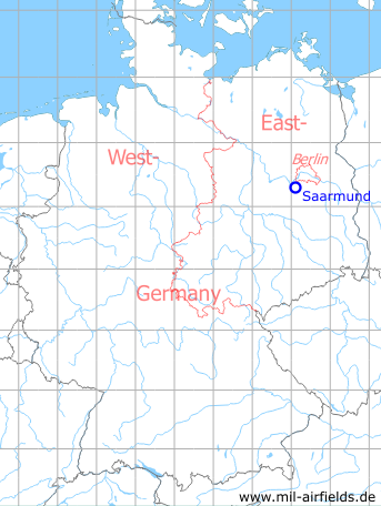
Germany during the Cold War Map
The history of the Cold War airfields: Saarmund
Location of airfield
2.3 km southwest of Saarmund.
During the Cold War
Use
Glider airfield of the East German pre-military organization "Gesellschaft für Sport und Technik" (GST) until 1979.
Helipad 3005 for Flugplatzpionierbataillon 14 (FPiB-14) and Pionierbataillon 24 (PiB-24) of former East German Airforce (LSK/LV) and helipad 6103 of former National People's Army (NVA).
In the 1960s
Situation
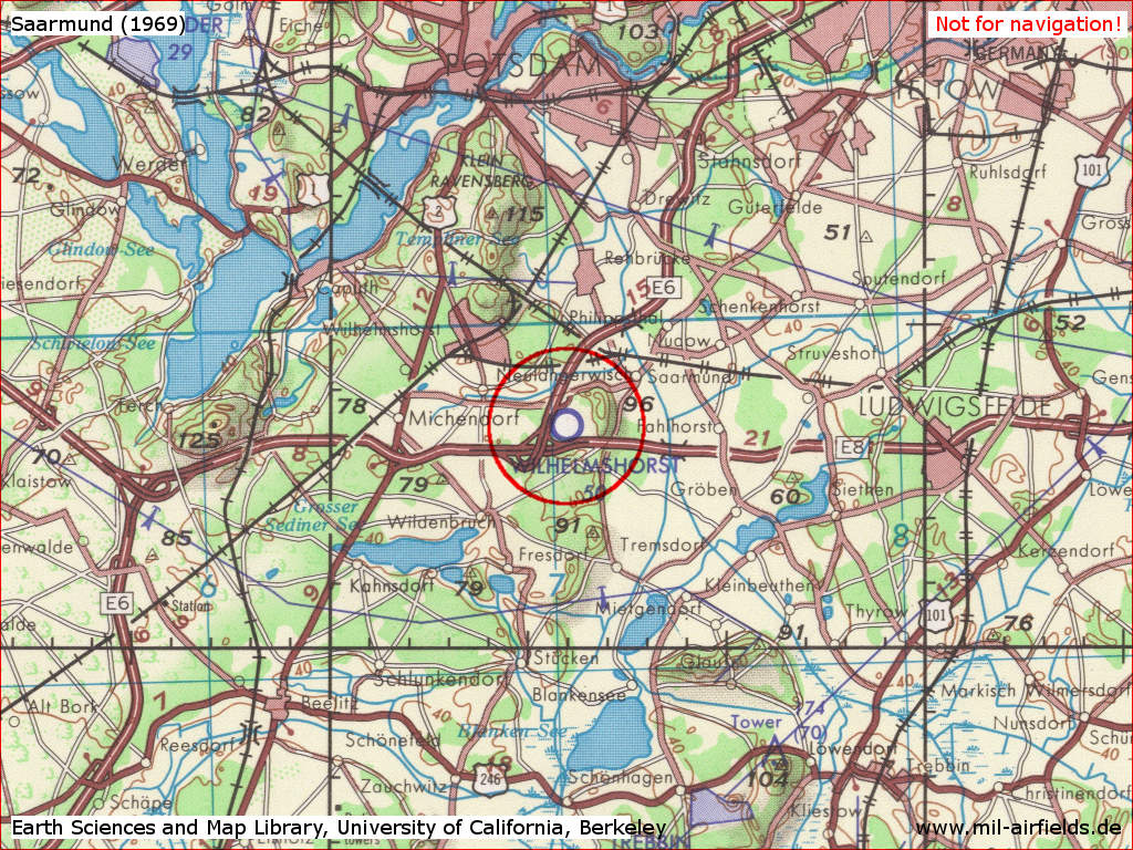
Saarmund Airfield on a US map from 1969
Source: Earth Sciences and Map Library, University of California, Berkeley
Overview
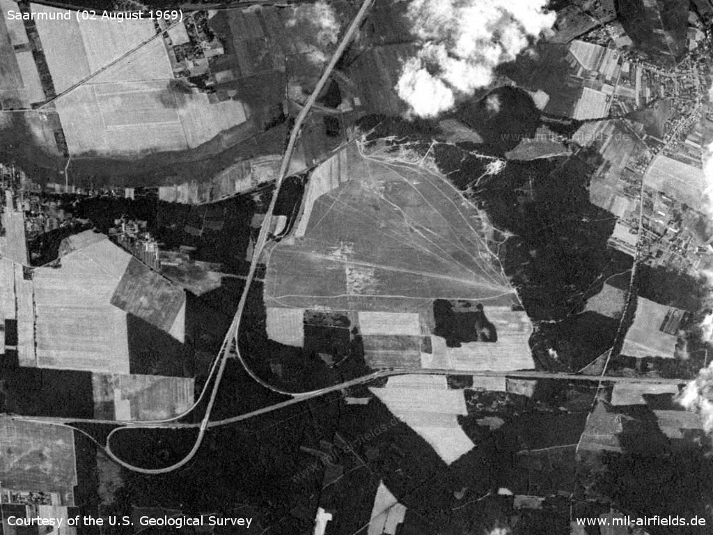
Saarmund Airfield on a US satellite image from 02 August 1969 - The location can be clearly seen at the Drewitz junction (today the Nuthetal triangle) with the East German Autobahn A1 Berliner Ring (today A10) and A12 (today A115) DDR motorways. Saarmunder Berg / Eichberg are located on the east side of the field.
Source: U.S. Geological Survey
In the 1980s and early 1990s
Use
After its closure as a GST airfield, Saarmund was designated as a helicopter landing site of the East German National People's Army (NVA)
Overview
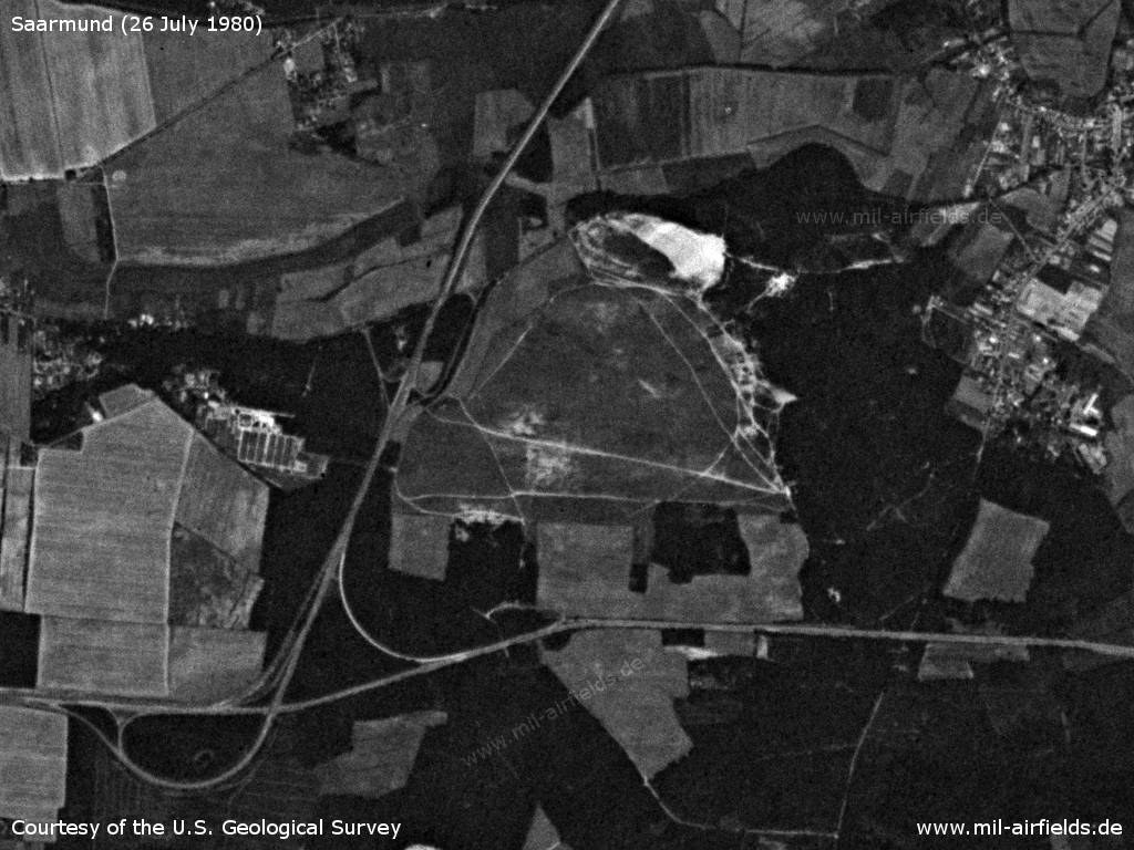
Satellite picture from 26 July 1980
Source: U.S. Geological Survey
Runways
- 09/27: 1000 m Grass
- 03/21: 1150 m Grass
Main takeoff and landing direction: 90°, 270°, reserve 30°
Capacity: 1 helicopter (for FPiB-14 and PiB-24)
Airspace and procedures
Usable at day and good weather conditions.
Alert time: 80 minutes.
Alert time: 80 minutes.
Obstacles
Forrest: direction 180-270°, distance 350-500 m, height 10-15 m.
Real property
The airfield or a nearby object had the National People's Army installation ID 04/351.
Today
Use
General Aviation.
Links
- http://www.flugplatz-saarmund.de/ - Homepage
Airfields in the vicinity
- 012°/9km Berlin: Steinstücken Helipad
- 107°/9km Ludwigsfelde: Helipad 1012 (HSLP 1012)
- 250°/13km Beelitz: Military Hospital Helipad (Beelitz-Heilstätten, Госпиталь Белиц-Хайльштеттен)
- 046°/17km Berlin: Berlin Command Airstrip
- 008°/19km Berlin: RAF Gatow Airfield (Kladow)
- 245°/20km Neuendorf (Brück): Helipad 1030 (HSLP / HLP 1030)
Categories
Military Airfields GermanyMilitary Airfields in former East GermanyHelipads of former National People's ArmyHelipads of former National People's ArmyRecommended
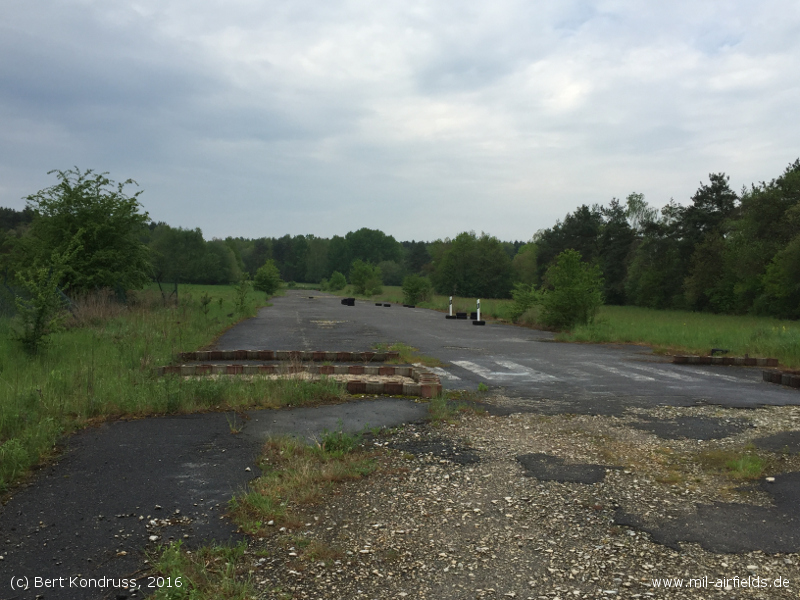
Image credits are shown on the respective target page, click on the preview to open it.
 Follow mil-airfields on Facebook